Calmer than when we arrived.
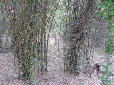
Despite driving alongside it for many kilometers this is the last good sight we got of it. The trees alongside the road are impenetrable with the camera.
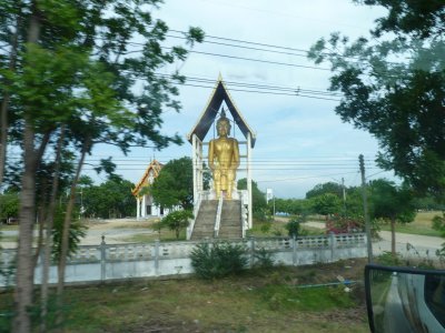
Most are well maintained and stand out along with government buildings.
By contrast the buildings either side of main roads show the signs of pollution from the traffic.
Arrived late and rented a tent for the night. 150 baht. A pragmatic solution as the alternative was 150 baht each.
We thought we had National Park pricing sussed. 200 baht entry per foreigner per park for 7 days. But no. All parks are not the same. No entry fee for this one.
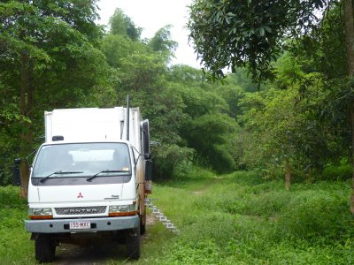
The camp site was about 4km from park headquarters down a single width rough sealed road. Looked like an old road that had long since been replaced.
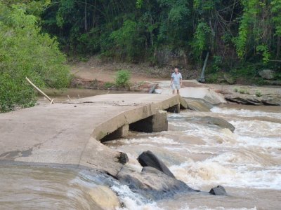
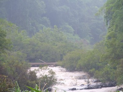
We decided to give this crossing a miss. Fast flowing, not sure if it was rising or falling, up to my knees, only just wide enough for Tardis, second ford on a lean, center span not well supported (though 300mm thick). We really had no pressing need to take a risk and cross it.
I've never seen one since.
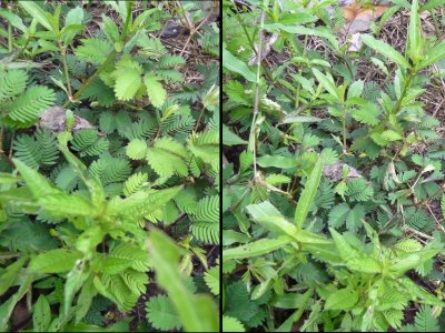
Just next to our steps was a fine example of just that plant. Photos are before and after.
I believe it folds itself up as a form of defense. An animal thinks its inviting, touches it, and suddenly it doesn't look inviting any more.
Edit:- Friend Lawrie in Aus reckons its a "sensitive plant" that grows well in Northern Queensland. A noxious weed!
And Sharon tells us its Mimosa Pudica or Sensitive Plant. Originally from Central and South America, now a pantropical weed.
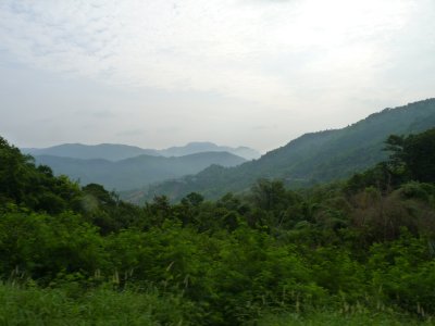
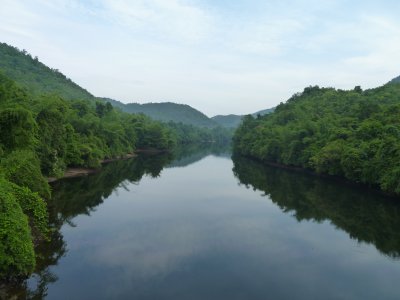
This was the view from half way down.
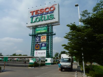
This one for Tesco (supermarket) was readable from more than a km away.
Its still only a baby sign though.
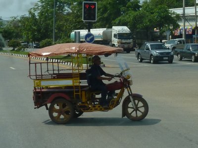
This trike crossed in front of us while we counted down the lights.
It all seemed good natured though we guessed it cost some money.
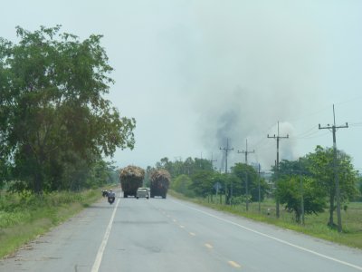
The truck on the left was a tractor and trailer. Moving at a snail pace. The truck on the right was a truck. Moving a little faster than a snail.
The car in the middle decided not to, it waited a bit and overtook normally.
The motorbike overtook on the inside where there was heaps of room.
We were fortunate nothing was coming the other way and drifted past.
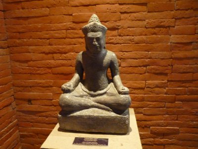
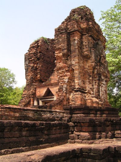
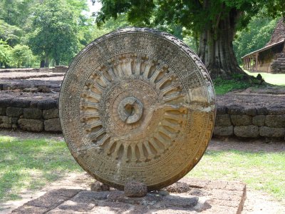
From some time before 14th century.
The Buddha has been recovered from Si Thep, a walled, moated, city.
The major influence is Dvaravati Buddhism. Imported from Sri Lanka. A period before the Khmer conquest and Angkor Wat influence.
We'll look for signs of Thai influence in Yunnan and Sichuan in China where the people and culture were well established before they moved South into Thailand and Laos in small groups.
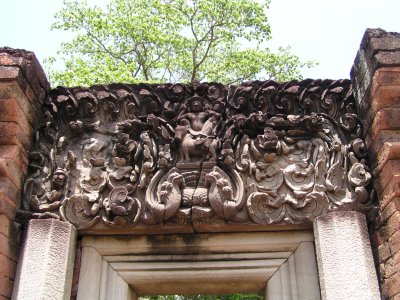
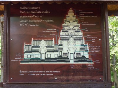
We assume there is a standard form for such religious buildings, much the same as the cathedrals we were brought up with.
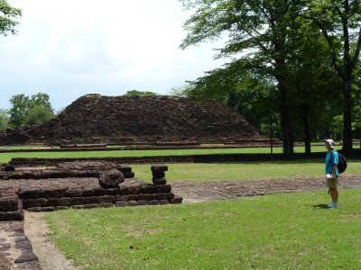
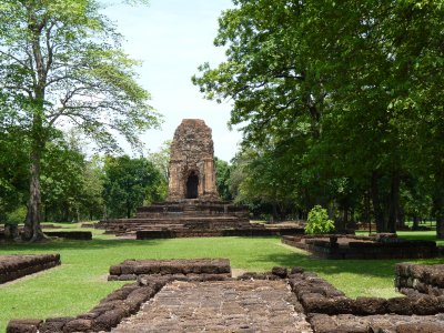
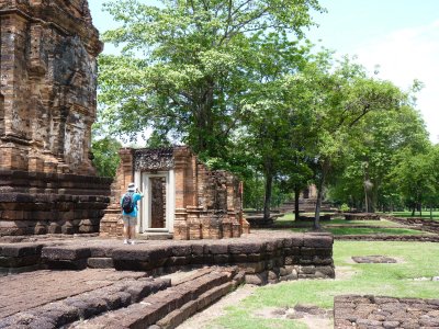
In the background here. Its all laterite, about 12m high and 44m long by 28m wide. Covered with mortar and decorated with stucco.
There's a few remains of the decorations around the base.
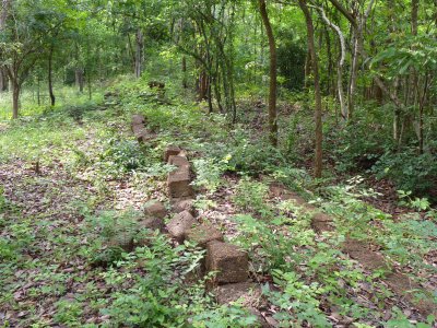
There was a ridge, about 10m high, running all the way round. We found a part where there were still some laterite stones remaining. It looked like there could have been a path along the top of the ridge.
Outside the ridge was the remains of a moat.
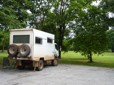
We picked a corner of the car park for a peaceful night's sleep.
A pleasant place to be.
This patch had large (10mm long) thorns facing backwards which made it impenetrable to us. Nasty stuff.