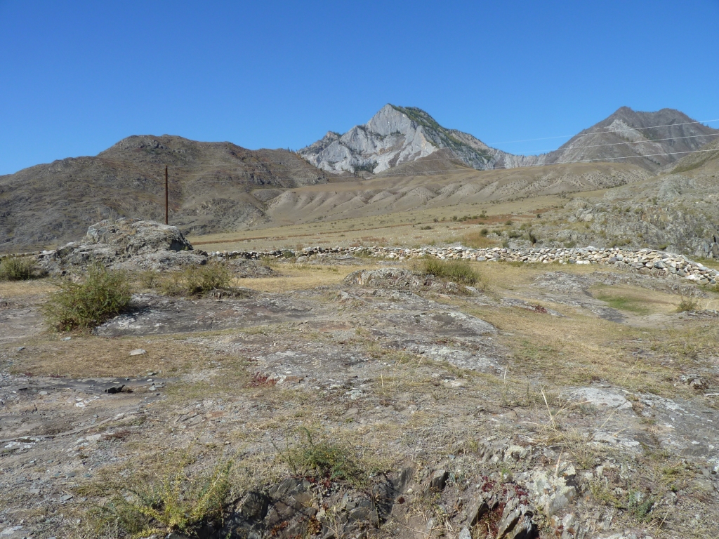
There's something about the Altai Mountains that makes us want to linger.
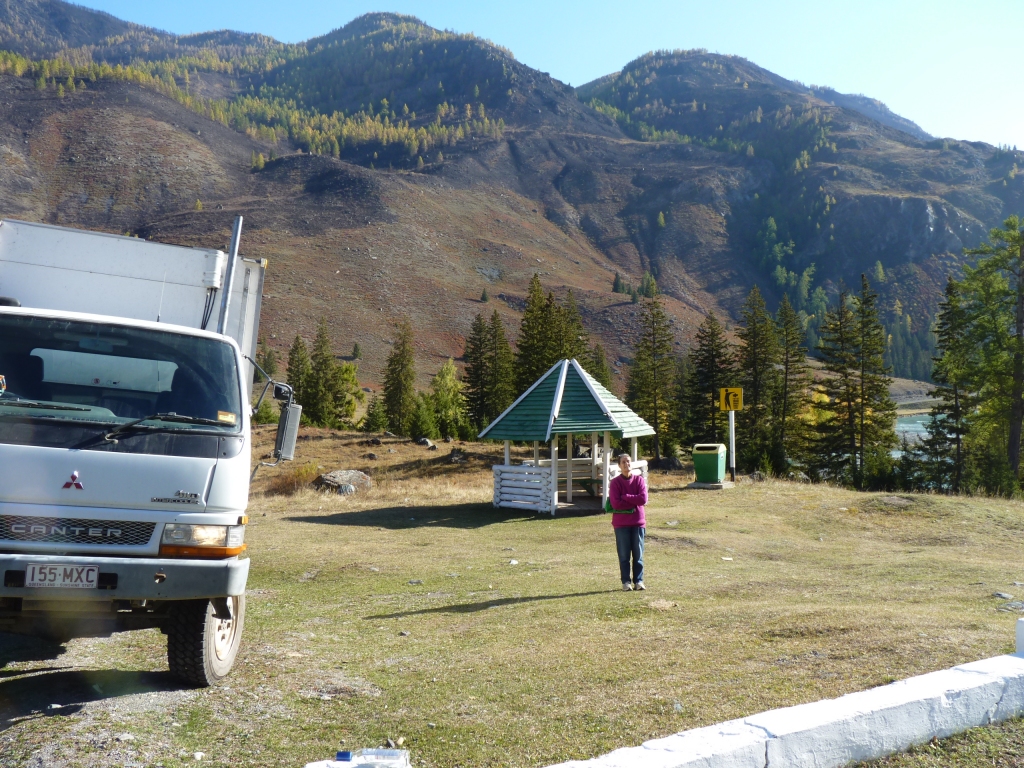
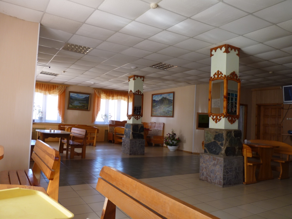
This is a clean tidy rest area.
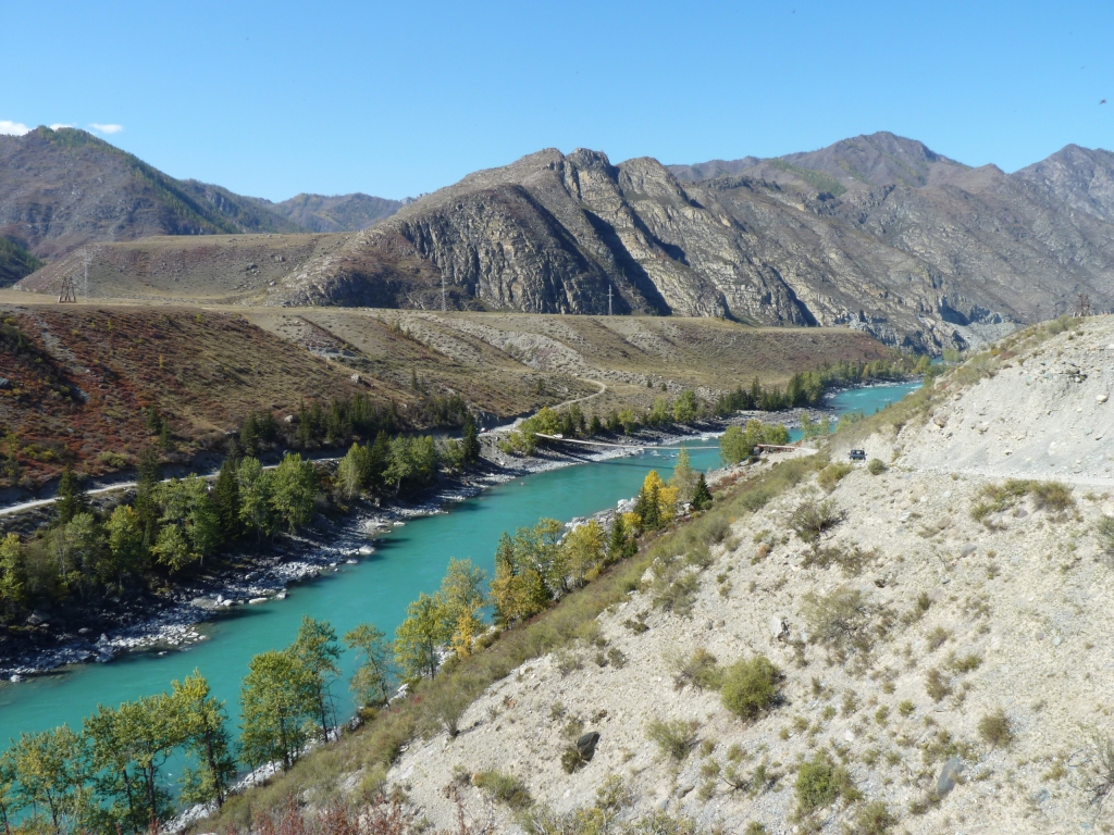
We aren't quite sure but we think the whole of the route we are on is named the Chuysky Trakt. The road is the M52 all the way.

The rocks are a geologist's paradise. Or an amateur geologist's nightmare.
So many colours, oriented every which way, some evidence of glaciers, some of volcanoes, lots of water, even some loess.
And we think patches of mudstone that's faulted every which way.
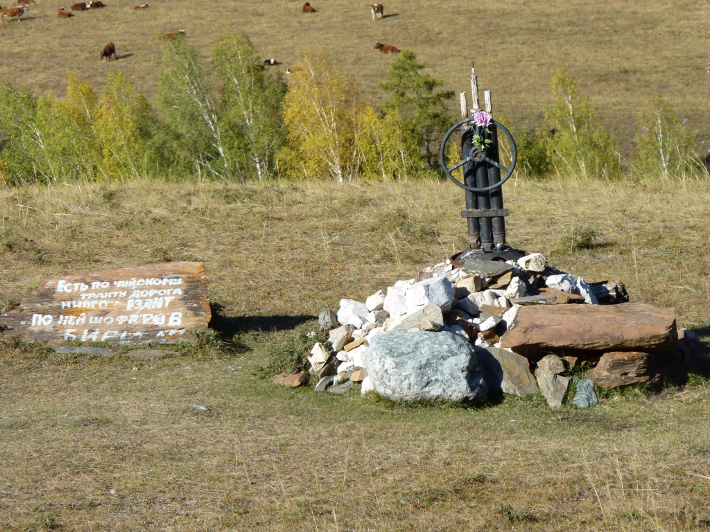
We assume from the steering wheel and drive shafts they are marking the sites of fatal road accidents.
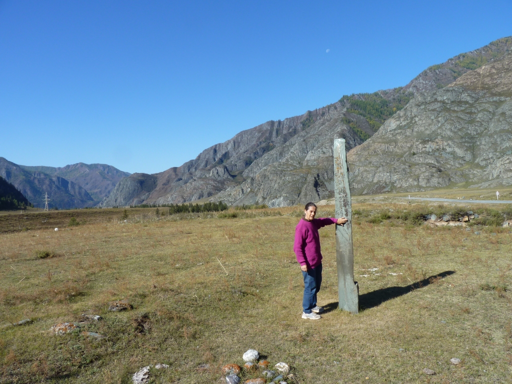
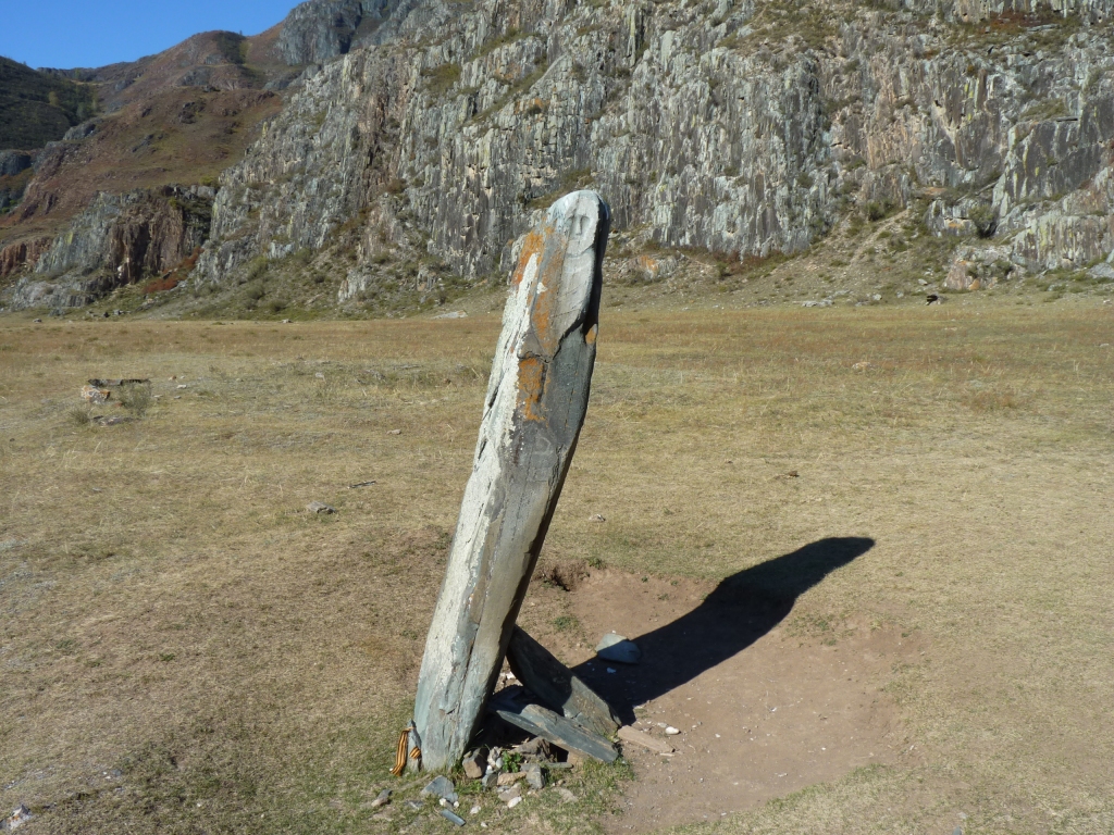
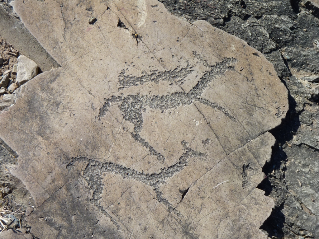
This one we found by accident while looking for a stone idol.
It has some faint scratchings on it which I think may be simply graffiti but Ali is more romantically and historically inclined to think they are petroglyphs.
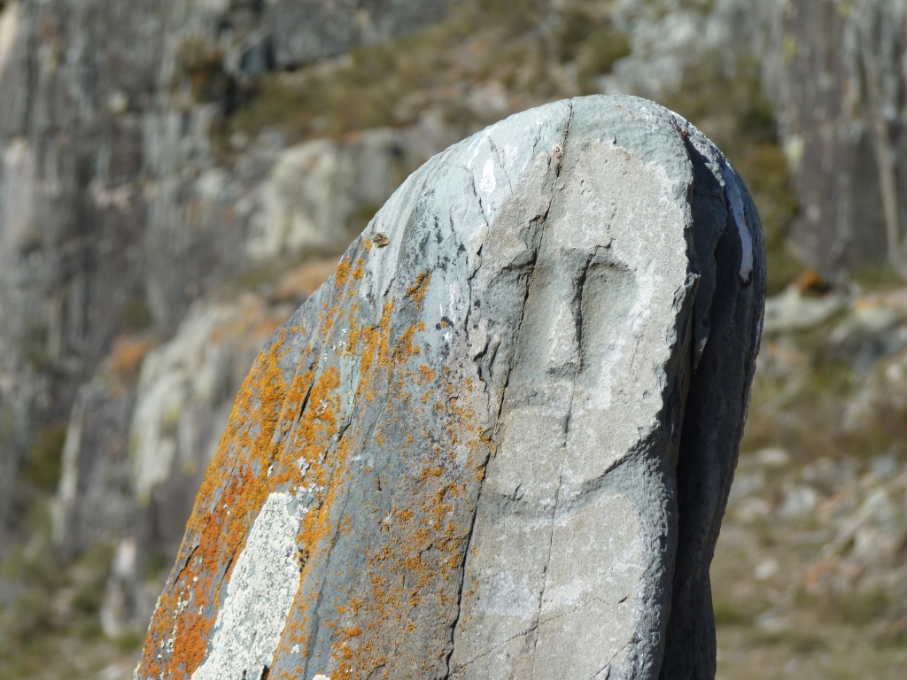
Its anthropomorphic - big word for having a human image.
Its image has a moustache.
We hope to find some explanation of origin in the Gorno Altaisk museum.
We couldn't identify the sword that is supposedly part of the design.
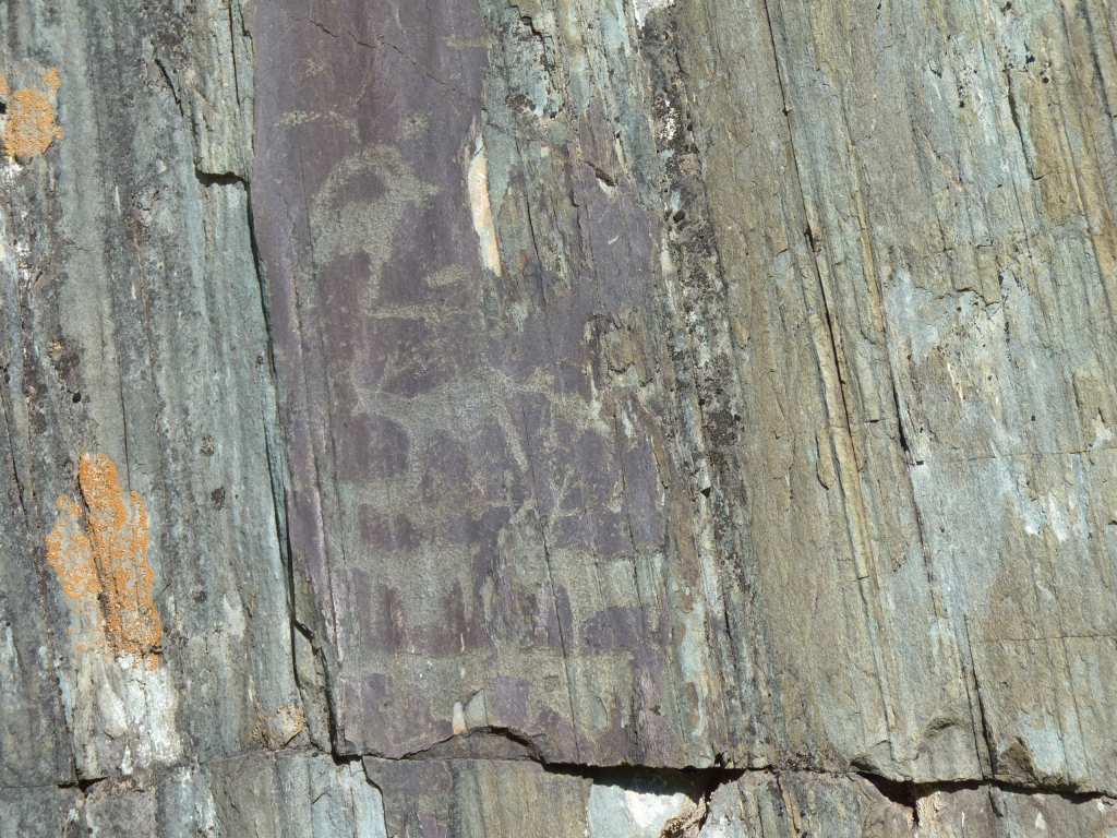
These look like deer to us.
We failed to work out which way the bedding planes were aligned. At first glance it all looked tilted vertically. This field geology stuff isn't at all easy.
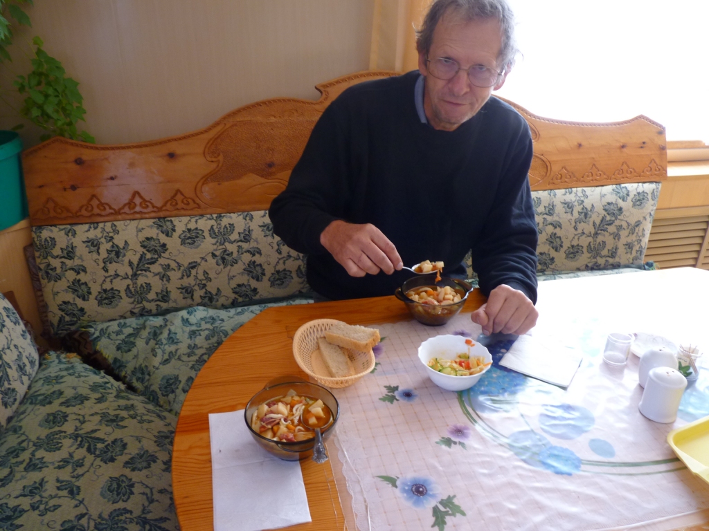
A local soup with noodles, potatoes, meat, and some pleasant spices. Plus bread and cabbage salad. We are in a land of cold weather vegetables.
The cutlery wasn't chopsticks and didn't bend when used.
Had to be careful what we threw on the floor.
Plus mirrors, paintings and flowers.
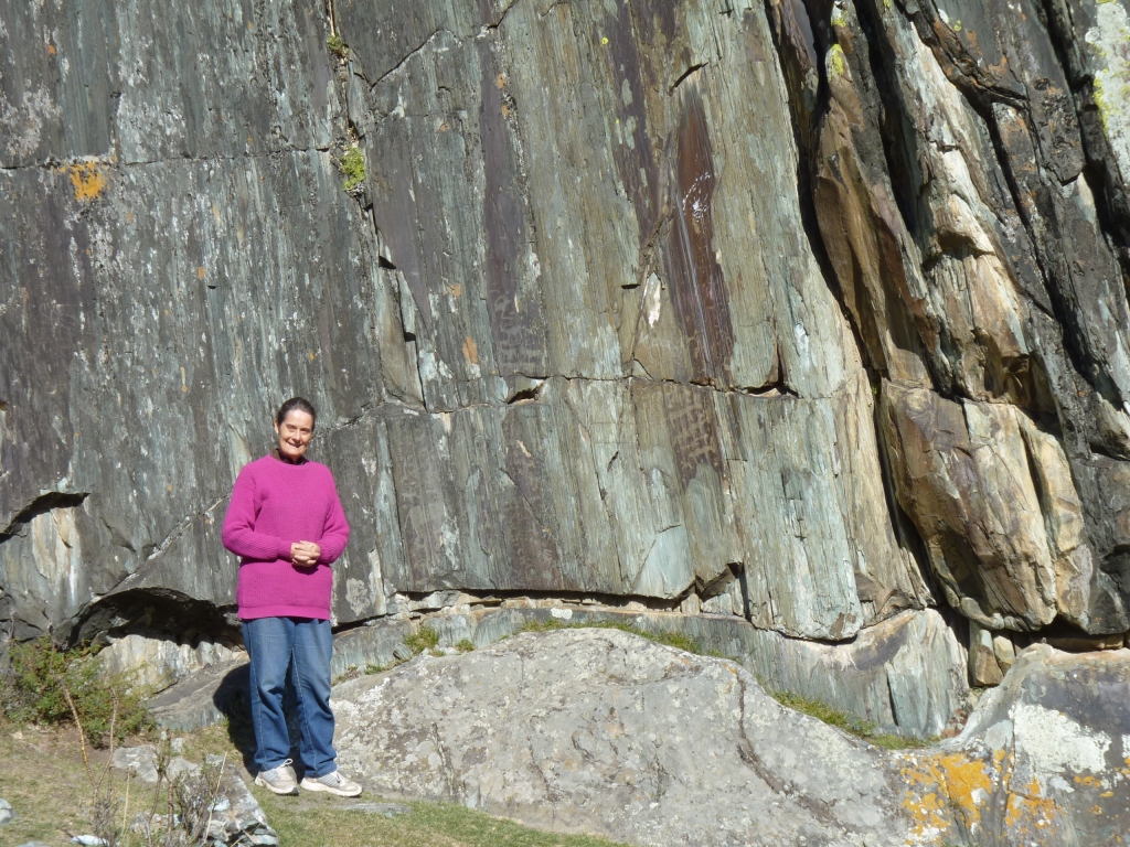
We knew they were somewhere near but nearly missed them. As if by magic a Russian had just got out of his car to look and waved us over (very determined and emphatic). He seemed to know where to look and, if we could have translated, a bit of history.
More deer, though less obviously so.
The technique (coarse engraving?) reminded us of Mutawintji in Aus.
Partly also because the preservation may be similarly a very fine film of "desert varnish" (windborne manganese rich fine dust which oxidises and preserves). This has the colour and look though obviously the climate is very different now. The surface is at about 10 degrees to horizontal with no shelter from the elements. Either the petroglyphs are young, the weather has been kind (unlikely?) or they are naturally protected.
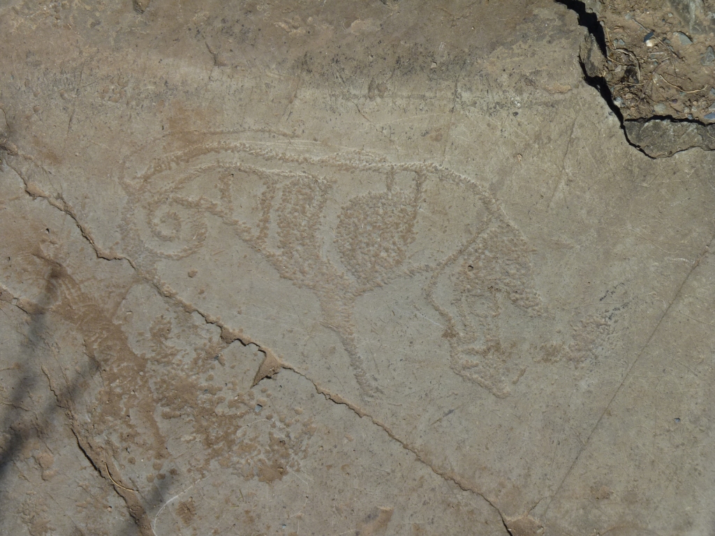
This petroglyph seemed a variation on the technique and looked like it had been cleaned.
We suspect there are more further away from the road but haven't a chance of finding them on our own.
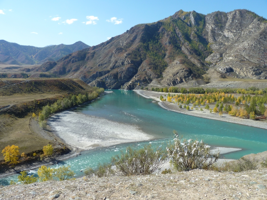
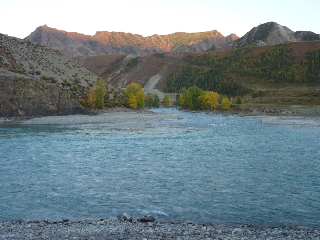
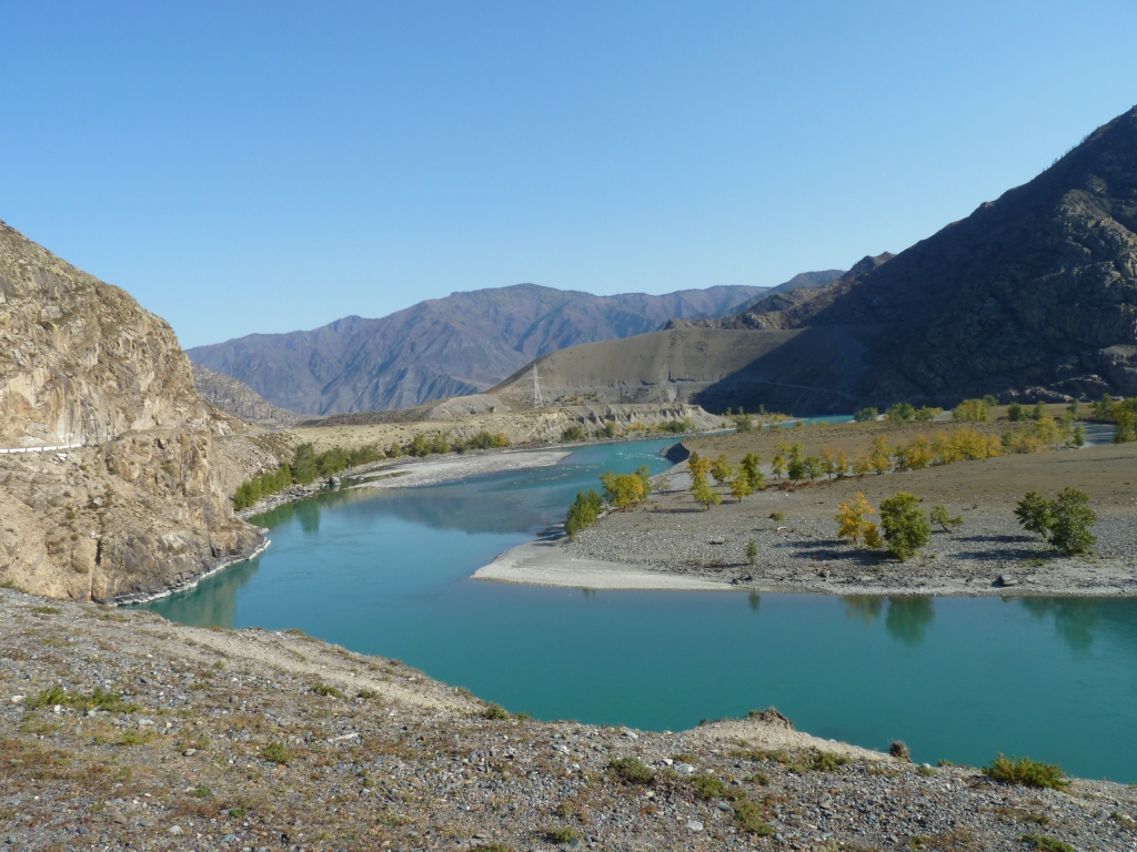
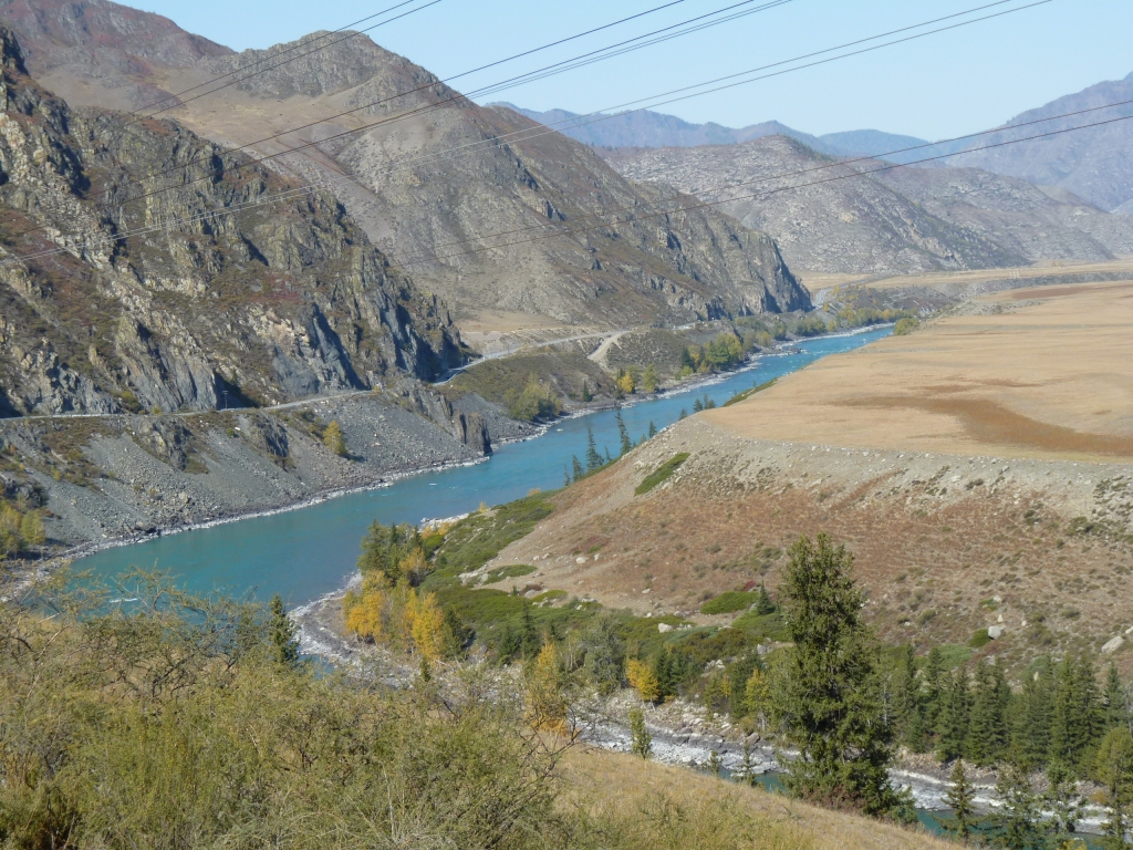
From here on its all called the Katun River. Its the bigger river.
Siberia doesn't have the longest river in the world but has a lot that are not much shorter.
That flat bit of ground on the opposite bank (on the true left of the Katun) looked inviting.
In the foreground the shrubs are festooned with white linen ribbons. We think similar to the blue ribbon on the Mongolian ovoos, but without the ovoo.
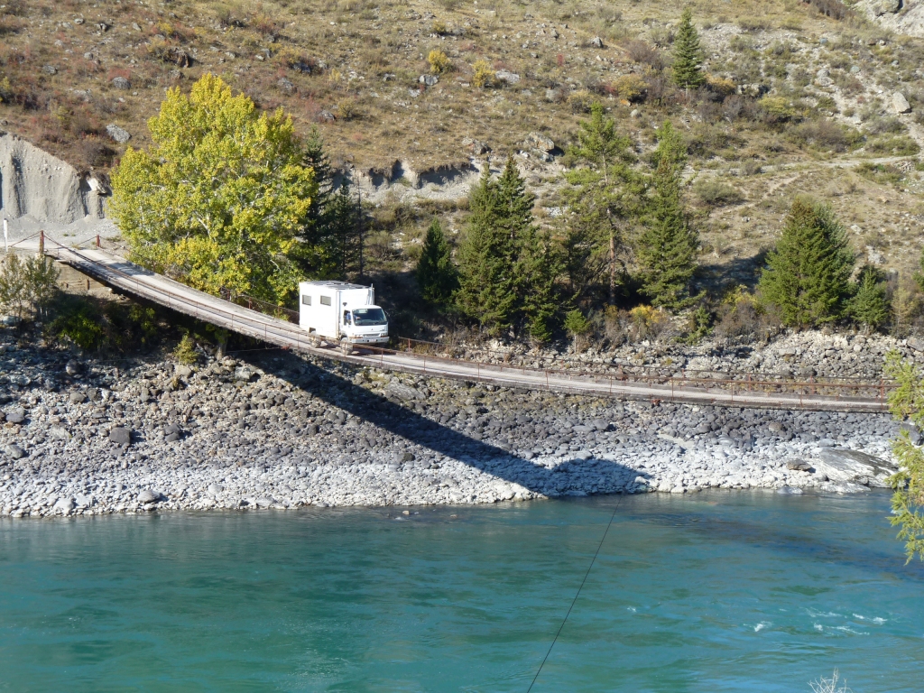
A suspension bridge, but unusually without a tower each side. Which made me very uncomfortable.
There's a car coming up the road from the bridge.
We used the binoculars to look at the signs, black letters on white background inside red circles - 7t, 5 (probably km/hr) and 3m width limits. Its 120m long. On paper we can cross!
The engineering looked substantial enough for us and there was surprisingly little movement as we watched some 4wds cross it (after people had got out to walk across and inspect). Looked like a club outing for a Sunday.
With towers and ropes looped between them the road bed can be made flat, suspended by hangers from the ropes. With this design, no towers, the road bed has to follow the loop of the ropes. I suspect the shape of the loop adjusts a bit as a vehicle moves across. Also, the tension on the ropes is probably greater as the loop is possibly not so loopy! Which in turn makes it more difficult to get the road bed flat across ways. Plus, I suspect, a greater tendency to twist. And so on ....
There are a couple of stays visible from bridge middle to bank, to resist sideways movement.
The approach wasn't too bad though the 4wd club had made a bit of a meal of it. A rocky bit part way down and a bit of a lean.
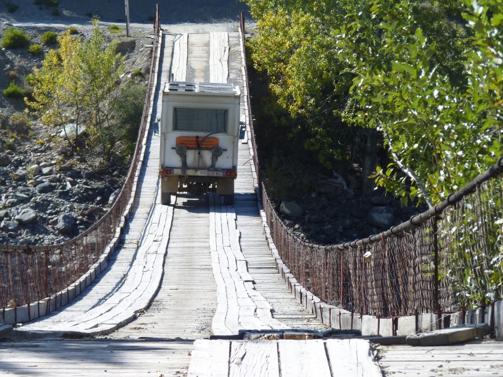
A first gear crawl. The tendency is of course to travel much faster!
Next time I'll turn off the radio (usb stick). Some of the music sounded terribly like bridge timbers creaking!
There's not a lot to be done once started. I hoped it was all my imagination.
A drink of water on the far side for the dry mouth! Mind over matter has its limitations!
I hope its a good campsite!
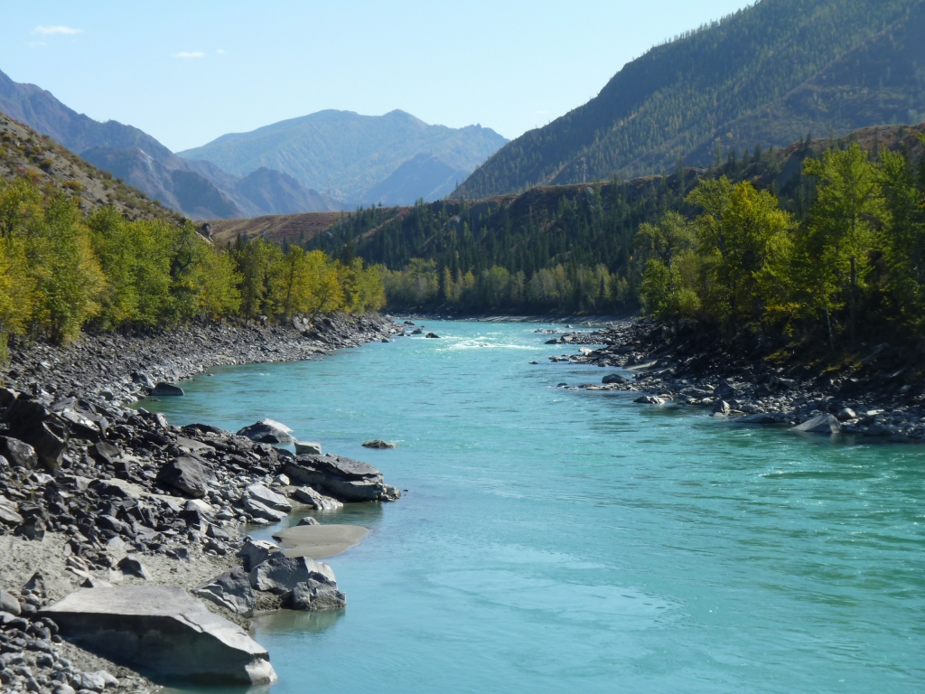
It looks like the river has cut a succession of increasingly narrow gorges.
Vaguely reminiscent of the Yellow River.
The track is on our map as a dotted line and signposted to Tyungur. A bit out of our way. It would have been passable if we'd pushed our luck a bit.
On the way in a Russian tourist driving out in a small people mover had stopped us and showed us the damage to his vehicle mirror. He also showed us photos and explained the height limitation - one of those bits where the inside wall had an overhang.
On closer inspection of the track there looked like lots of room. Perhaps inexperience (ours or his?). A tendency to keep away from the edge - I would have been fine with right hand drive!
Either way, we had no need to follow the track so we stopped on the flat as planned.
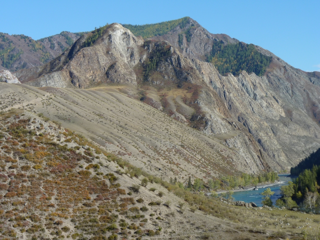
The mount in the center (also center in the picture above) may well be the core, or part of the rim, of a volcano.
It looks possible and was suggested by the same Russian that showed us the petroglyphs. This is a very contorted landscape.
Possibly a good part of the explanation for why the rivers meet as they do.
There's no obvious way for us to reach it. We'll have to check the satellite photos when we have a chance.
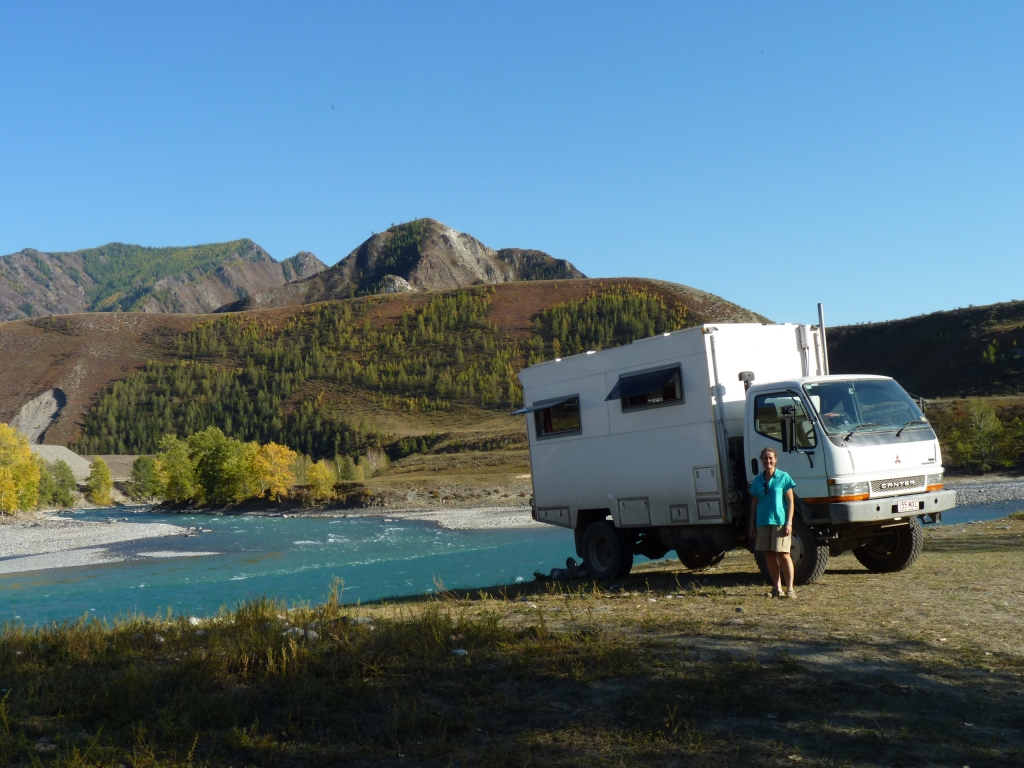
Our altitude is 350m. A lot lower than we've been for the past few weeks. Shorts and tee shirt weather (in mid September). Is this the Siberia of permafrost that we've read about?
We later moved Tardis forward by about 2m. Just to make it level. The first time in 5 months we have been so picky!
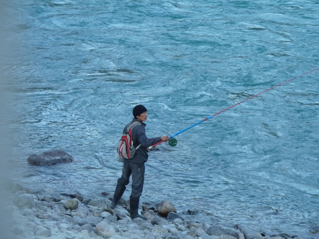
We had dress circle seats watching this lone Russian fisherman.
His basic gear is a lure and a float. He's fishing the edge of the turbulent water just where the two streams meet. And just as the sun went off the water.
One of those people who look like they know what they are doing!
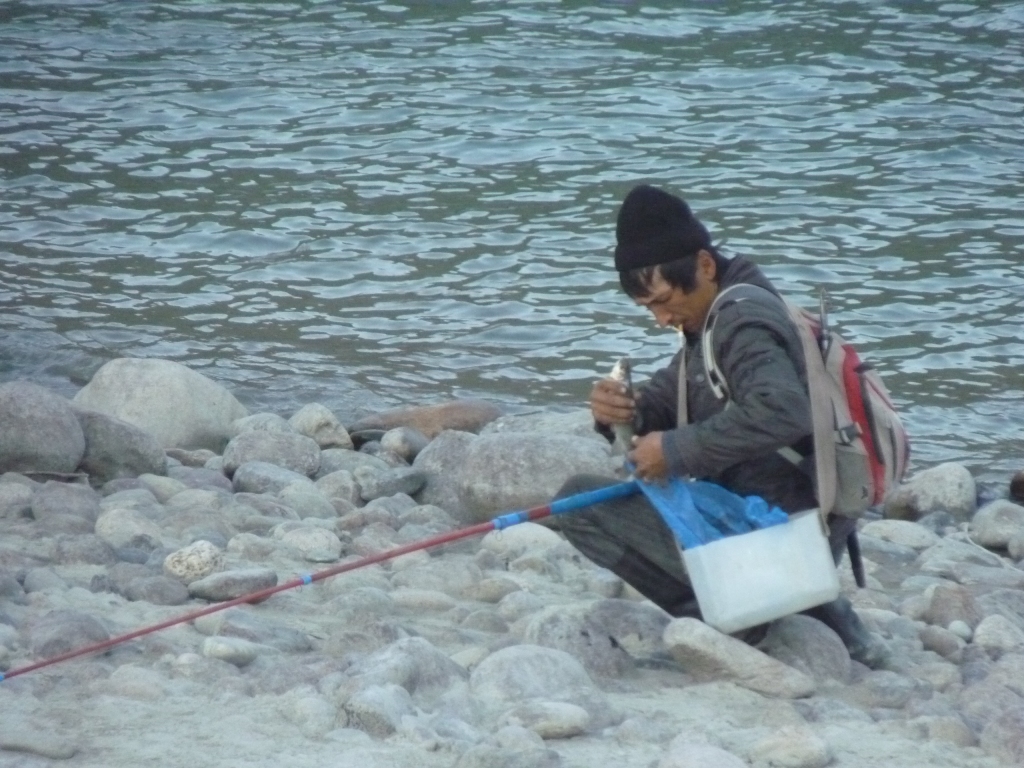
We don't know what sort of fish.
And we couldn't help noticing the number of cigarettes smoked per fish caught!
Those large stones are on the inside of the river bend and are nicely rounded. We wondered how they got there. Perhaps the rivers flowed very fast at some time.
A bit warmer this morning as we are lower.
The second crossing was still a very long two minutes in first gear.
Turning the radio off didn't help. The noises were really coming from the bridge as timbers creaked.
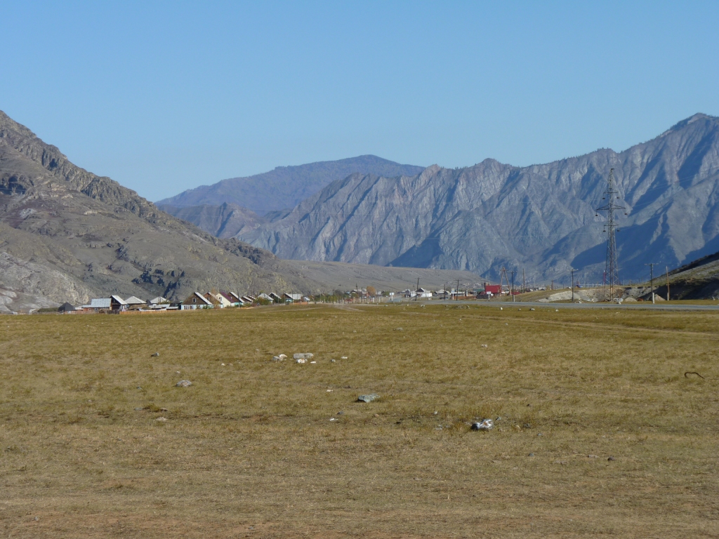
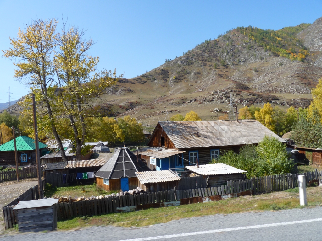
The towns are every few kilometers. Population one or two thousand.
Getting bigger as we sense the mountains getting lower.
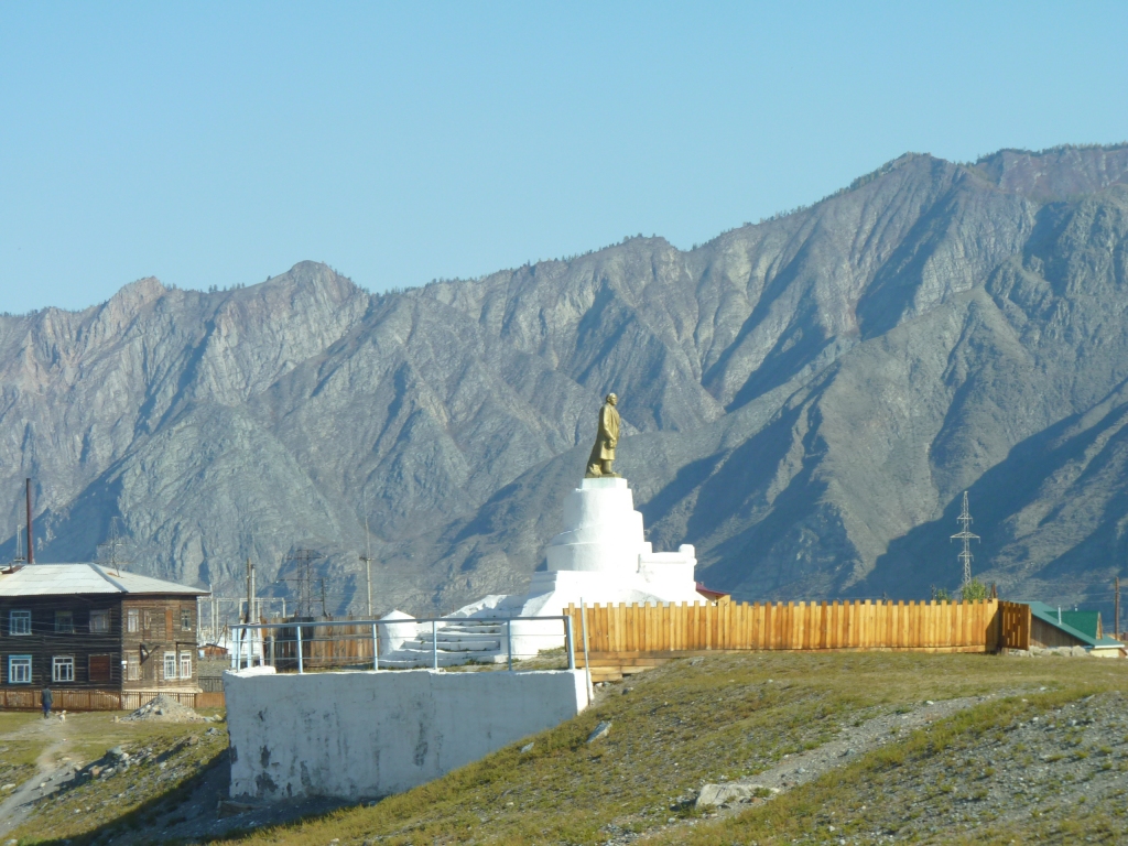
There are second world war memorials in most of the villages, and occasionally statues of Lenin.
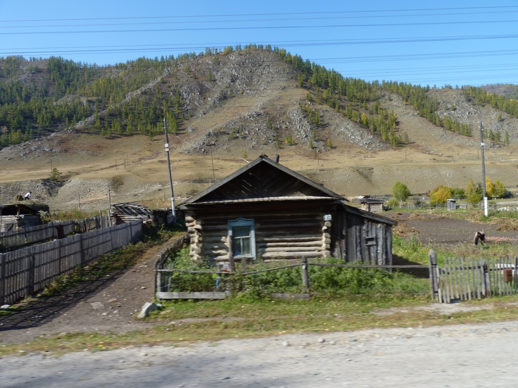
It was outside a house on the way to Bolshoy Yaloman.
We expected to see yet more stone idols but the locals didn't seem to know where they were and were a bit odd so we retreated.
We have an impression that the high mountains have been pushed there by the granite underneath. As we head west the mountains have been worn away a bit more and the granite exposed.
We think.
No doubt we'll think some more in the next few days.
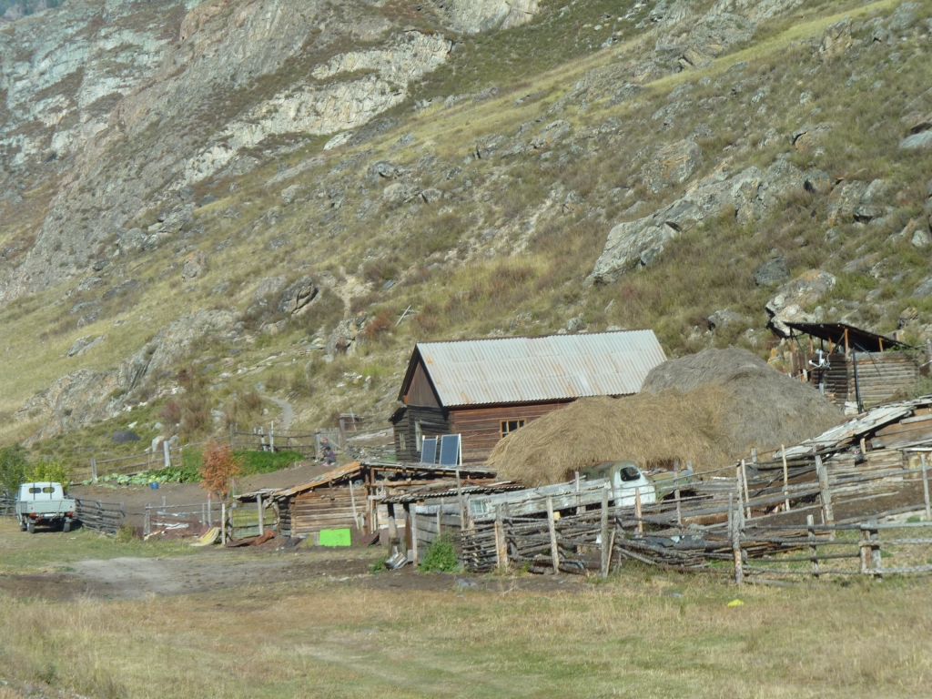
We also think the conical building is the local equivalent of a sauna. Haven't been able to confirm. Most houses seem to have one.
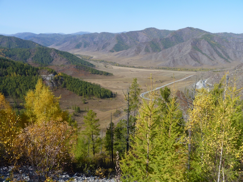
The road forward.

We may have misinterpreted the sign but its possible the road was first built in 1927 then improved in 1996.
It would have been an interesting drive to Mongolia in the good old days!
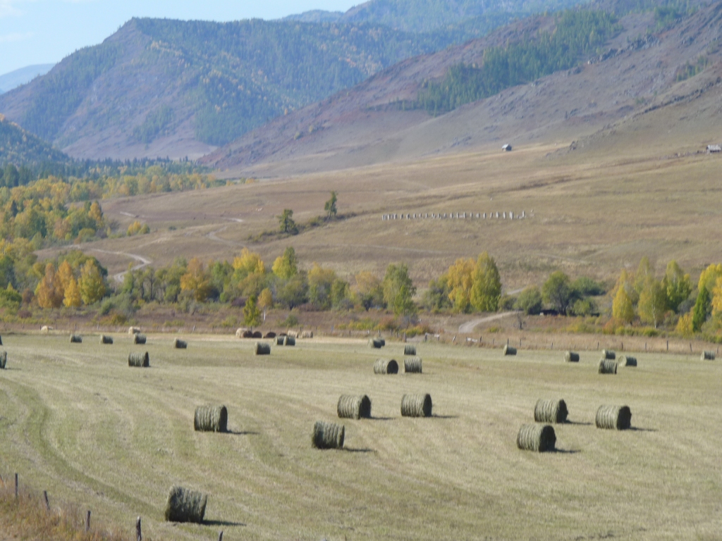
On the way down from the pass we saw our first real hay making in quite a few months.
Large scale agriculture, growing grain (which Russia does a lot of), as we slowly emerge from the mountains.
We wonder what it will be like further west.
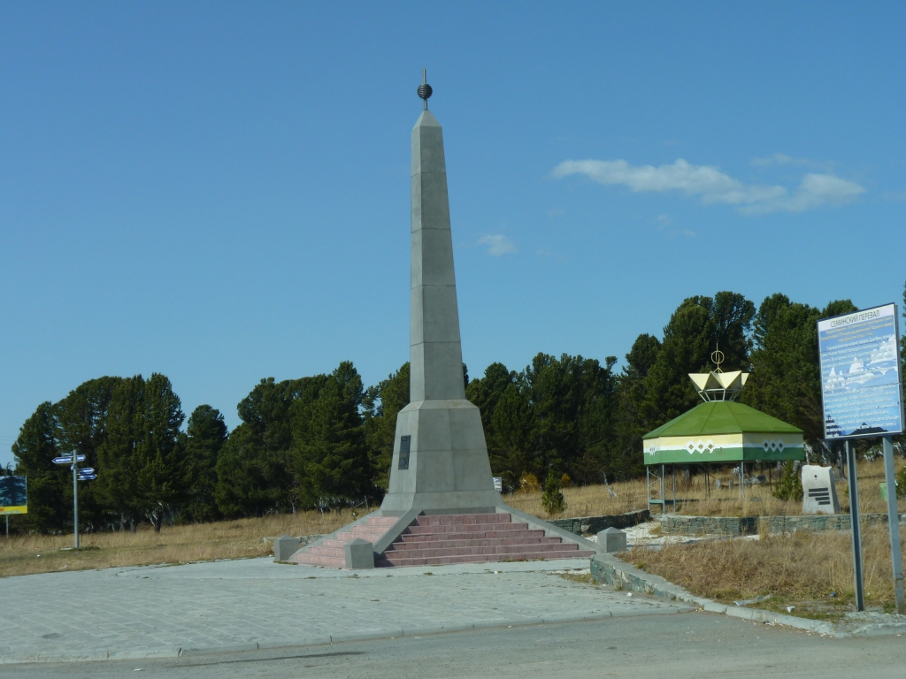
We haven't a clue who Seminsky was but we guess he may have been important.
There's a small winter sports training facility opposite.
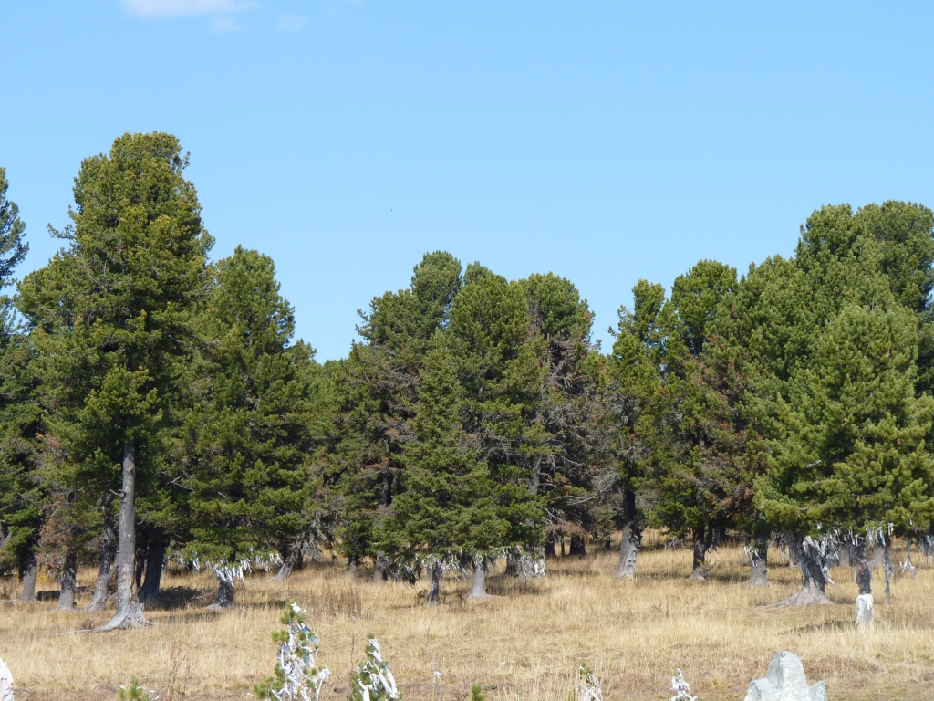
A different variety of conifer for the windswept pass.
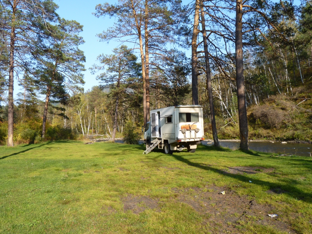
Beside a minor river (unnamed on our maps), shortly before the road meets the Katun River again.
This really is luxury. Lush green grass and a river bank in among the trees.
Tomorrow we'll do some shopping. Food, visa registration, sim card for mobile internet, bank for money, then head to less populated places.
Hopefully we'll have time for the museum and put some of what we've seen in the last few days in perspective.