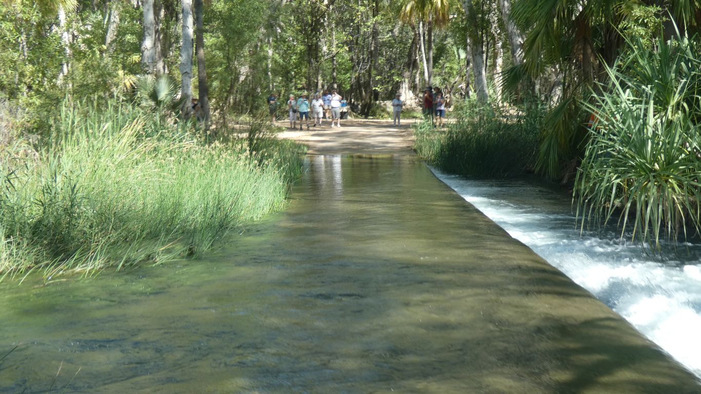
We cross the Gregory River just south of Riversleigh. About 100km from where we camped last night.
Behind us is a tour bus, waiting a turn to cross and let the passengers take a photo. We provided an unpaid bonus. We waved and smiled anyway.
The crossing is a bit deceptive. The concrete is very slippery. 4WD engaged.
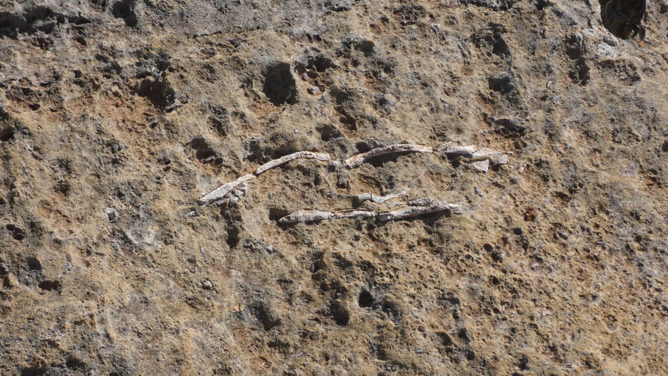
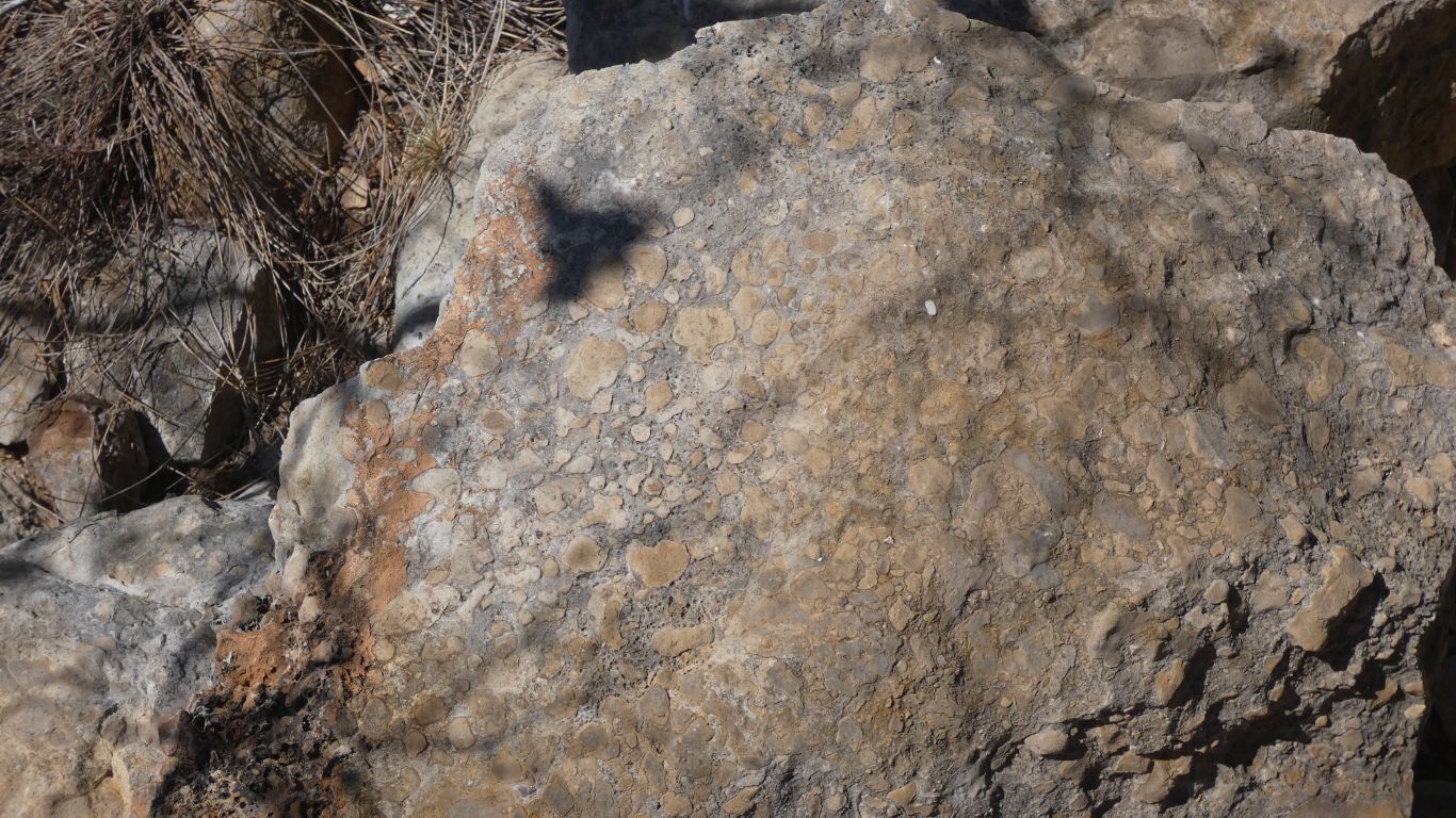
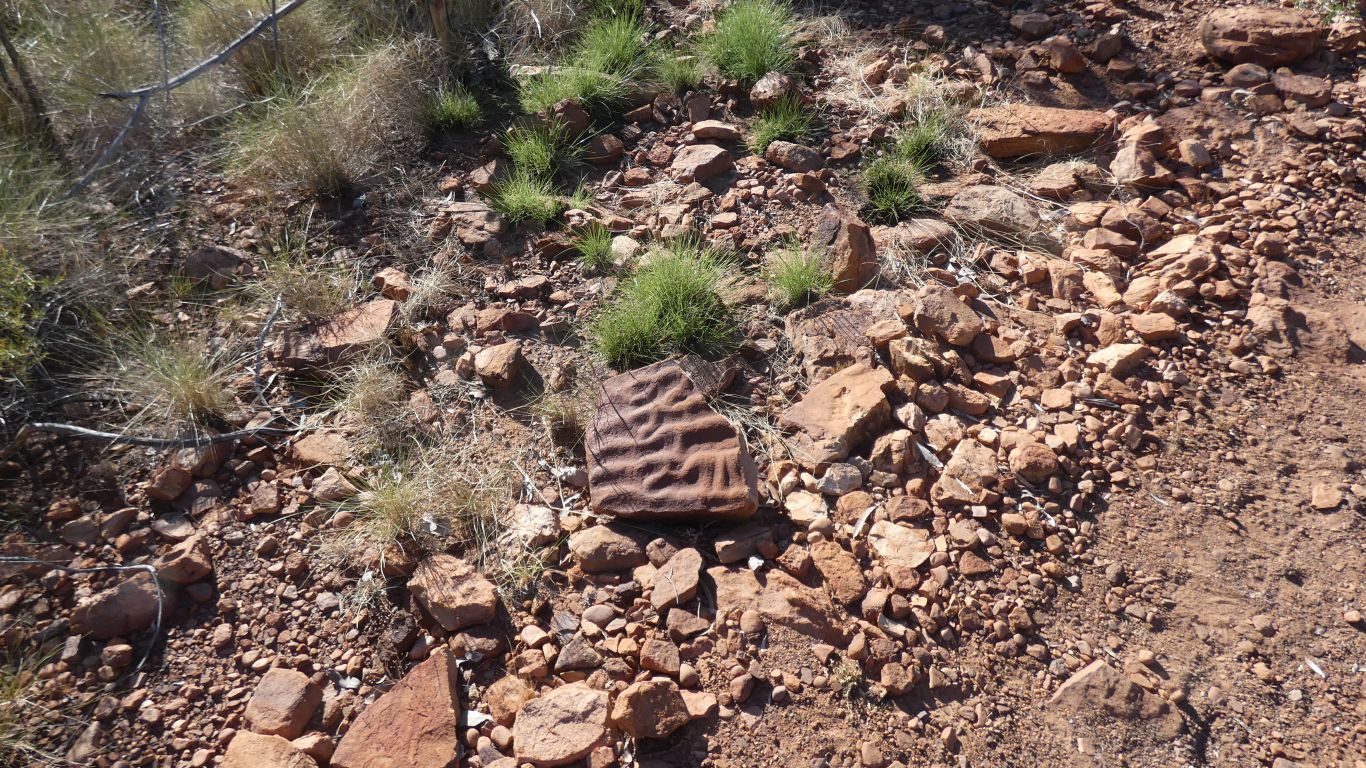
Disjointed bones in limestone. A challenge far beyond the scope of the average jigsaw fanatic.
Apparently it hunted mainly on land.
As the limestone was eroded by water sink holes formed as lakes with a topping of limestone. Animals broke the surface and fell into the water. Some drowned. Most were eaten and bones scattered. Becoming fossilised in the bottom of the lake. The lakes eventually filled.
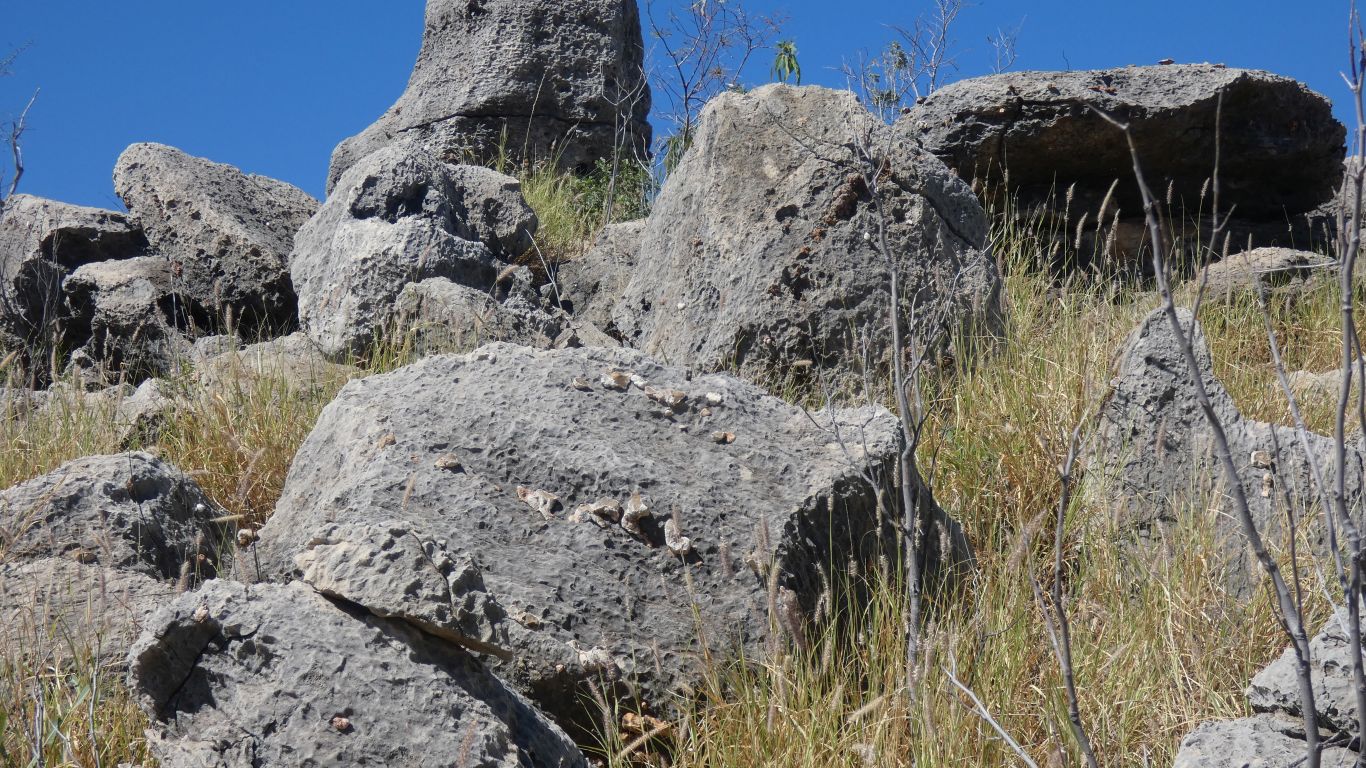
The surrounding land eroded, leaving the limestone that had filled the lake as an outcrop. Full of fossilised bones.
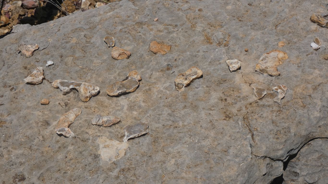
But no. They are firmly embedded in the limestone. I guess they erode more slowly than the surrounding rock.
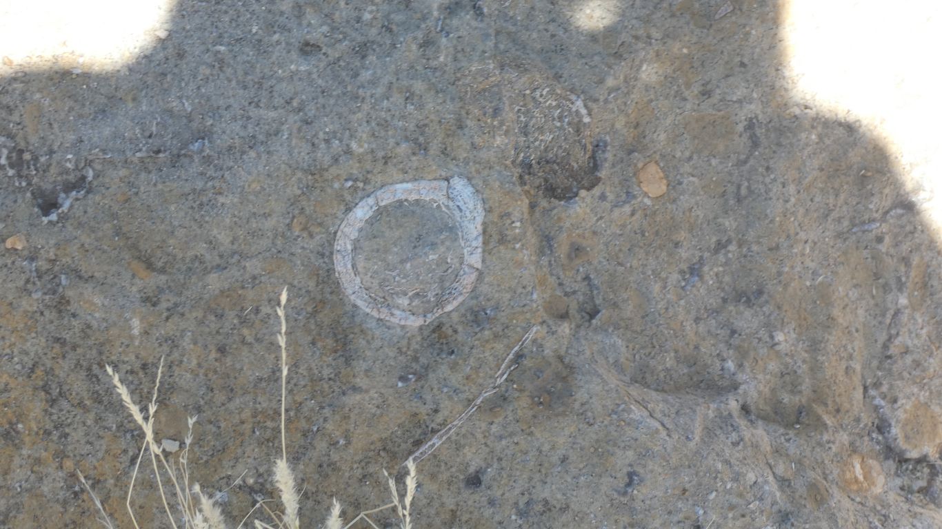
The round polished stones embedded in the rock are gastroliths from a bird's crop, to help with digestion. (I read that on the helpful sign ..... ).
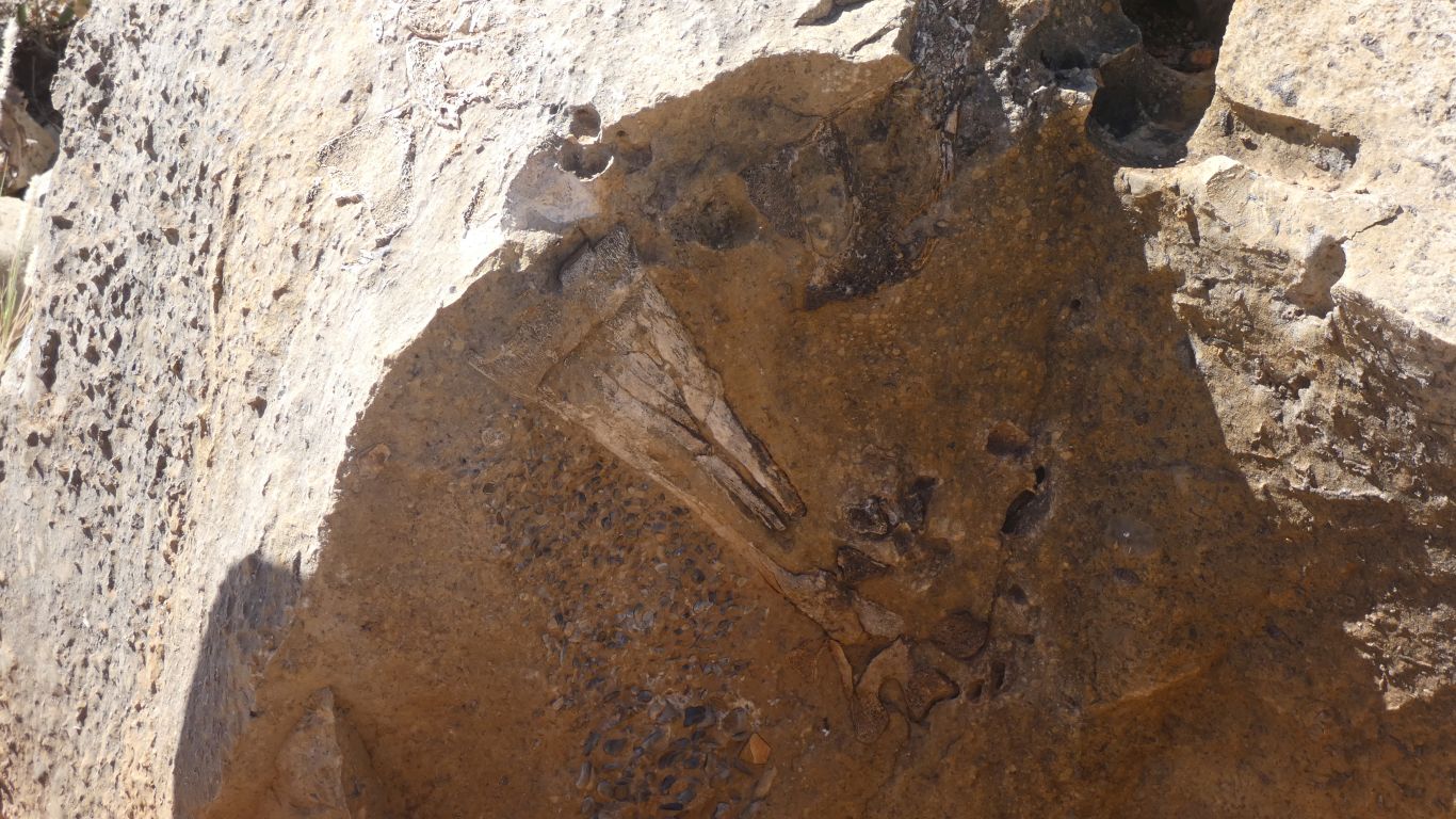
This is a jumble (technical term?) of bone fragments.
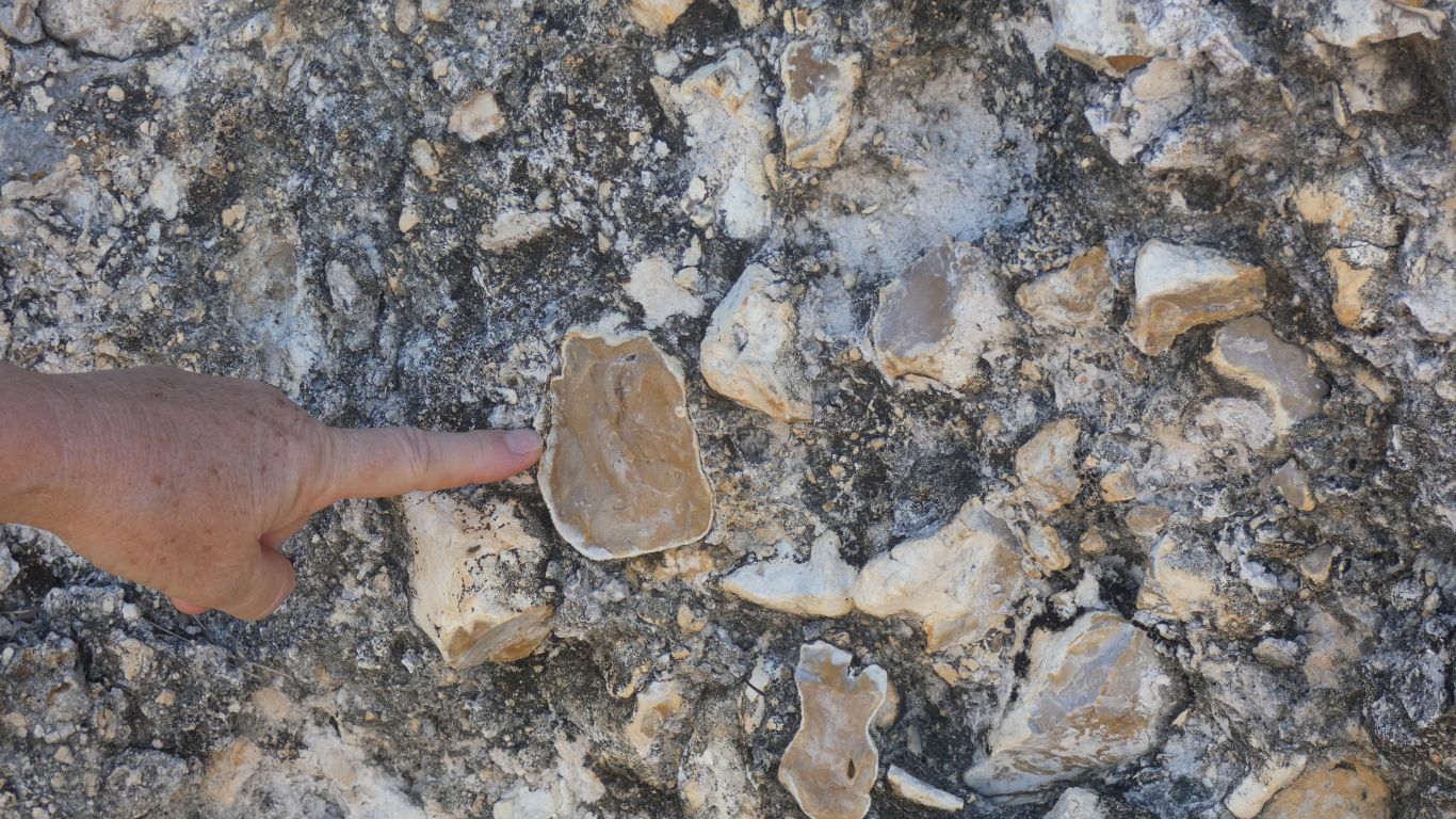
Ali happened to mention "I'll believe it when I see one opalised".
So here we are, helped by Ali's perfectly manicured finger.
Not the colours of opal, but bone replaced by mineral.
We had lunch and spent the afternoon near the Gregory River crossing.
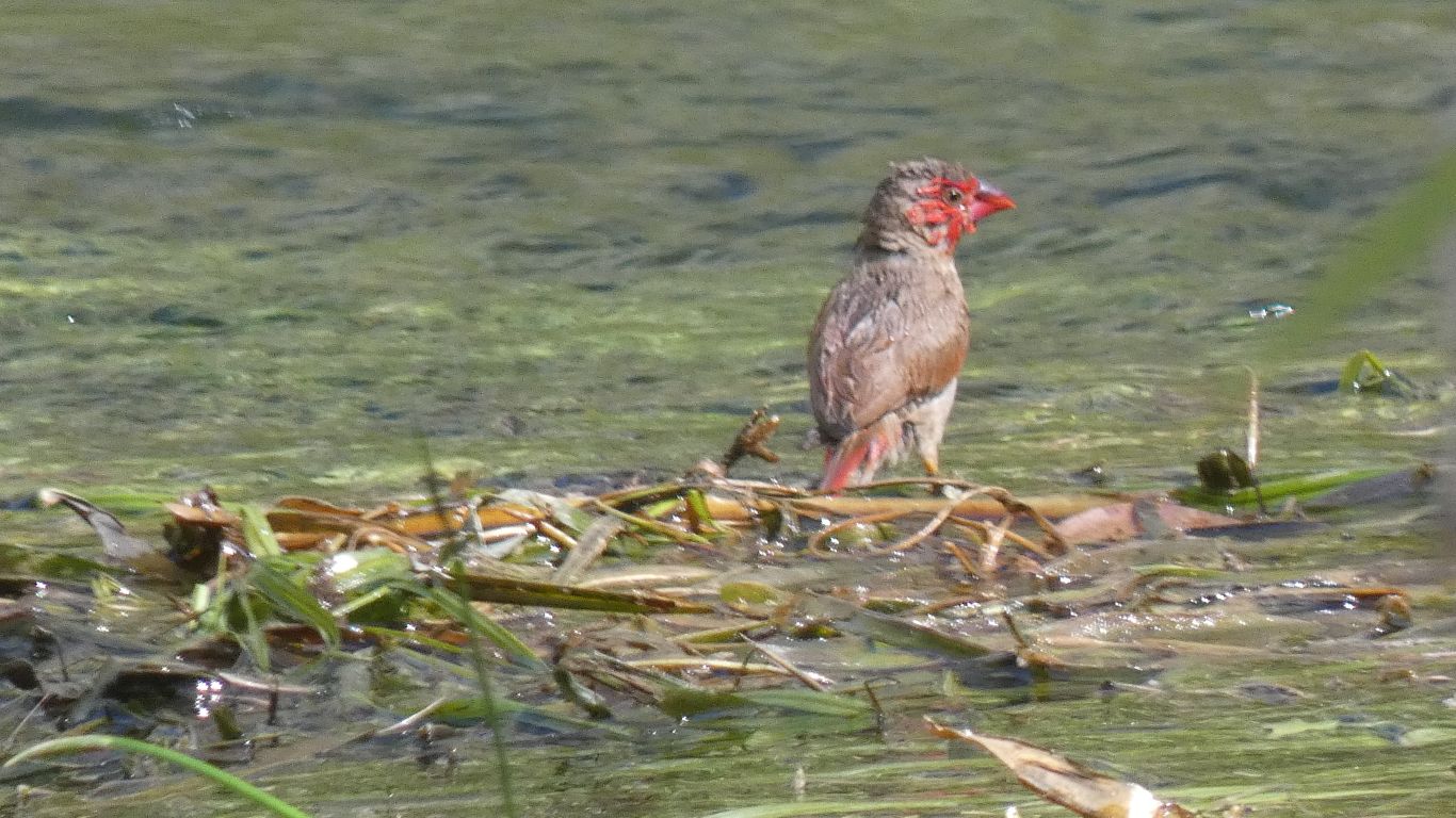
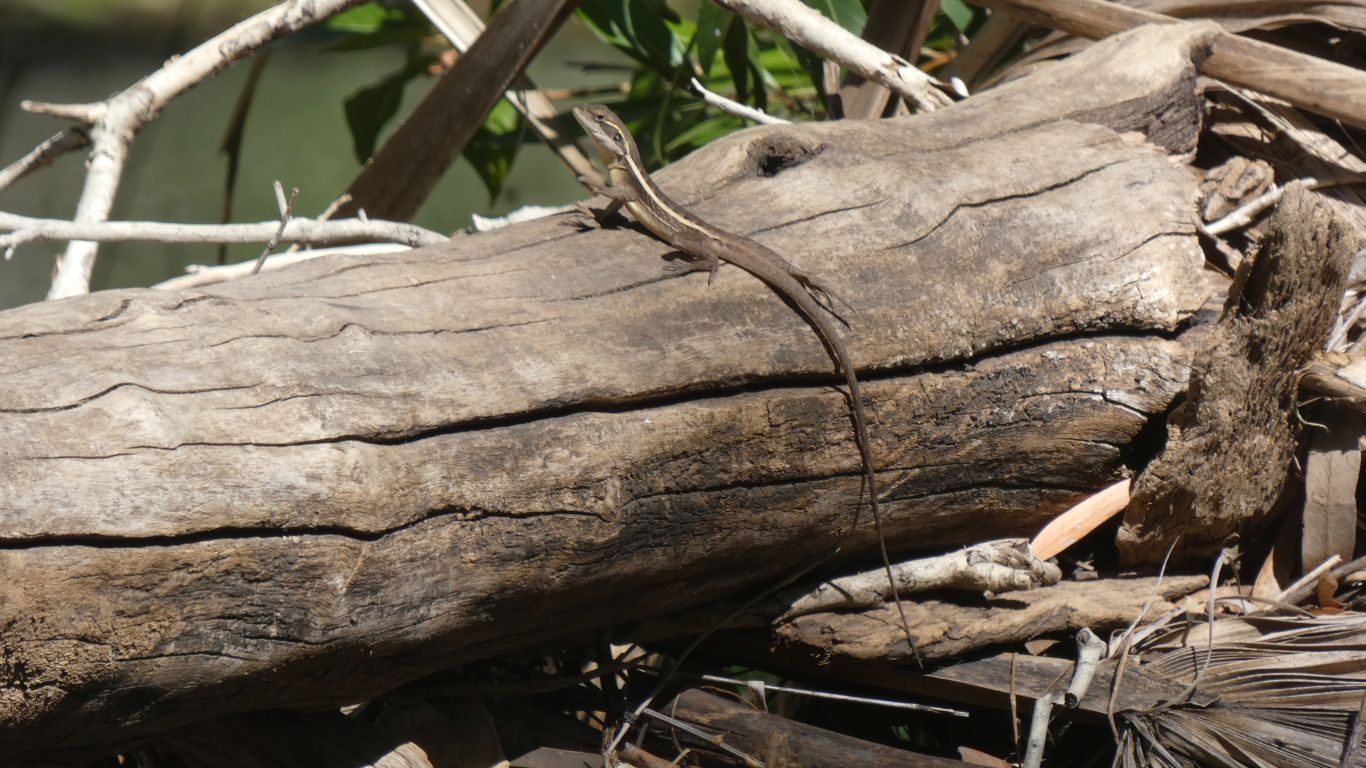
A crimson finch, one of several among the reeds.
We waved, it waved back. Sometimes with left hand, sometimes right hand.
Something to keep us amused? I have a couple of 5 second videos, but will have to rediscover how to shrink them for the blog.
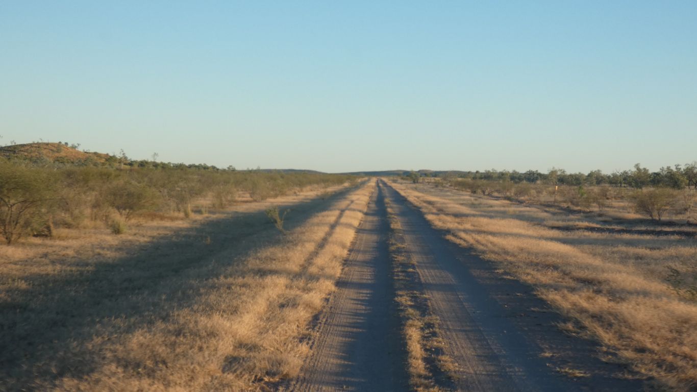
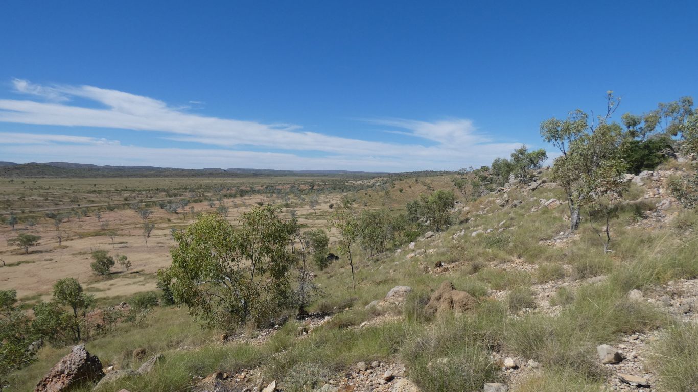
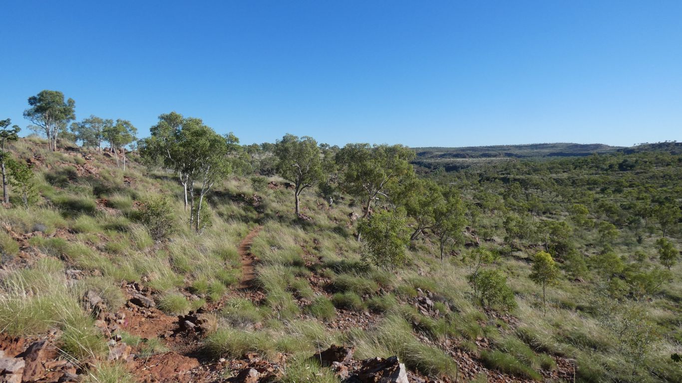
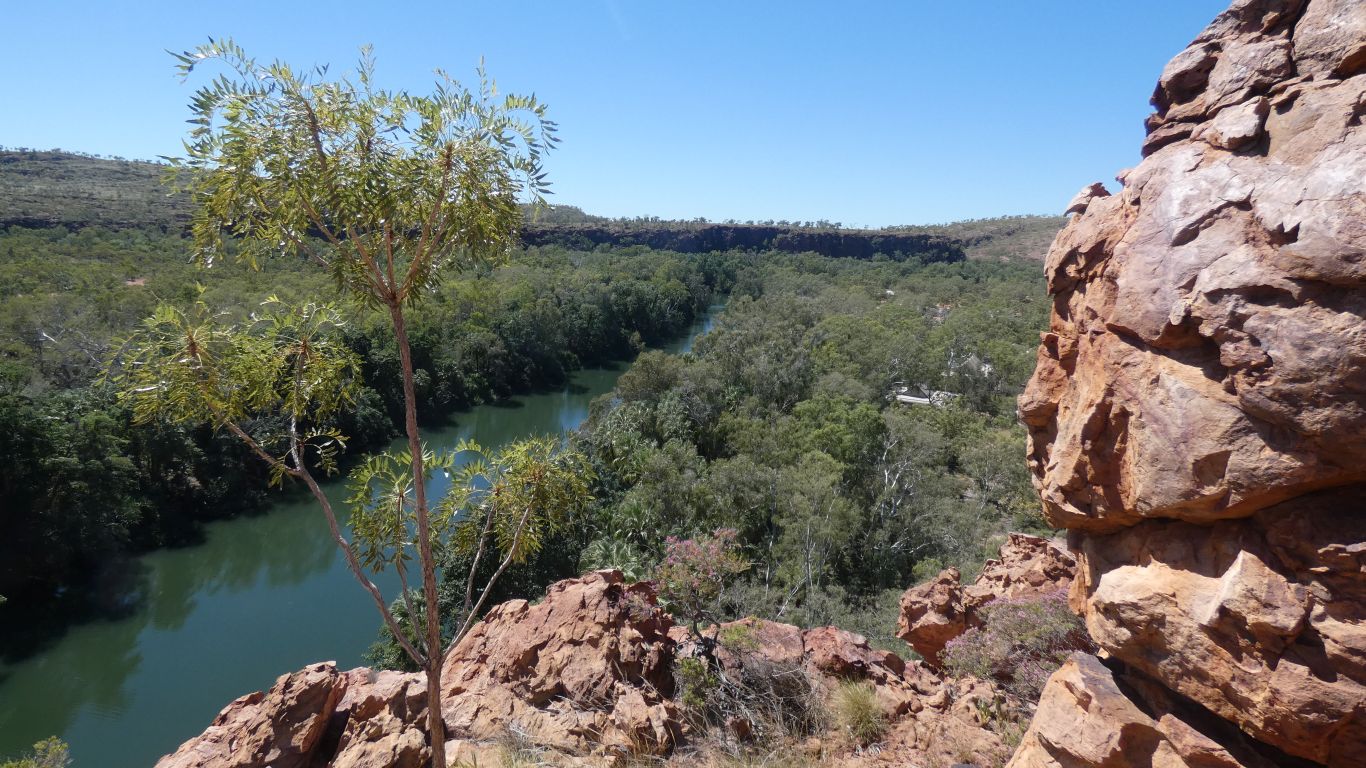
So next morning, awake at the crack of dawn and on the 50km of road north to the gorge. A few washouts, but generally in good condition considering the tour bus traffic.
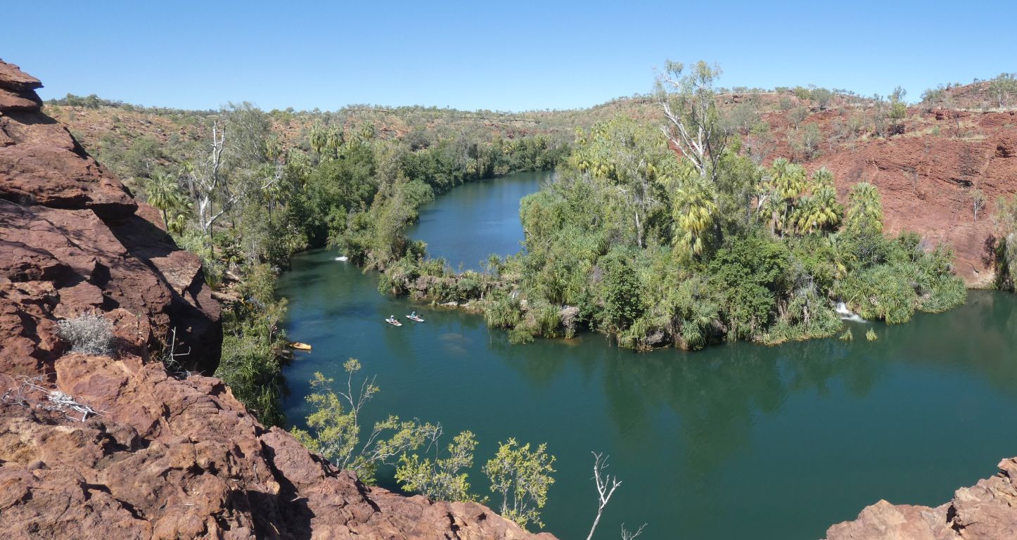
There's an 8km circuit, we took the easy way through a valley parallel to the gorge with a little uphill at the end, and returned along the riverside, which included a couple of steep descents.
With age comes wisdom!
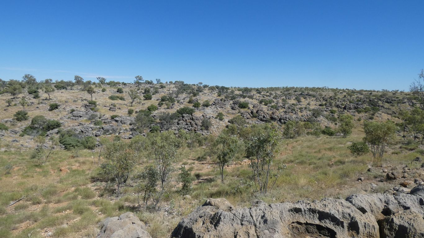
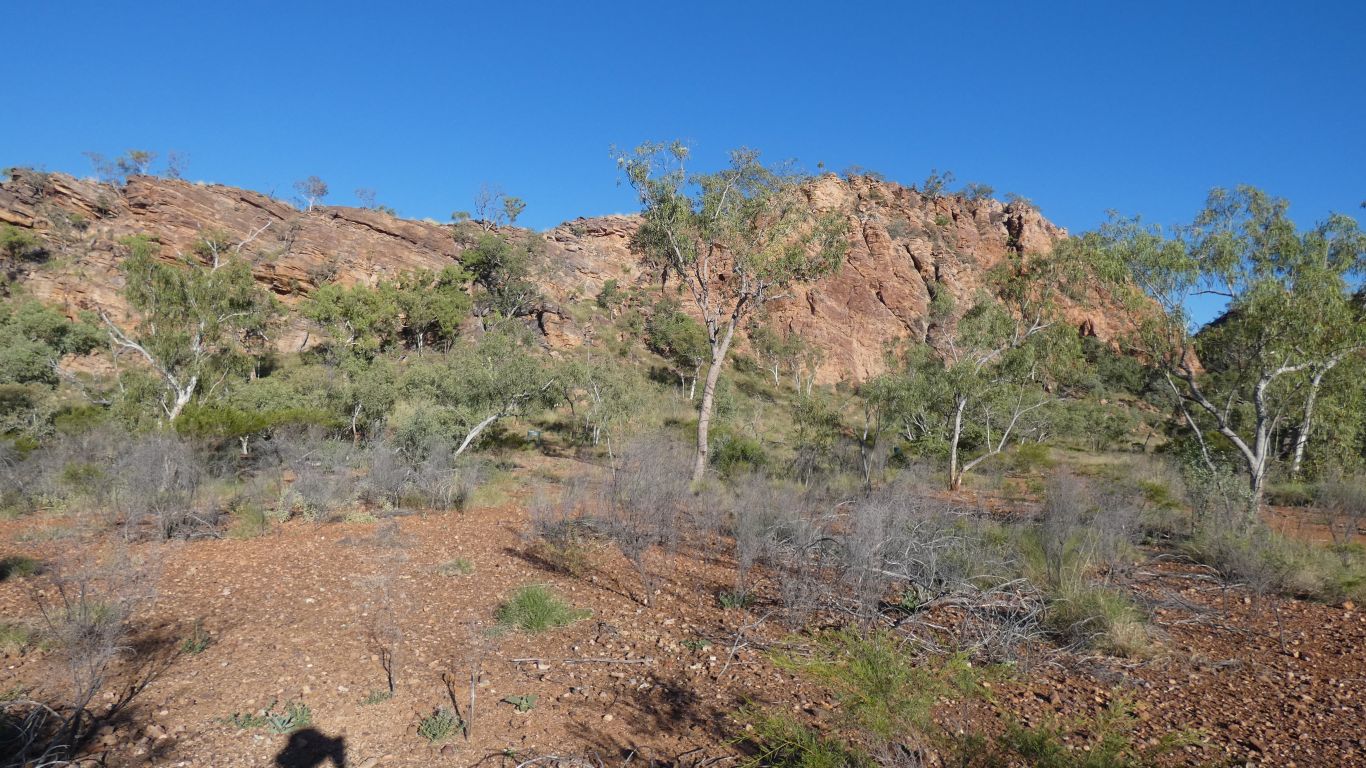
We weren't quite prepared for spinifex. The first we've noticed this trip. We wonder what is different about this area.
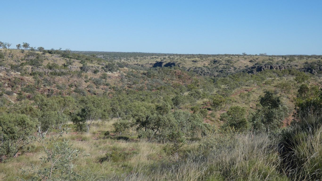
Its about here that we became separated. And both radios were in the same pack.
Two of us along the track, two took the "alternative route", straight up and over the ridge. Not the first to make such a mistake, there were footprints. Until they disappeared.
Had they turned back, or gone off the track? The eternal question. With answers only available later.
Either way, if we went back we would miss them or never catch them.
Having gone back to look, and waited a while, we carried on.
Lo and behold, there they were. From the top of the ridge they could see the track on the next ridge. A rough scramble down and up, and we were all together and on our way again.
And now we know what we are capable of we can plan ever more difficult excursions ....!
The bedding planes in the limestone look vaguely horizontal. Which suggests the sandstone tilted before the limestone was laid. Though really we haven't seen enough of the landscape to be even vaguely conclusive. They may be tilted away from us, and we can't see it from a side.
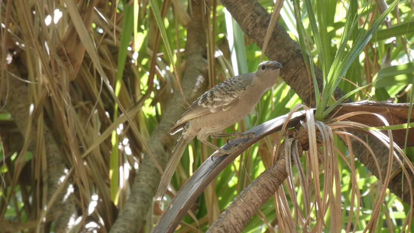
A quick pic of a passing bower bird.
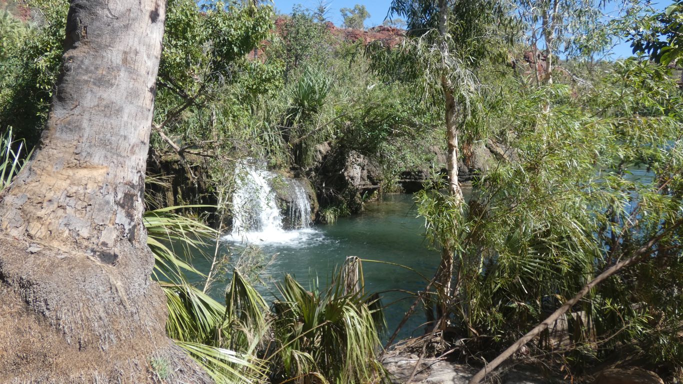
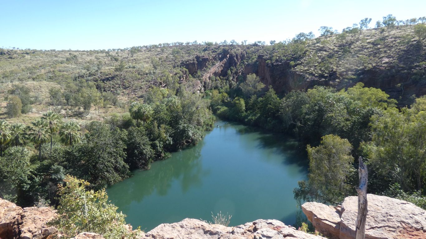
The canoists stop here for a swim. And sometimes domestic disputes about how hard or easy it is to carry (portage for the canoeing enthusiasts) over the falls.
Clue .... there's the track and convenient landing places, but the canoes look heavy.
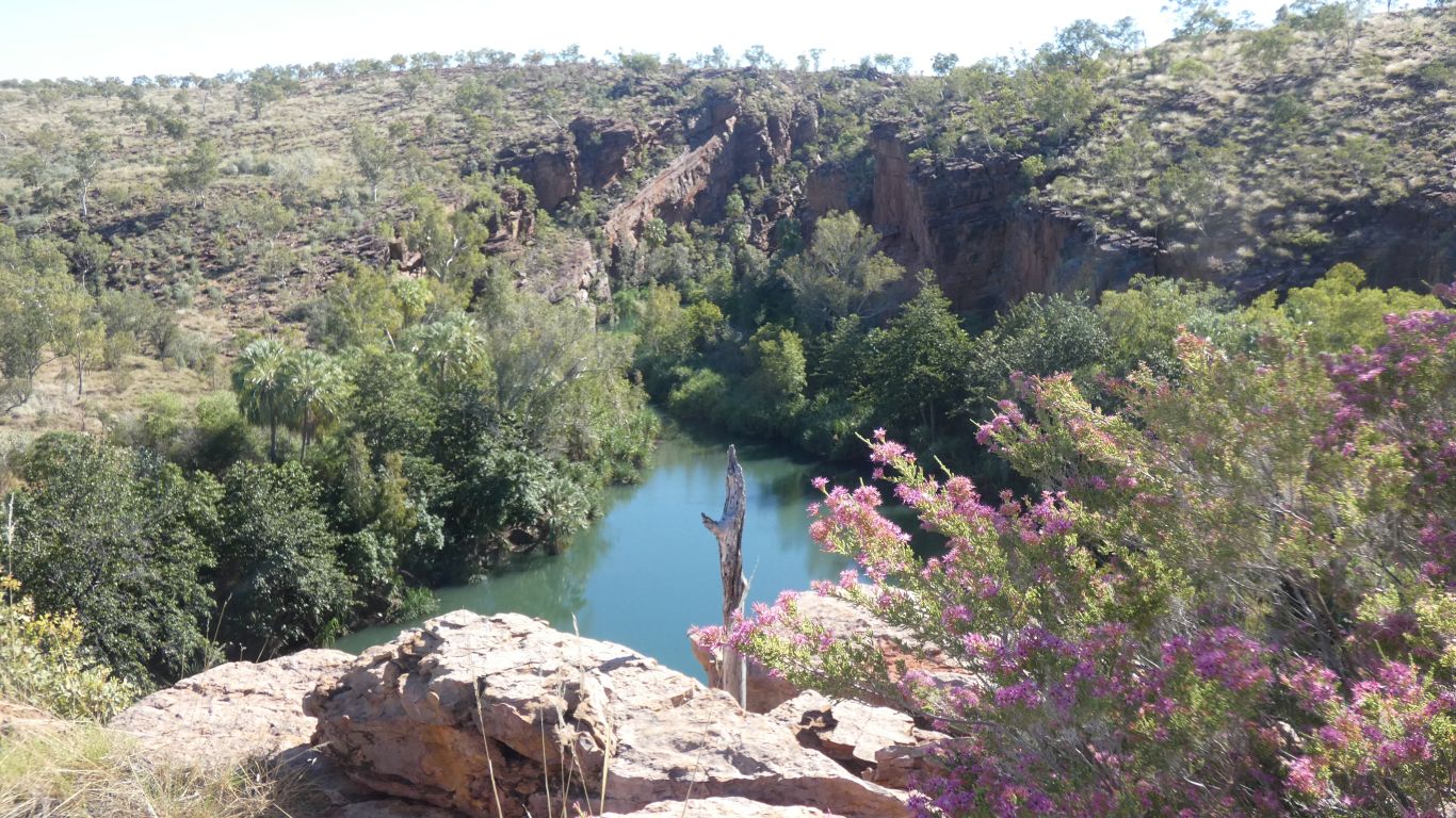
Sandstone gorge with tufa waterfall. To us a tad unusual. Formed as the calcium carbonate in the water crystallises out as water evaporates. Giving the classic convex shape as the falls build rather than the concave shape of falls (such as yesterday's Leichhardt falls) as they erode.
Just enough to remind us of Plitvika (Croatia), though very different and on a different scale.
"Do we have to?". Sadly, "yes". That's where the shortest track to the truck goes.
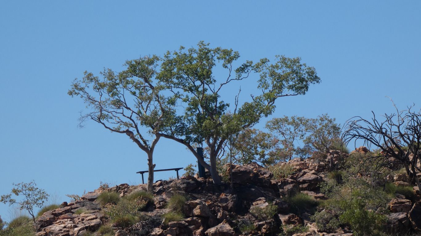
Nice to sit on the park bench for a while.
The steep bit is on the far side. We chose well.
We've drunk lots, and have lots left. Drank lots more back at the trucks.
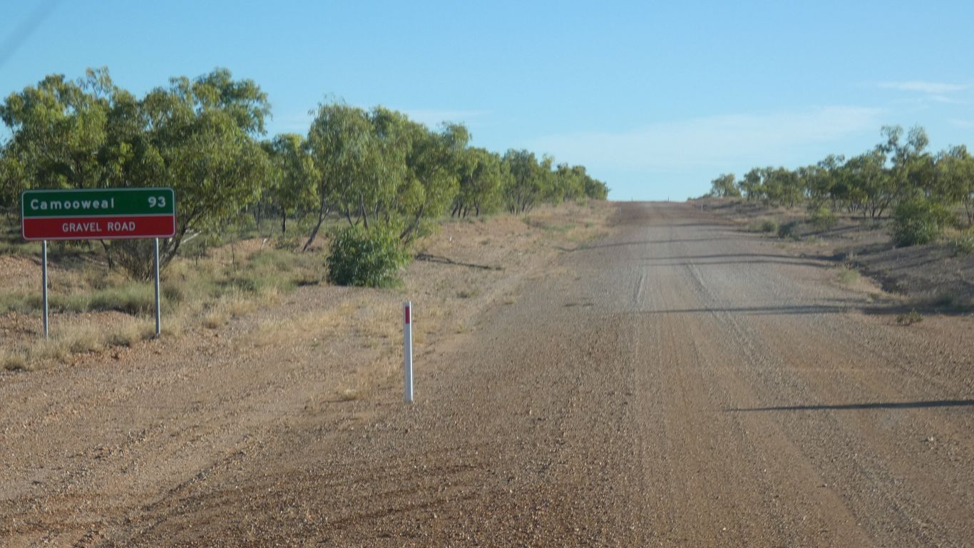
About 180km. So off we set.
We arrive at the southern most lake on dark. Every time the sun moved to be directly in front of us there was a bend in the road, the last 15km being due south.
Slow due to the difficulty of seeing obstacles in the gravel roads, with surface changing frequently, but generally good.
A good night's sleep was had by all.