Yesterday's biting wind subsided overnight, but returned with fresh enthusiasm some time after dawn.
A short stroll to Hell Hole Waterhole.
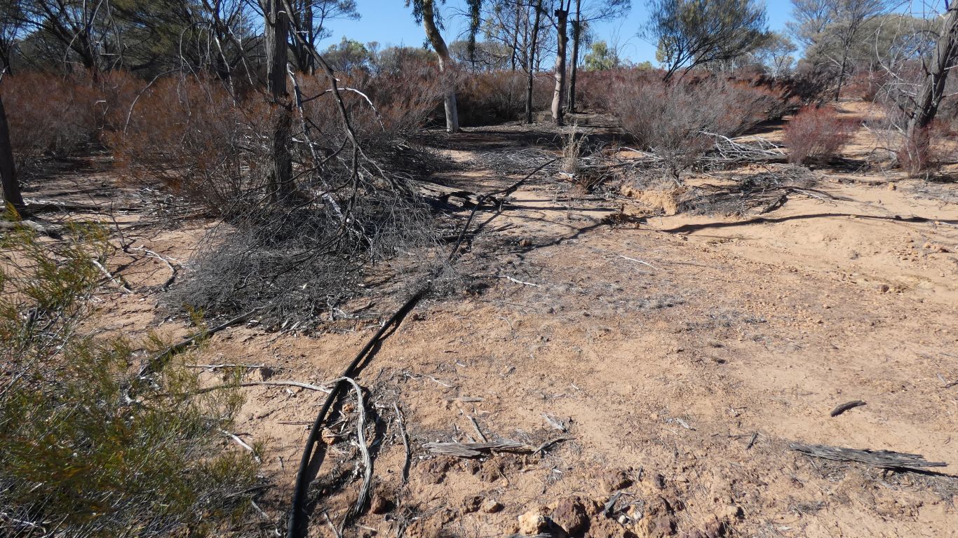
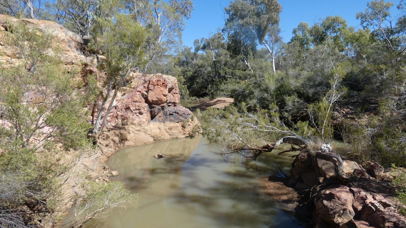
We think, the old vehicle track to the campsite crossed Powell Creek near the campsite by driving up and down each side on the rock ledge. We easily crossed the creek a few km upstream.
We trip over a blue reflective marker referred to in some vehicle descriptions. While looking for orange triangular markers glued to the rock and difficult (for us) to see.
We cross. Following the elusive orange markers.
A party of day trippers follow us.
There are vague, unsubstantiated, stories of a massacre of Aboriginals, throwing them into the hole, following the murder (by spear) of the local, well connected, personality, Welford.
Otherwise, we can only imagine how this place was given its name.
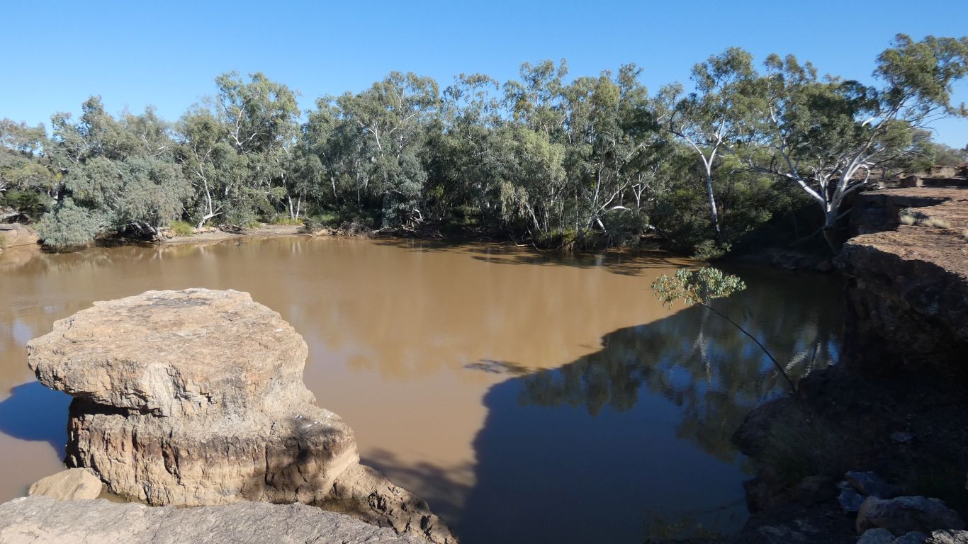
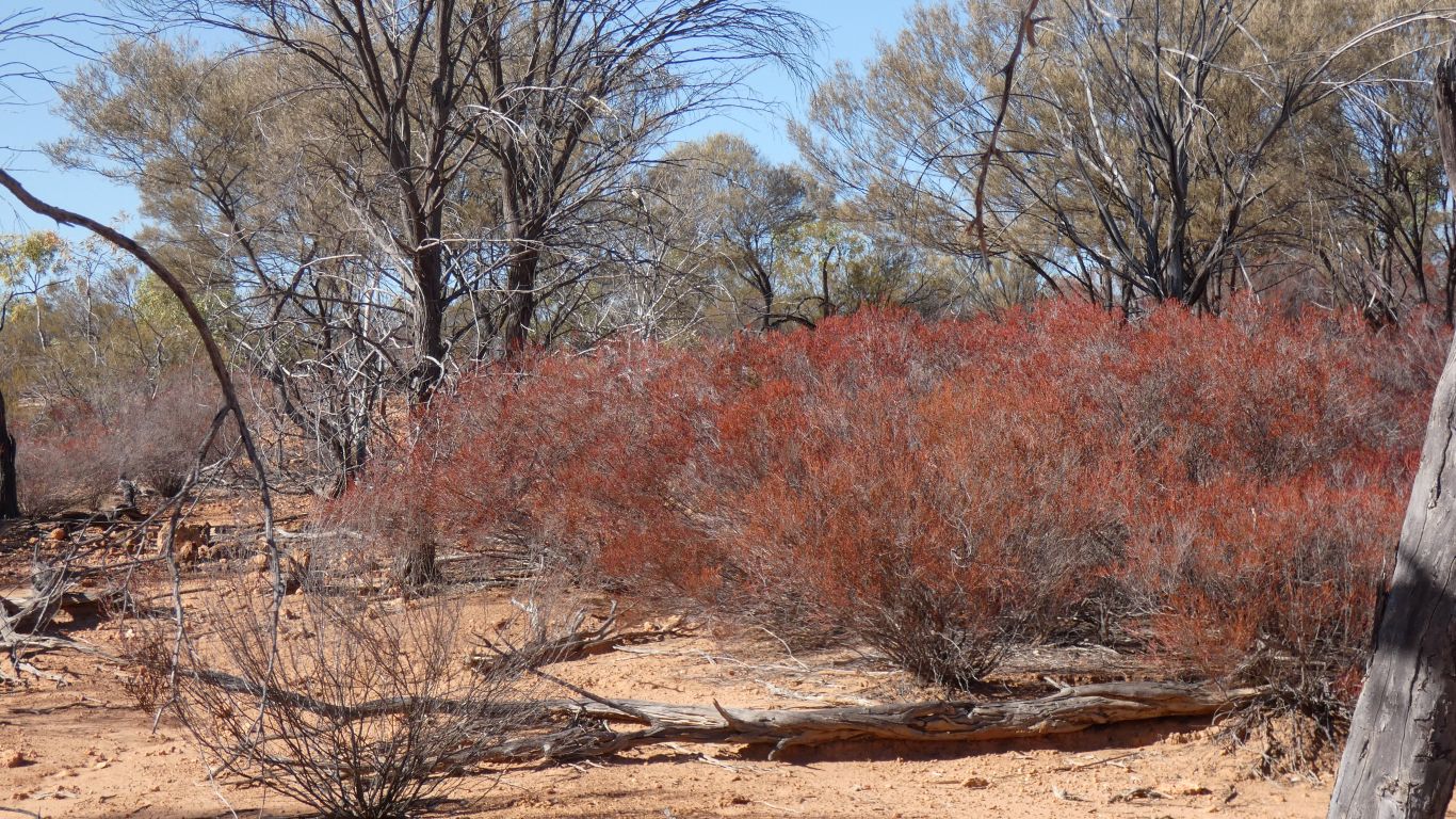
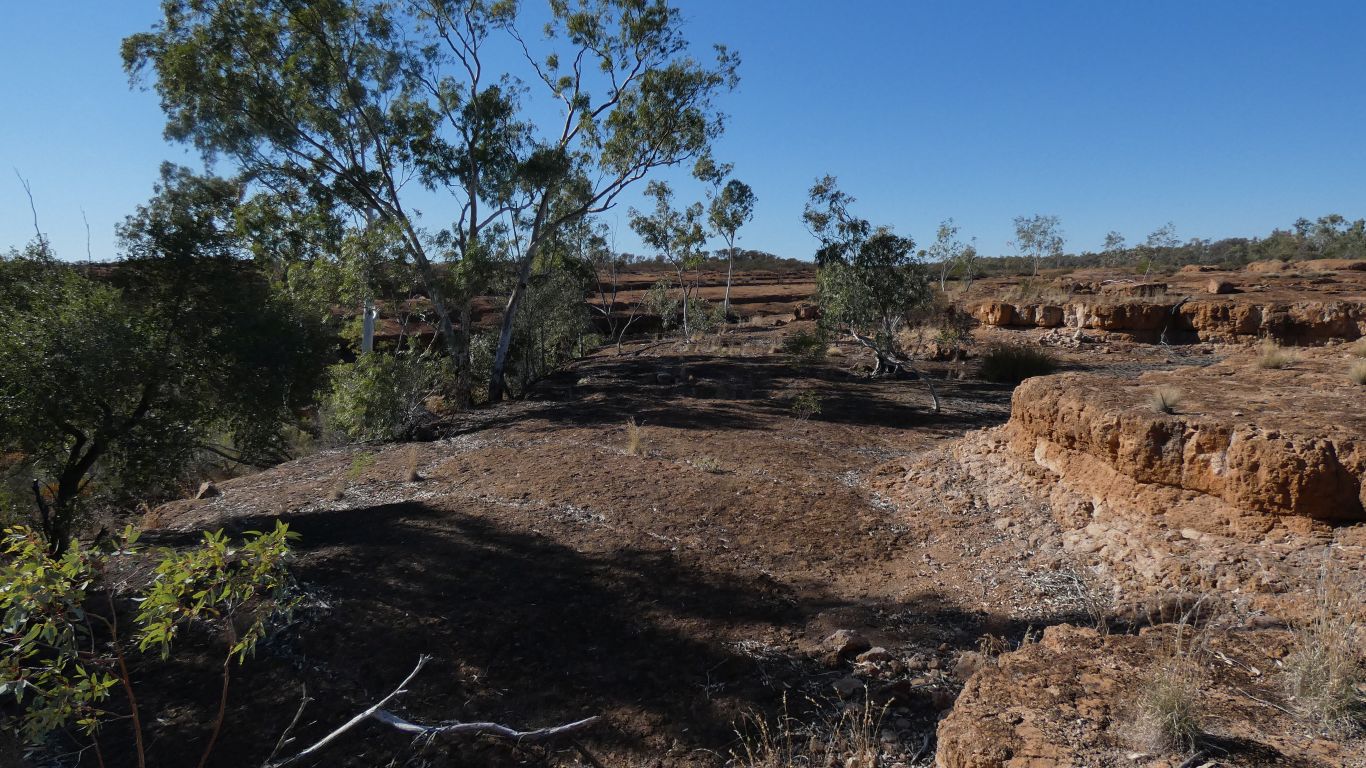
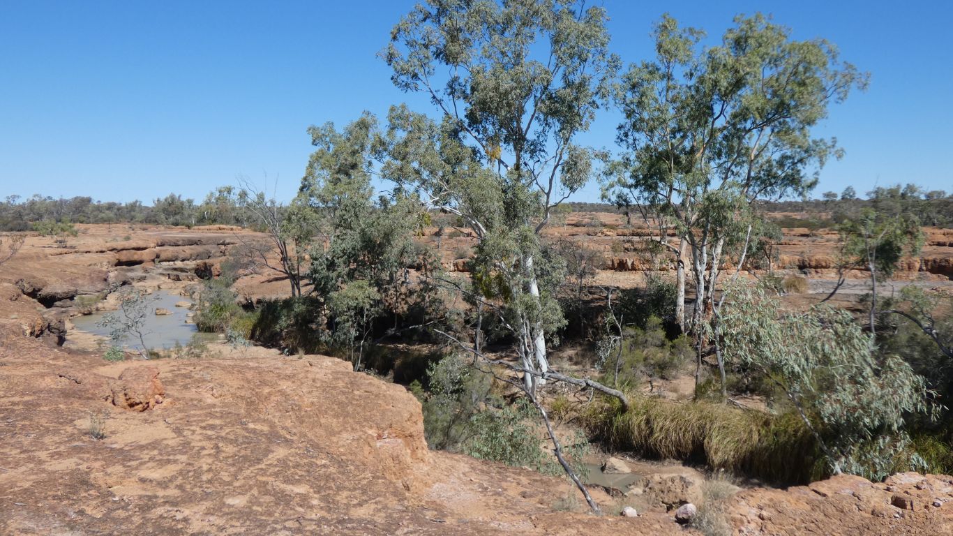
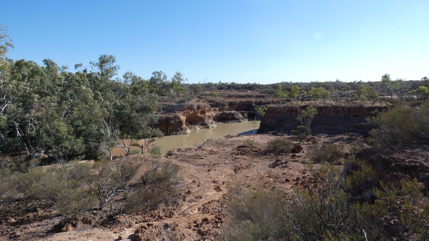
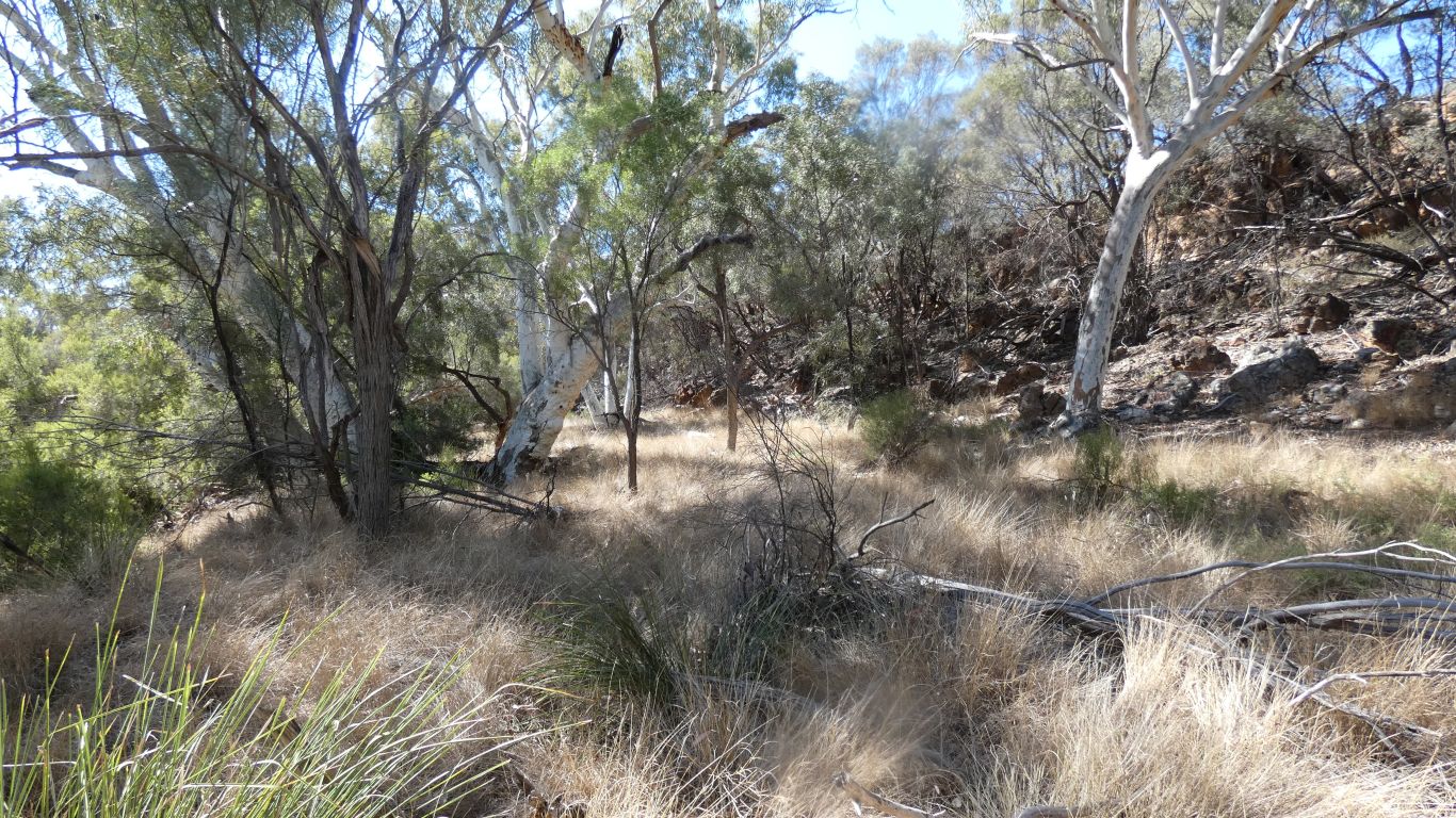
To us the waterhole looks like an oasis in an otherwise arid landscape.
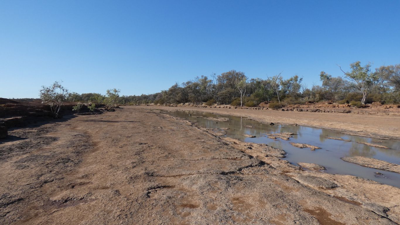
Bounded by two branches of Powell Creek and Spencer Creek.
We follow the edges round to where we crossed Powell Creek.
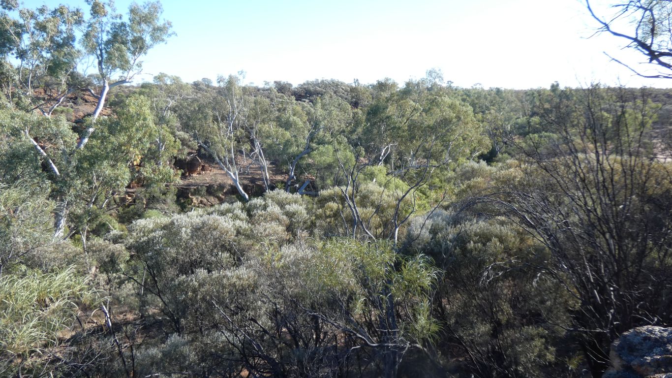
The gorges protect the large gum trees that have found the water.
Challenging what we know of photosynthesis.
The soil here is barely thick enough to be called soil. Difficult to know how the roots of plants hang on.
An old length of plastic pipe that disappears into the gorge.
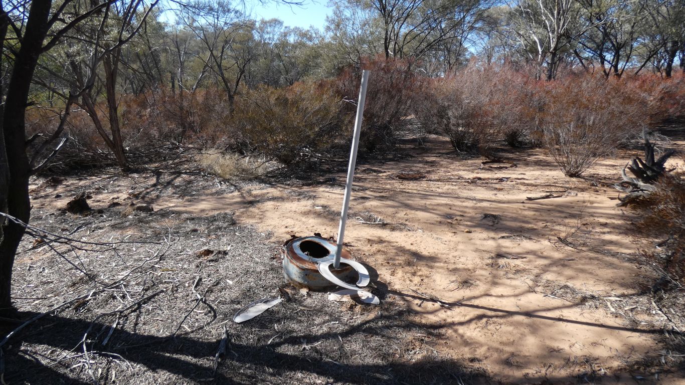
There are no facilities at present.
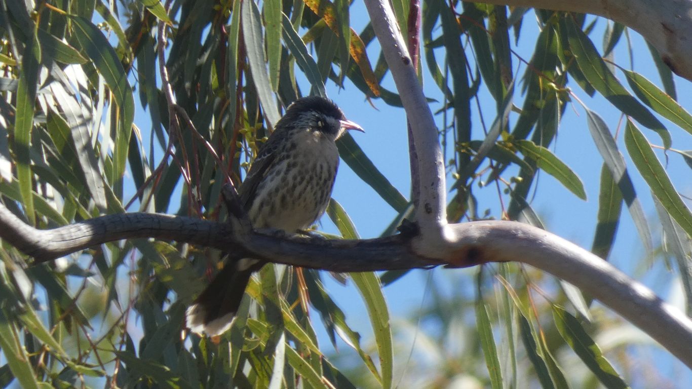
The tail feathers, last to grow, are blue. Some wing feathers turning blue.
Of course I guess it could also be female.
A tad more than 3km by the time we add campsite to track beginning.
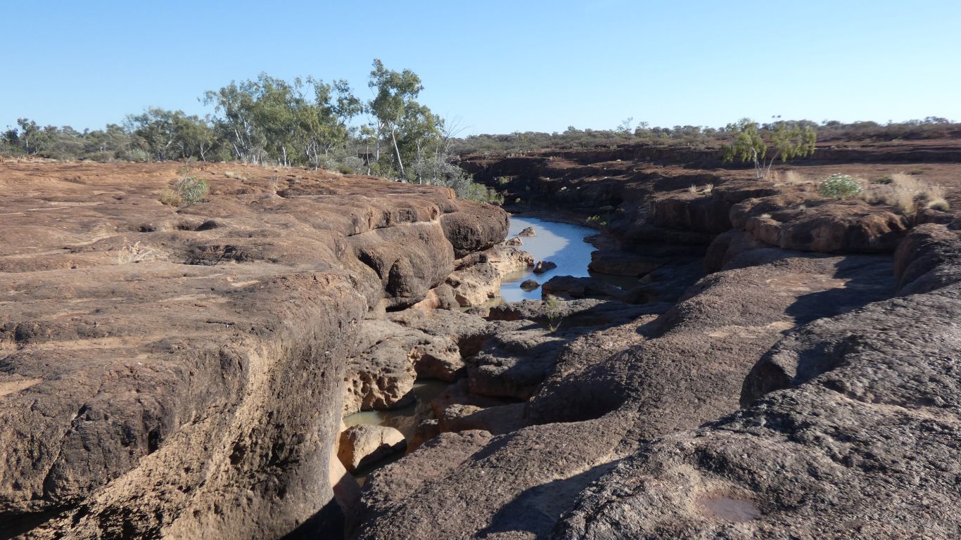
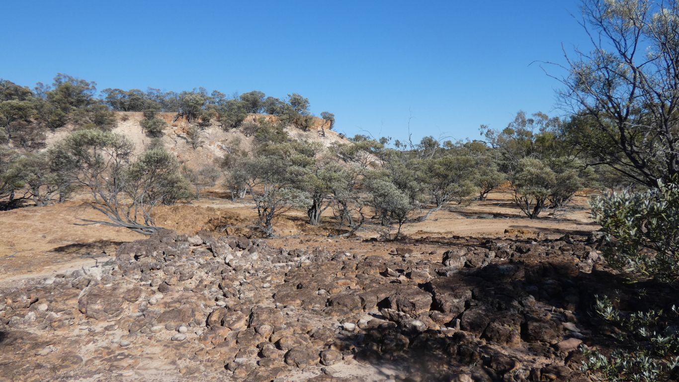
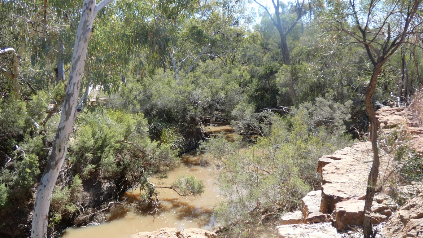
The gorge is on our left.
Perhaps this is "Curly".
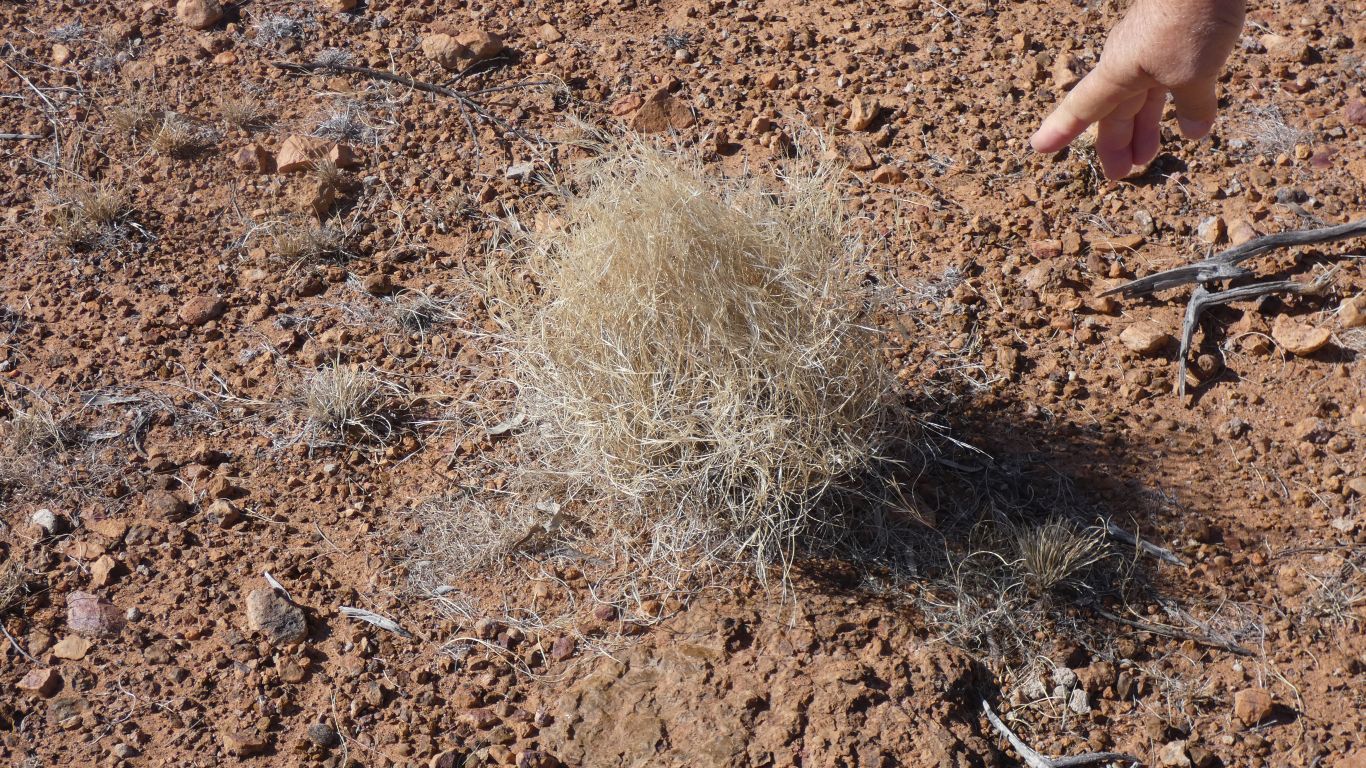
After a while everything becomes Mitchell Grass.
We've seen spinifex pigeons, but little spinifex.
And then a penny dropped, as we try to make sense of the landscape.
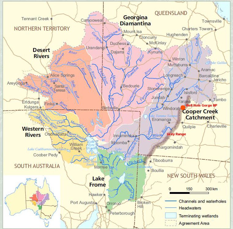
We are in the vaguely north east - south west Grey Range. Roughly marked on the Eyre Basin map.
The Barcoo River has to flow round the north end of the Grey Range.
The Bulloo River rises to our north, in Idalia National Park, south east of Isisford, and flows south on the eastern side of the Grey Range, to terminate at Bulloo Lakes just north of the border, east of Tibooburra, with an overflow extending 150km south.
Now I know why it didn't appear on the Eyre Basin map.
The east west Gowan and Warrego Ranges form the basin boundary, the watershed, west of Tambo. Bulloo flows south, and Barcoo north.
The eastern boundary, north of Tambo, is, of course, the Great Dividing Range. I recall being a tad surprised, when we camped there, that Lake Galilee is in the Dividing Range.
It only vaguely registered when camped at Lake Carellan, near Camooweal, part of the Georgina River, that we were also near the edge of the Eyre Basin. We had our minds on progressing north. I guess the basin is so big its hard to avoid.
All very complicated. I just have to remember water flows downhill!
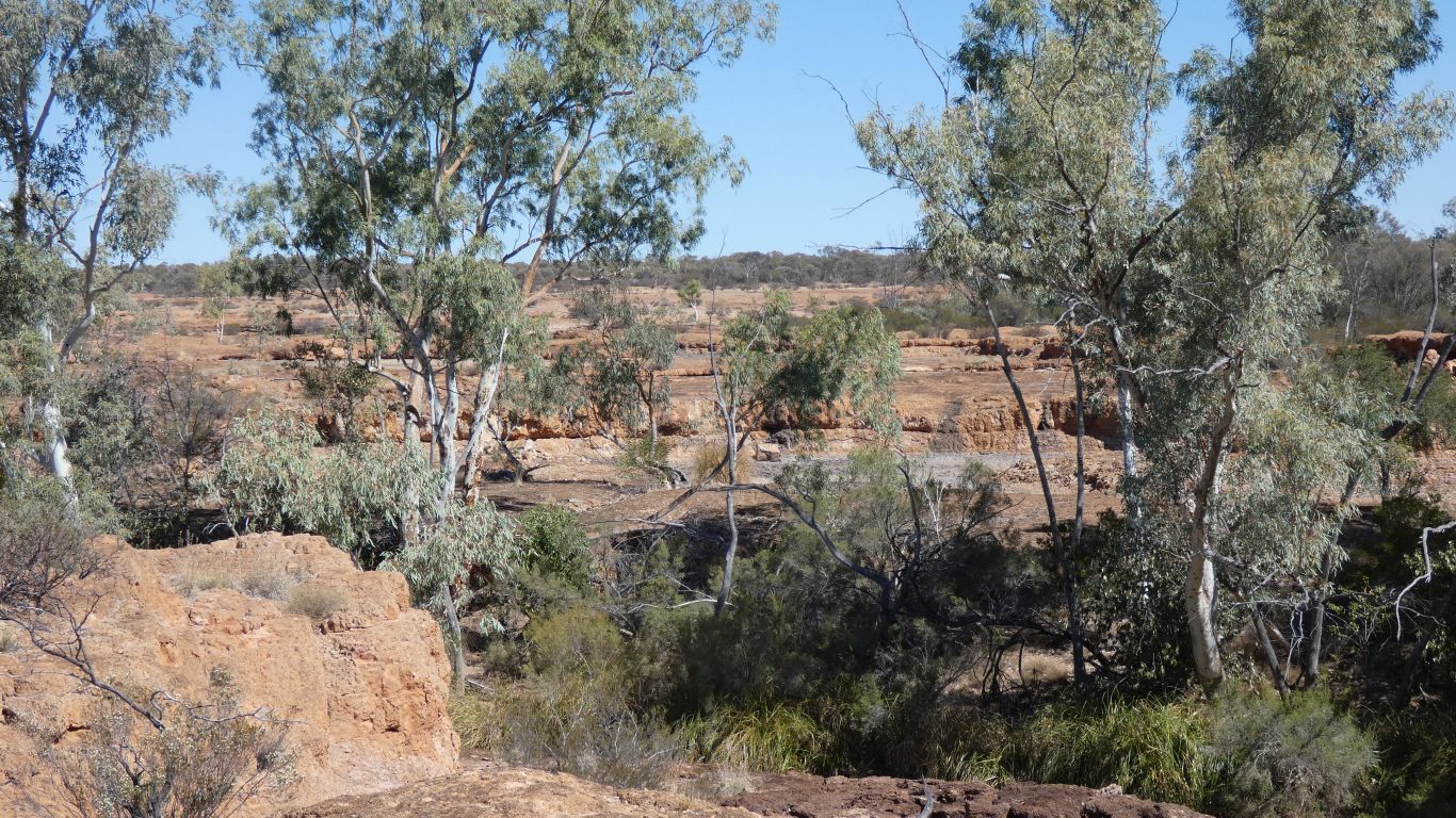
The gorge is a bit difficult to see with all the trees.
Sort of steps, and ledges, from the plateau down to the creek.
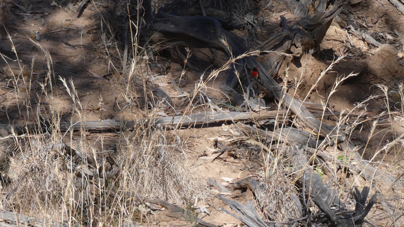
We last saw red-capped robin in the Pilbara and Kimberley.
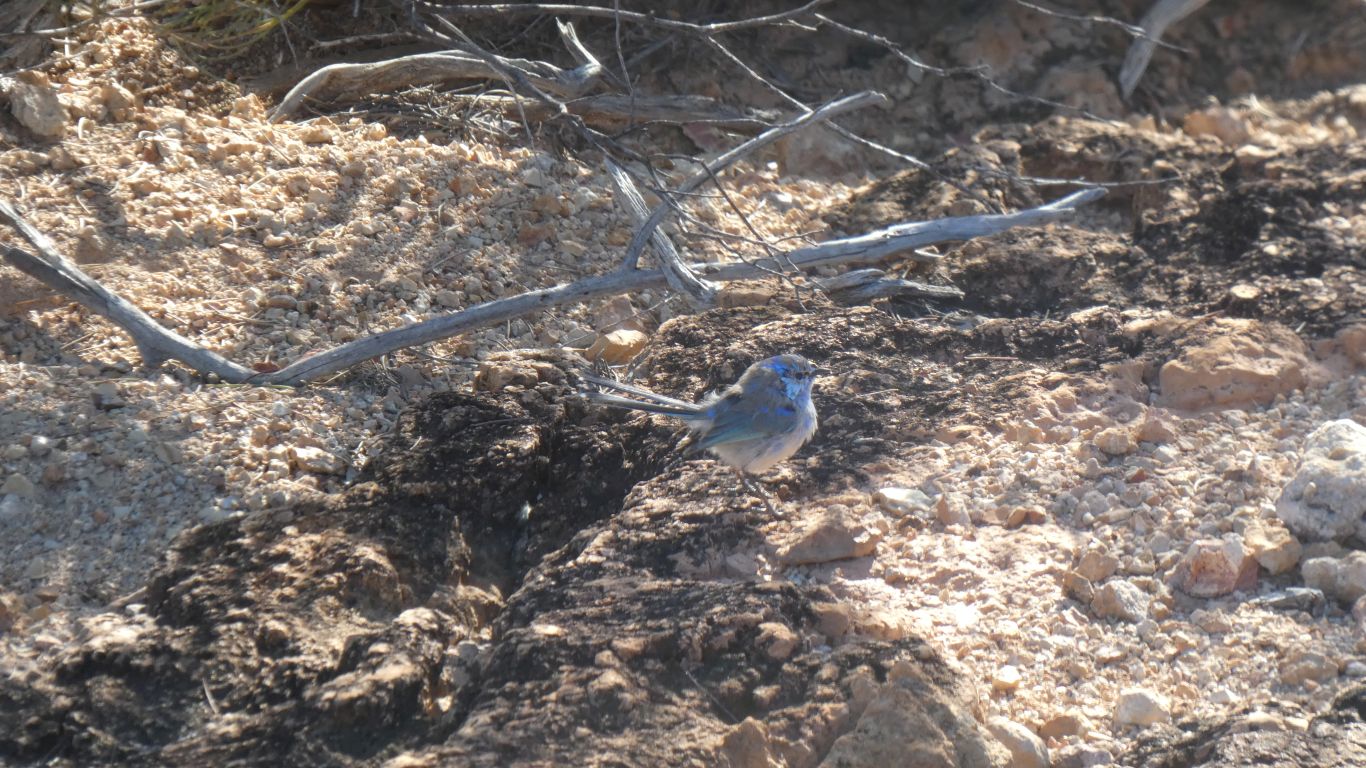
Perhaps they are juveniles maturing after all. Though probably a mix of male and female.
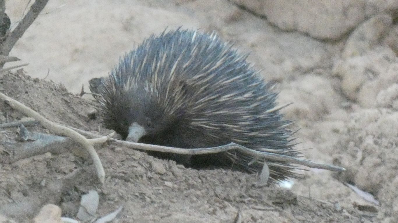
An echidna in the bottom of the gorge.
Grubbing away happily in the sand.
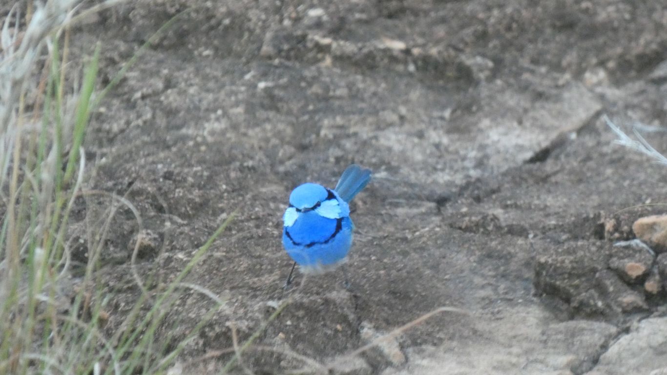
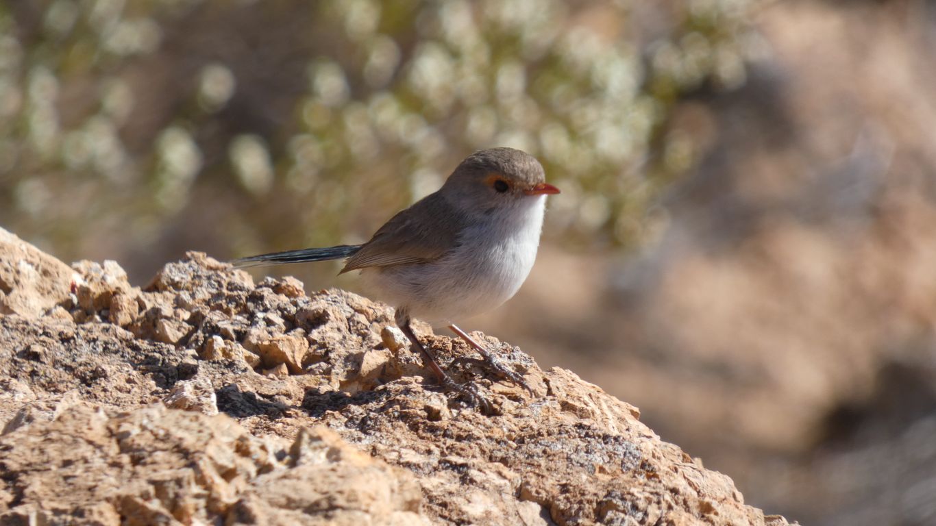
Not a superb fairy wren, the markings and colours not quite right.
But also we think not a splendid blue wren.
We haven't seen such a wren previously. A truly magnificent specimen.
We are near the same bush I saw the wrens earlier.
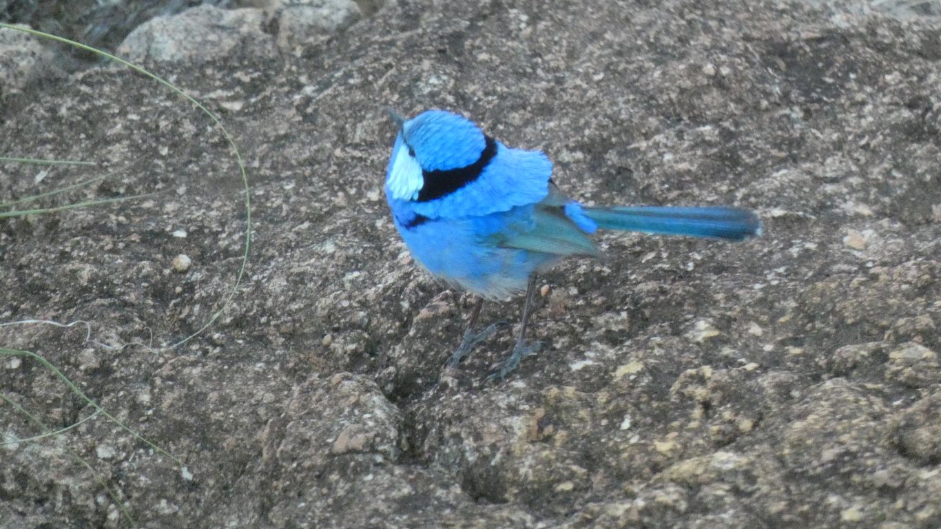
Almost too late in the day, not enough light, for a pic. But it stayed still almost long enough.
A fitting end to the day.
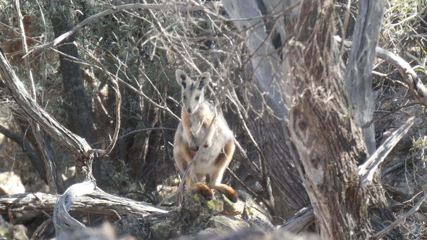
Though no yellow-footed rock wallabies, the recognised habitat of which we have invaded.
Rather than drive, we thought we'd walk.
Not far. 1.25km for crows. For us, from the map, about 3km. We have gps coordinates to aim for.
Walk along the edge of the gorge. Taking note of where the other side is .........
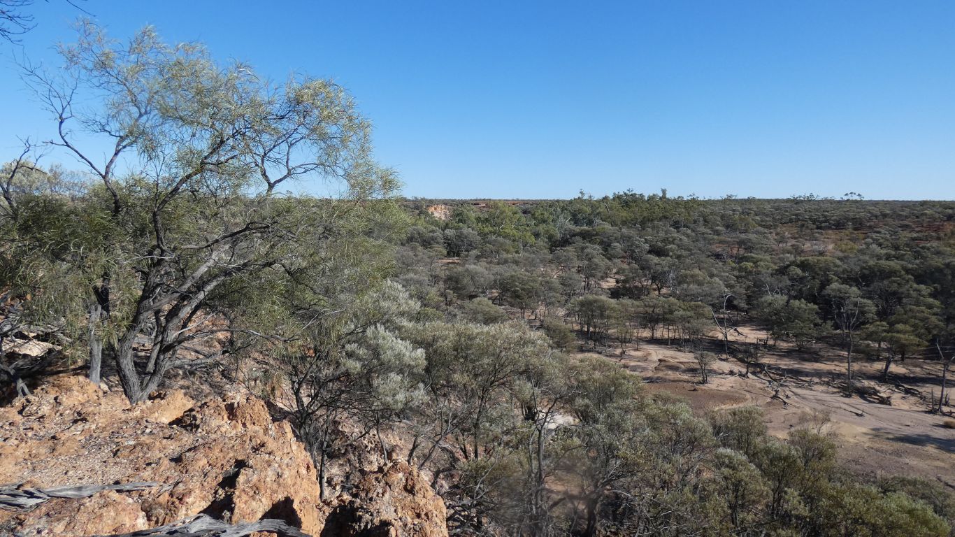
Our map is too large a scale, the contours too far apart, to be really useful for walking. But a useful indicator nevertheless.
We have "landscape reading" to guide us.
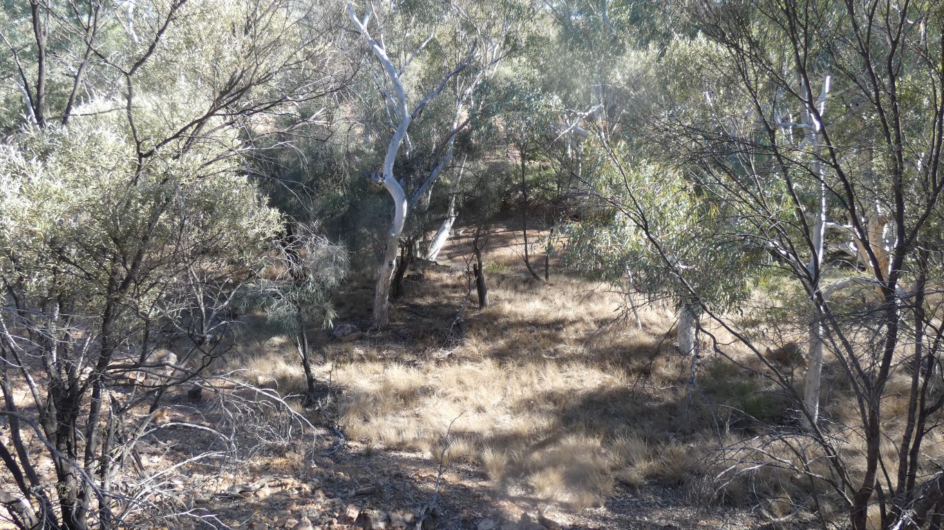
Easy going. A taste of what it may be like if we return in the gorge.
Ever mindful of snakes, we have seen none. Though that doesn't mean they aren't there.
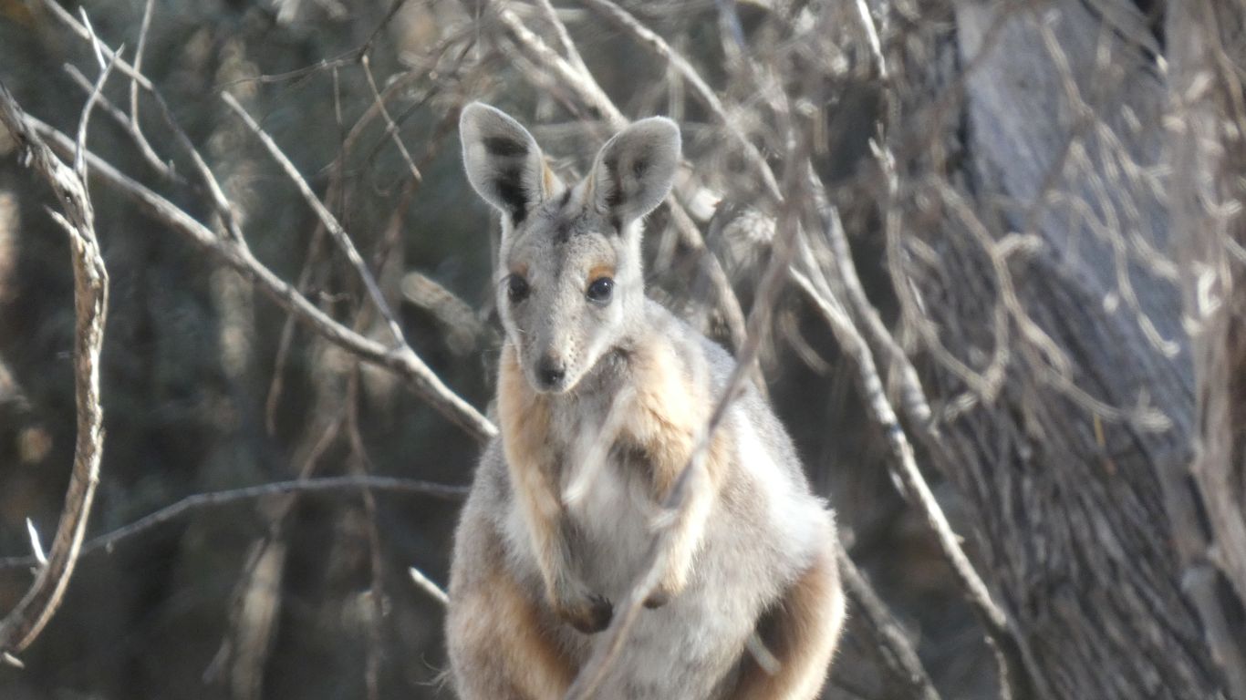
Looking into the sun starved cleft in the cliff caused by the tributary there were two yellow-footed rock wallabies among the trees and shrubs.
On reflection, a much more likely place to find them during daylight than the more open cliffs near the campsite.
One hopped away. The other stayed very still and watched me from about 10m away.
The camera behaved. Even to the extent of allowing me to change settings and use pinhead focus through the twigs. None of the "turn off camera then on again" or "zoom error" messages that have plagued a few photo opportunities recently..
It disappeared when I turned my head to talk (quietly) to Ali. I turned back within a few seconds .... and there it was, gone.
They are apparently endangered, elusive, and secretive. We feel lucky.
While I had coordinates for the turnaround we were fortunate a couple who camped near us were leaving and had called into to the waterhole. The vehicle visible from a couple of hundred meters. Easy navigation across the plateau.
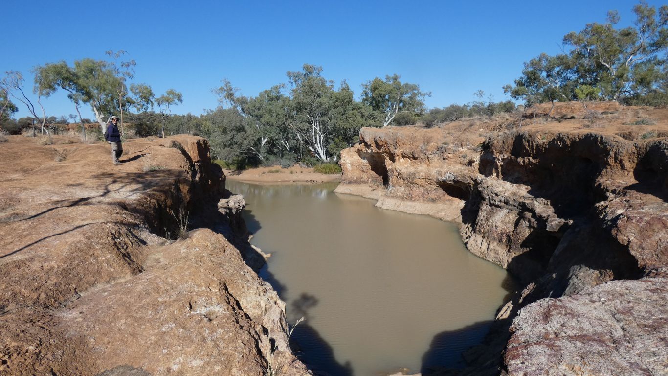
The east side cliffs of the gorge looked a bit difficult, with no obvious way down, so we crossed the creek to attempt the west side.
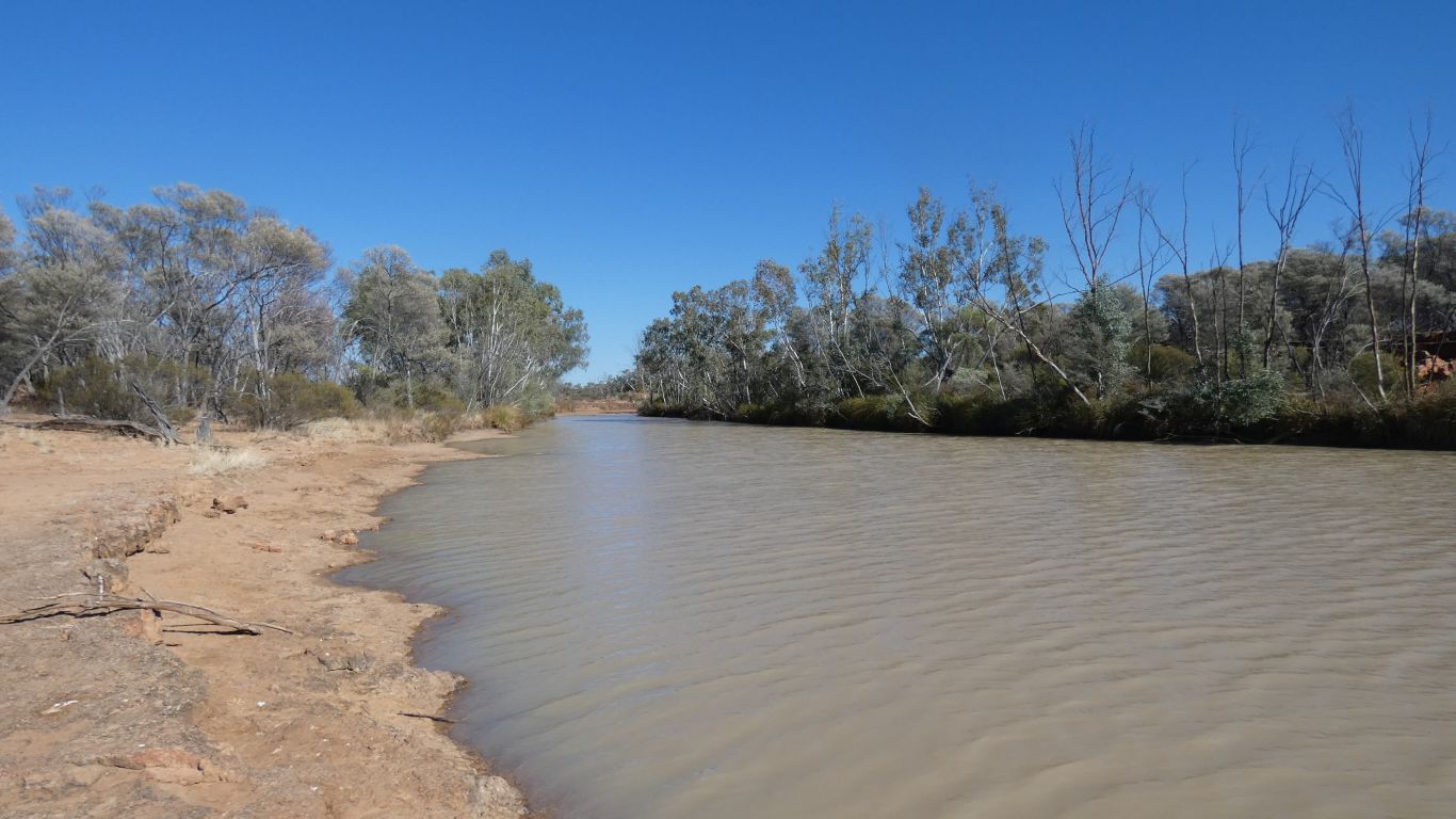
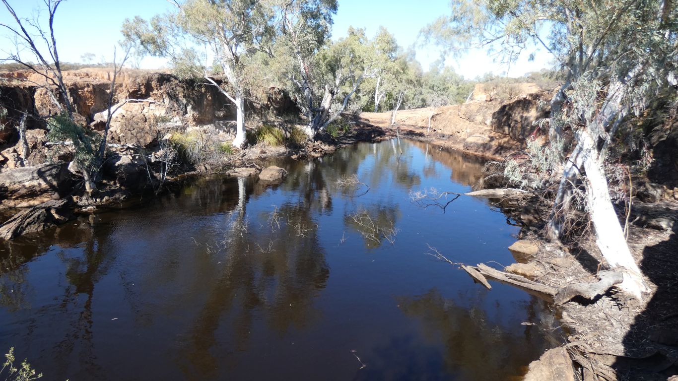
Passing, within 50m of the first, muddy, waterhole, an almost clear waterhole. At least I could see dead branches and rocks about 0.5m into it.
Not inviting enough for a swim, the biting cold wind was still with us.
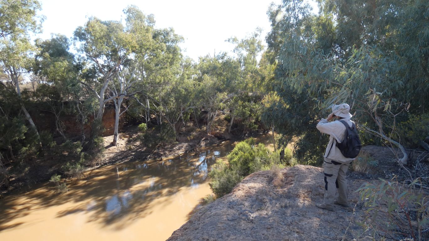
We pass several places where birds were singing to us. Stop for a pause.
Through the wide part of the gorge was easy.
As we sensed the gorge narrowing the vegetation became more dense.
We took the shortest route back to the truck.
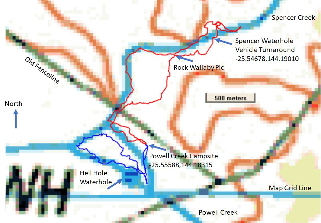
Red track today to Spencers Waterhole. About 6.3km, two hours walking, one hour stopped, watching.
Home for lunch. And scones.