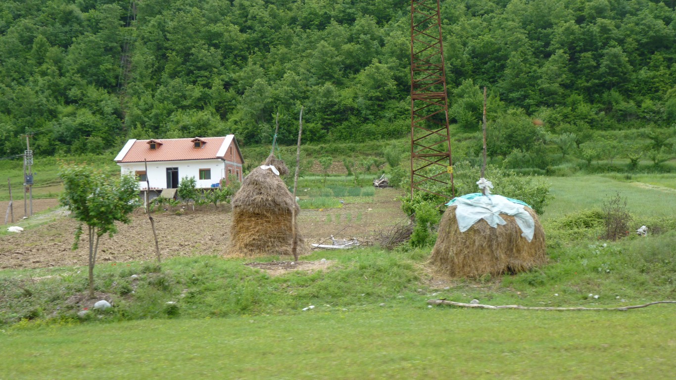
Ali likes haystacks!
We think we last saw haystacks a bit like this in SE Asia.
Maybe the time of year but it looks a bit like "pooh sticks".
Remove bits from the sides and hope it doesn't collapse.
By some quirk of fate, the districts of Albania are named the same as their principle town.
Which makes the heading for this page either easy or hard.
We've strayed a bit further east than we intended.
So we decided to head even further east to find a route south.
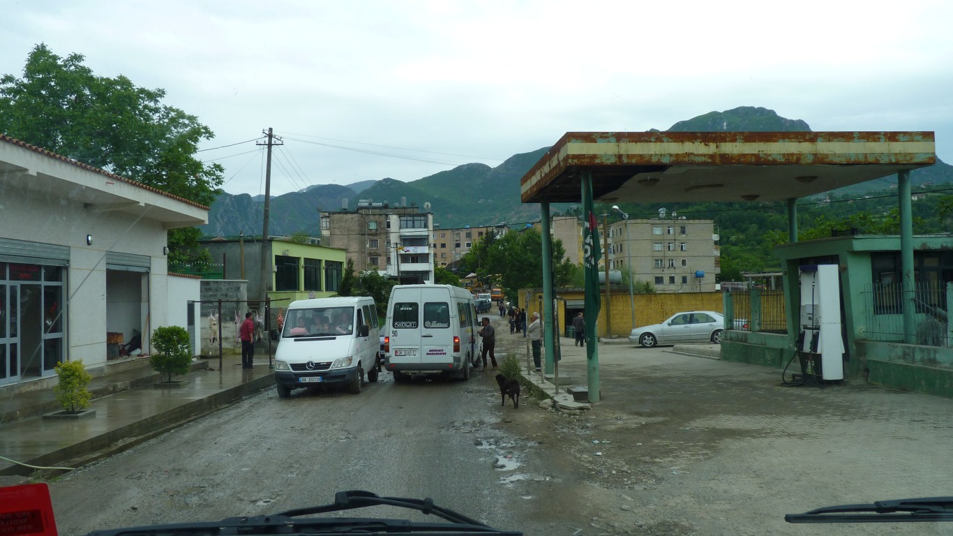
A small traffic jam in the next village after Sug.
The minibuses simply stop. And there were road works beyond.
I was tempted to use the fuel station as a by-pass.
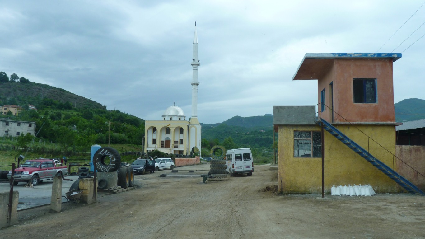
Albania is secular with most of the population stating they don't belong to a religion.
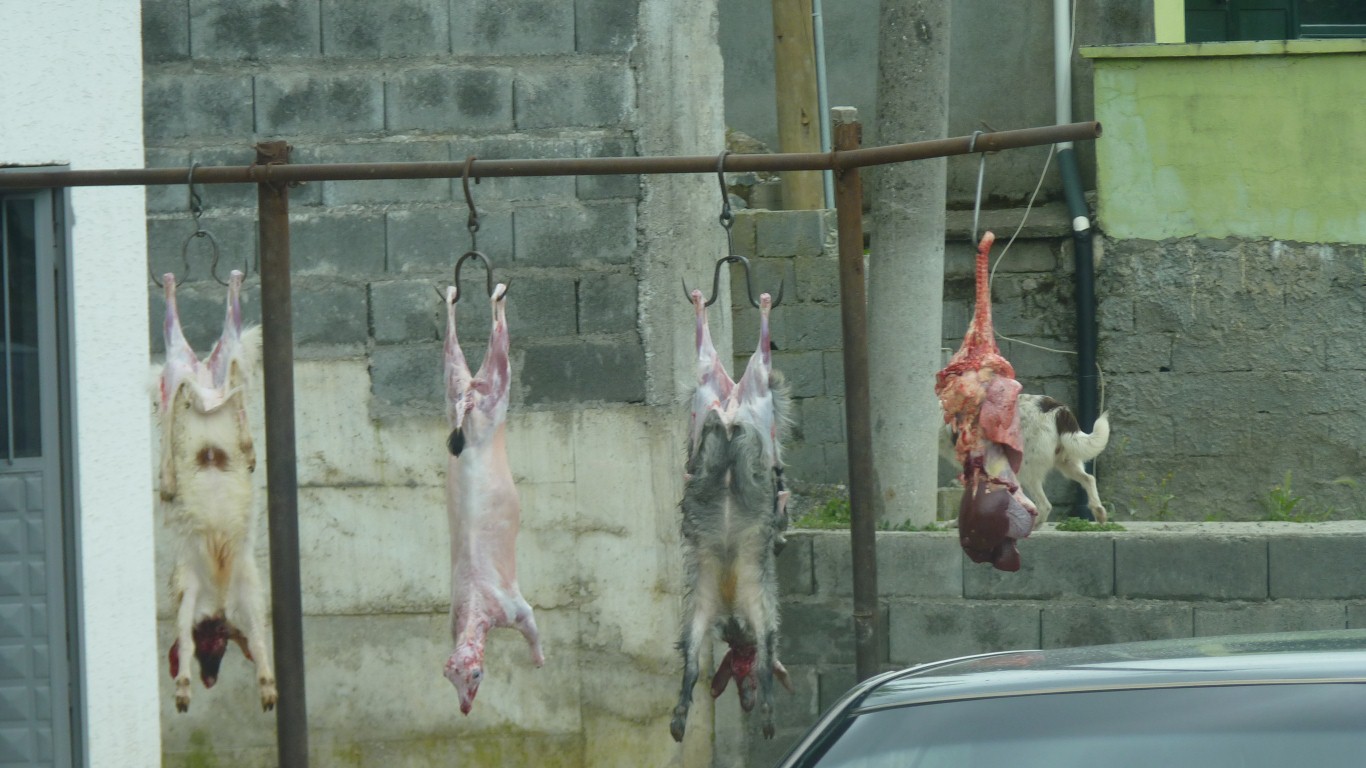
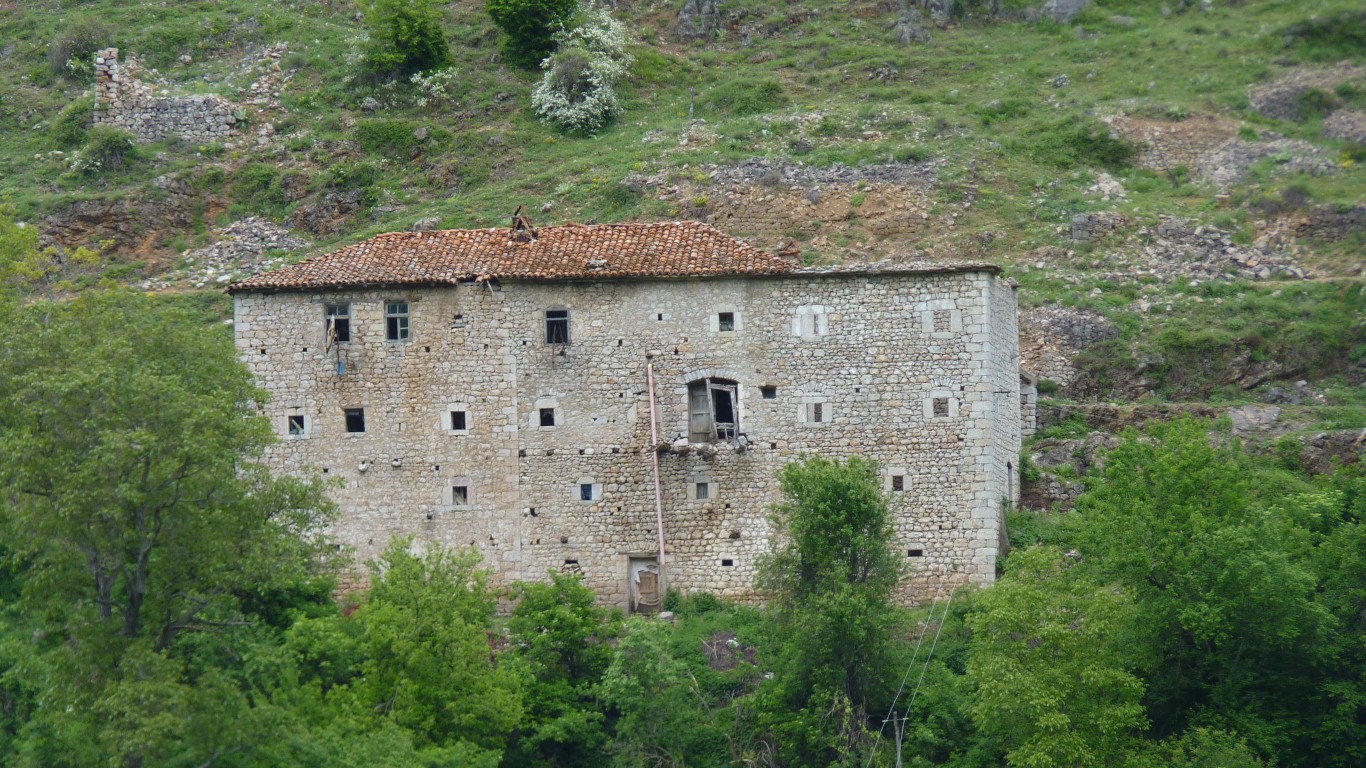
The nearer building is a tribute to the growth in motor vehicles. There was at one (recent) time a healthy smuggling trade in stolen cars from Germany.
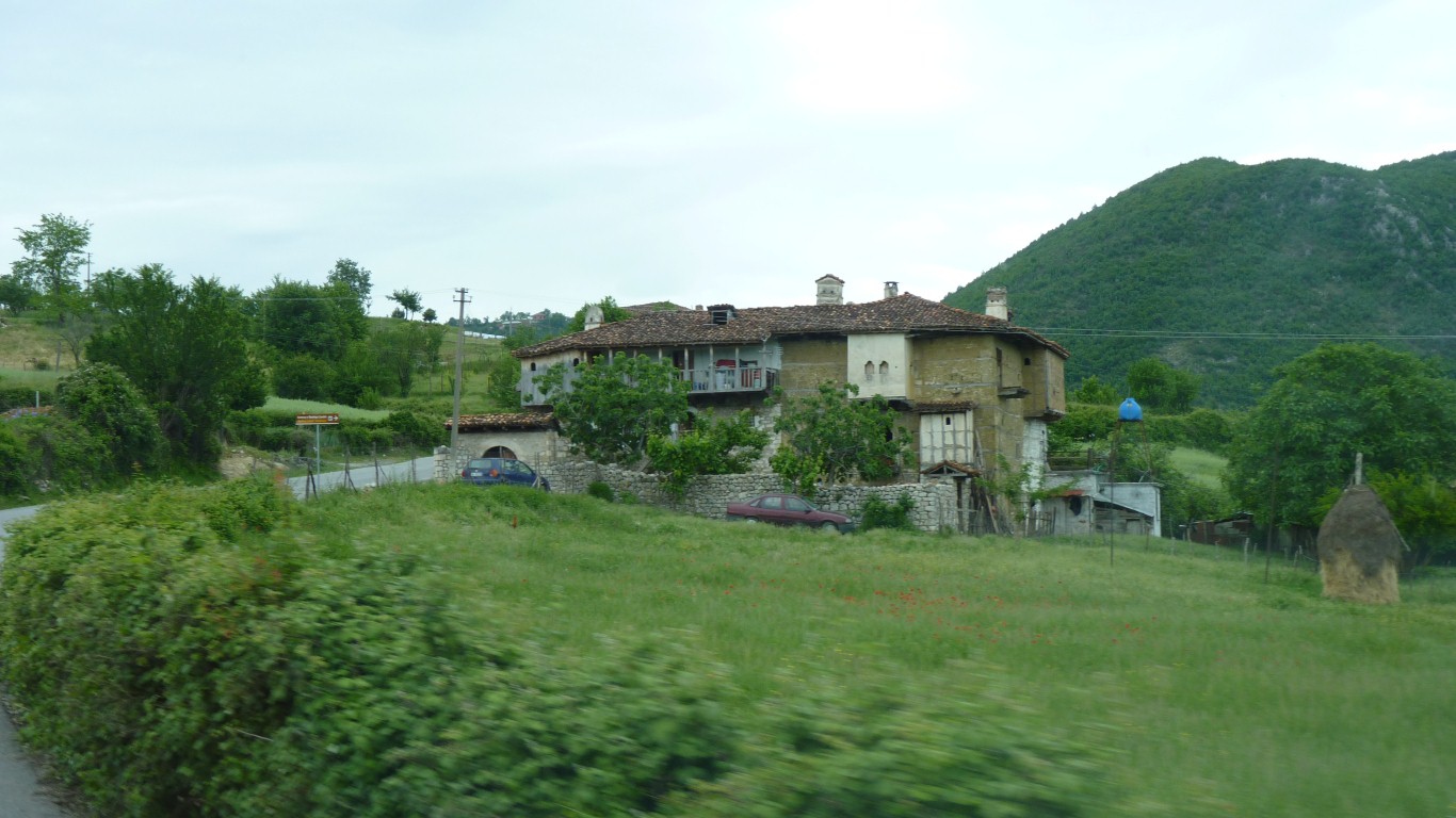
Stone and wood rather than concrete and blocks.
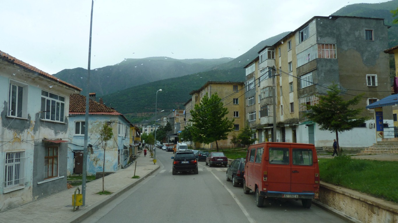
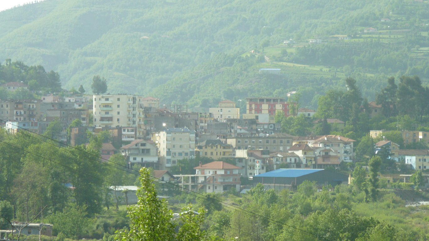
Looks like a mining town.
There's a sort of overwhelming depression about the buildings to our untutored eyes.
More chromite.
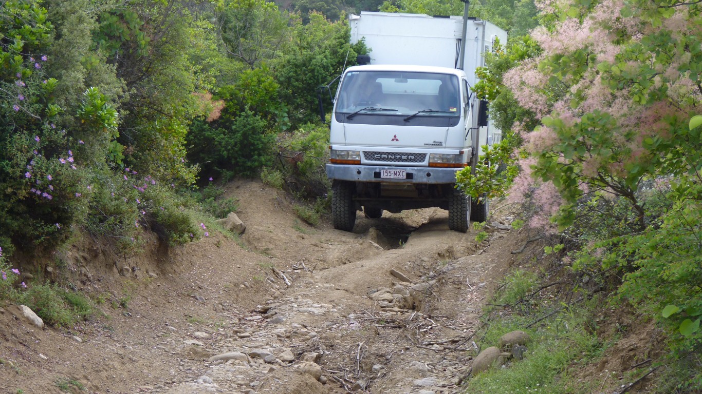
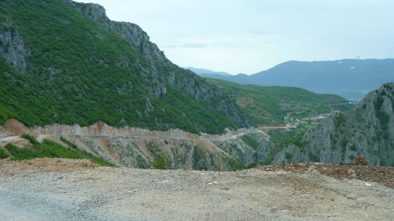
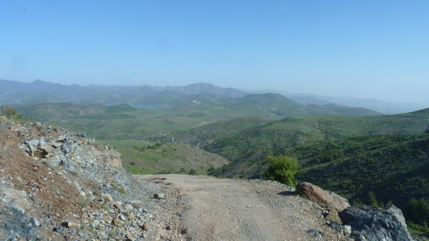
Our map says "4wd only".
We are not sure what to expect after the tracks of the last couple of days.
The track is roughly parallel to the border with Macedonian leading south.
In parallel with support for business, support for women in society, a fight against corruption, and working towards joining the EU.
While the world is appalled at the thought of a Syrian rebel eating his enemy's heart the elected Albanian president is a heart surgeon.
Our 4wd track has been upgraded to a reasonable gravel road.
A bit bumpy but more than 20 km/hr most of the time.
It seems to have been carved by connecting several older tracks and neither our gps nor the paper map know about the new bits.
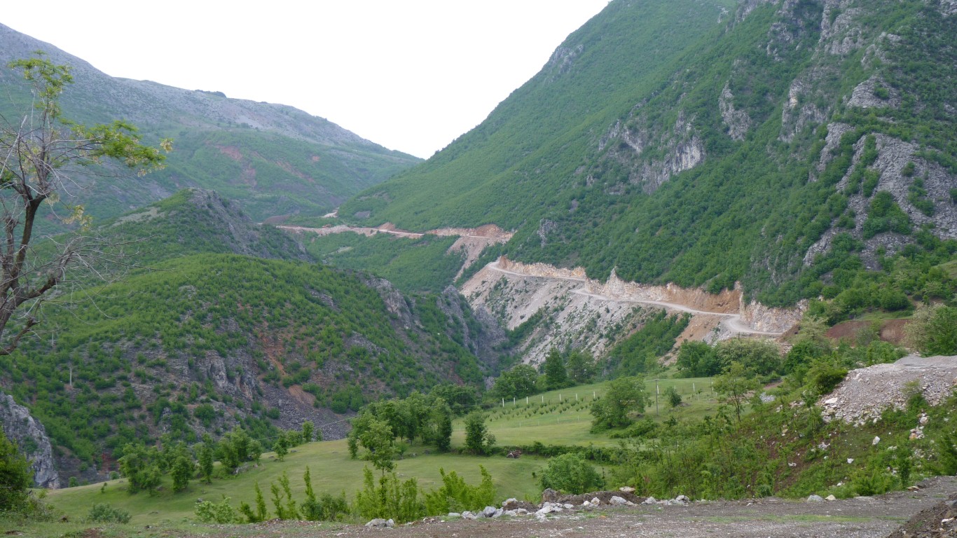
We followed our noses. Proceeding in the hope, and absence of a magic wand, that whenever it turns east, or west, or even sometimes curling back on itself, there will always be another turn to the south.
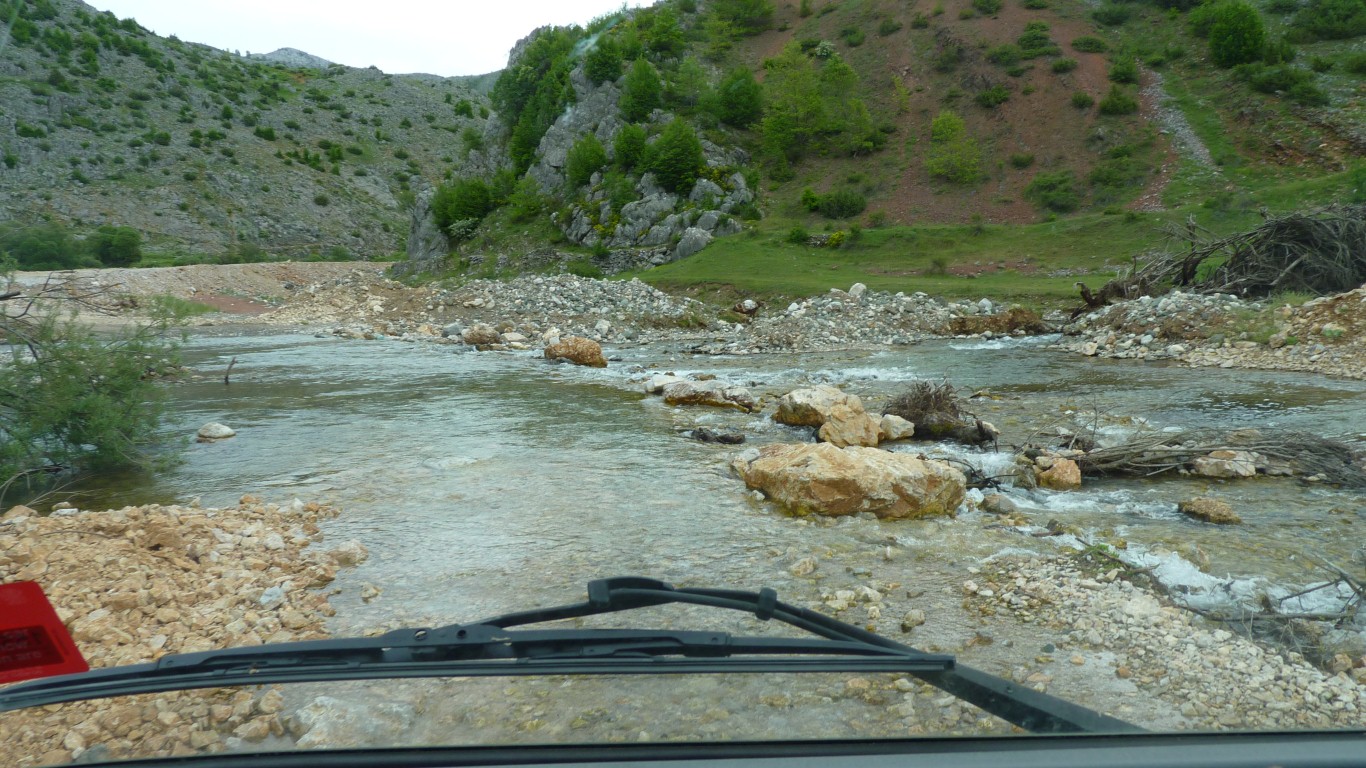
Very little traffic at all.
This little crossing would possibly have been a bit of a challenge for them.
Not too bad with our clearance, and we could see the stones. Just a bit loose.
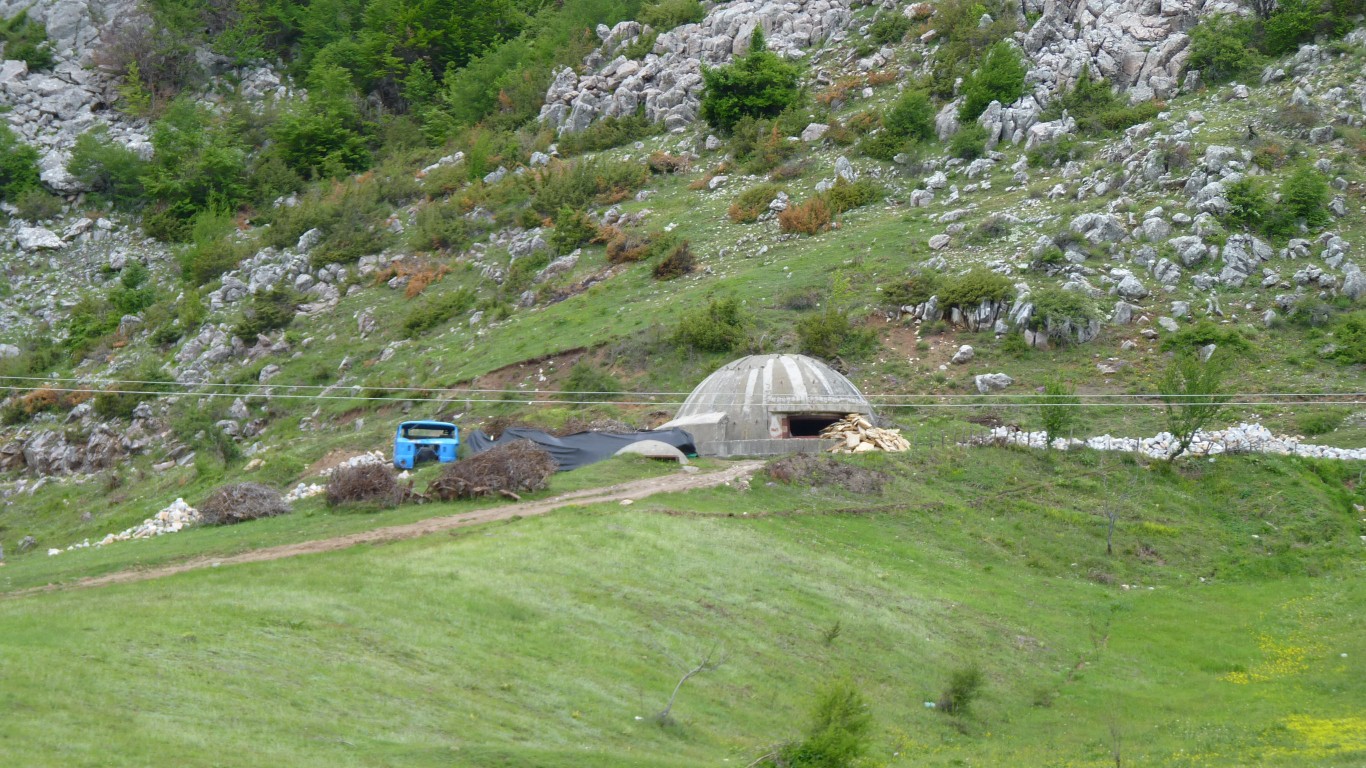
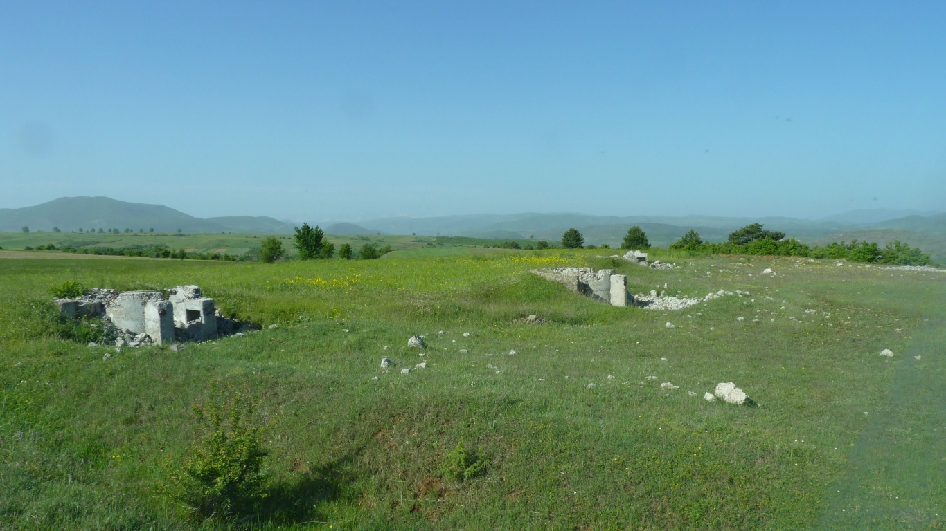
Built after the Soviet invasion of Czechoslovakia in 1968 following which Albania left the Warsaw Pact and sought help from China. Eventually Chinese support dried up.
The bunkers obviously worked as Albania wasn't invaded!
Albania gave up communism after 47 years in 1992.
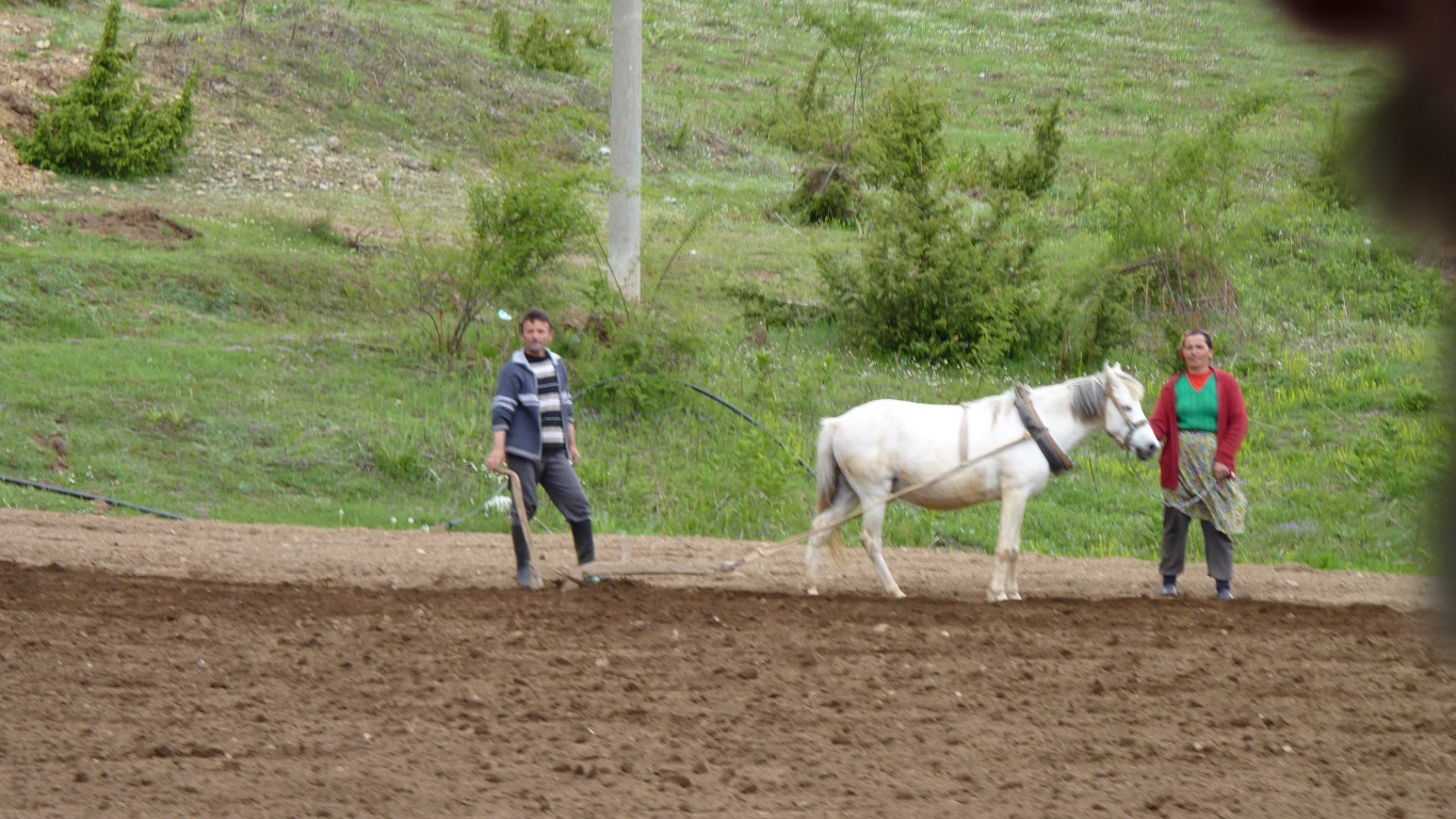
We've also seen a few small tractors and rotary hoes.
A bit too steep for the truck to hold its speed in third gear with the exhaust retarder. Slow but steady progress.
We camped somewhere near where the road disappears.
We were visited by an Albanian shepherd with about zilch English.
And we have no Albanian.
So frustrating as neither of us is any good at charades.
After some confusion between Austria and Australia the penny dropped.
Unlike most, who say "Sydney" or "Melbourne" to impress us with the extent of their knowledge, our shepherd said "Julia Gillard".
One wonders the combination of world news and interest that led him to remember our PM.
We were appropriately enthusiastic about his knowledge of the world.
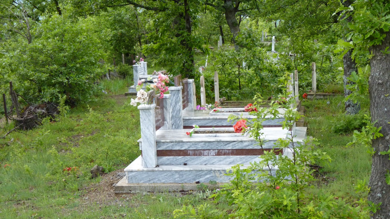
New graves for 1977 and 1984 deaths.
Some of the graves have footstones as well as headstones.
The dirt on the windscreen was left by the rain. We'll have to wash the solar panels some time.
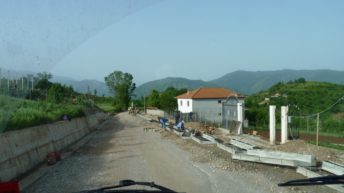
This crew are casting concrete edges to the road.
None of the machinery used for continuously casting concrete kerbs in Aus.
We've only seen one crew. Only another 30 km to go!
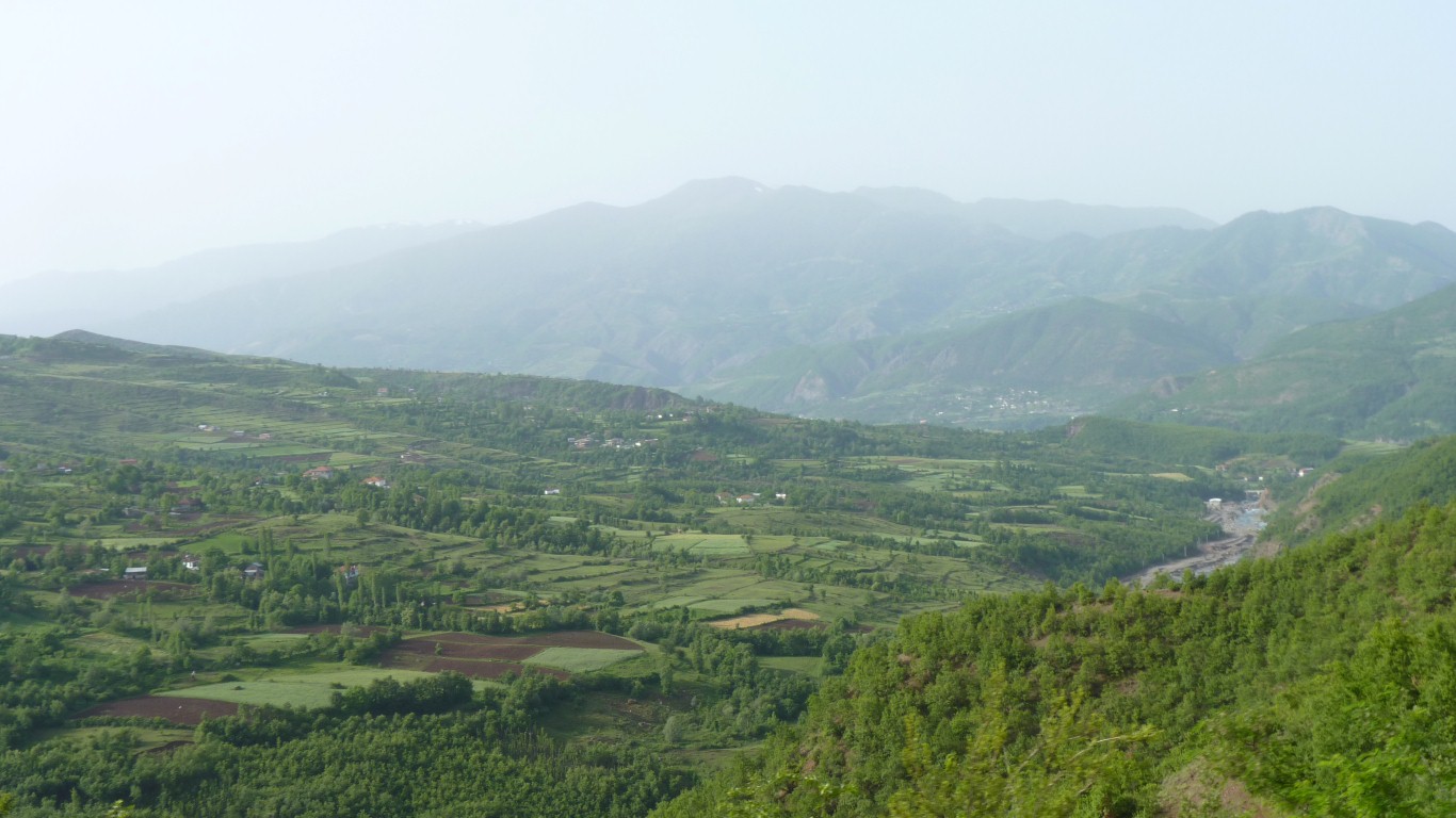
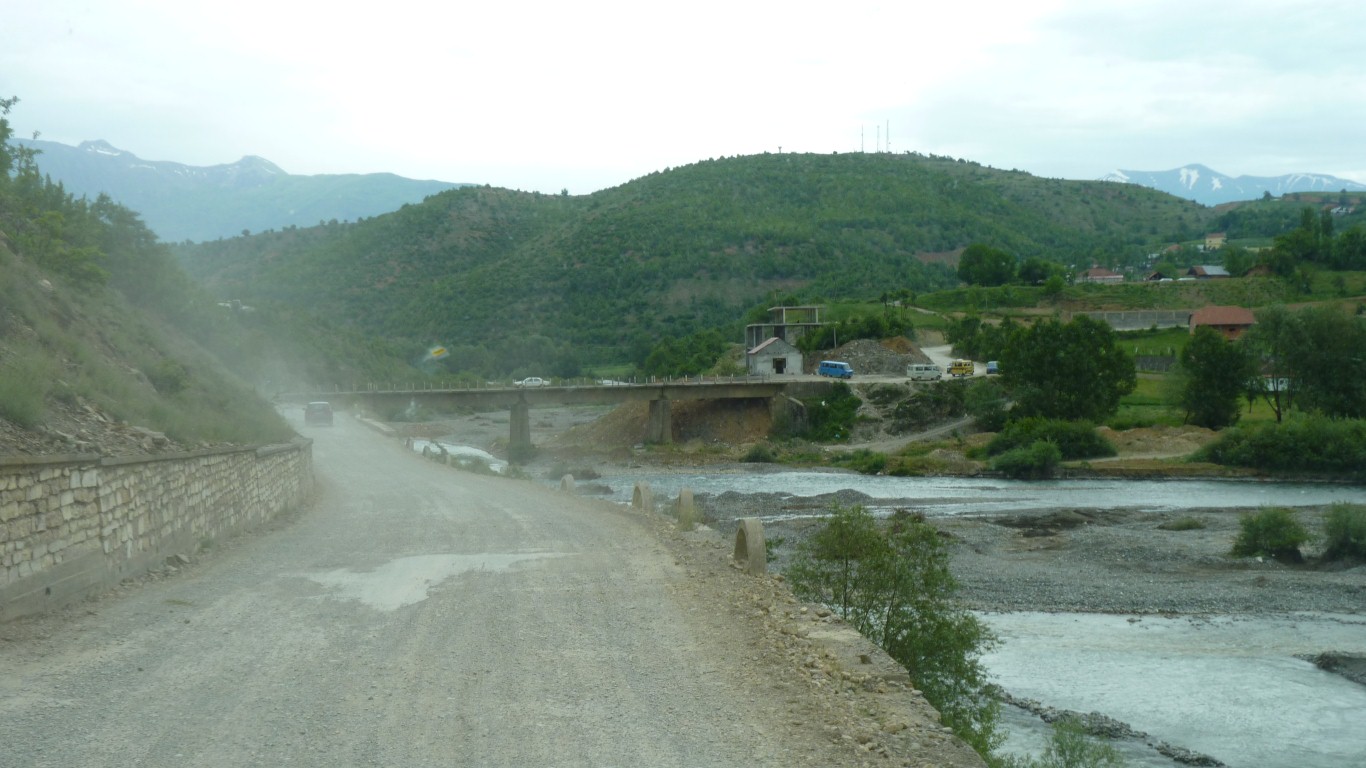
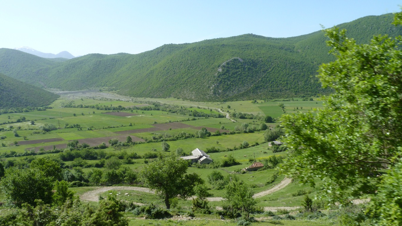
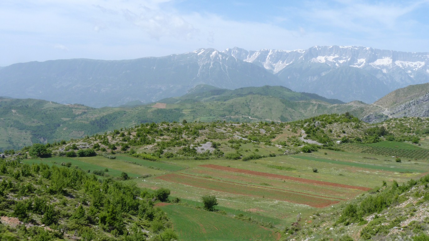
The river has become braided, the valley wider, the agriculture more intensive.
Got lost and asked directions of a taxi driver who, in true Albanian fashion, nodded sideways to say "yes" while giving us good directions.
We hoped!
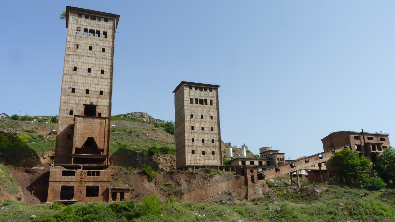
Not sure what was being mined or processed here.
The buildings are constructed of reinforced concrete beams and blocks to fill the gaps.
Including the angled conveyor belt housing.
I'm used to steel and corrugated sheeting.
This style of industrial building seems to have become the basis for new house building.
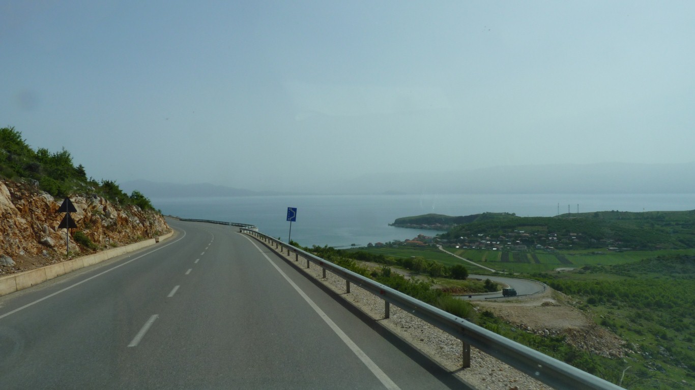
The road improved heaps.
Until it reached the lake.
There are fish restaurants along the shore.
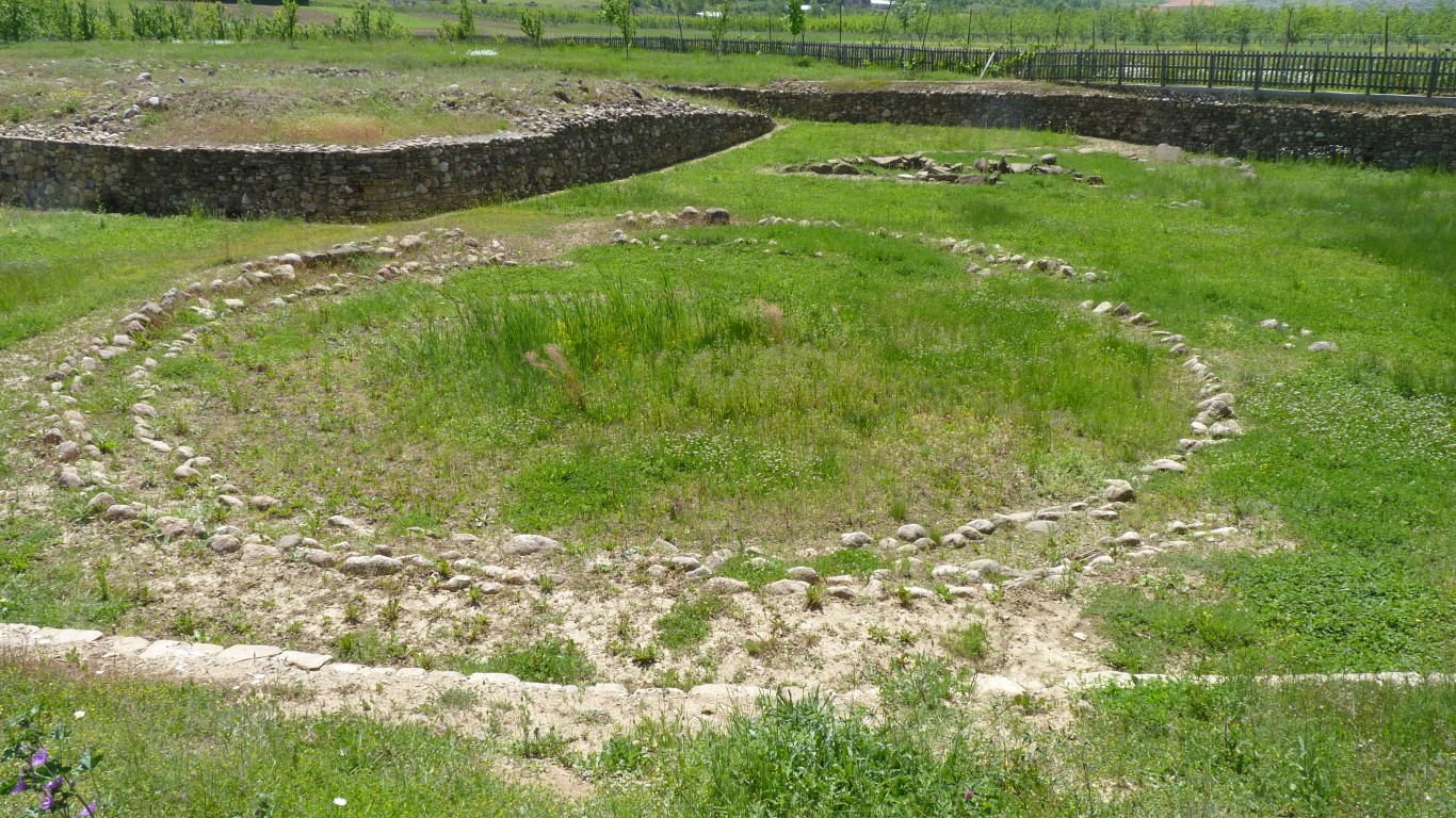
This is the outline of the first burial there, around 13th century BC.
About 13m across. The grave was in the center.
Similar tumuli nearby have been destroyed by agriculture. This site is on a river terrace and was covered in large stones.
There's an iron age hill fort site about 3km away.
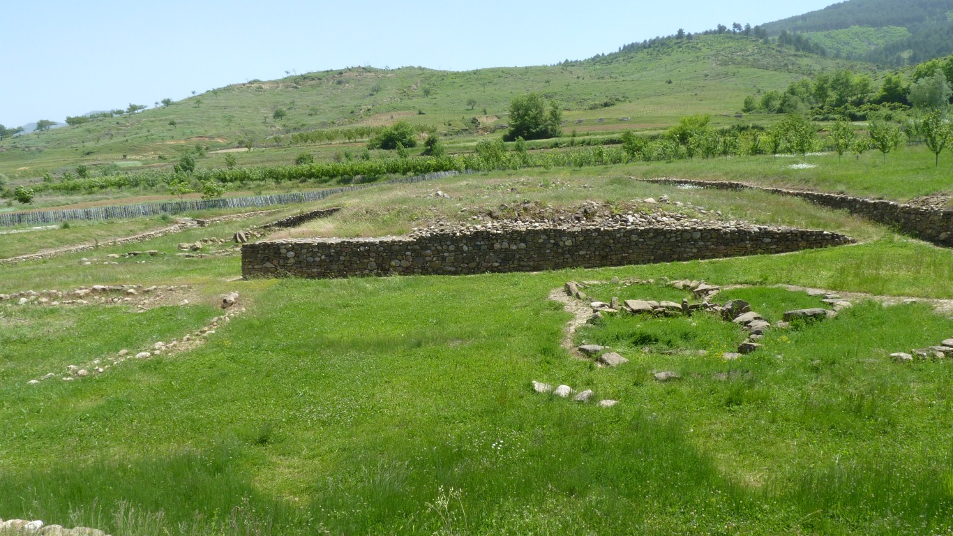
The wall is tidying up after the excavation.
The initial burial was covered in soil. The mound of stones was added later covering the whole burial site.
There's no entry or chambers. Its a tumulus not a barrow or a dolmen.
The last burials were around 6th century BC.
The small museum is fascinating. In Albanian and English there's a description of the site, the cultural significance, the dna results, the "finds", the surrounding area, the prehistoric brain skull surgery (seriously - cranial trephination), etc.
Just like "time team" describing "the context".
There's a strong wind and the air is hazy.
Just like a sand storm in Morocco.
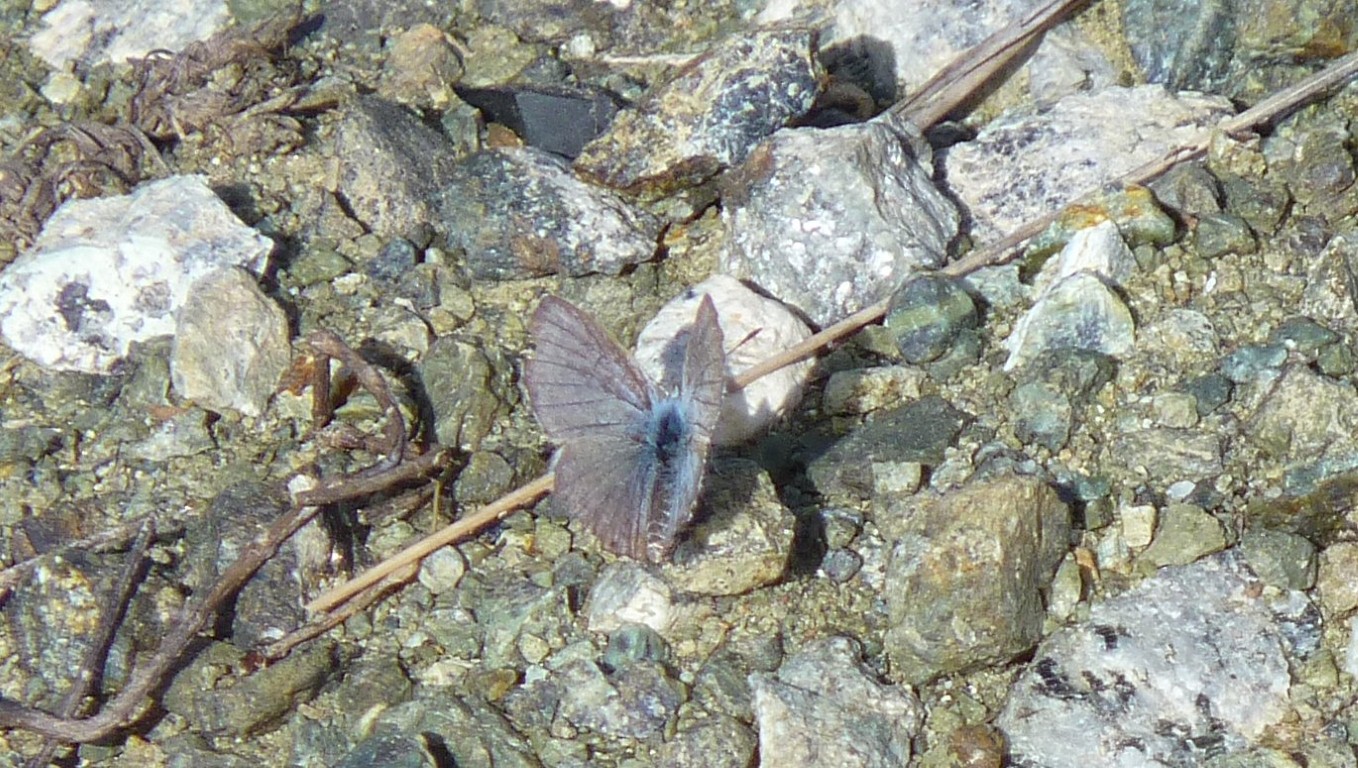
They are hard to photograph.
The swallows (or swifts) are so hard to photograph we couldn't.
But the butterflies must be choosy as we waited forever for some to land.
We've seen similar in the center of Australia.
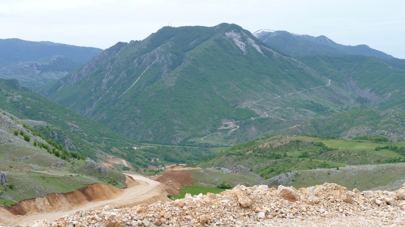
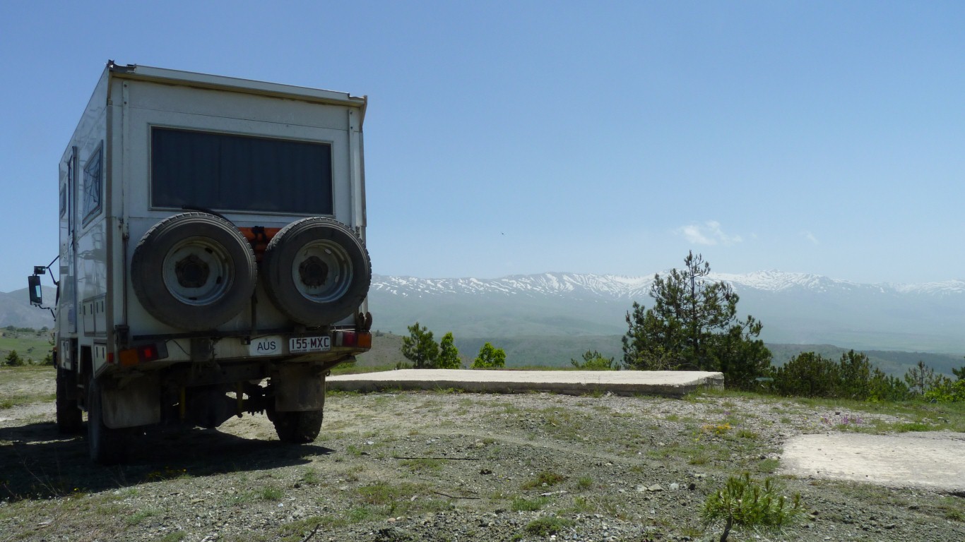
The descent from our eyrie.
We didn't watch much but we could receive Albanian analogue tv stations and a Macedonian digital station.
BBC world service on long wave was just audible at 2am.
Something happened here in 1942. It involved Italians. But that's as far as our lack of Albanian language skills would reach.
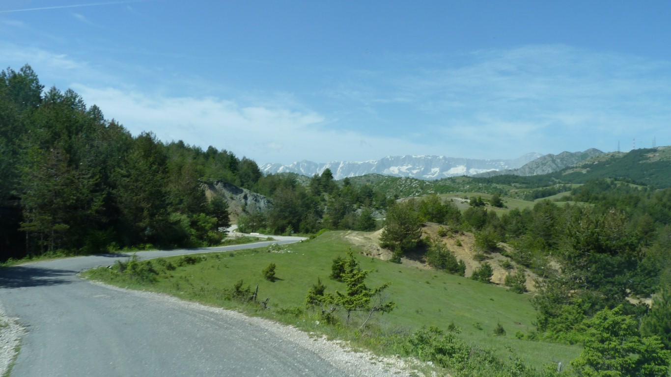
After a couple of hours driving they are still way in the distance.
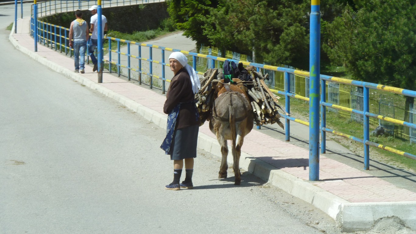
We don't really like taking photos of people without asking. This one slipped through.
We've been traveling around 20 km/hr on narrow, bumpy, hilly, curvy roads.
Then we realised we are looking at an aquaduct.
It runs to a penstock for a small hydro power station.
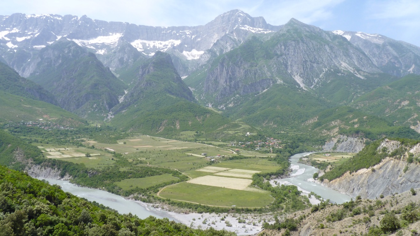
Still east of Permet.
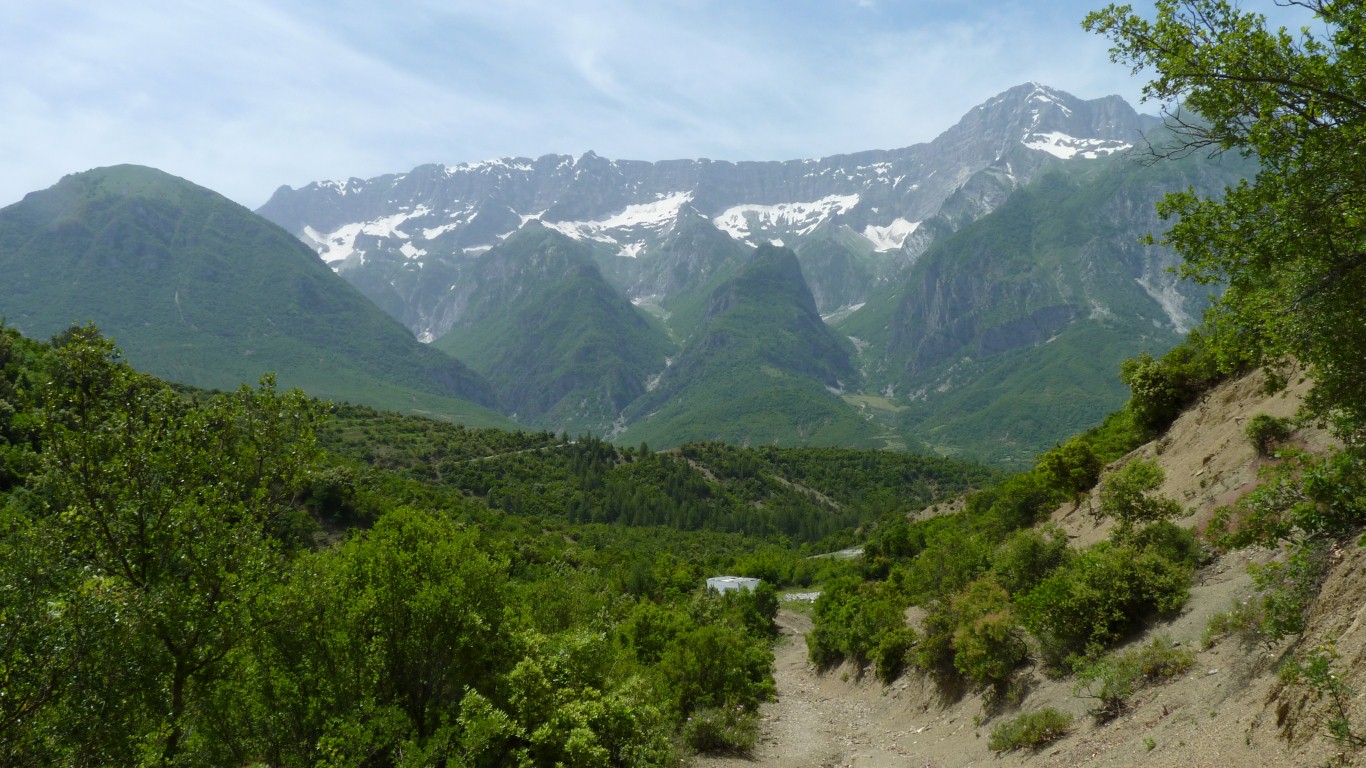
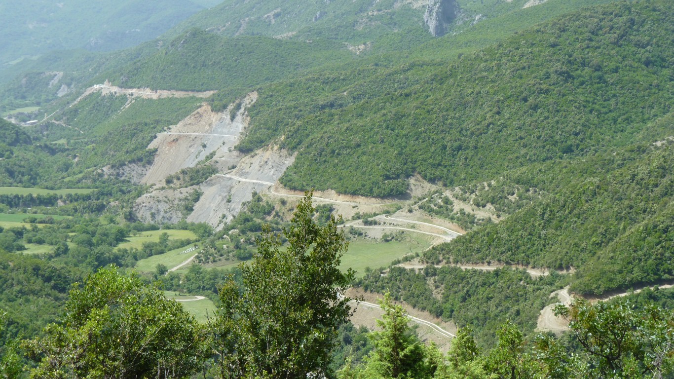
The road is a couple of hundred ft below us.
We can see it traversing the ridge in the distance.
A bit steep and rough to get to. Needed clearance and 4wd just in case.
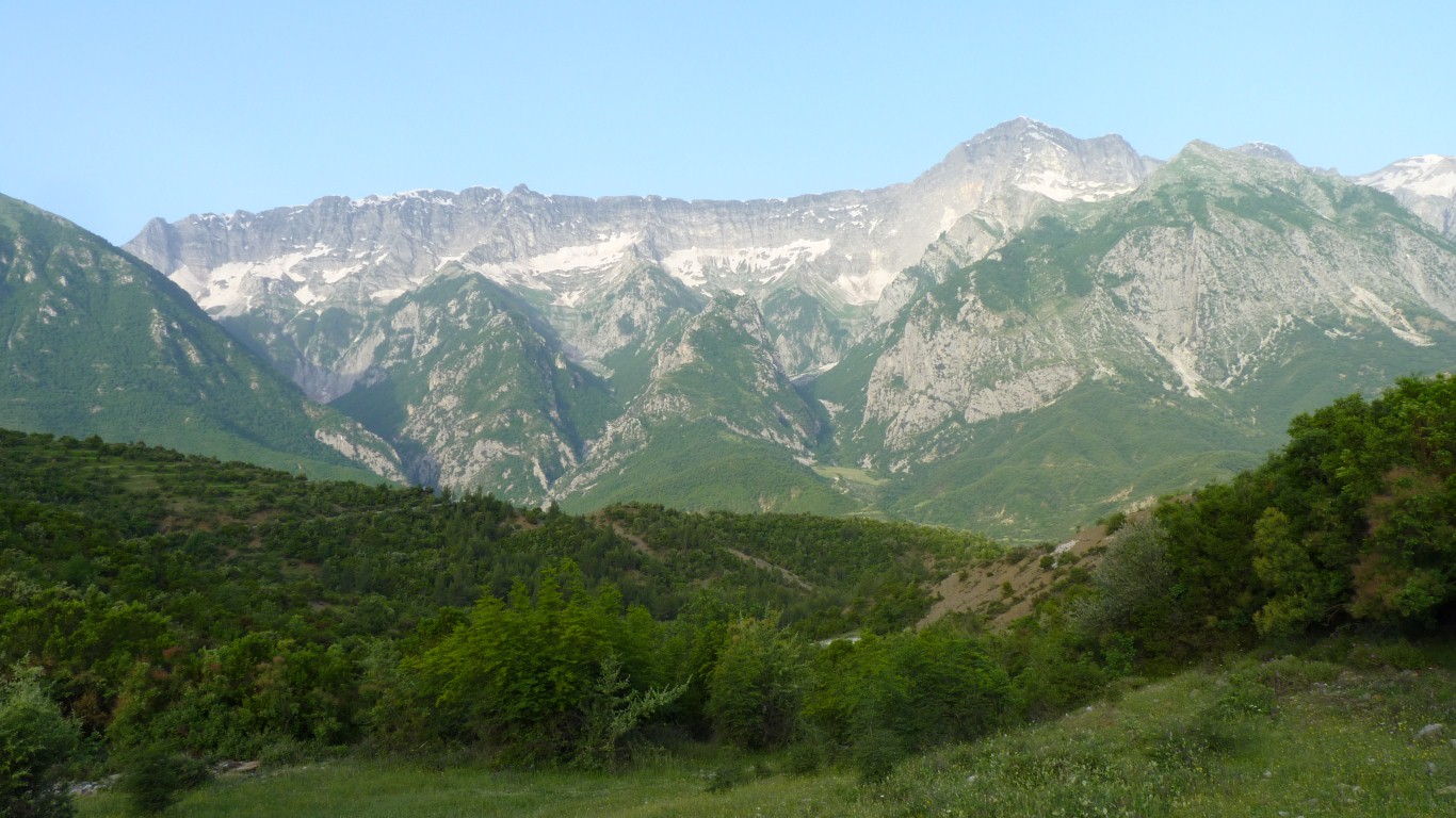
Perhaps because neither us nor the mountains had moved.
The range is the Malesi e Nemeckes.
The peak is probably M. e Drites at 2485m.
Our road follows the valley to the north west until there's a way through to the south.
There's a small gap and a vague track to the south on our paper map before the mountains continue as the Matesi e Dhembelit range but we'll follow the main road.