We are driving about 2,500 km to Alice Springs. To the beginning of our trip.
Instead of the shortest route, to Birdsville and straight across the Simpson Desert (last year's trip), or round the south through Broken Hill, we'll try a different route. To Boulia in Western Queensland then along the Plenty Highway. North of the Simpson Desert.
Its only when I write it like that I realise how geographically central the Simpson Desert and Alice Springs are in Australia.
We'll be travelling for 5-6 months. A big trip!
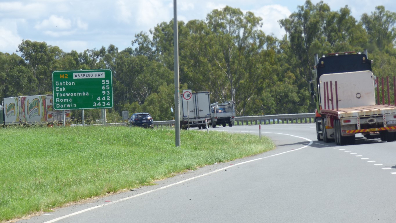
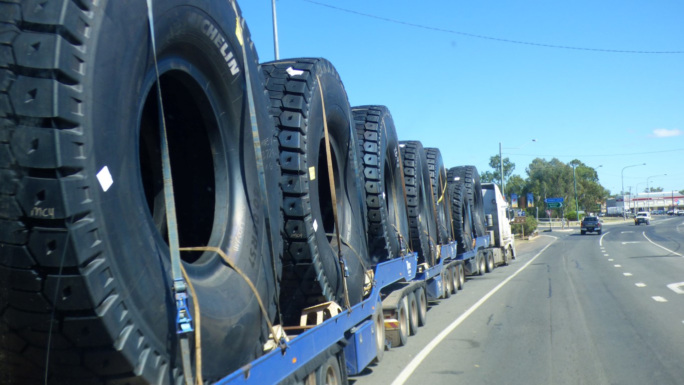
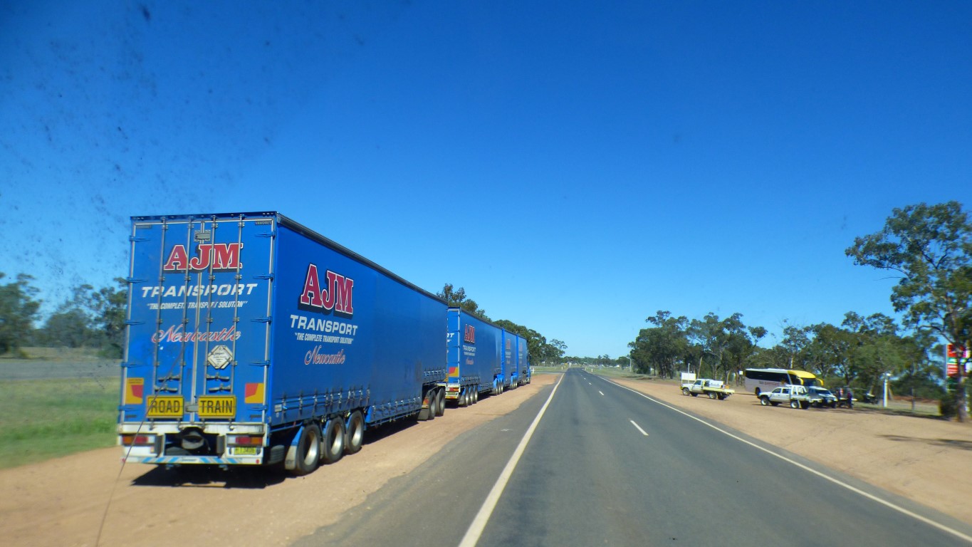
In the meantime, the further west in Queensland the smaller the roads and the bigger the road trains. Lots of tyres for mining trucks.
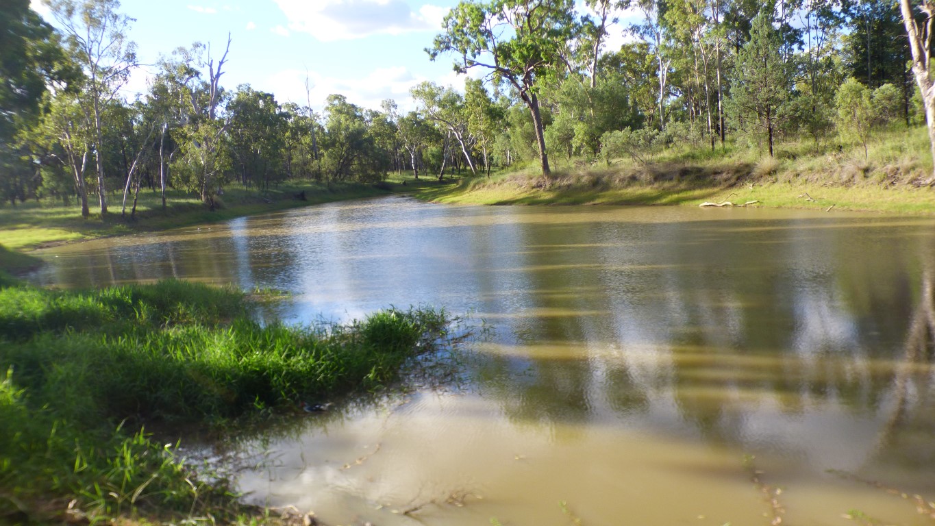
First stop Jedds Lagoon at Yuleba. A convenient couple of km off the Warrego Highway.
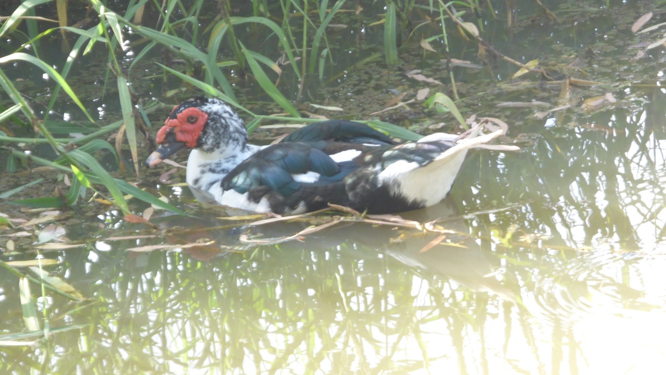
We remembered the bird book this time. Unfortunately this specimen isn't in it. We think a Muscovy Duck. We suspect a domesticated cross between chickens and ducks.
Apart from being big, Australia is our home. Which means we don't have to put the truck on a ship. We just have to drive long distances. But it means we can take annual trips. Australia is also hot in the north, and not so hot in the south. We are not ready to join the nomads that annually trek north-south with the weather.
So here we are. Travelling west. Wondering when the afternoon temperatures will fall a bit from their average 35 deg C.
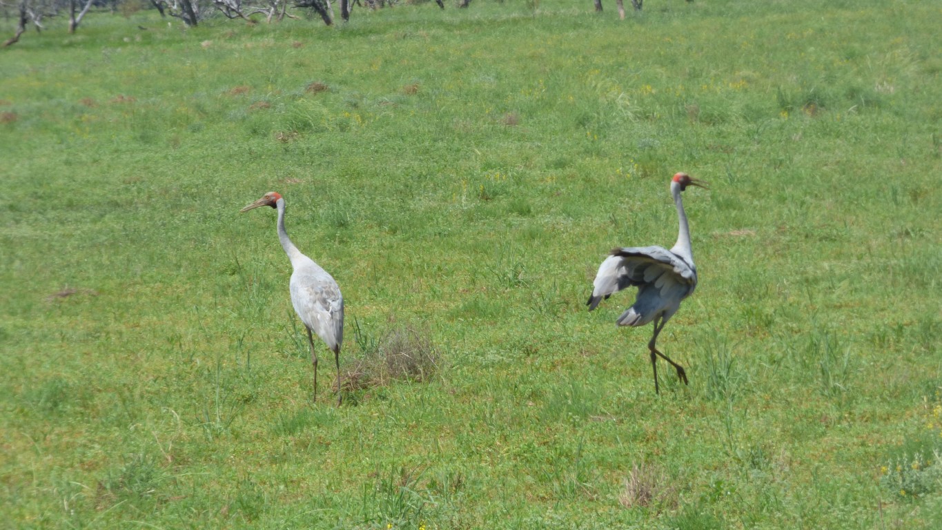
We could hear birds, and occasionally see them disappear as we approached, but really need to stop for longer to really see them.
Perhaps its time to mention "the flies". Possibly because its rained recently. Perhaps its because the temperature is about 37 deg C max during the day. Maybe there are just lots anyway.
Technique is to park facing the sun, gather up stuff from cab, rush to house door, get in, open all windows, pull down fly screens, leave door with only fly screen. Then a quick dose of insect spray and our sanity returns. Every so often rotate the truck a bit to keep sun off the sides.
We've set off a bit early in the season. Before inland temperatures lessen. Another couple or three weeks.
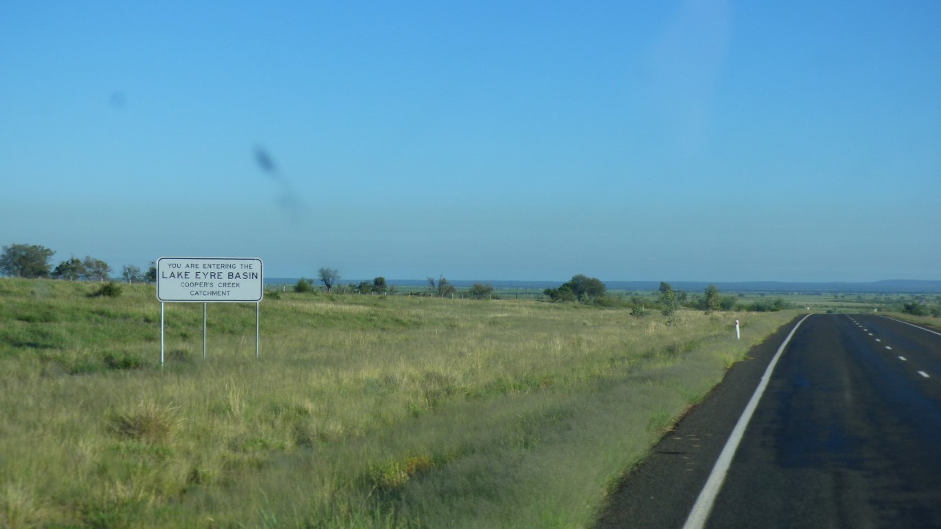
Between Tambo and Blackall we cross an almost indescernible ridge. We leave the Murray Darling Basin and enter the Lake Eyre Basin. Both are vast catchments. However, the creeks and rivers in the Murray Darling Basin flow year round, exit to the sea is somewhere south of Adelaide. The Lake Eyre Basin flow occasionally and empty into Lake Eyre, to evaporate.
To put things in perspective, most of where we've been travelling is between 150 and 300m above sea level. Which is probably why it takes a couple or more months for water to reach its destination.
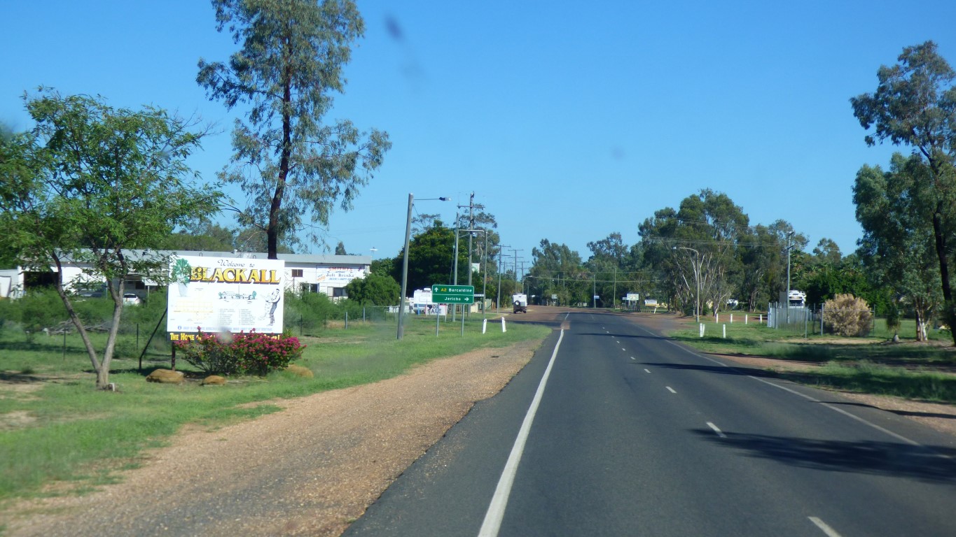
Anywhere past Blackall is "Beyond the Black Stump".
We assume westwards.
We didn't see the Black Stump.
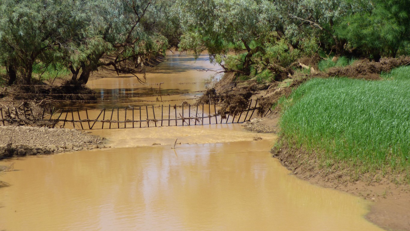
Our original plan was a shorter route via Quilpie through Windorah and Bedourie to Boulia. However, heavy rain a couple of weeks ago closed roads. Particularly where the Diamantina River crosses the Diamantina Developmental Road.
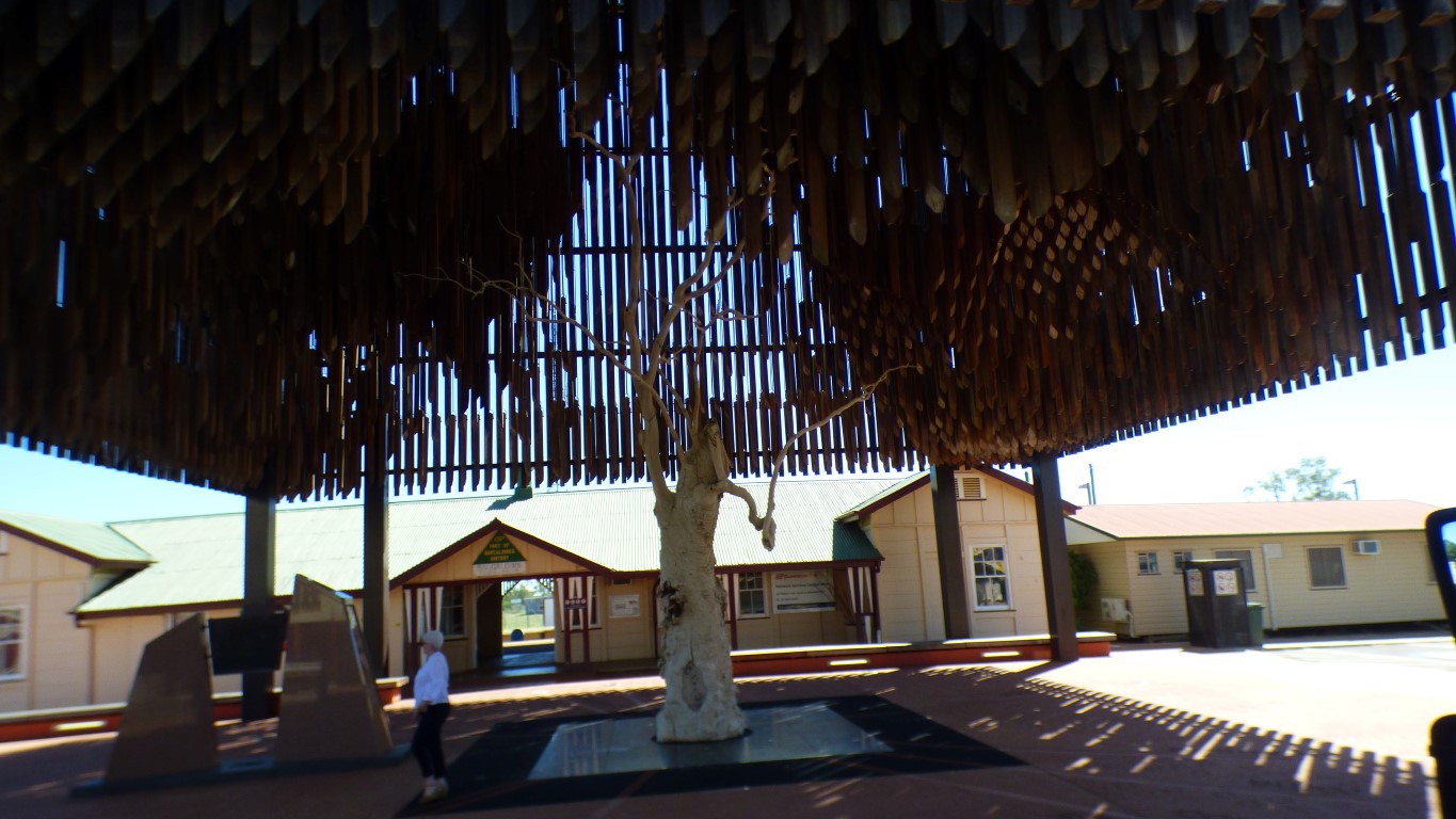
Etched into Australian history as the tree that provided shade for sheep shearers who formed a union and decided to strike. A bitter struggle.
Also where the Queensland Labor Party was formed.
Alas, the tree was poinsoned, and died. Preserved.
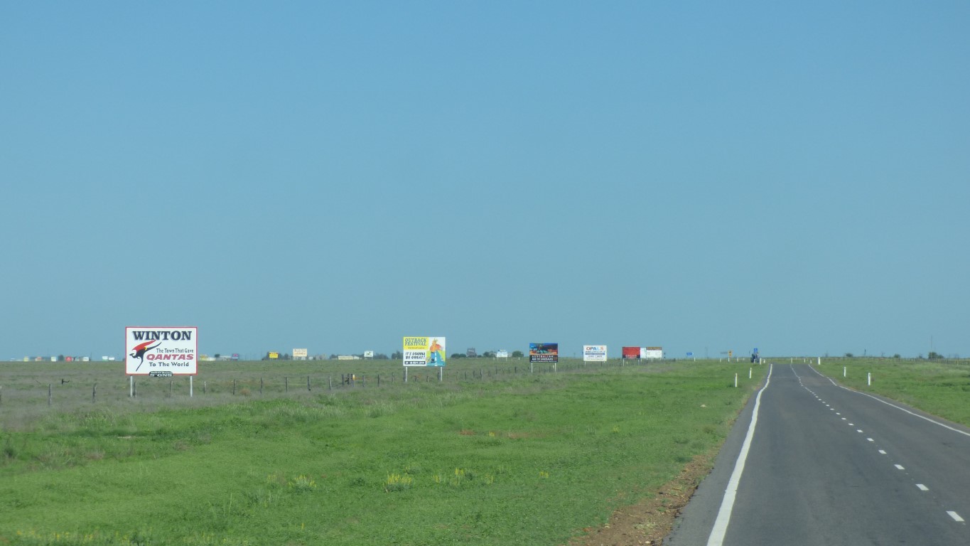
Railway station in the background.
The tail of a Qantas Jumbo can be seen in the distance. There was enough runway for it to land, leftover from wartime Flying Fortress base. But not enough for it to take off. It was flown here to be a museum piece. Qantas started life just along the road at Winton.
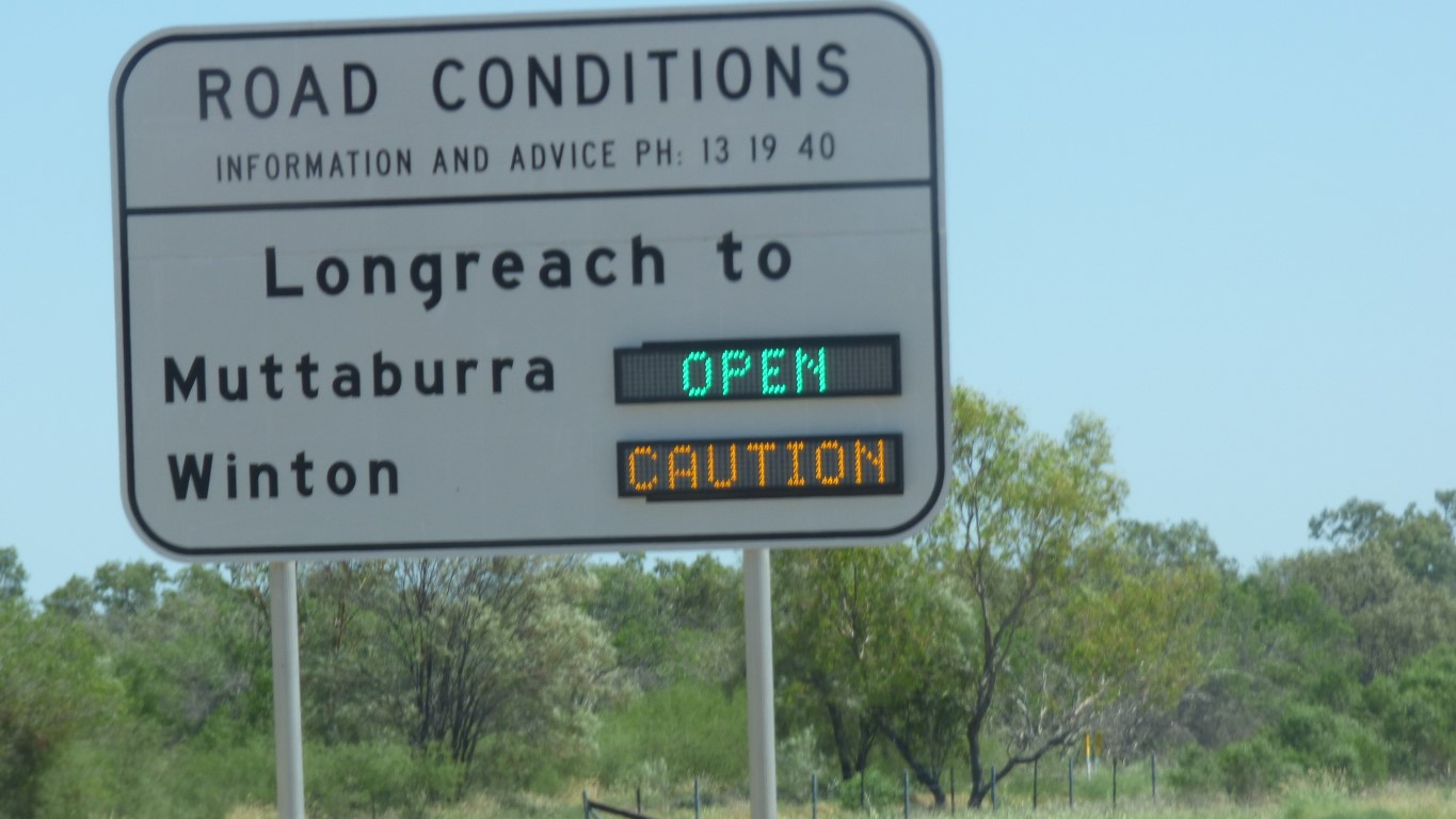
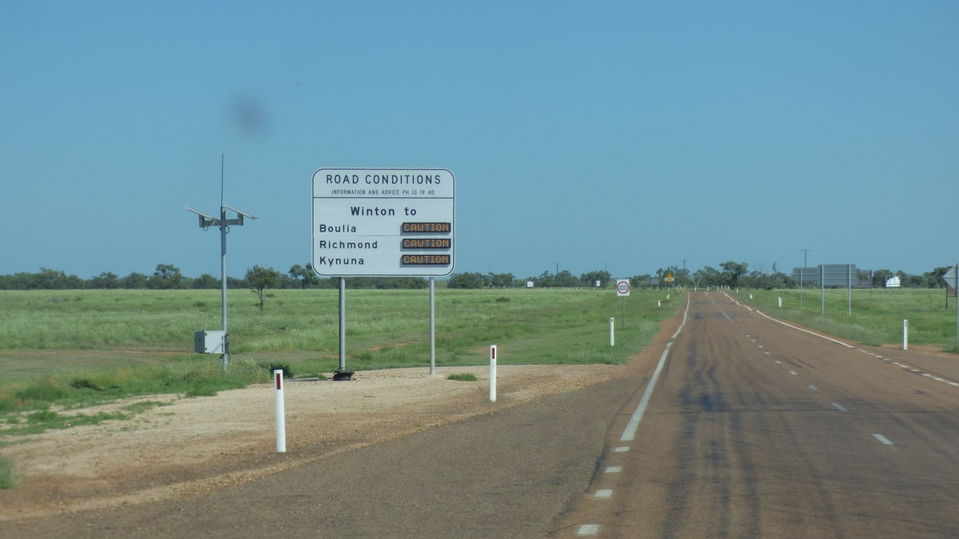
We are not sure what to be cautious about but we'll manage.
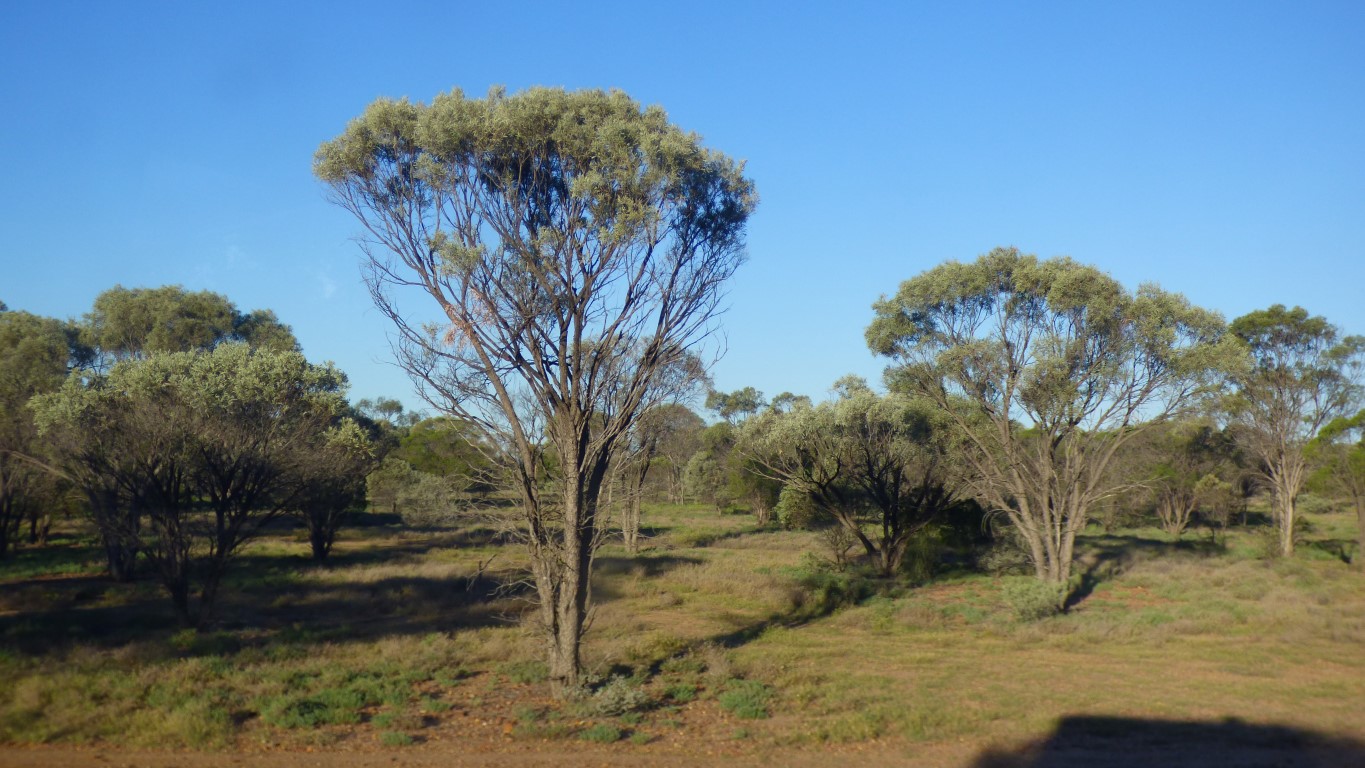
Whilst I tend to associate Australia and gum trees there are just as many, if not more, areas of acacia.
Open woodlands.
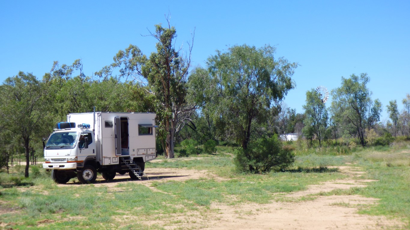
We tested our new hand held gps. A successful test. We walked round a rough circle and found our way back to the truck.
We've been filling our fuel tanks as we go.
After Winto we expect prices to be much higher.
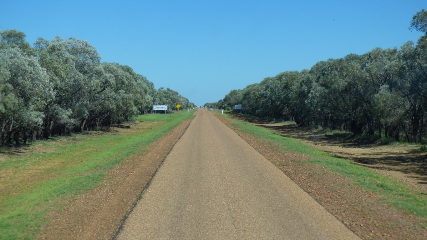
Which made this bit of road look like an avenue of acacias to us.
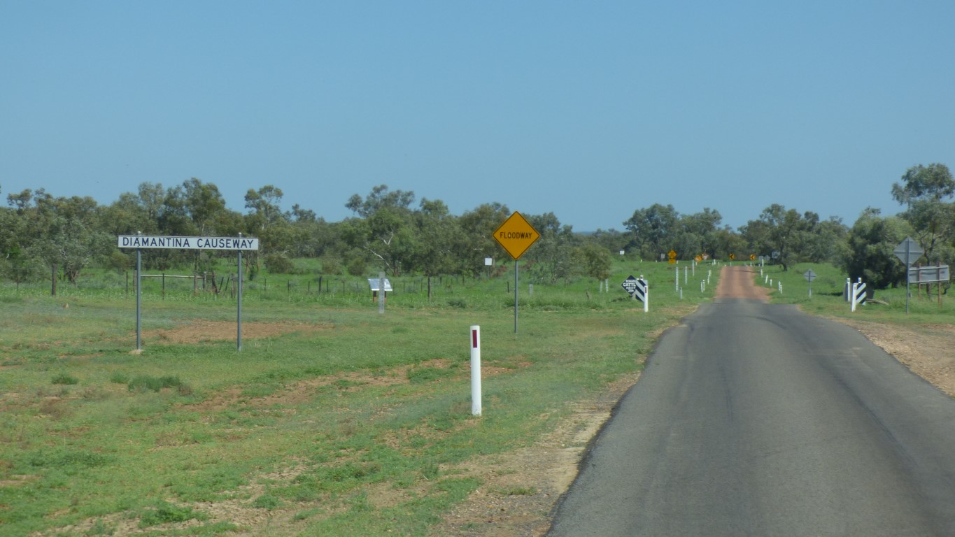
The rivers are very braided. Which happens when rivers flow slowly with very little fall.
The causeway crosses lots of little Diamantinas. A couple of weeks ago it would probably have been just one big shallow slow moving river.
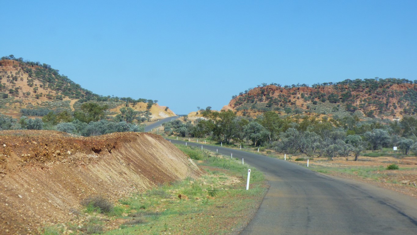
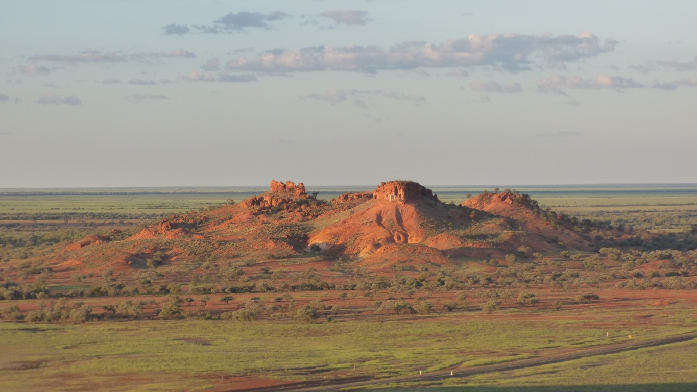
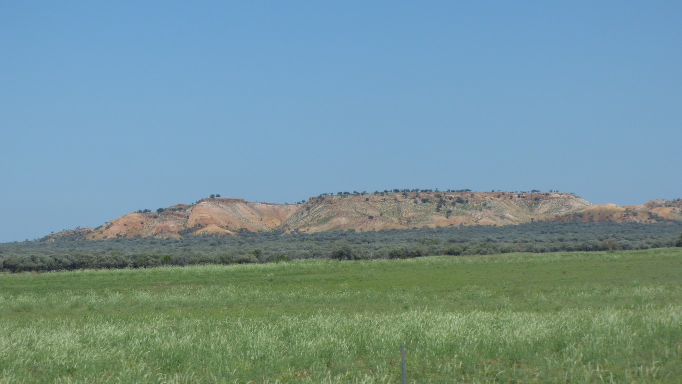
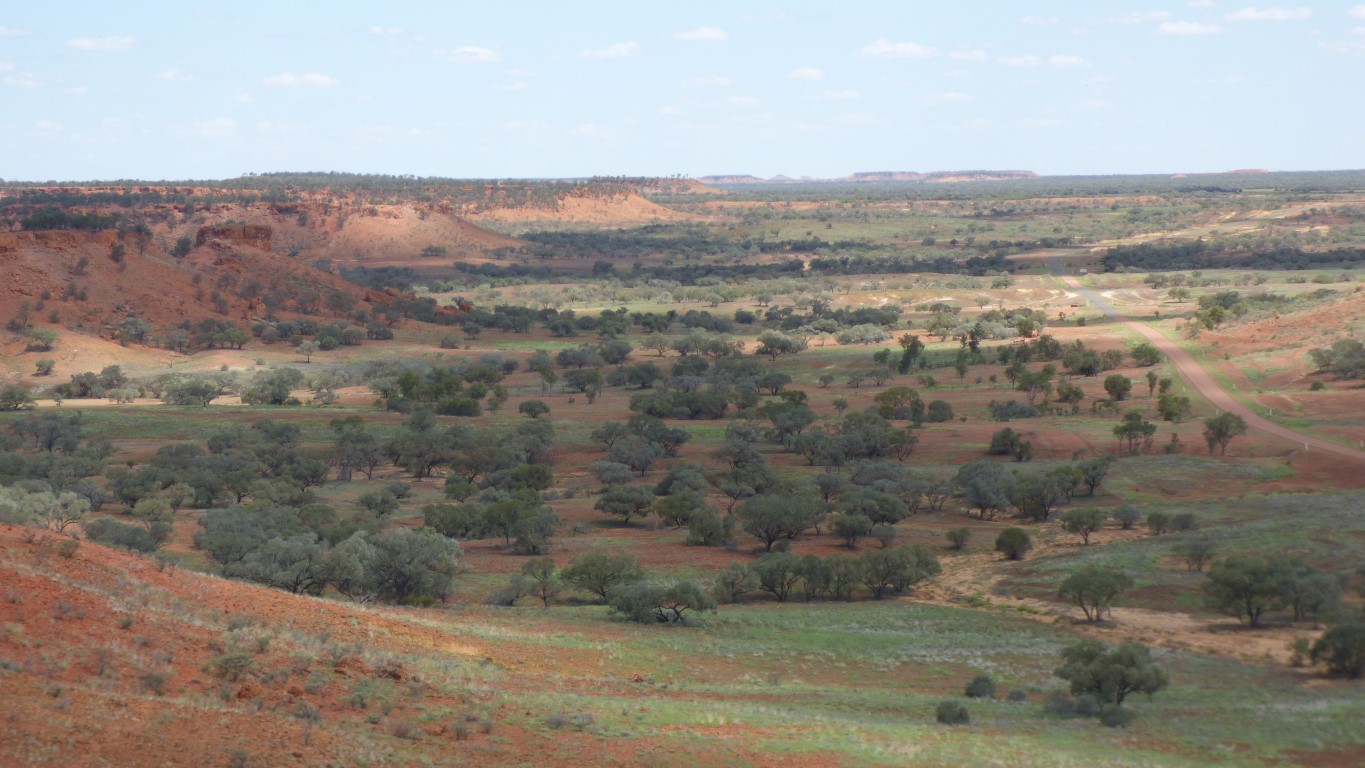
We think "Carters Range".
The bitumen is mostly single lane.
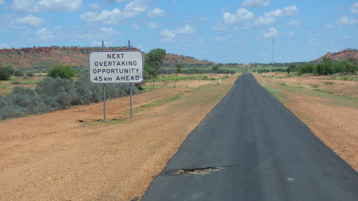
The sign lied (there was an overtaking opportunity about 5km later) but we found it amusing.
If there had been any traffic trying to overtake us we would have pulled off the road.
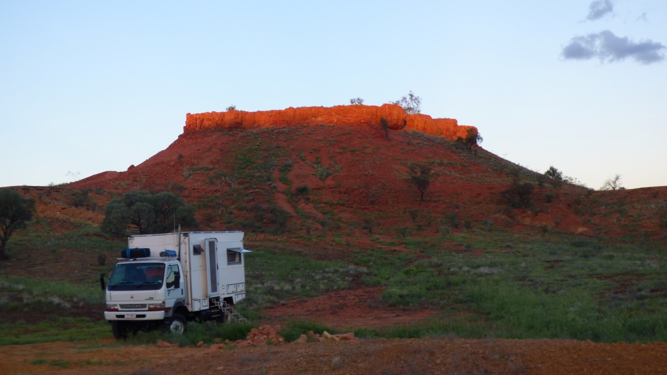
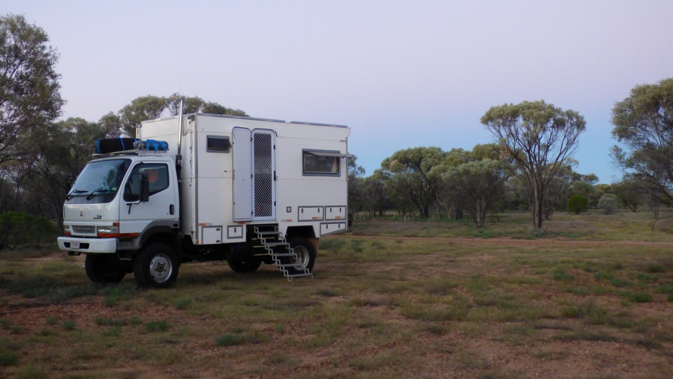
We stopped (and camped) at the Cawnpore Lookout. We think there's a Cawnpore in India. There's certainly a Lucknow, just like the station a few km west of us.
Just like when we passed through Ilfracombe we thought there was an Ilfracombe in Devon.
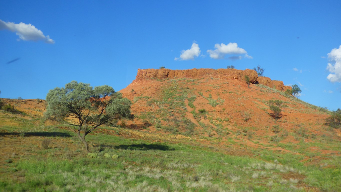
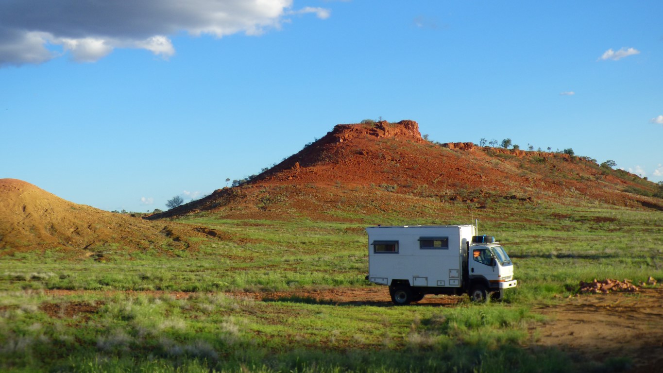

These are the colours of the outback that we came to see.