I was late .....
I fell asleep.
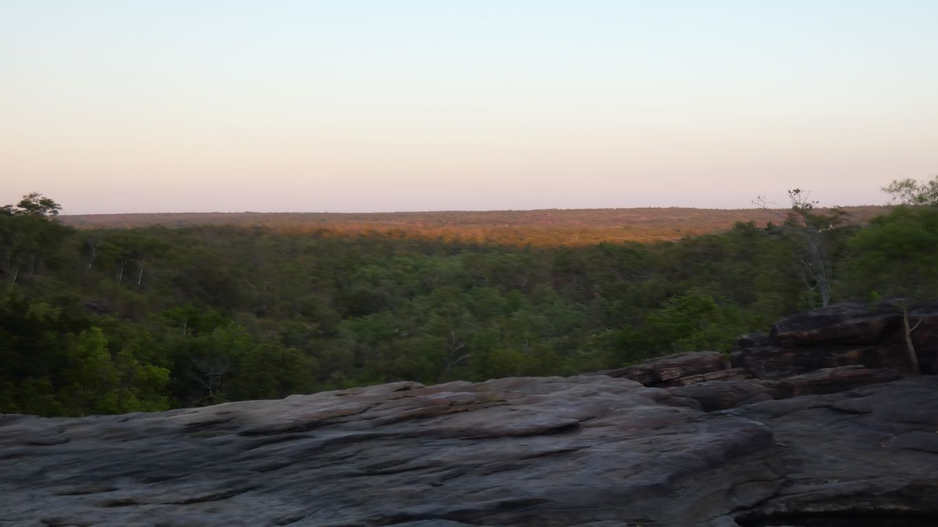
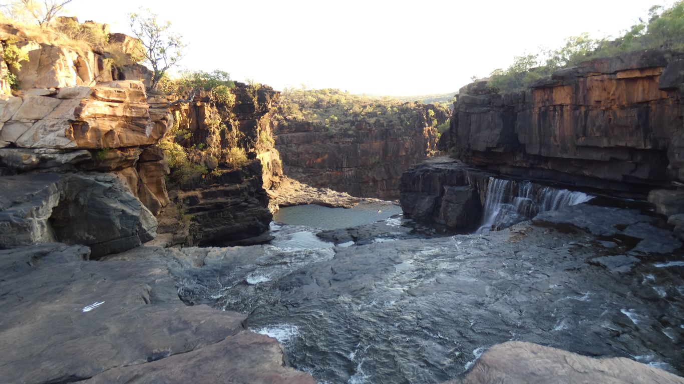
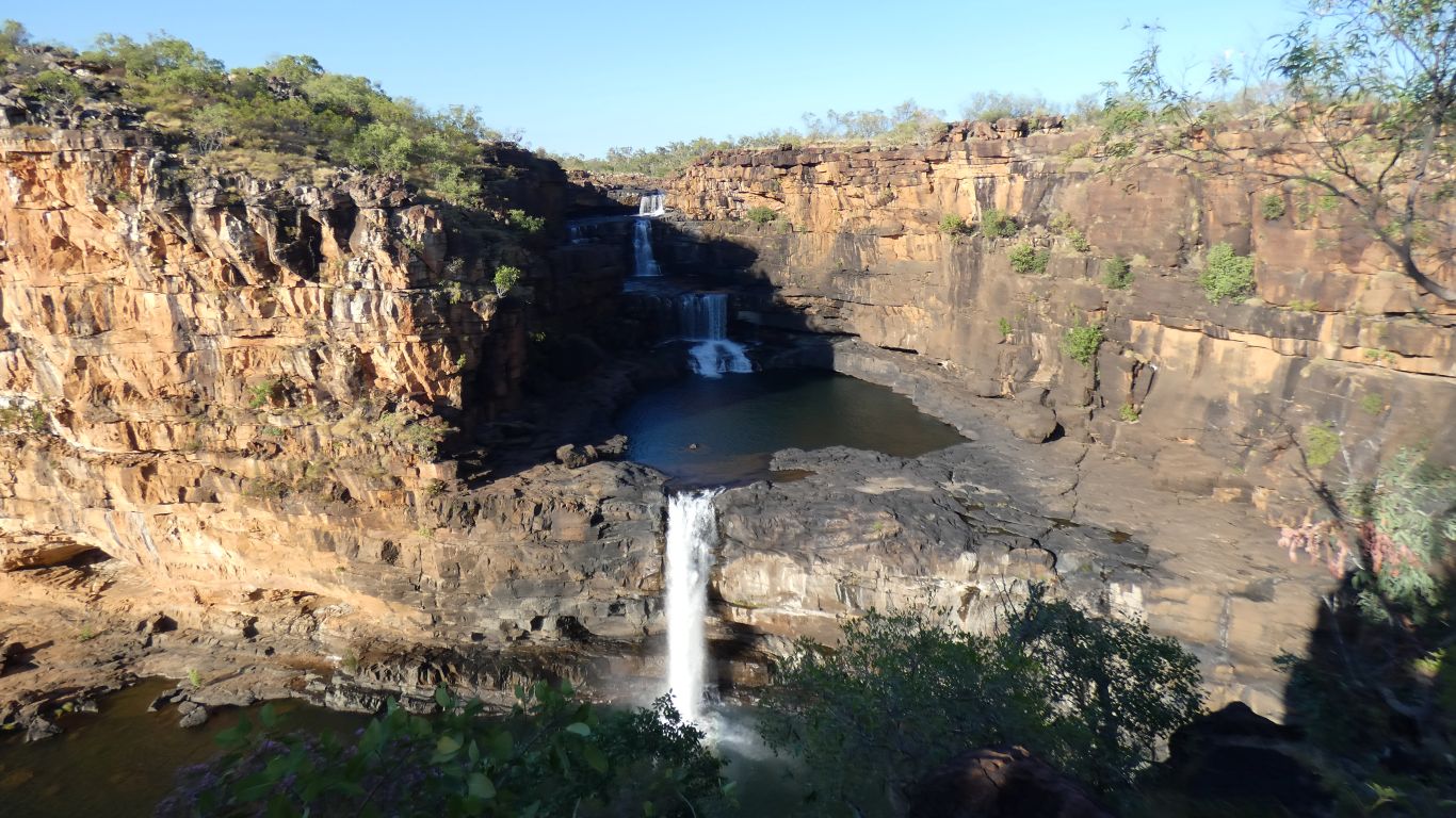
From the top of Little Mertens Falls around 6:15am.
Vegetation is greener near the water courses.
Having "calibrated" ourselves to the WA National Parks assessments of tracks in Karijini we prepare ourselves for a difficult day.
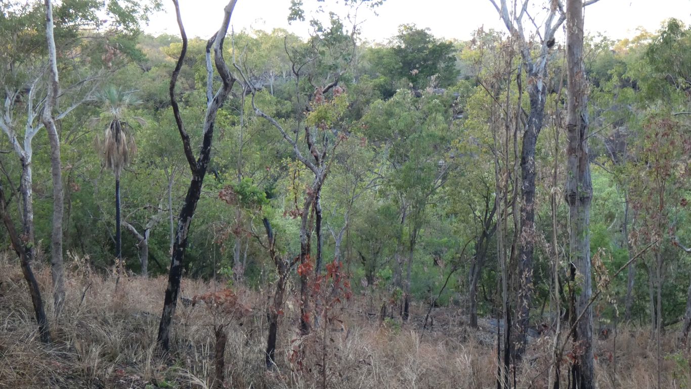
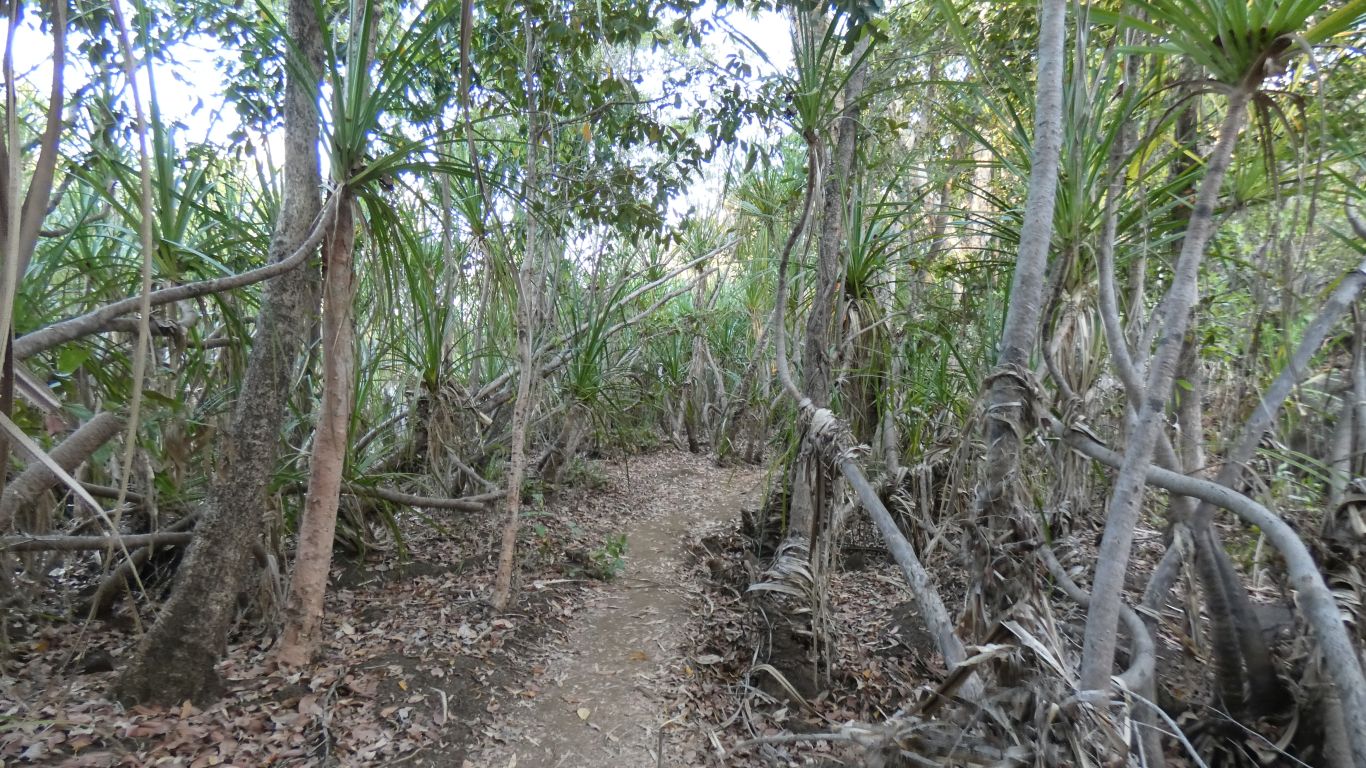
Areas of pandanus palms.
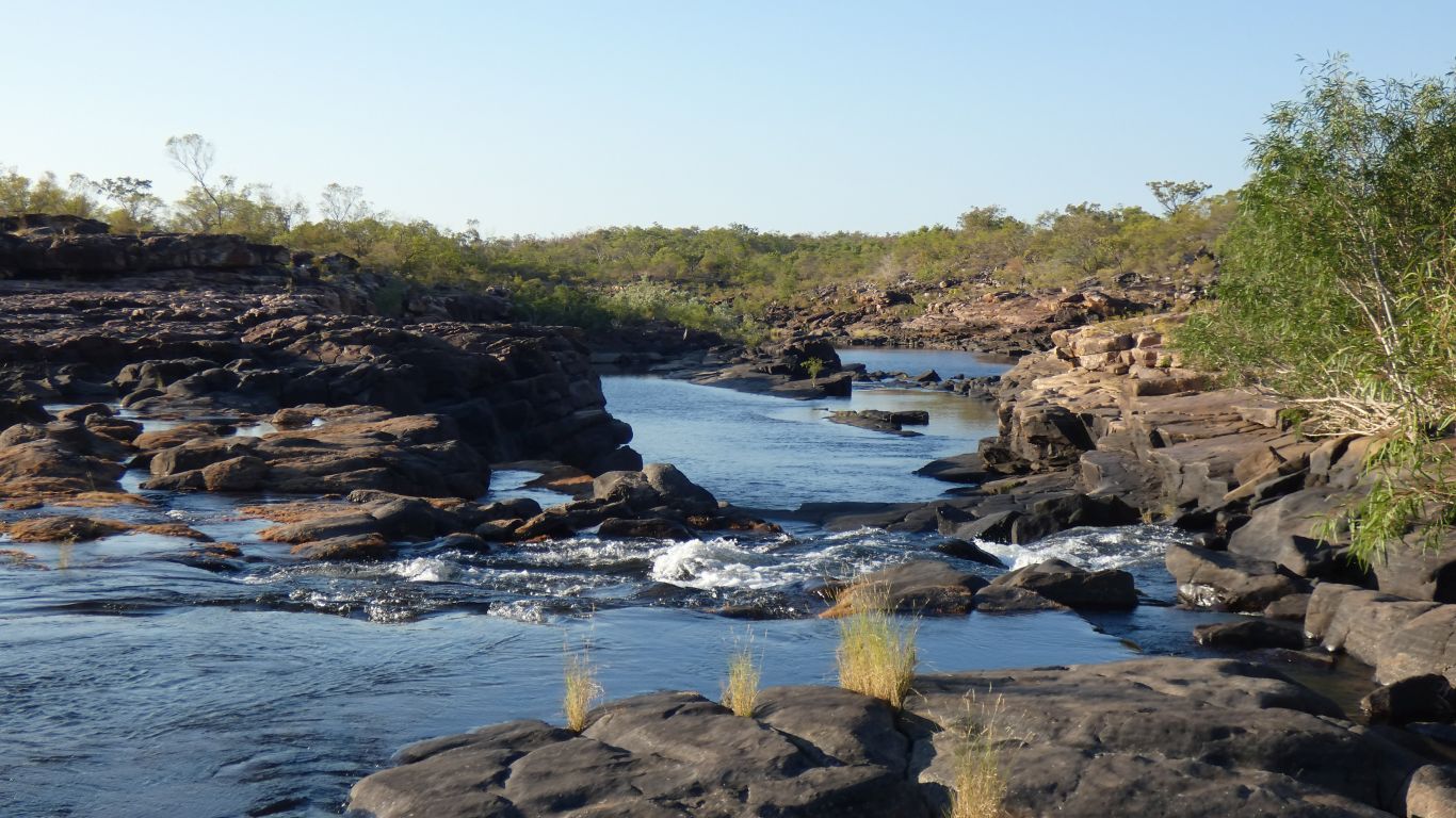
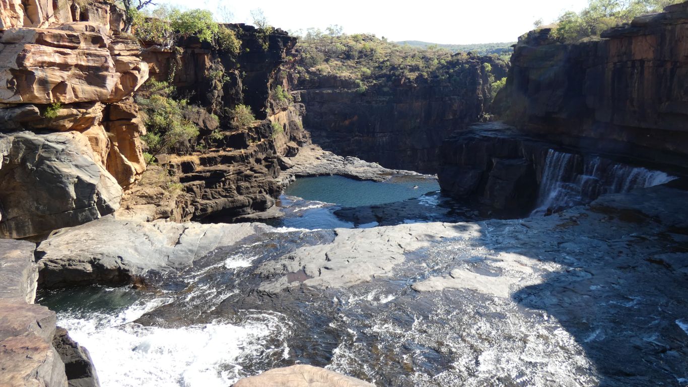
Looking upstream the swimming looks inviting.
But it isn't yet hot, and we really haven't been walking for long.
We idly wonder if there is a way down. But not enough to do anything about the thought.
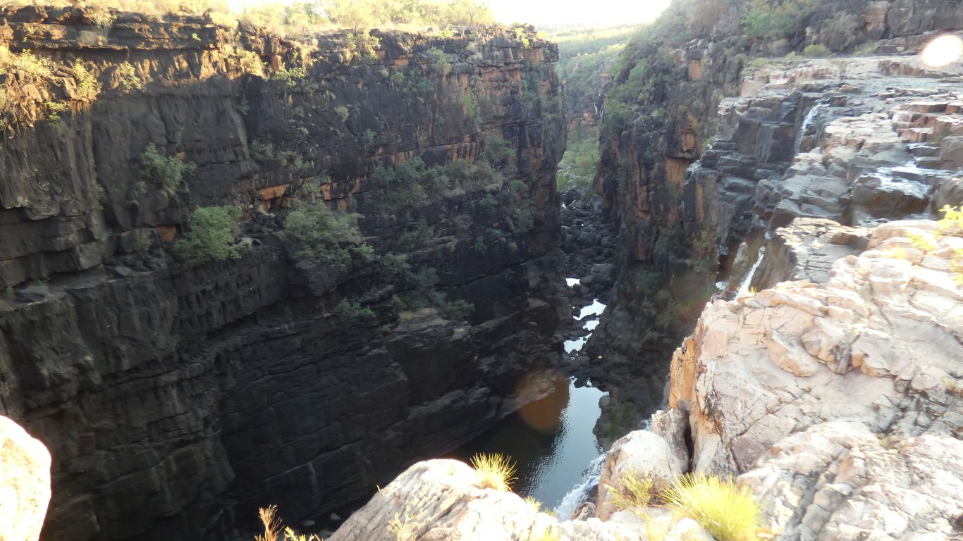
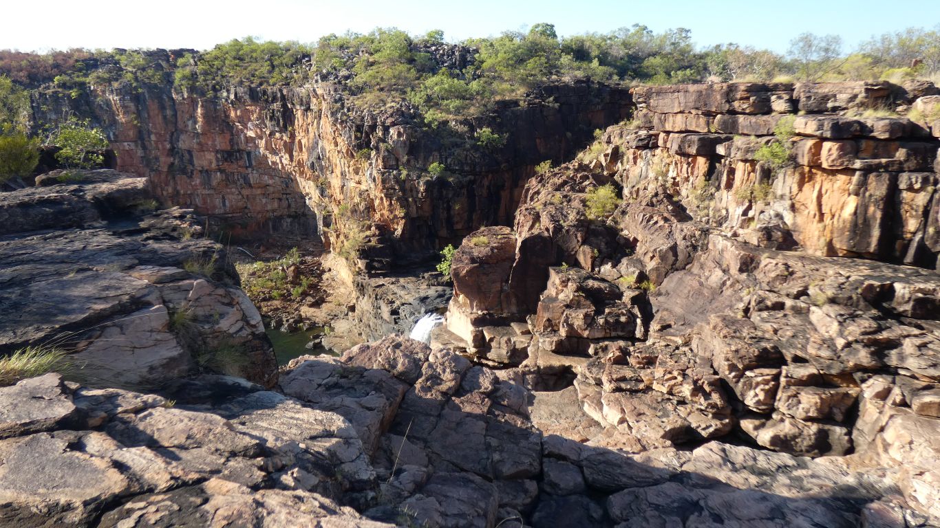
The dark walls of the gorge are more like our expectations of basalt than the pinkish rock we are walking over. But its all basalt, just some is cleaner.
Looking upstream.
Wet feet to cross.
We follow a couple of marker posts, footprints, and our nose to a cliff top we saw from the top of the falls.
We haven't been hurrying. Its taken us about 90 minutes to reach here.
Either our Karijini calibration is wrong or the track is nearer class 3 than 5. Just a few high steps and a water crossing.
No matter how hard we try its hard to find the Goldilocks moment.
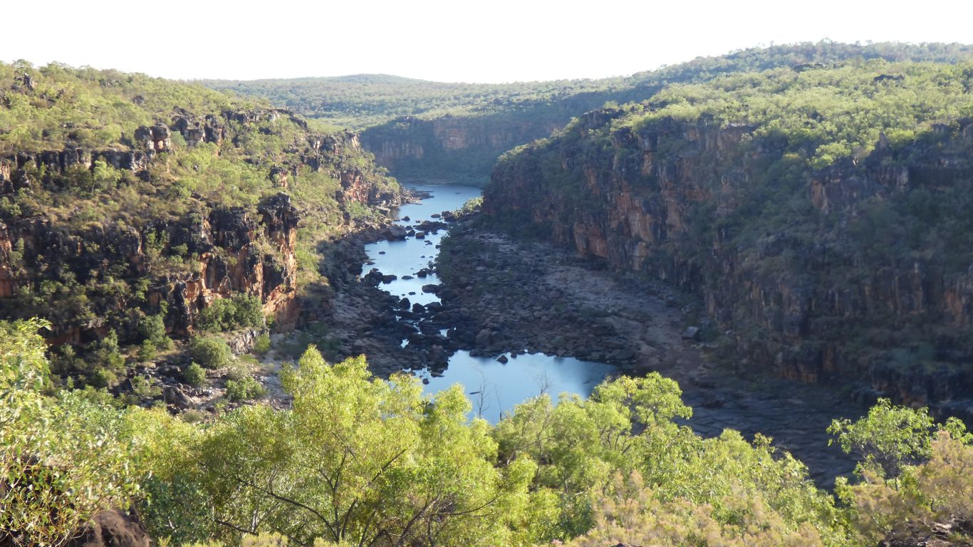
Looking downstream.
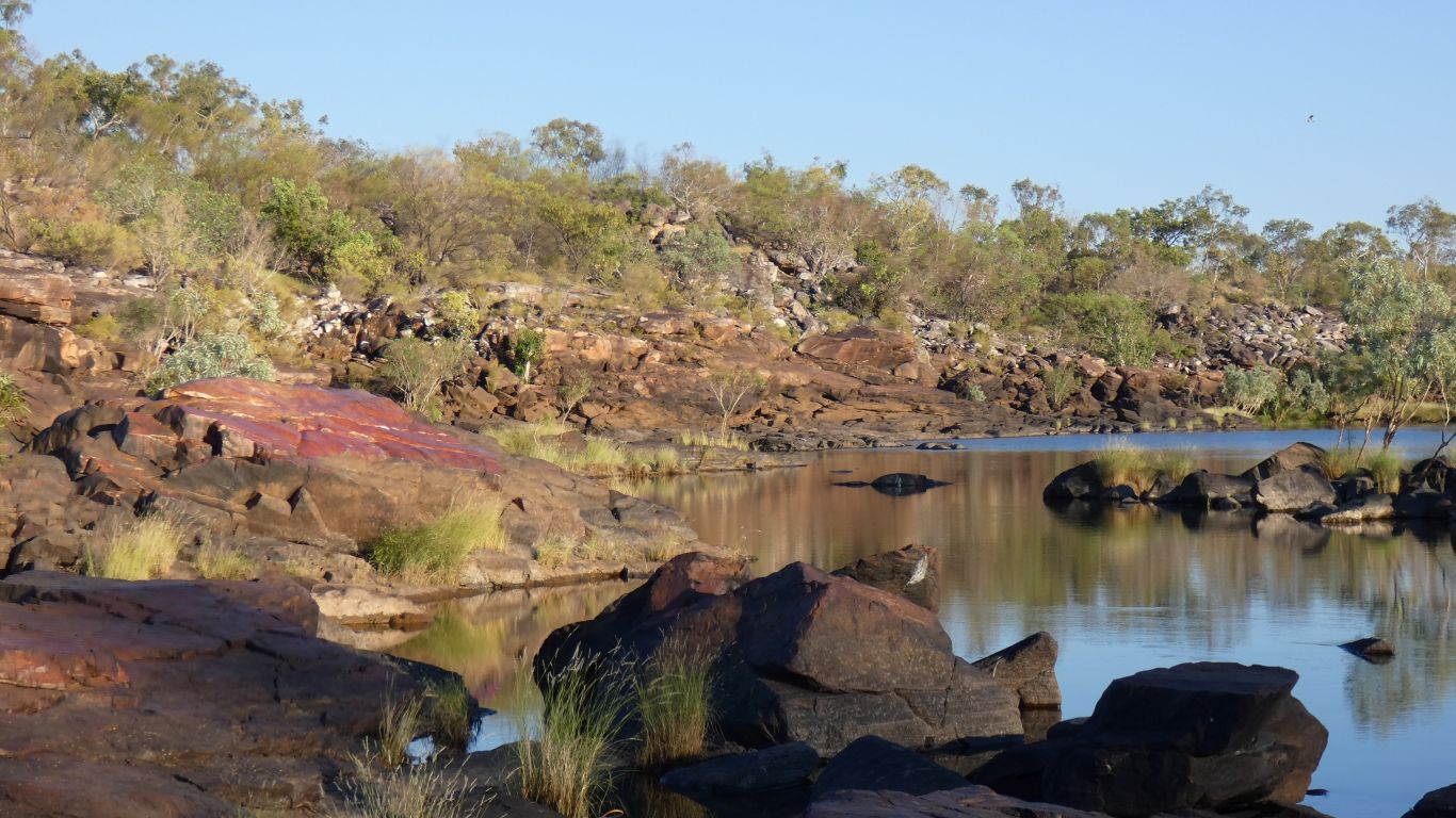
There are reputedly salt water crocodiles down there.
Beneath the layer of basalt is sandstone.
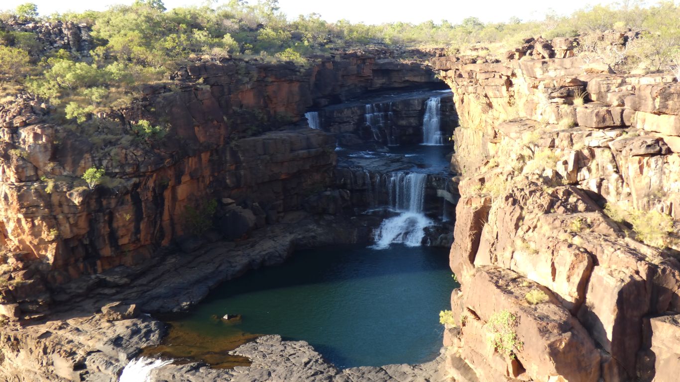
There was a clue to the "best spot" .... the sign that said "cliff risk".
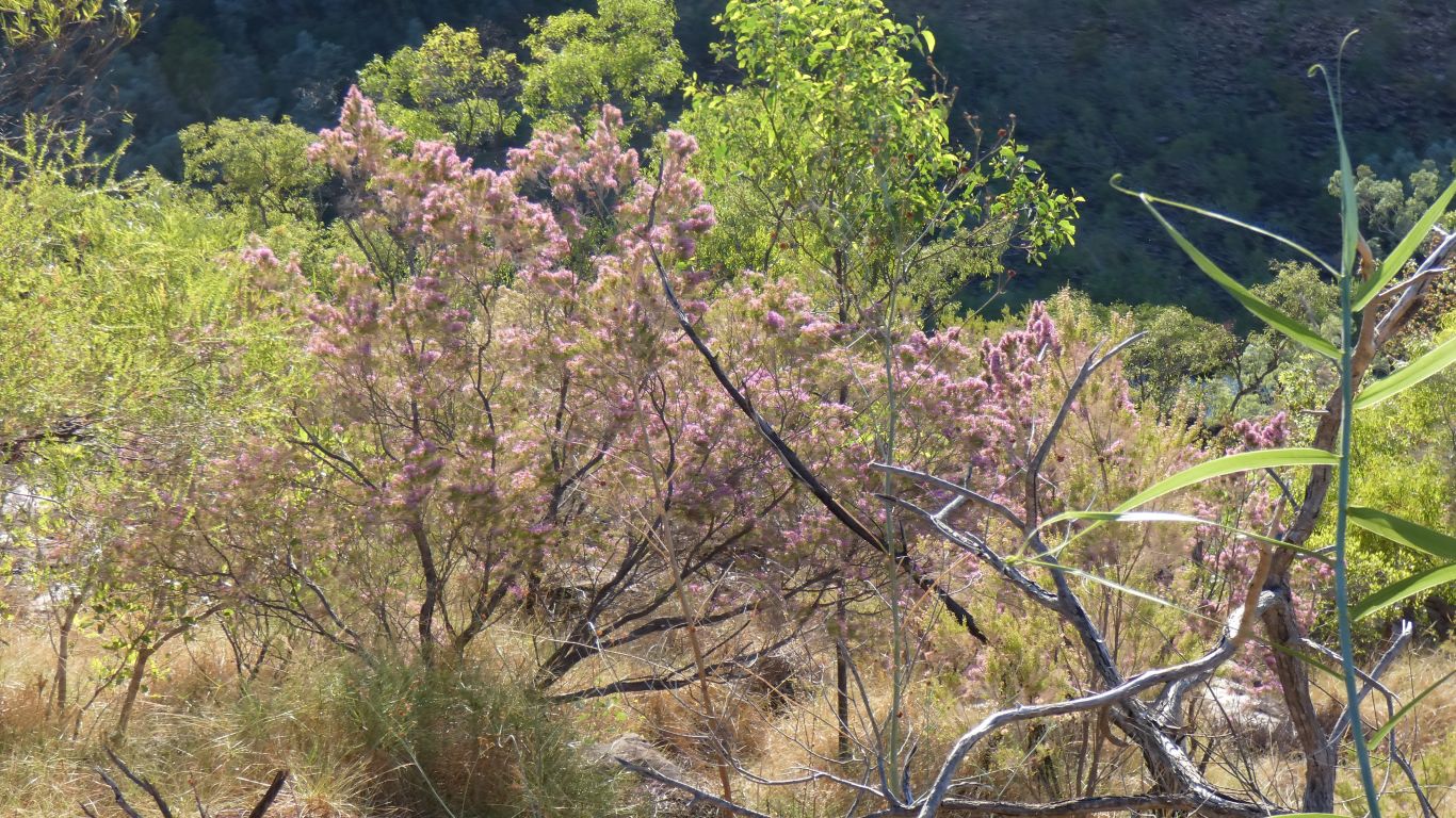
Though with a bit of research we later discovered its Kimberley Heather (Turkey Bush).
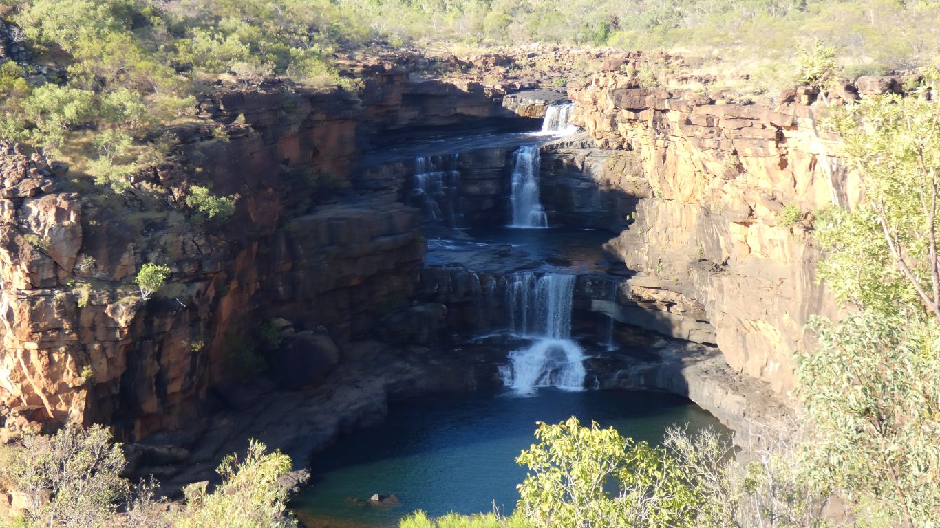
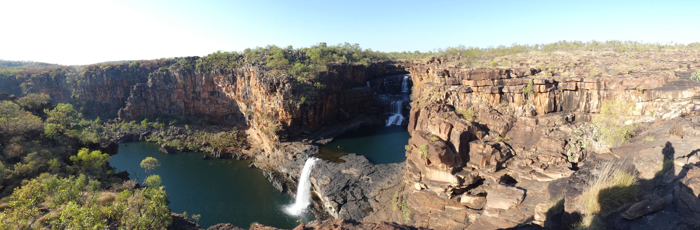
The river was strategically aimed across the mouth of the falls and has caused the bend in the Mitchell River.
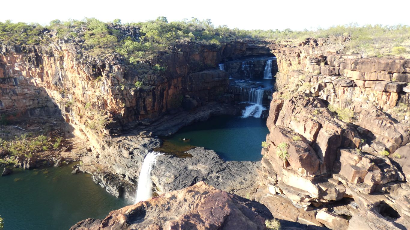
This is a panorama pic. The shadow on the right is me ..... (not a wanjina).
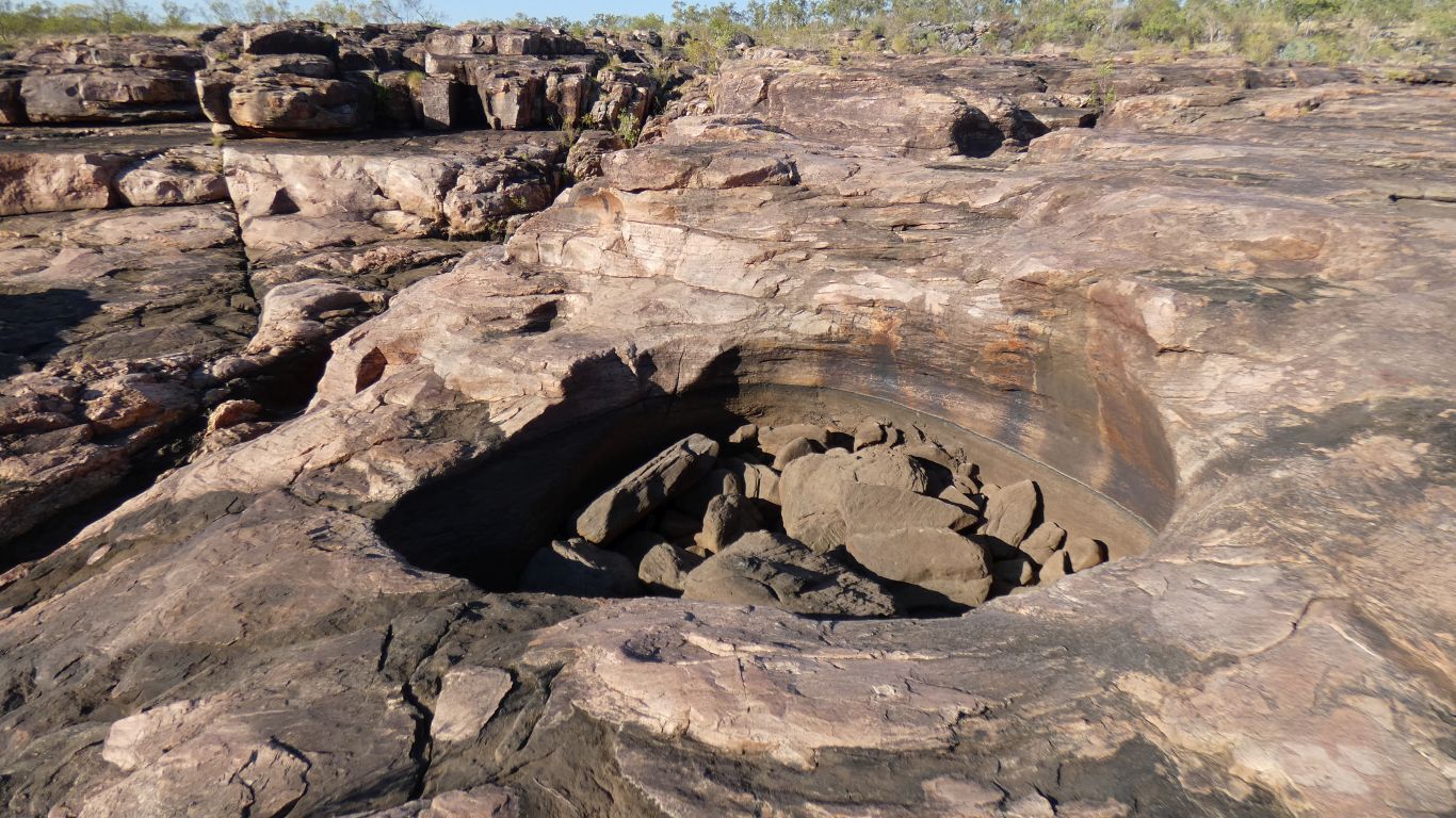
The stones that have washed around to grind the hole are too big for me to lift.
On the way back to camp.
We meet our first people walking in. The first helicopter isn't until 8:30.
We've had the falls and track to ourselves until now. By the time we get back to camp we will have encountered only a handful of people.

It doesn't quite match the bird book, which says scarce and endangered. But we can't match it to anything else.
The leaves barely move under it. There's lots for it to eat.
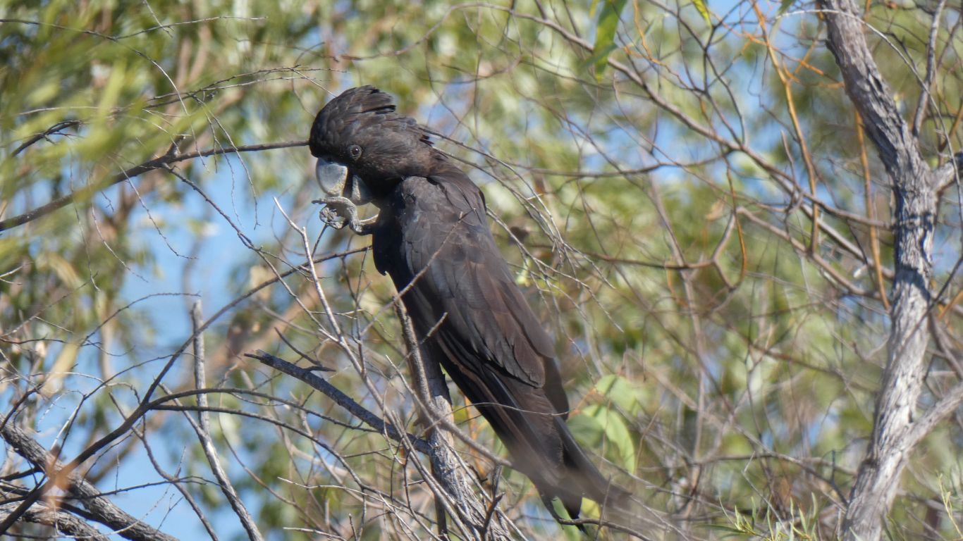
We are used to them flying away as soon as we approach.
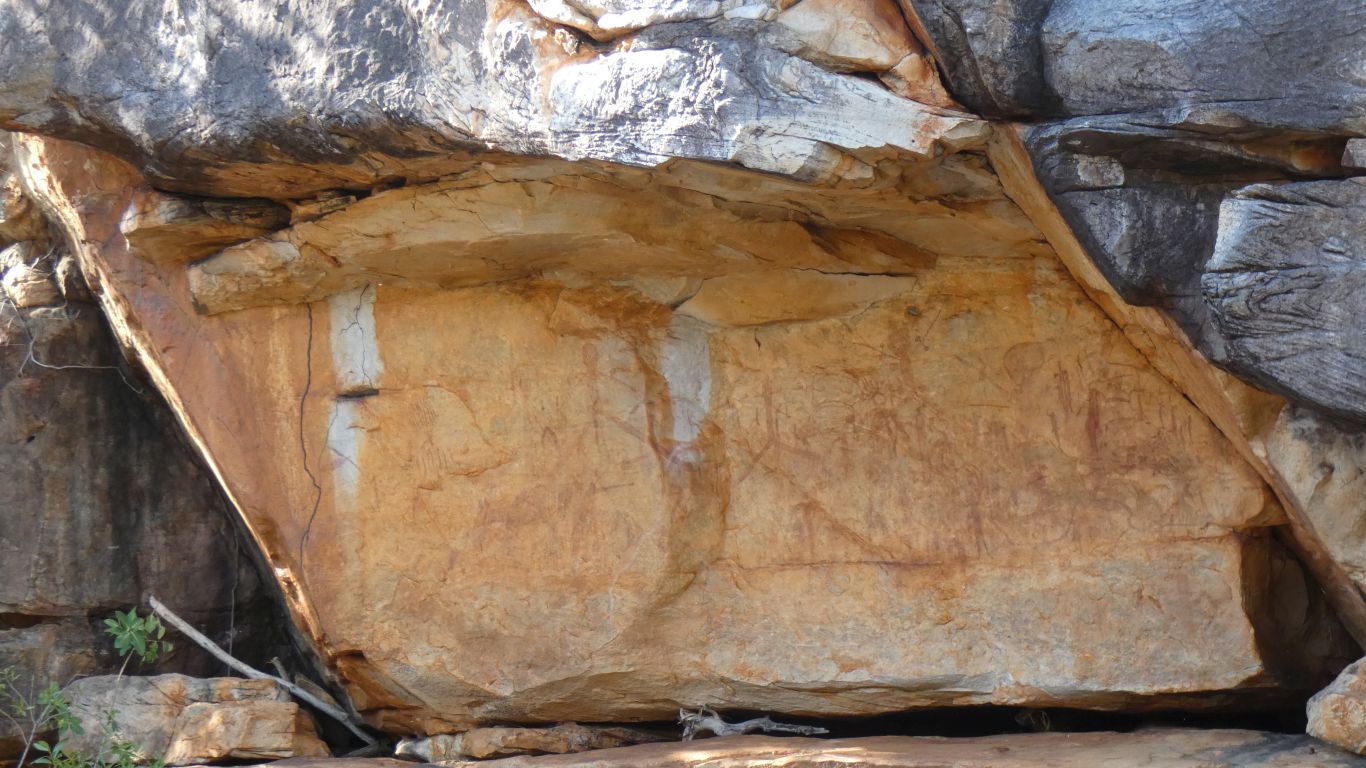
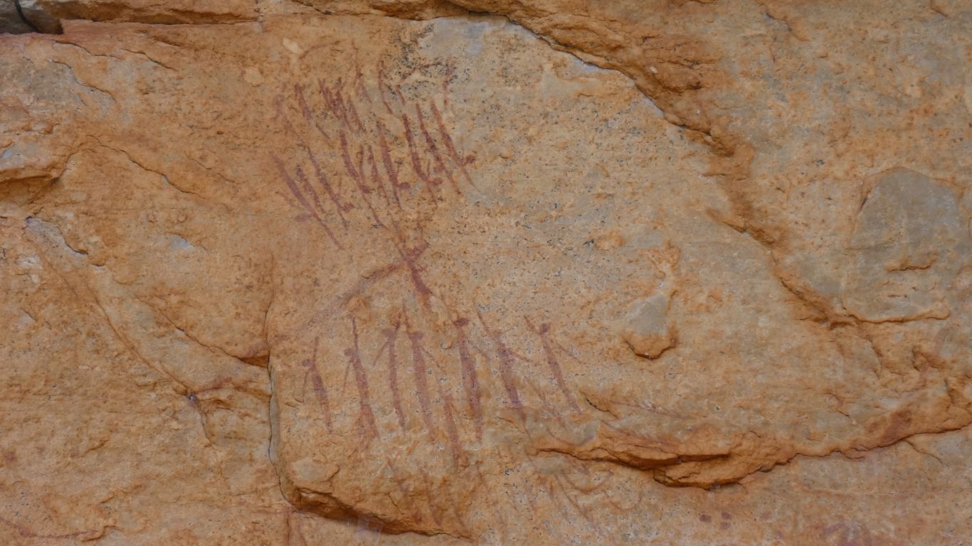
We think Gwions (Bradshaws). "Anthopromorphs". Artistic.
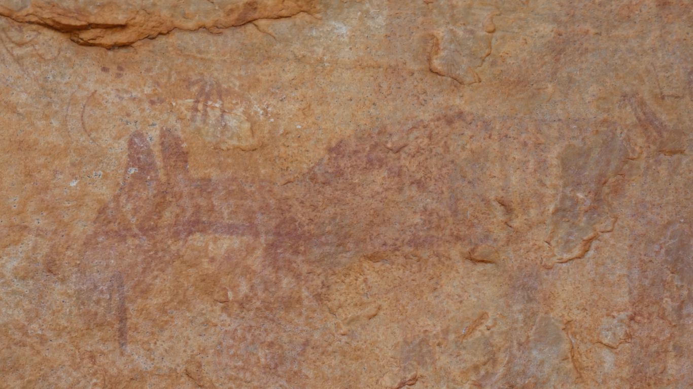
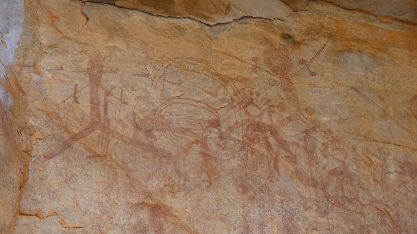
A later wanjina painted over all sorts. Some are outlines, some partially filled, some totally filled.
There is another gallery on the Mitchell River upstream of the Mitchell Falls. About "an hour", which we decided against tackling.
An odd (to me) conversation in which I think I understand that the art sites within the national park are not signposted but if we know they are there we can ask and be told how to find them. In odd contrast to the boldly signposted Munurru sites. What an odd world I live in.
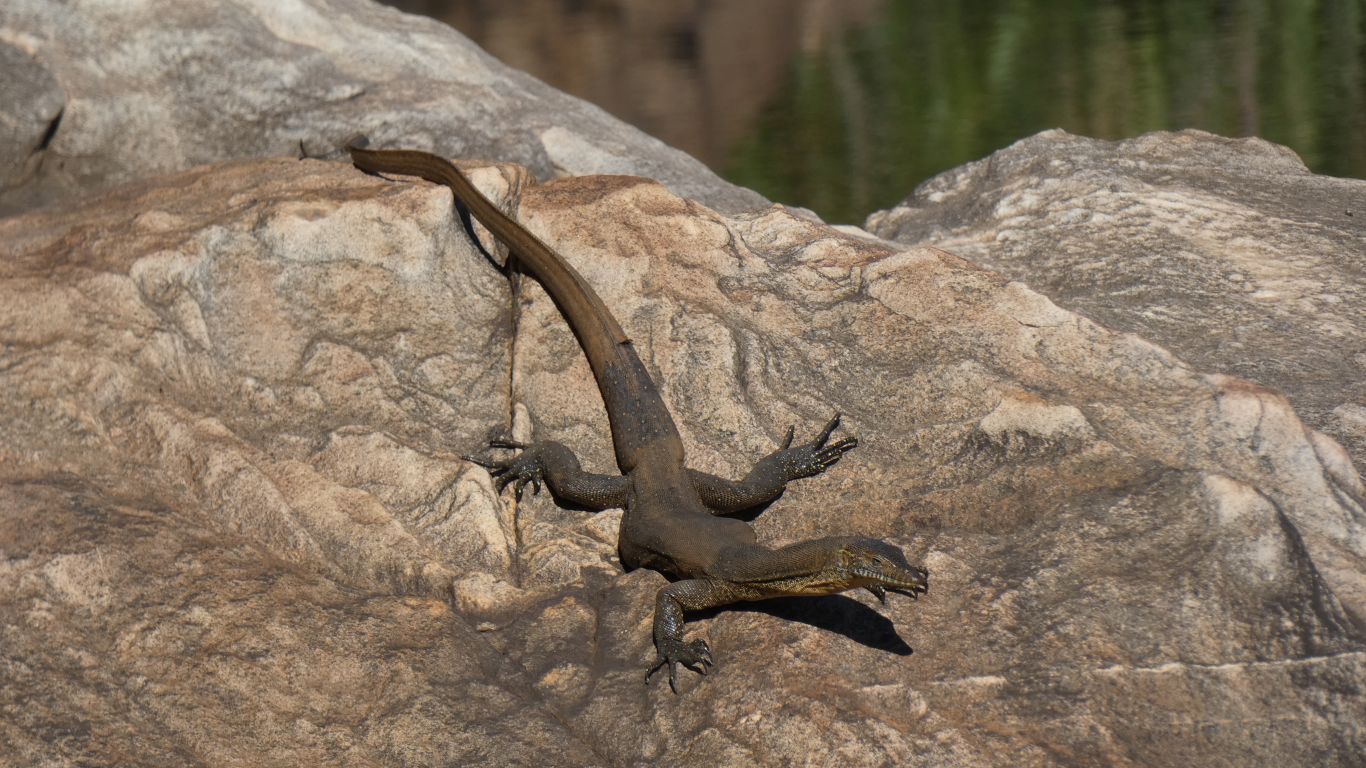
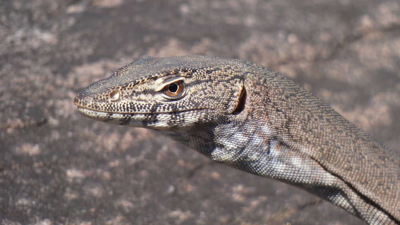
Alert and ready .... but unmoving.
A Mertens Monitor.
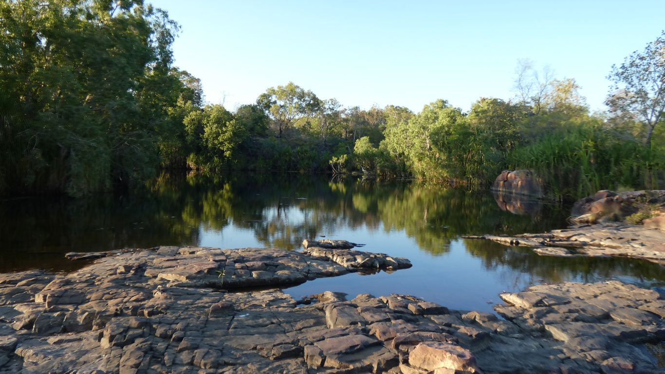
We are on the banks of Mertens Creek.
We are both more than a little tired and achy after about ten and a half kilometres plus a cooling swim.