Way back in 1922 there was a plan to dam the gorge. Which would have flooded Taroom, 45km to the south west.
Resurrected in this century as a dam at the entry to the gorge. A lower level. Saving Taroom.
That plan also seems to have lapsed. For now, simply because its not yet economically viable.
We stopped briefly in Taroom to empty the loo cassettes, fill one diesel tank, fill our water tanks, and buy some food.
Lots of camping space, we'll return after a loop around Isla Gorge National Park.
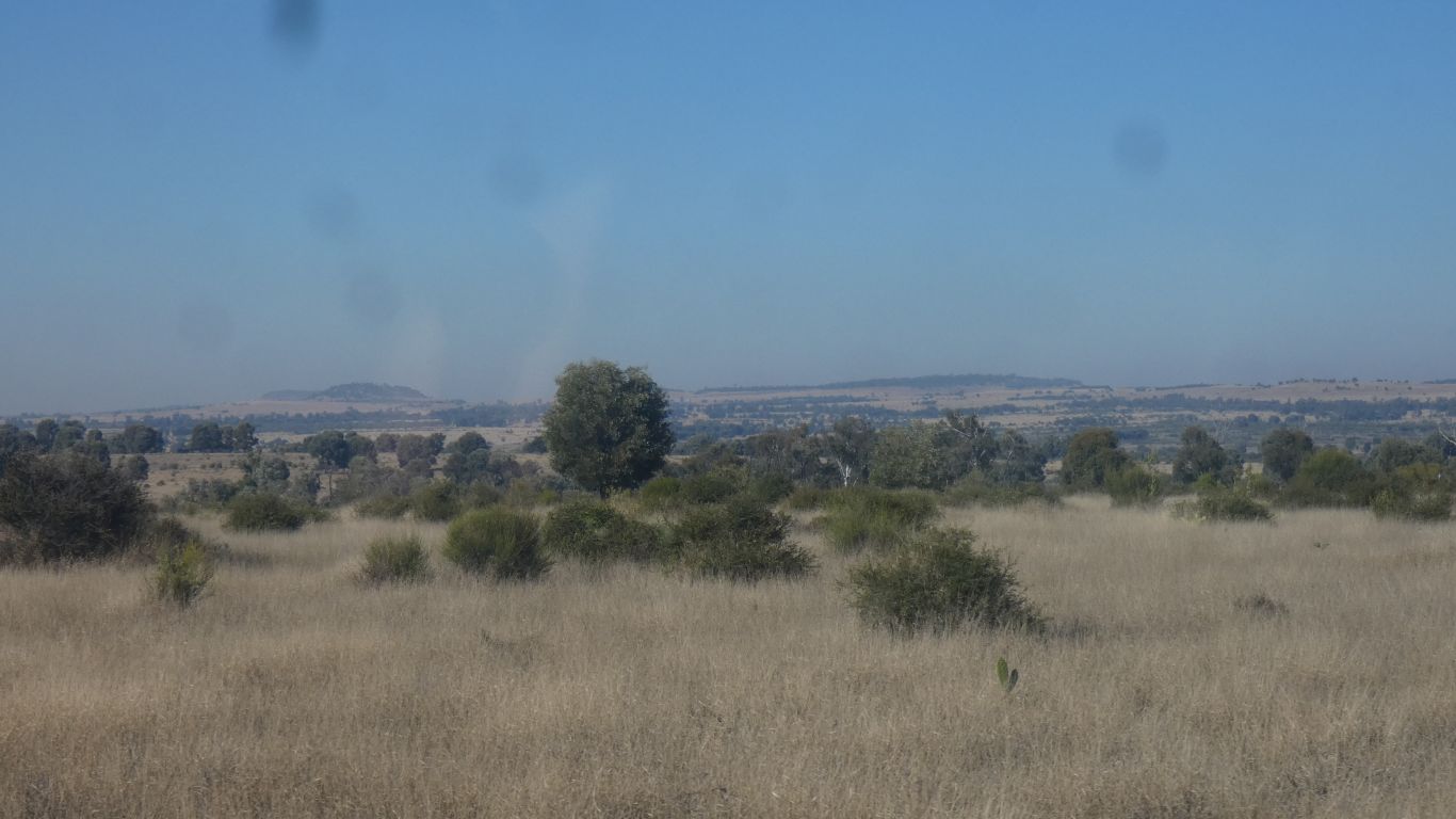
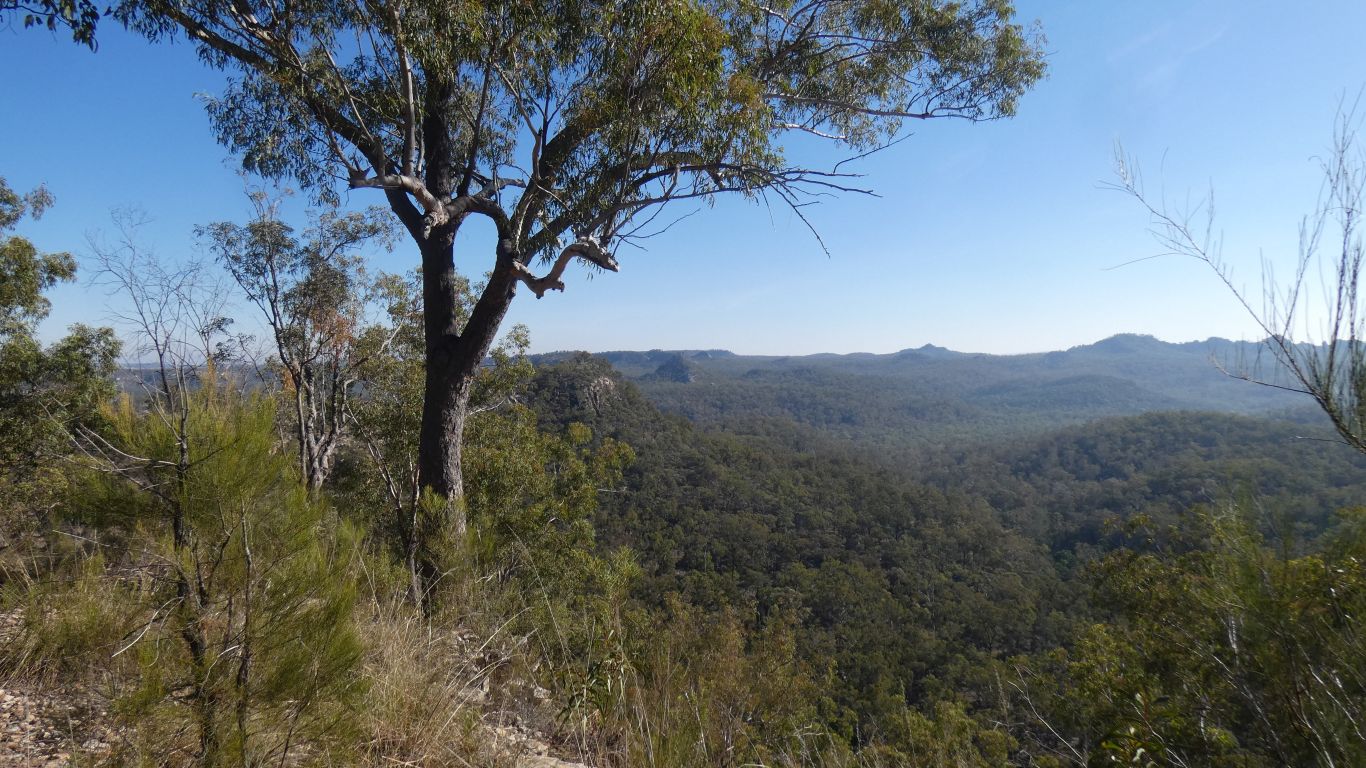
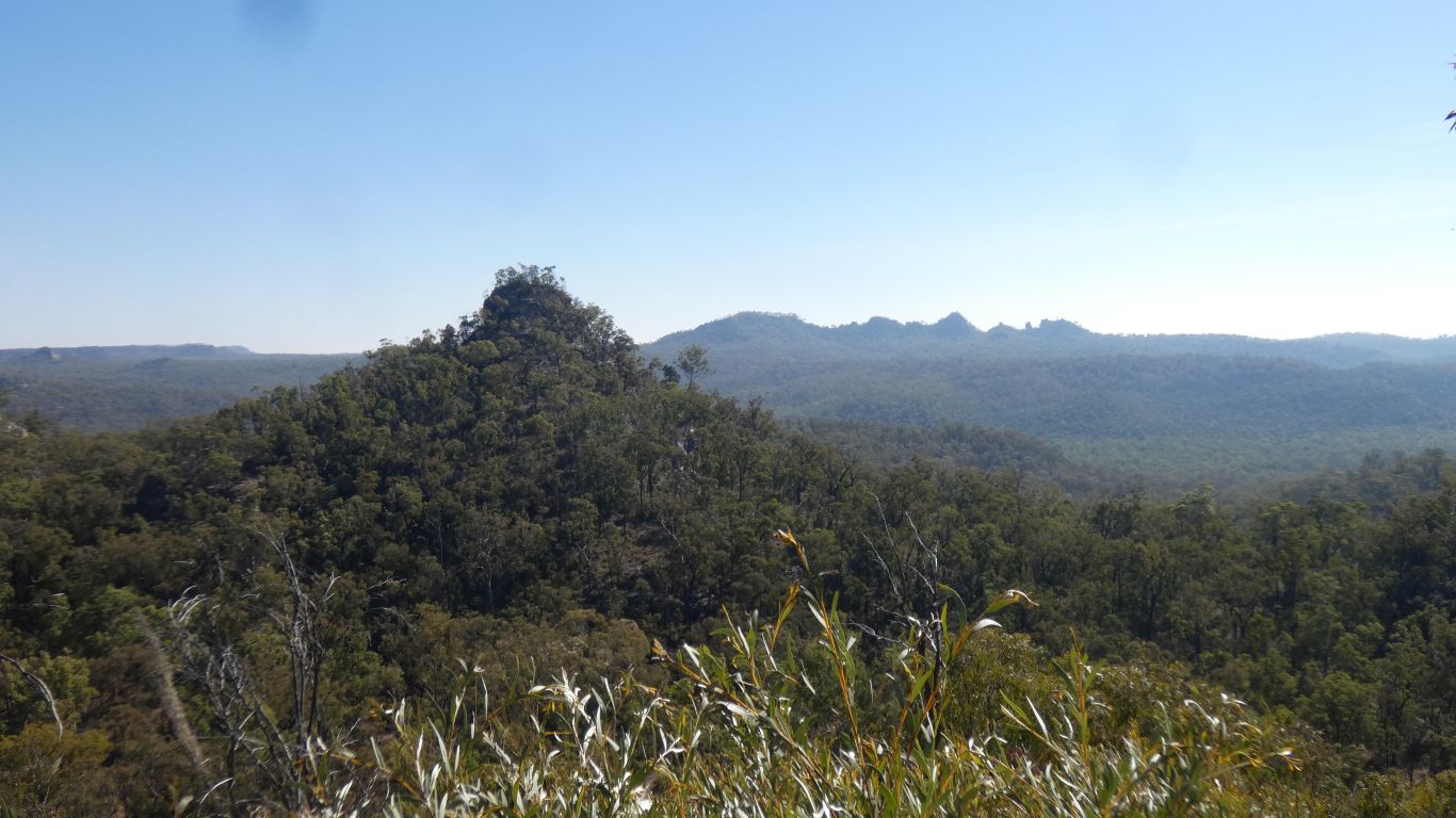
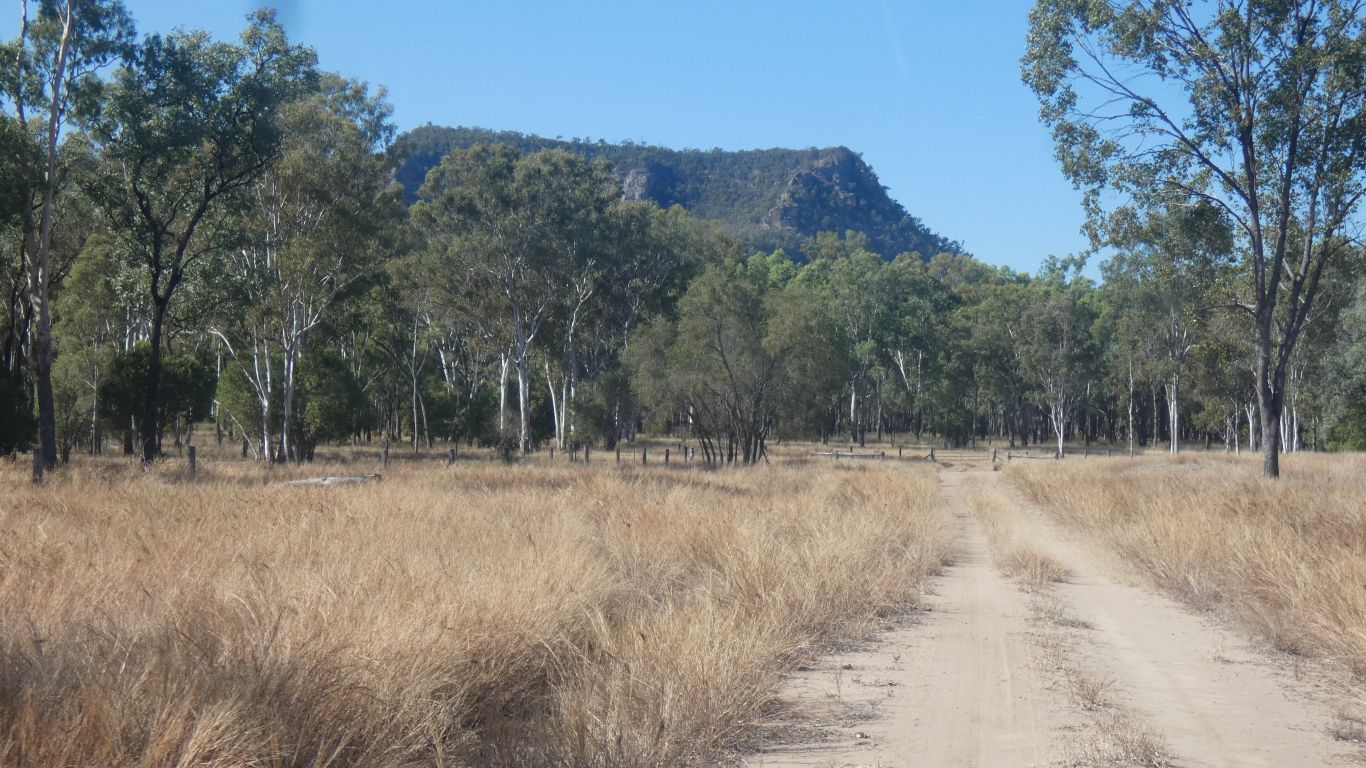
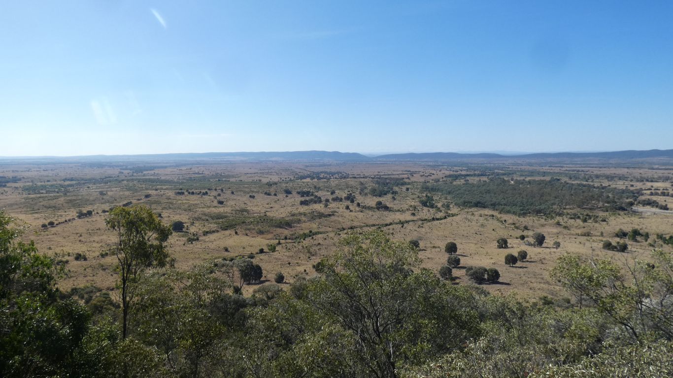
This is our first glimpse from the campsite in Isla Gorge NP. Looking a bit east of north, towards Devils Nest.
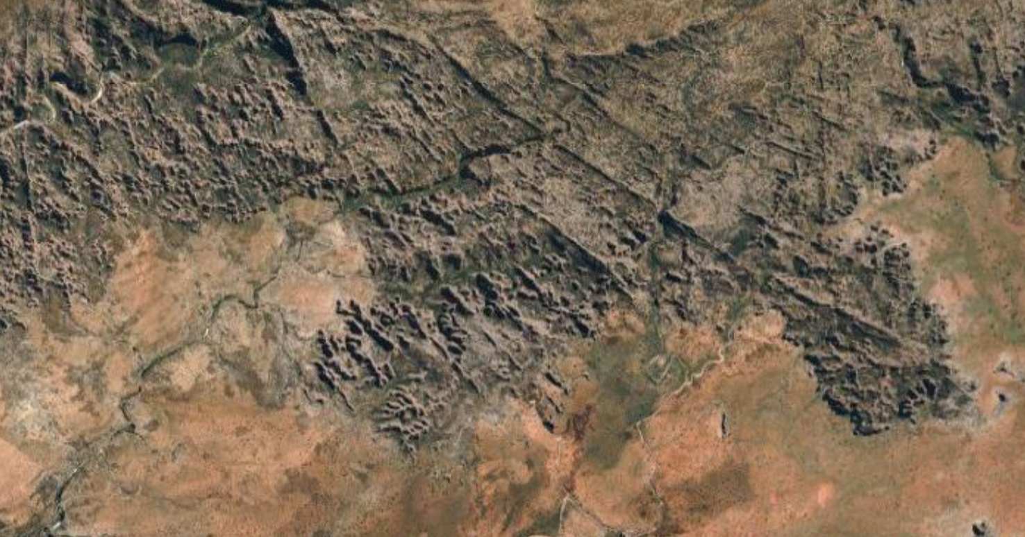
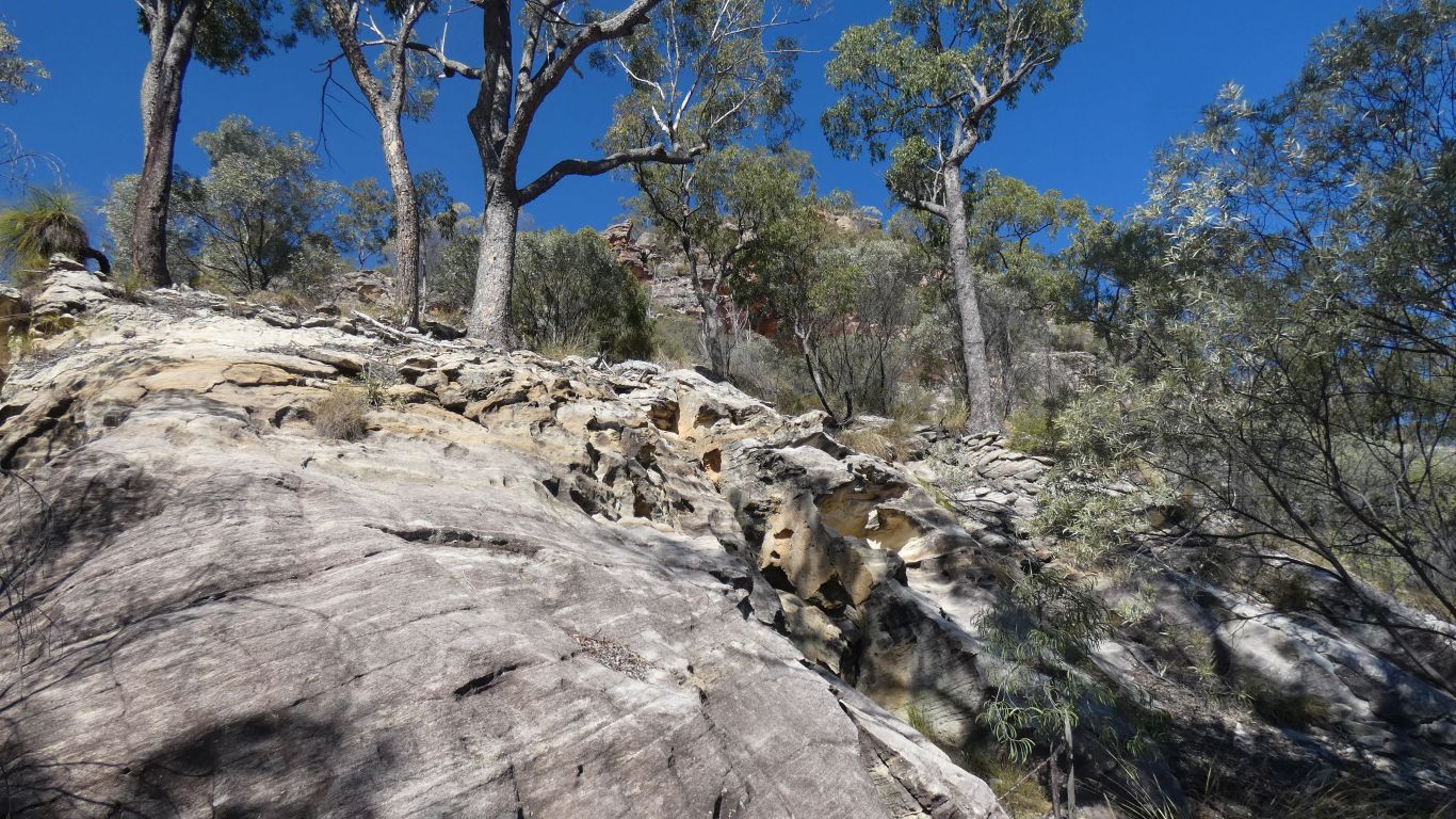
It seemed obvious that this was a "karst" formation. Eroded by water.
I think the park is called precipice not because it has precipices but because it is formed of precipice sandstone. A major layer of rock in the Bowen and Surat basins. And beyond.
Deposited by fresh water flowing rather than under sea. Then, in the case of the park, later eroded. Perhaps uplifted a bit as the erosion is more obvious on the eastern side than west.
That's about the limit of what I could discover. The park is inaccessible to us, so no chance of knowing if the sandstone is more or less coarse on one side or another, indicating the direction of depositing water flow. And no chance of knowing where the very big mountain that was eroded was.
It must have been a very big range, precipice sandstone covers a vast, and thick, expanse of Queensland basins.
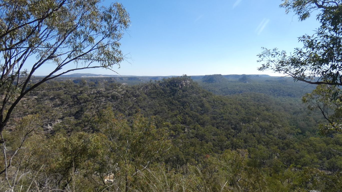
This pic is at approximately the same scale as previous pic.
The similarity ends there of course. The sandstone layers in the bungles provide a distinctive banding, while the relative fineness at the southern edge allows the domes to form.
Precipice sandstone was laid down during the Jurassic, 145-200 million years ago. The Bungles are older at 360 million years ago. I have no idea if domes formed and have been further eroded, or never formed in Precipice. Precipice is "craggy" with scree like slopes. Unlike Bungles where the domes meet the floor, the eroded rock washed or blown away.
Interesting (to me) is that in the Bungles we were restricted to being at the bottom of gorges and formations. Looking up. Apart from the helicopter flight that is. When I asked a Ranger about access to the plateau the answer was "yes and no". Yes its possible, but no, not for you. At Nathan Gorge, and Isla Gorge, we are on the plateau, looking down.
Having compared them, simply as karst formations, the Bungles is obviously much more impressive and spectacular. But this sandstone area of Queensland is looking impressive in a different way. Both enjoyable in their own distinctive way.
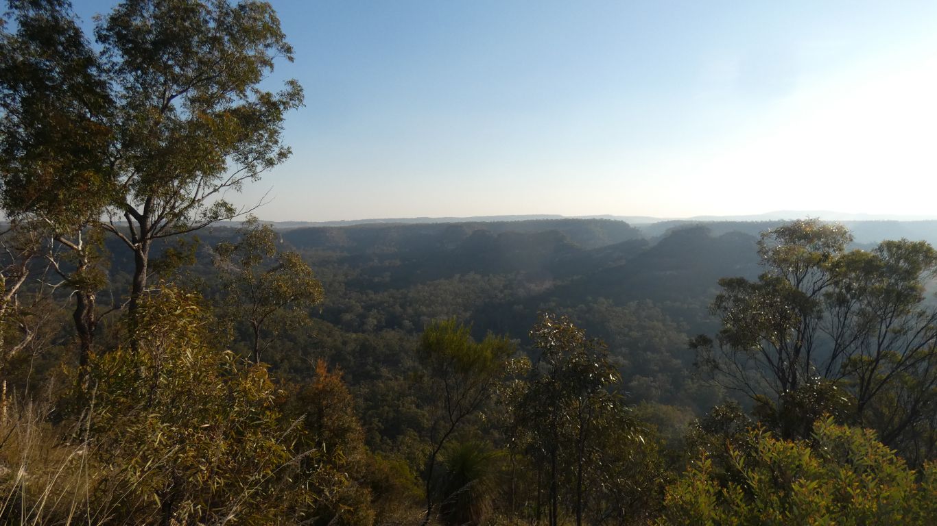
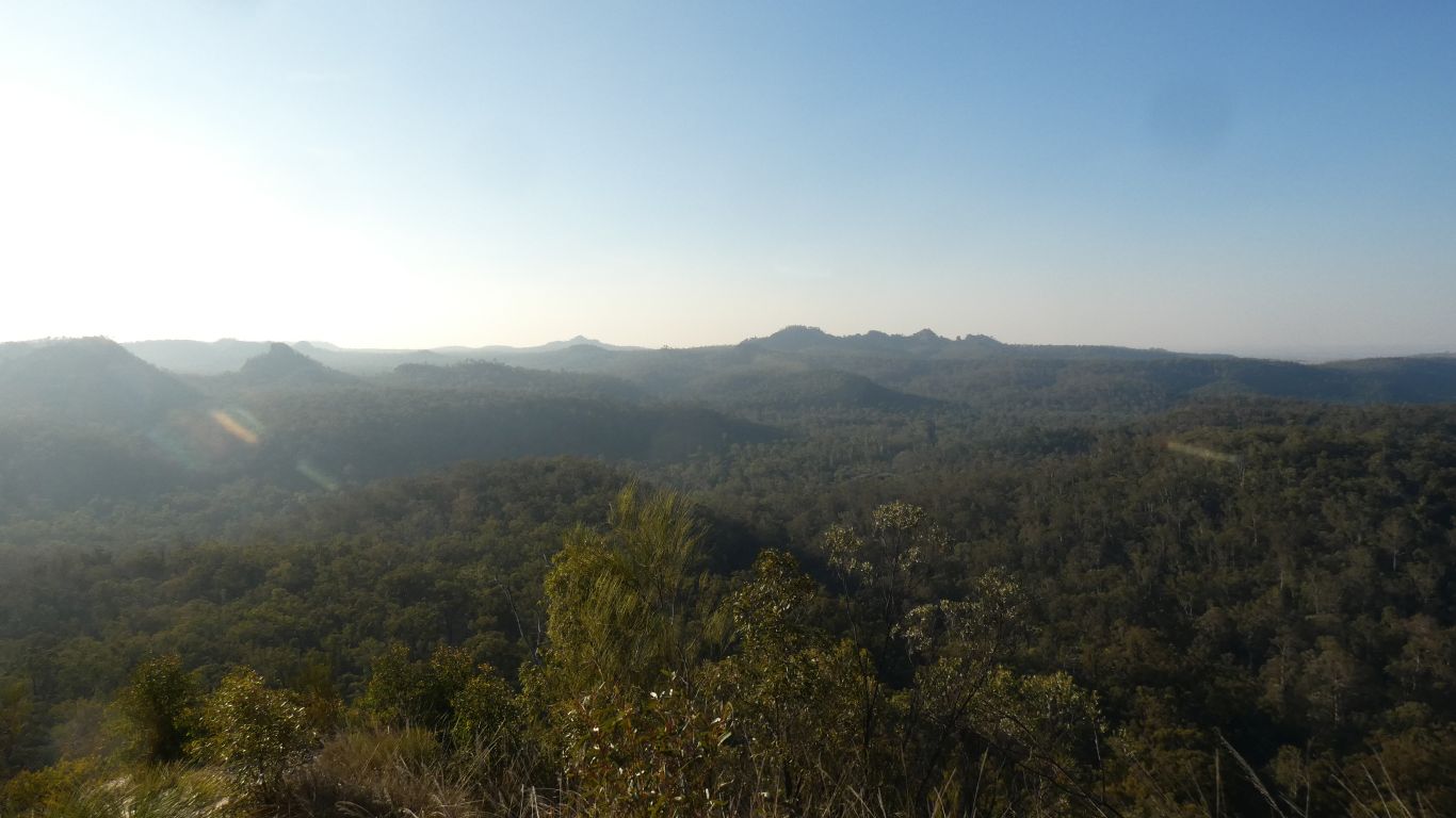
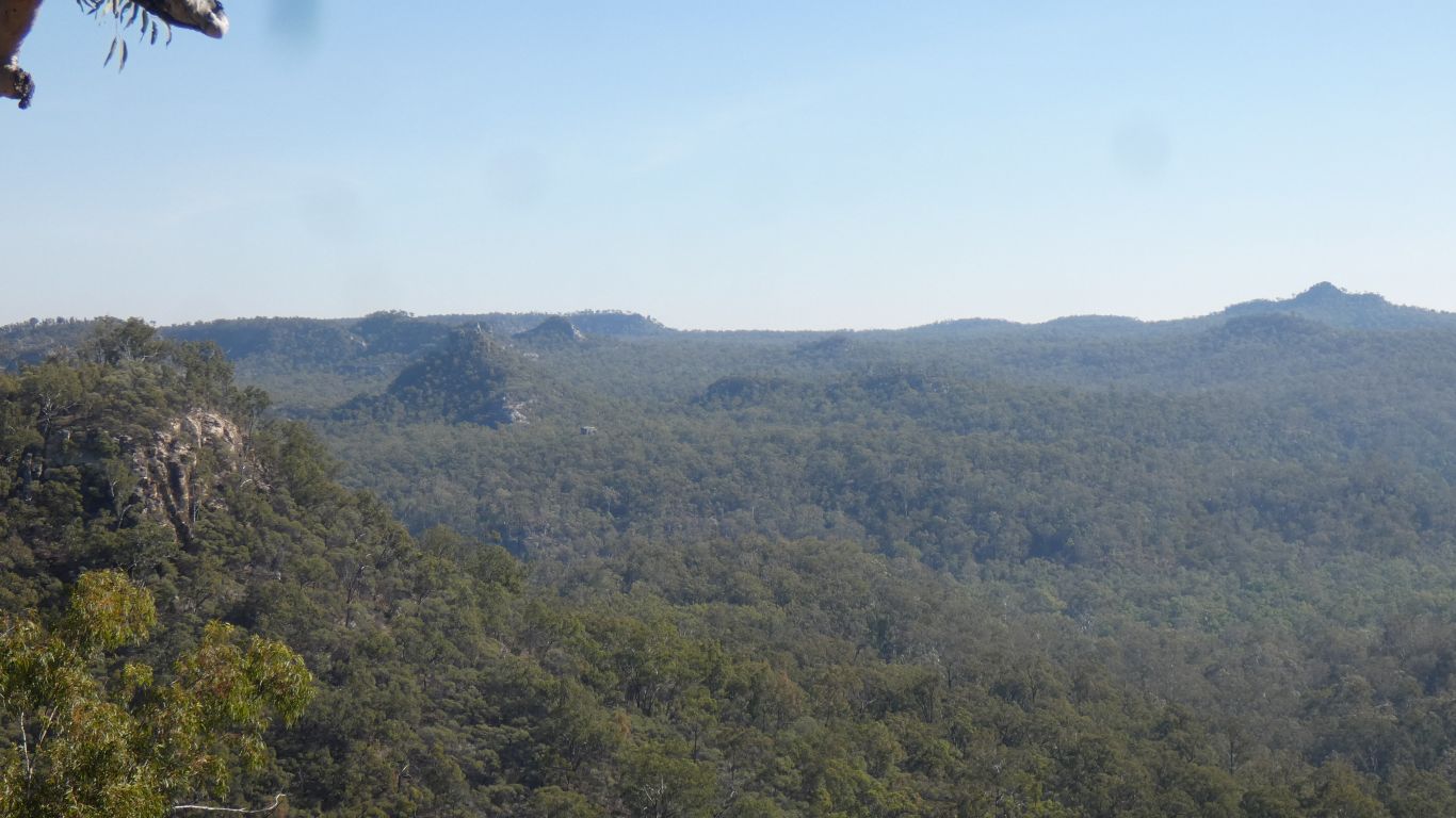
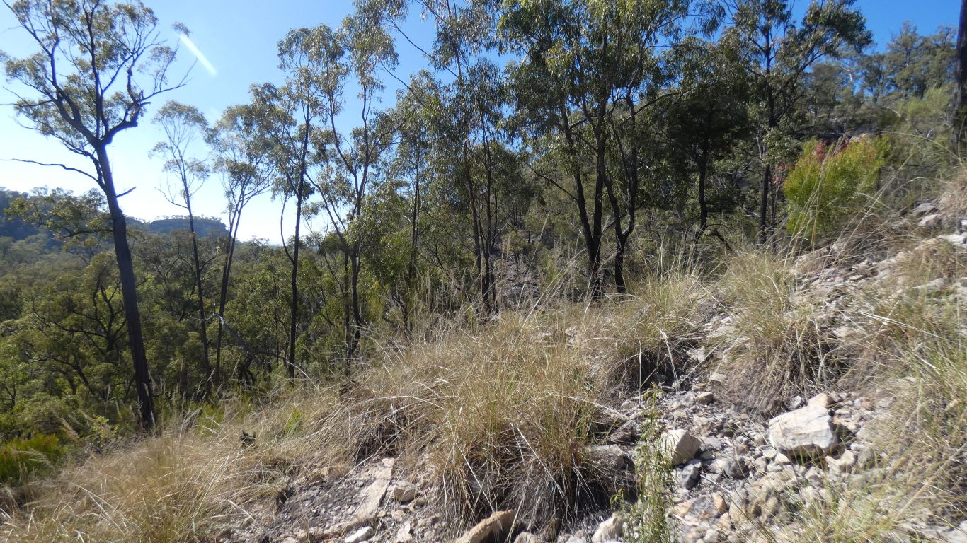
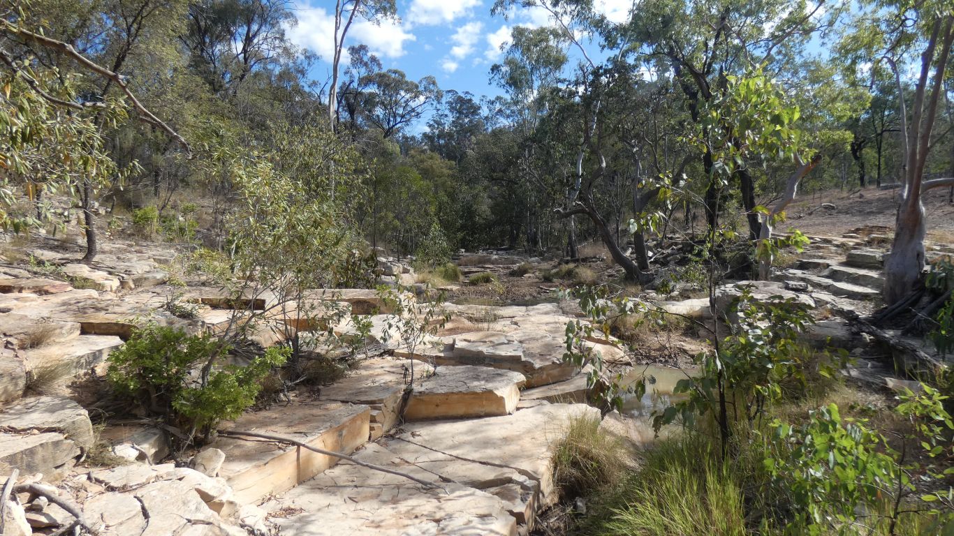
We followed a track northwards from the campsite for a few hundred meters. Followed a ridge, with steep sides, to a lookout at the end.
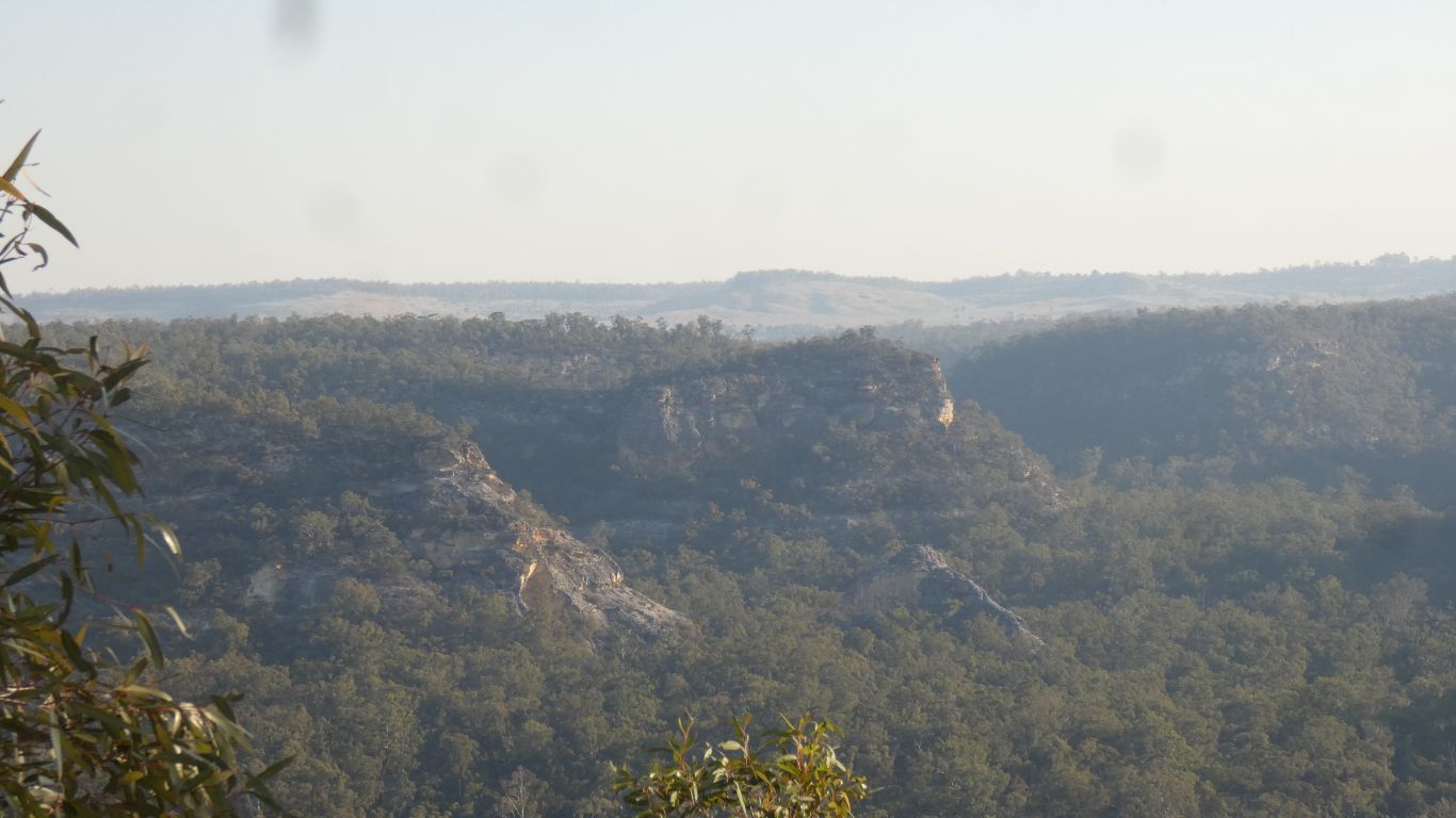
With the additional detail of cliffs and crags.
There's smoke in the air, from a fire at Kroombit Tops. Many km to our northwest.
We thought about whether we could descend from the end of the ridge towards the gorge creek. But perhaps a little steep.
Looking north towards Devils Nest.
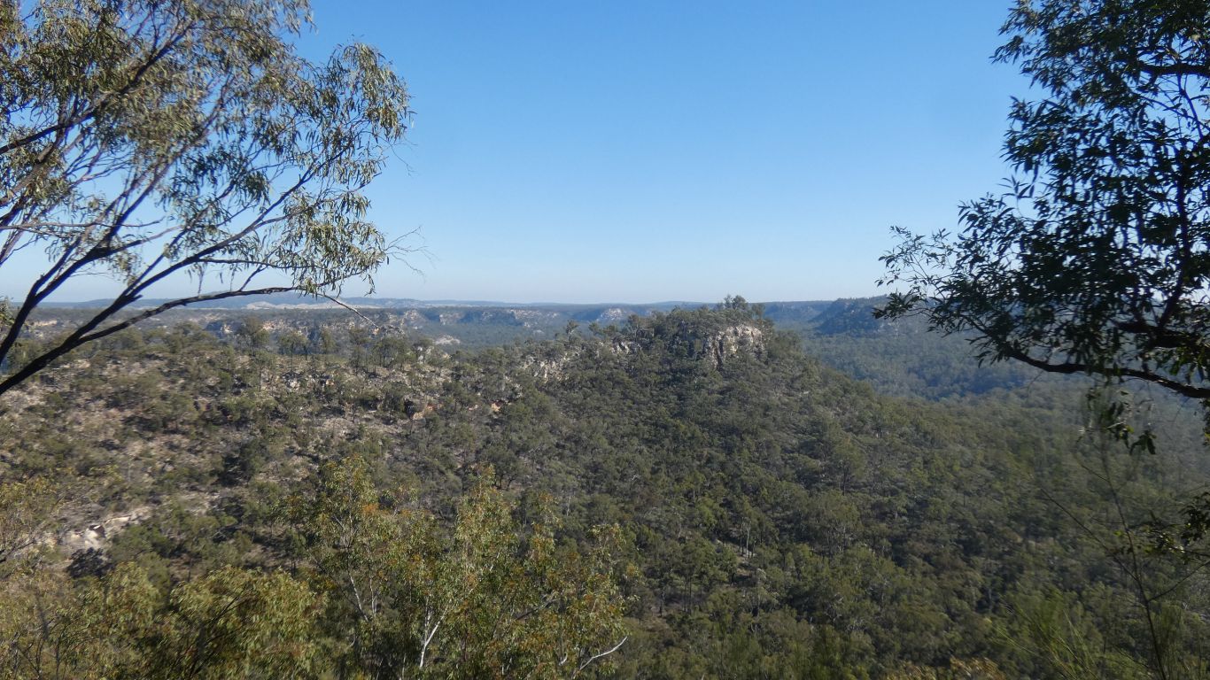
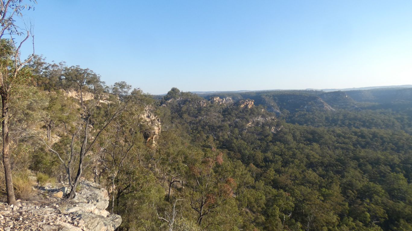
This is looking back at a parallel, but less passable, finger.
A ridge sufficiently eroded that the tip has become isolated.
Then followed yet another finger northwards.
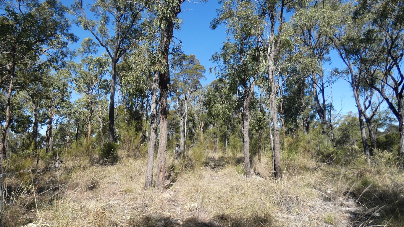
Not far to its tip we found the slope sufficiently inviting, we began our descent.
Mostly like this, sometimes a bit steeper, a couple of rock outcrops to climb down rather than walk.
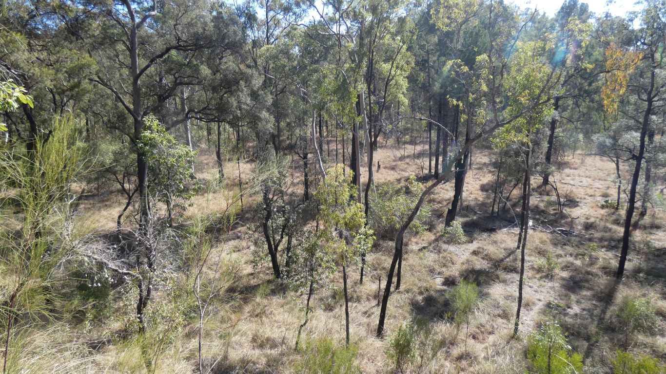
The grass a bit more dense, and soil under our feet, but otherwise similar vegetation.
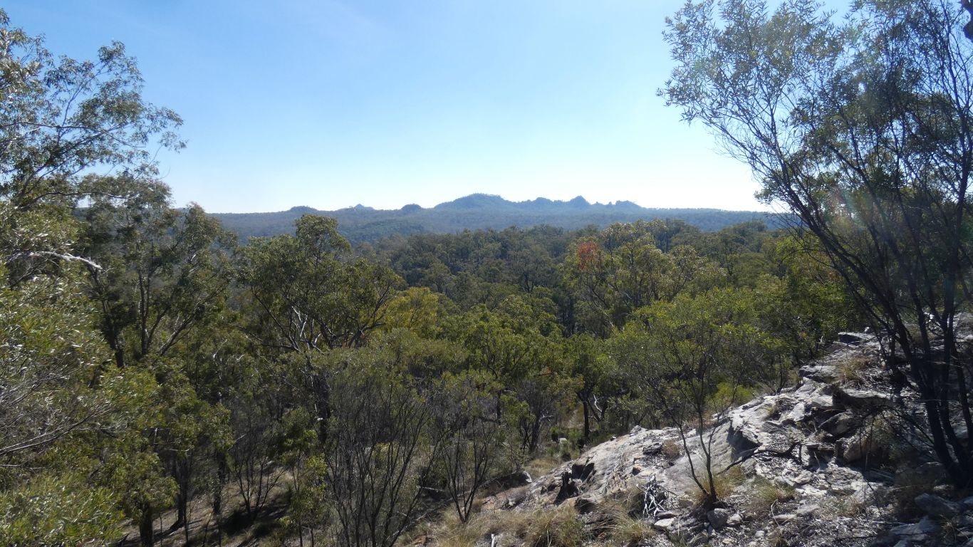
And of course the Devils Nest in the background.
Useful to maintain our bearings, though we had our gps tracker.
I have no doubt there are rock shelters, and possibly rock art of some form, but they elude us.
I suspect the sandstone is a bit coarse for painting, but perhaps engravings. I may never know.
But first a detour along Dukes Plain Road. Along the north eastern side of Precipice National Park. The closest we can get to it without walking.
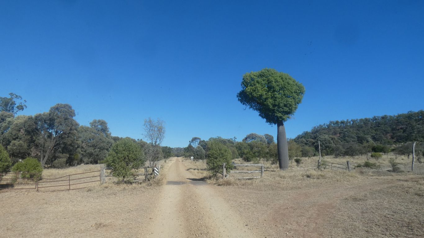
A solitary, rather odd looking (to us) bottle tree.
Just as we (and hopefully everyone else) would expect on the edges of a large karst formation.
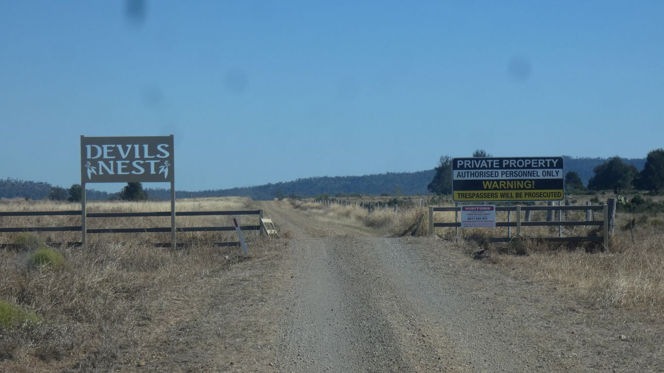
On the edge of the park is Devils Nest State Forest. Andersons Road is shown as being through the state forest and into the national park. The peak that is Devils Nest is just outside the park.
It seems the Devil is in residence. We are not certain of the legality of the sign but are sufficiently discouraged. Which of course is the intent.
The conventional "no through road" sign at the beginning of the road helped our decision - the track north perhaps non-existent or impassable.
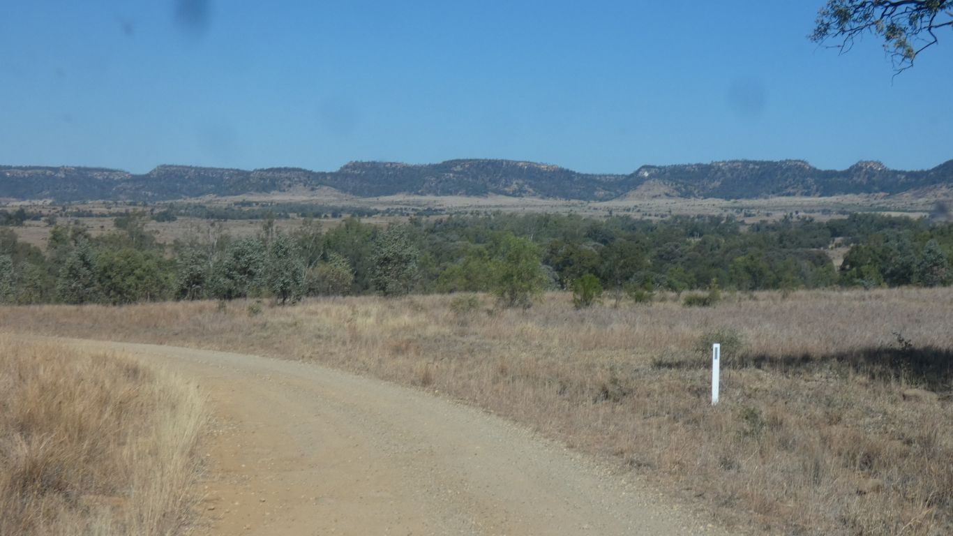
It passed through Glenmoral Gap in the Dawson Range. A long, narrow, steep, ridge. More or less north north west to south south east, from Blackdown Tablelands for a couple of hundred km.
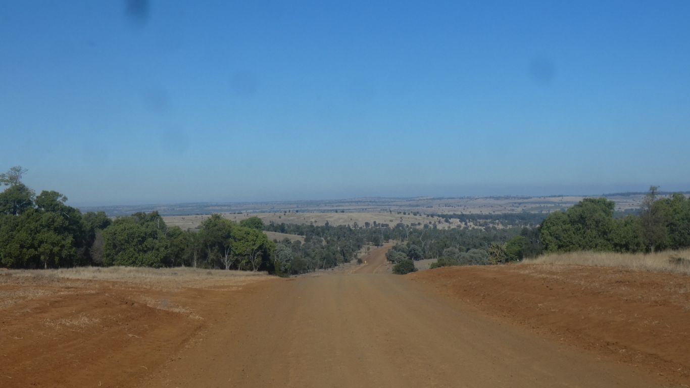
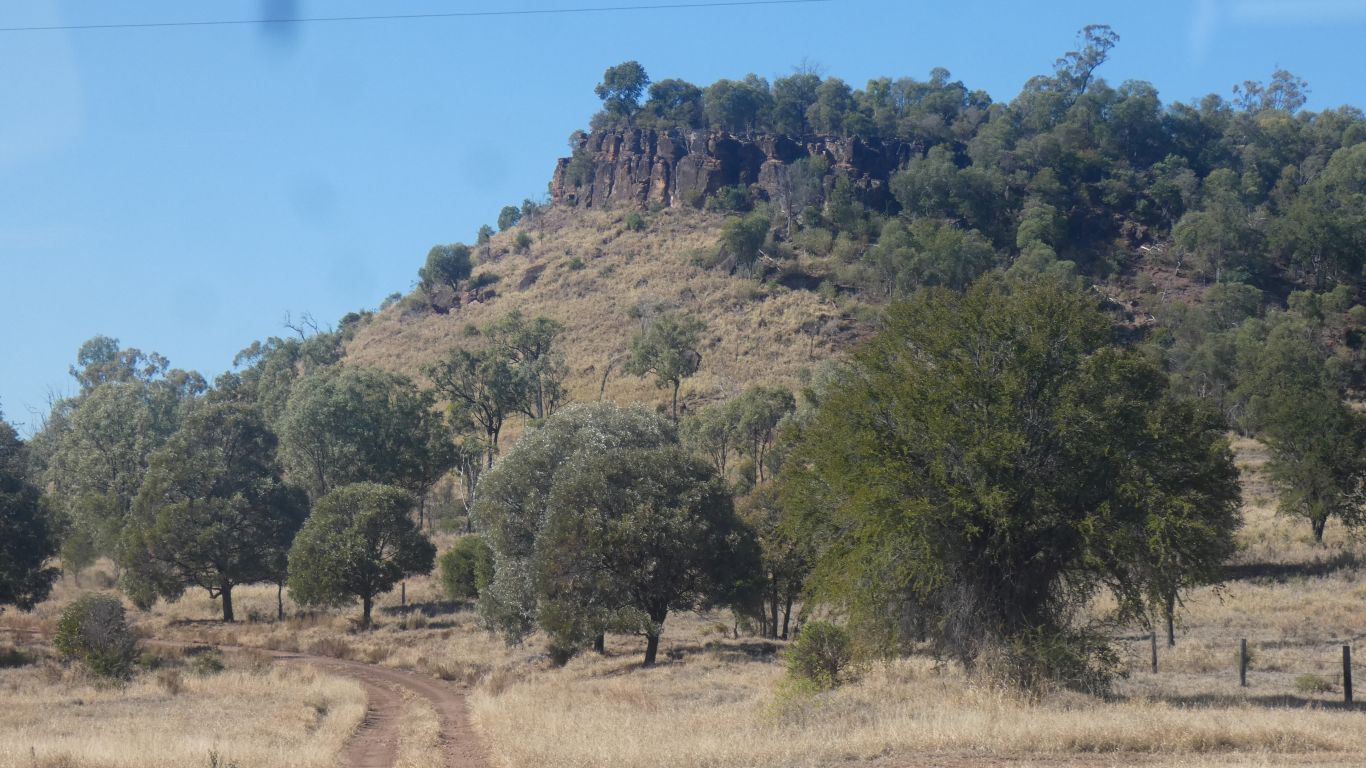
Once through the gap we see the northern part of Isla Gorge NP.
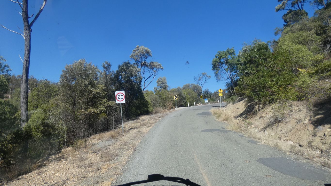
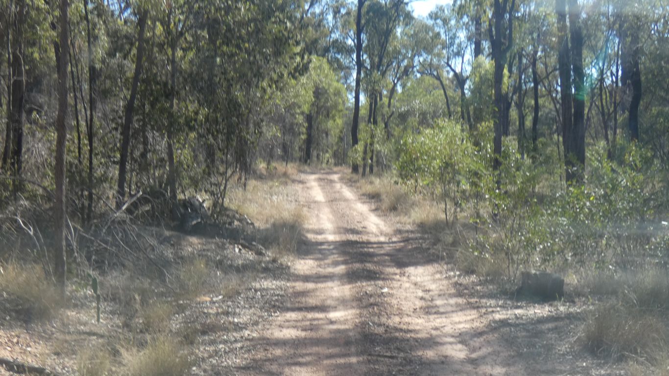
Not too steep. Third gear.
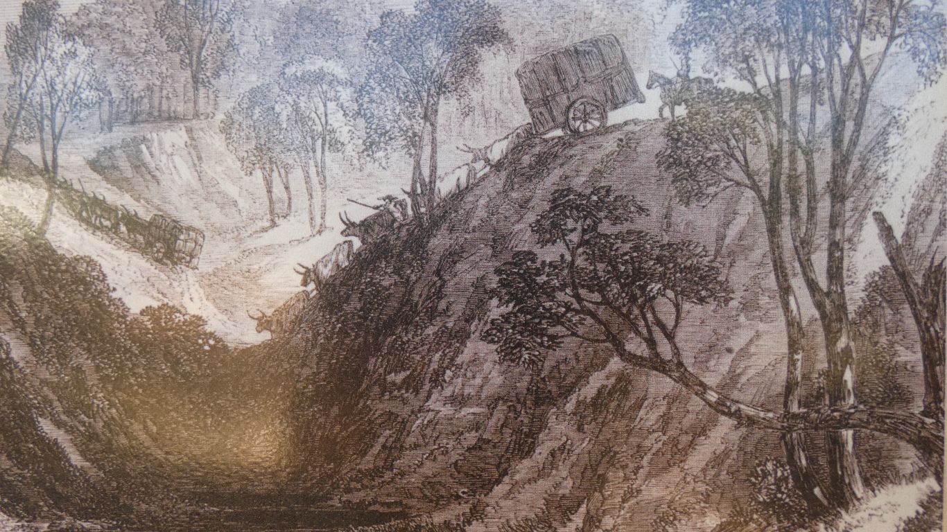
This pic was apparently published in the Illustrated London News, in 1863. Describing how difficult it was to transport wool from within Australia to London.
We hope the brakes worked.
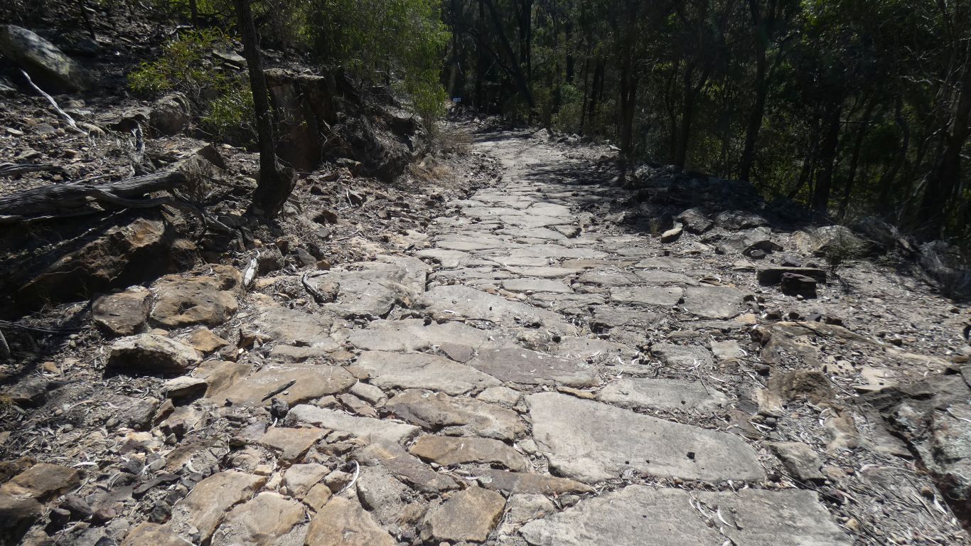
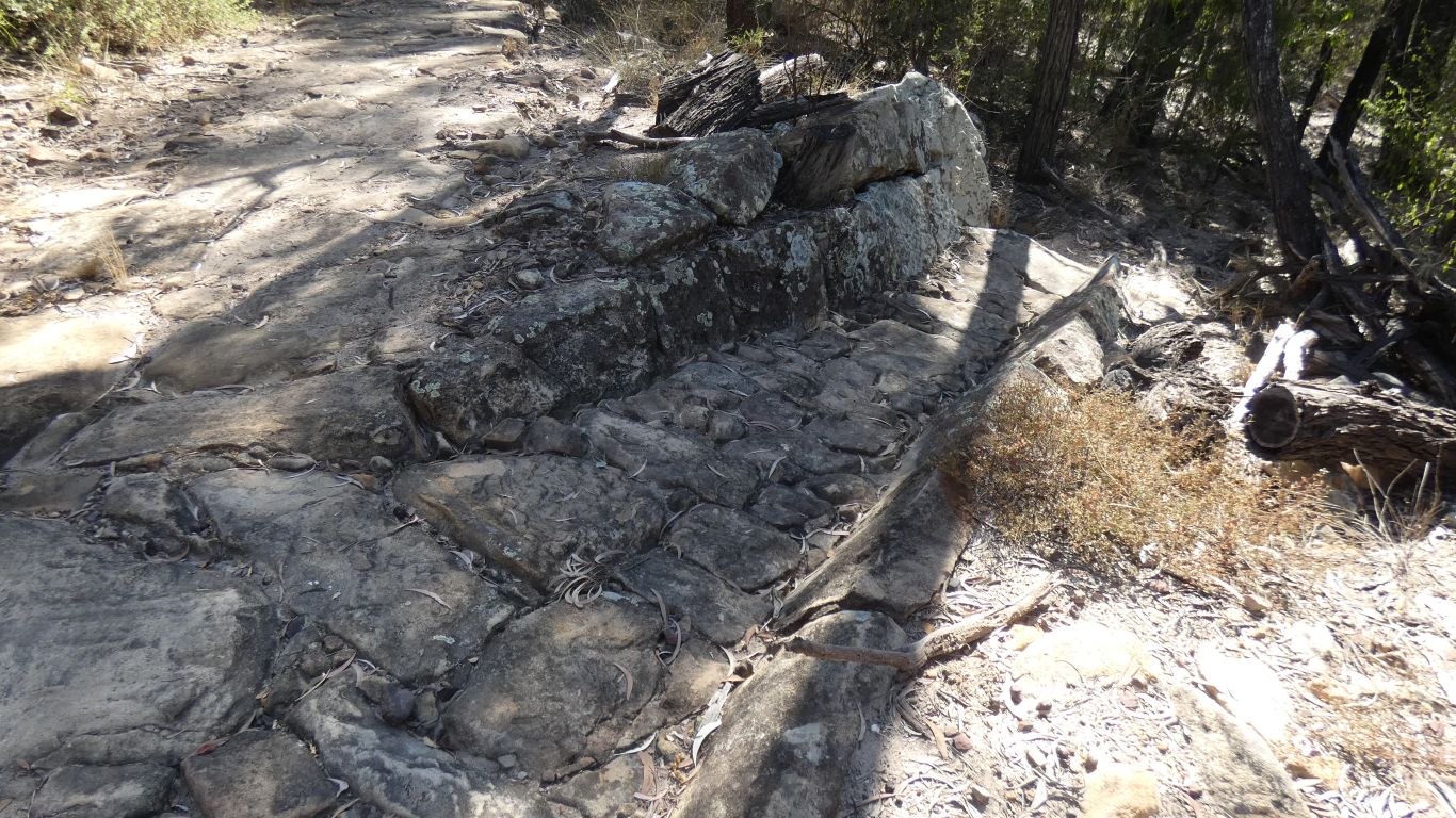
Quite impressive even now.
Designed for bullock carts, so wide corners (the bullocks are always in a straight line, with just a joint to the cart, so they have to shuffle sideways on corners).
Traffic declined in the 1930's as a new road was built between Taroom and Theodore, and a new toll road at Toowoomba allowed wool to be transported through Brisbane.
I've studied the map several times, in fact more than one map several times, and wondered which way the wool was traveling from Roma. Whether up this hill, or down.
A description on the park interpretive sign is of needing two bullock teams to haul heavy loads up steep hills.
But that doesn't feel right for this hill. Perhaps backloading supplies. Or my sense of direction is kaput.
I'm sure sense will be made in the fullness of time. Perhaps a visit to the Taroom Museum is in order.
In the distance the Dawson Range. Almost central in the pic is the Glenmoral Gap that we passed through earlier..
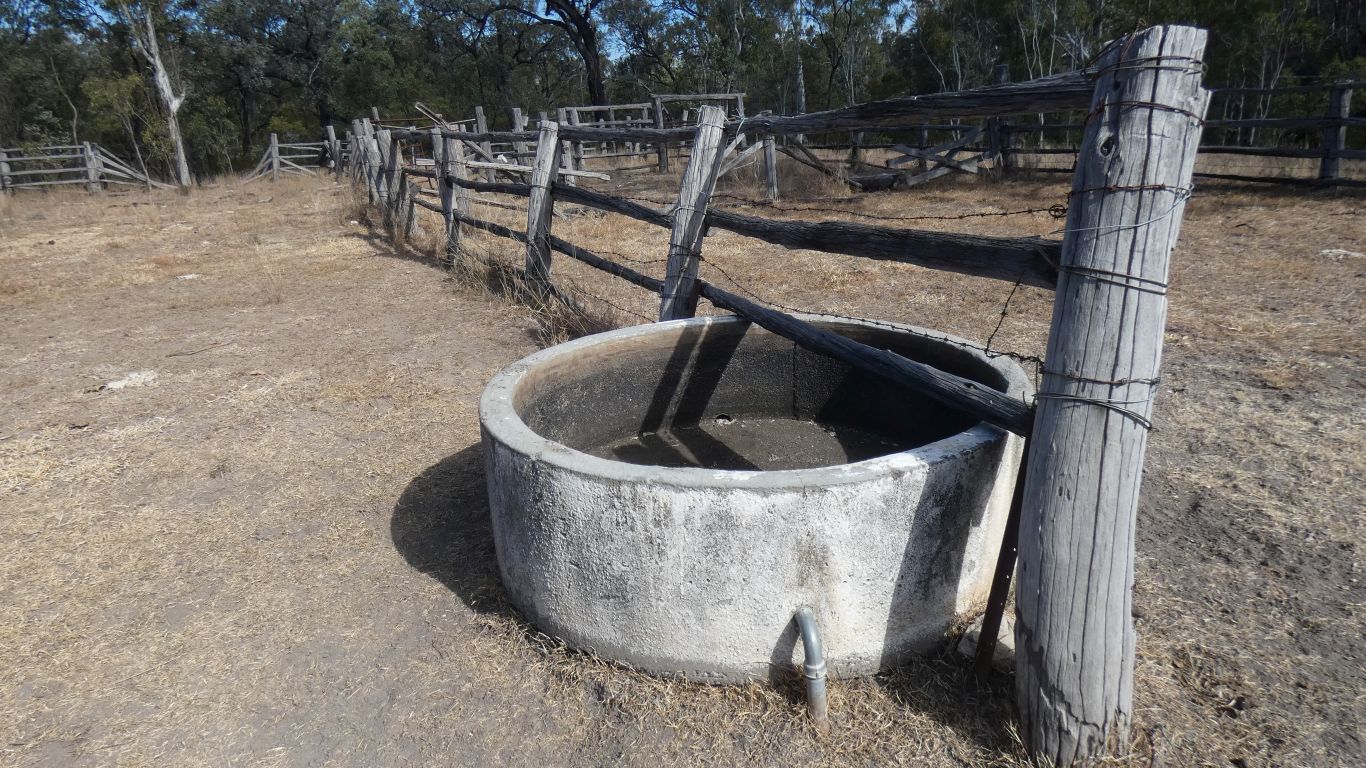
We've seen a few concrete cylinders in the last few days and assumed they were wells.
Apparently not. Simply water troughs. An inlet pipe and a float valve to keep it full. I have no idea where the pipe comes from. Its no longer carrying water.
So we backtracked a few km and are hidden down a short track into state forest. Found a flat spot about 50m from the end of the track. Not far from the edge of the cliffs overlooking valley to east. Just a fence for edge of national park in the way.
Internet a bit iffy but usable. I'll put the phone up the pole to upload blog.
More importantly, lots of sun to dry the washing, stretched across the track, and fill the battery.