Cradle Mountain February 28
 
  The early start not quite so early, we drive the 10km to Cradle Mountain Visitors Centre to arrive around 8am when it opens.
     
  The mist dissipates quite rapidly.

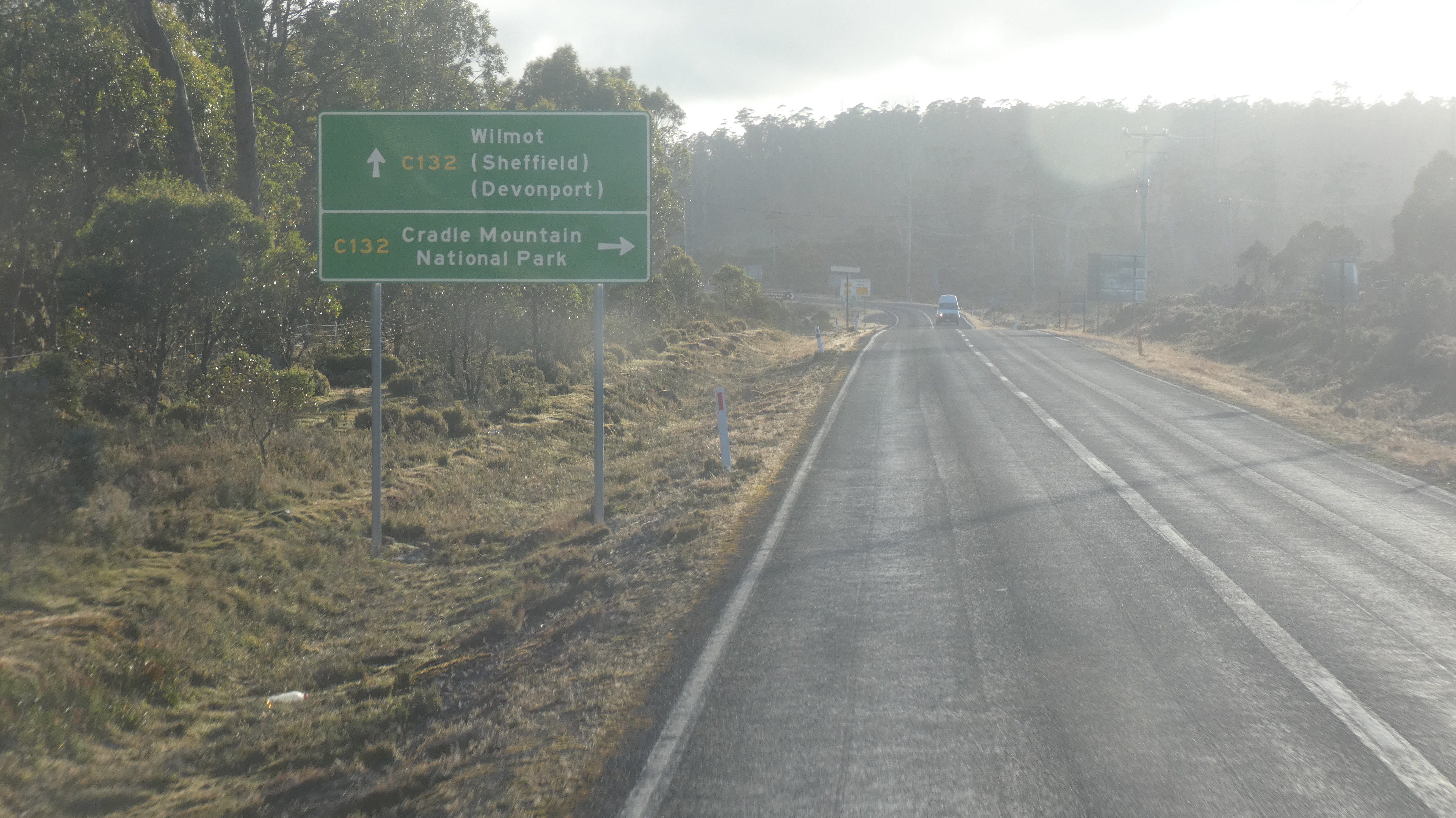
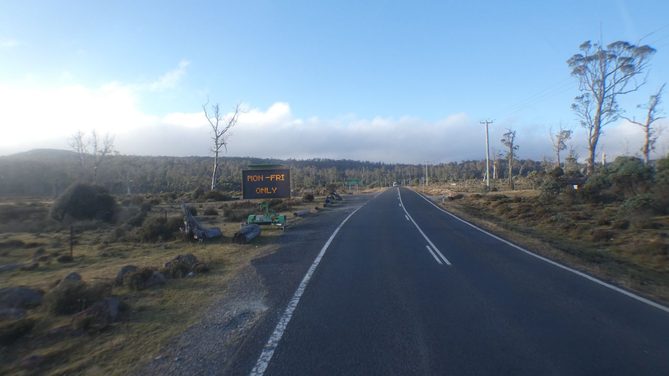
Road works won't effect us.

     
  Buy our shuttle bus tickets, one queue, made longer as four ticket sellers sell other things and provide advice.

We miss the first bus, catch the second.

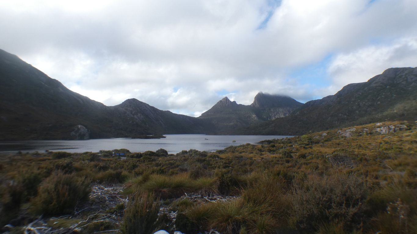
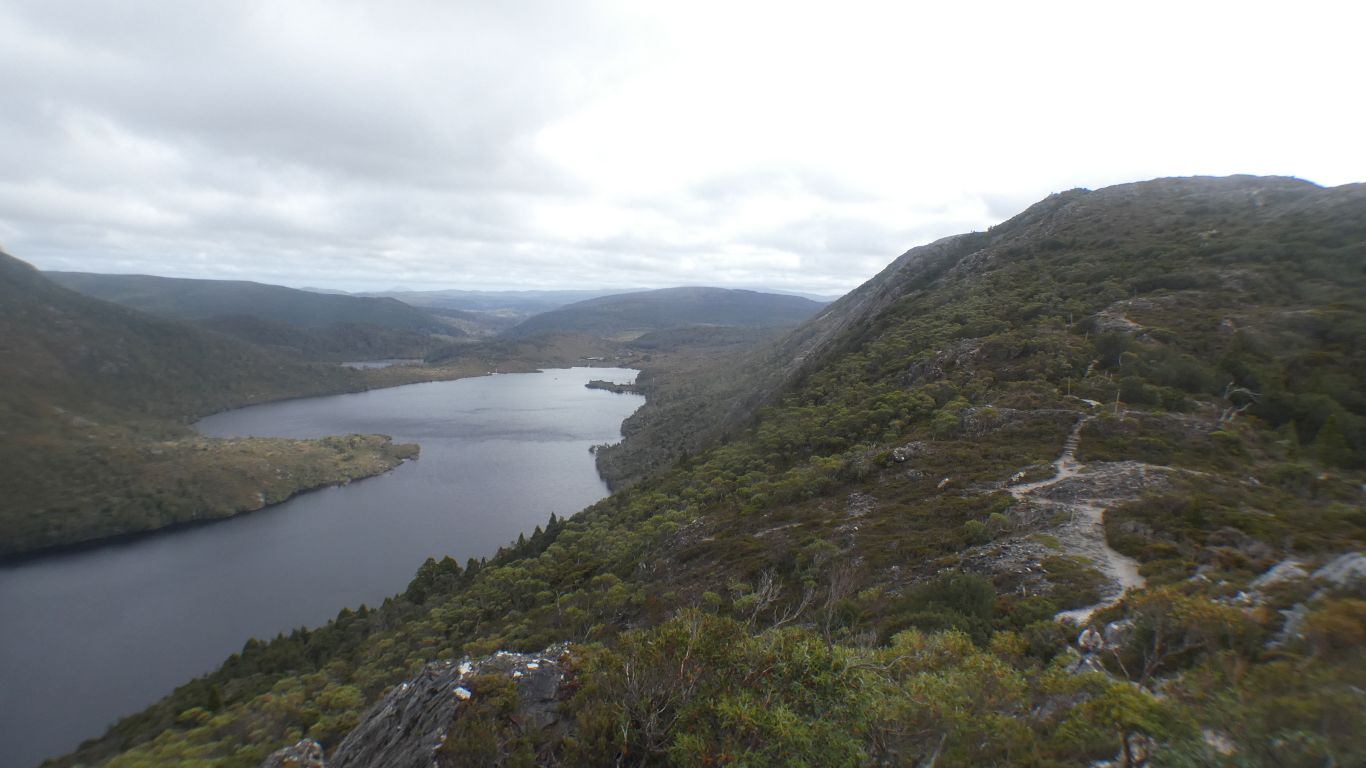
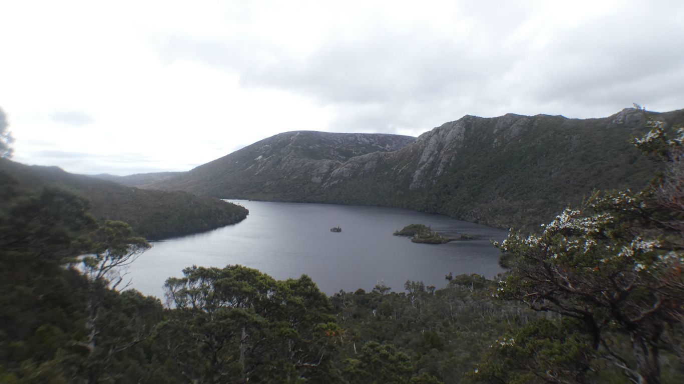
We set off around Dove Lake about 08:40.

I was last here in about 1988. A quick drive in and out in rain.

     
  Trying to make sense of the landscape.

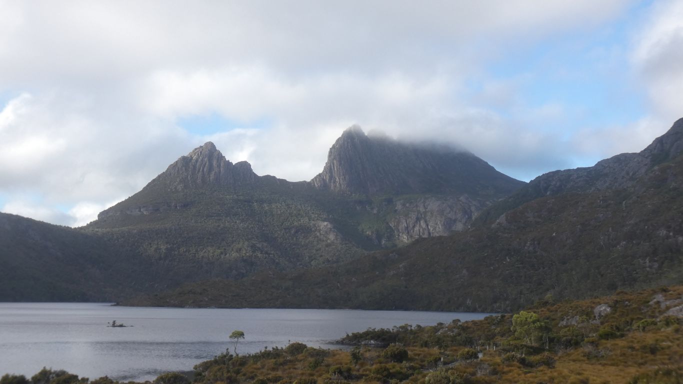
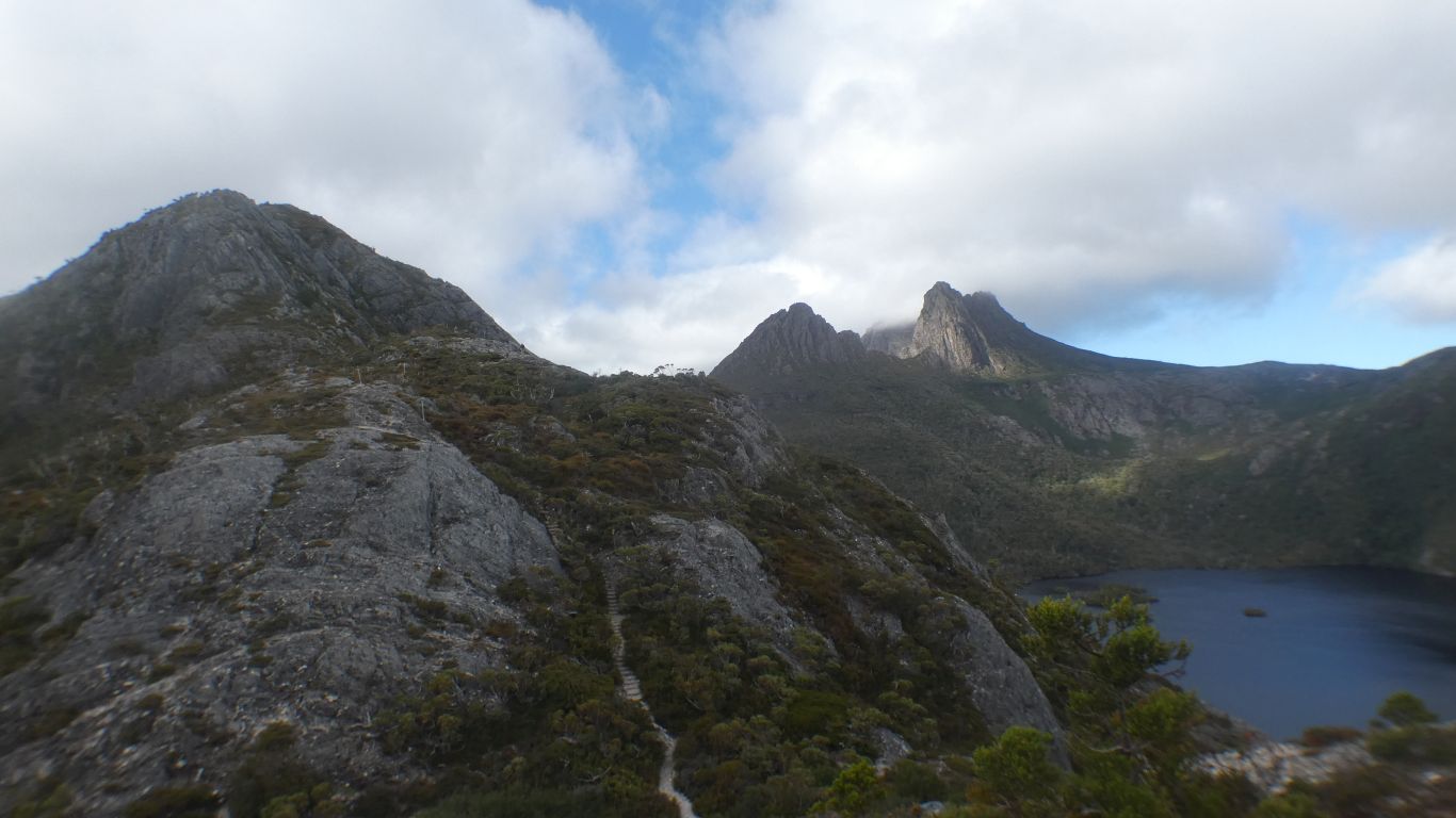
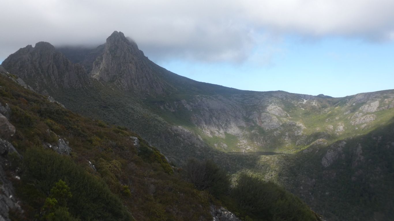
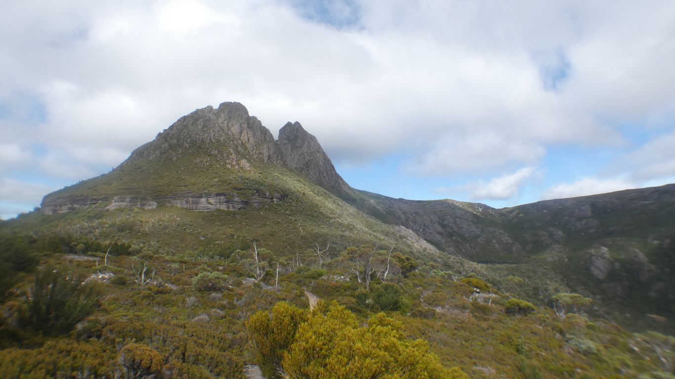
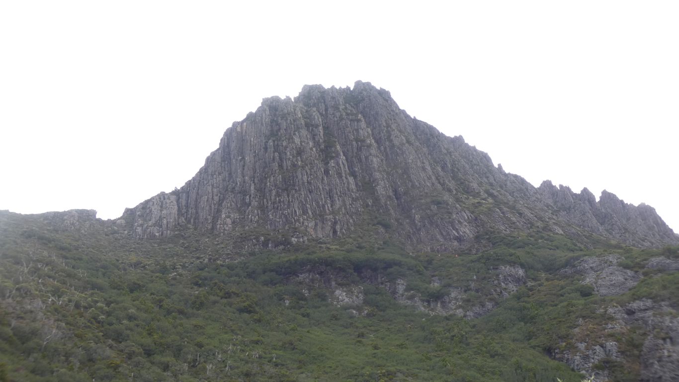
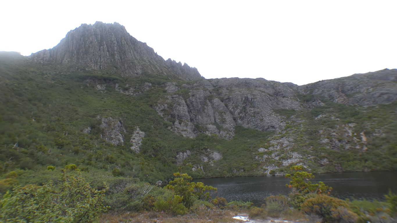
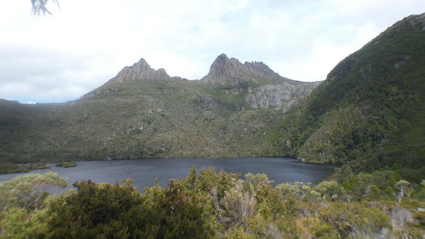
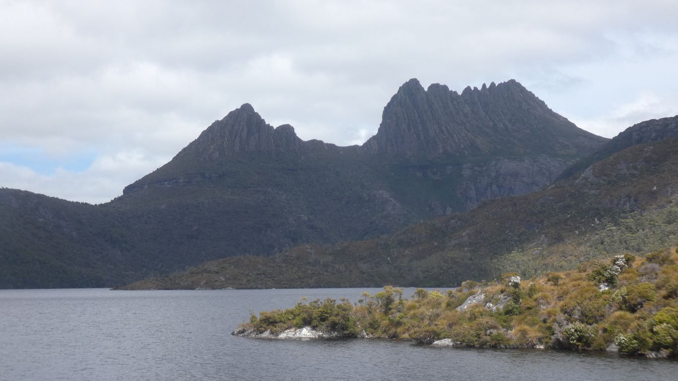
Cradle Mountain is dolerite. Volcanic intrusion on top of sedimentary rocks.

Tilted. Carved by glaciers.

     
  We look across at the boathouse. Built in the 1940s.


  Our original plan was to walk around Dove Lake and decide when we reached Lake Wilks track whether to follow a different loop.

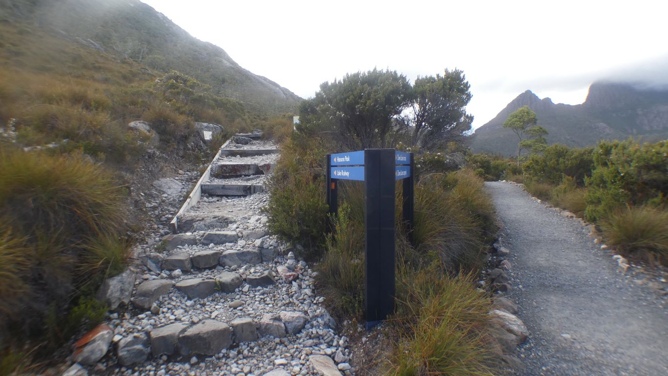
Advice from Visitors Centre was its easier to go up Hansons Peak and down Lake Wilks track.

Good advice we think in retrospect.

This junction not marked on the small map at the beginning of Dove Lake Circuit. We are a bit confused as its also named differently on different maps.

We turn left.

     
  And look back.
     
  Slowly our perspective on the mountain changes, a different angle.

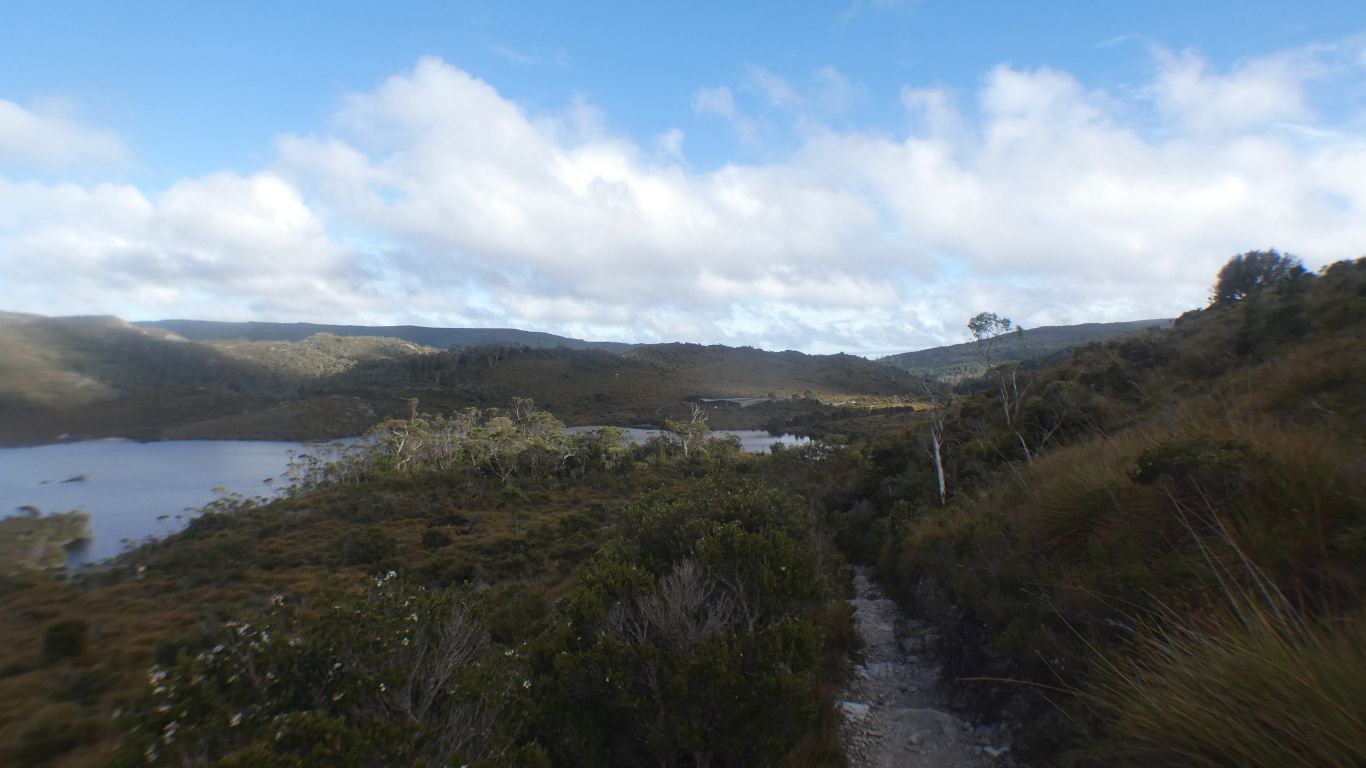
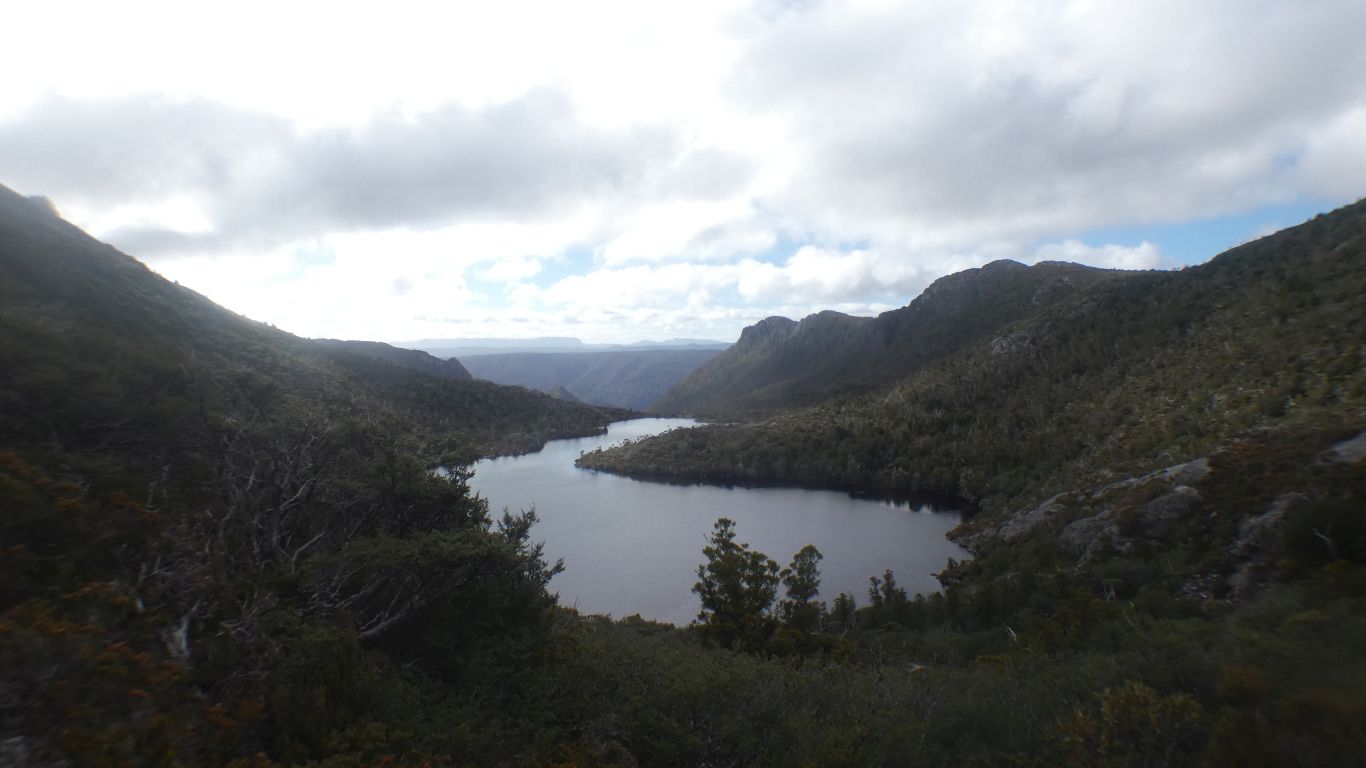
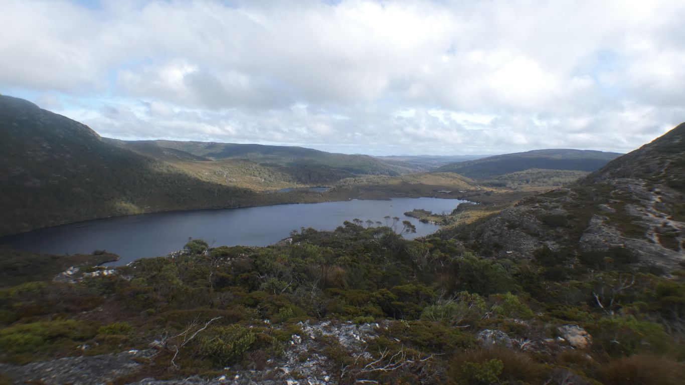
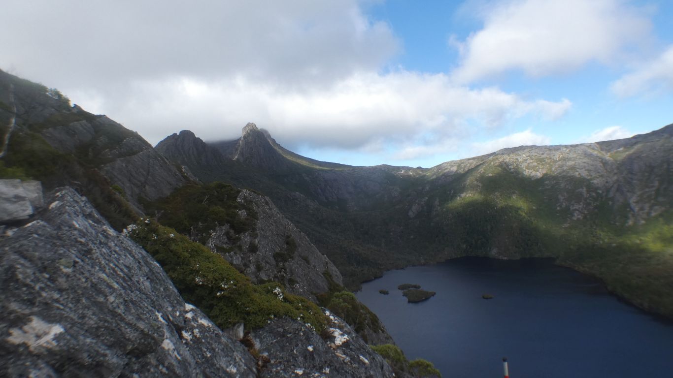
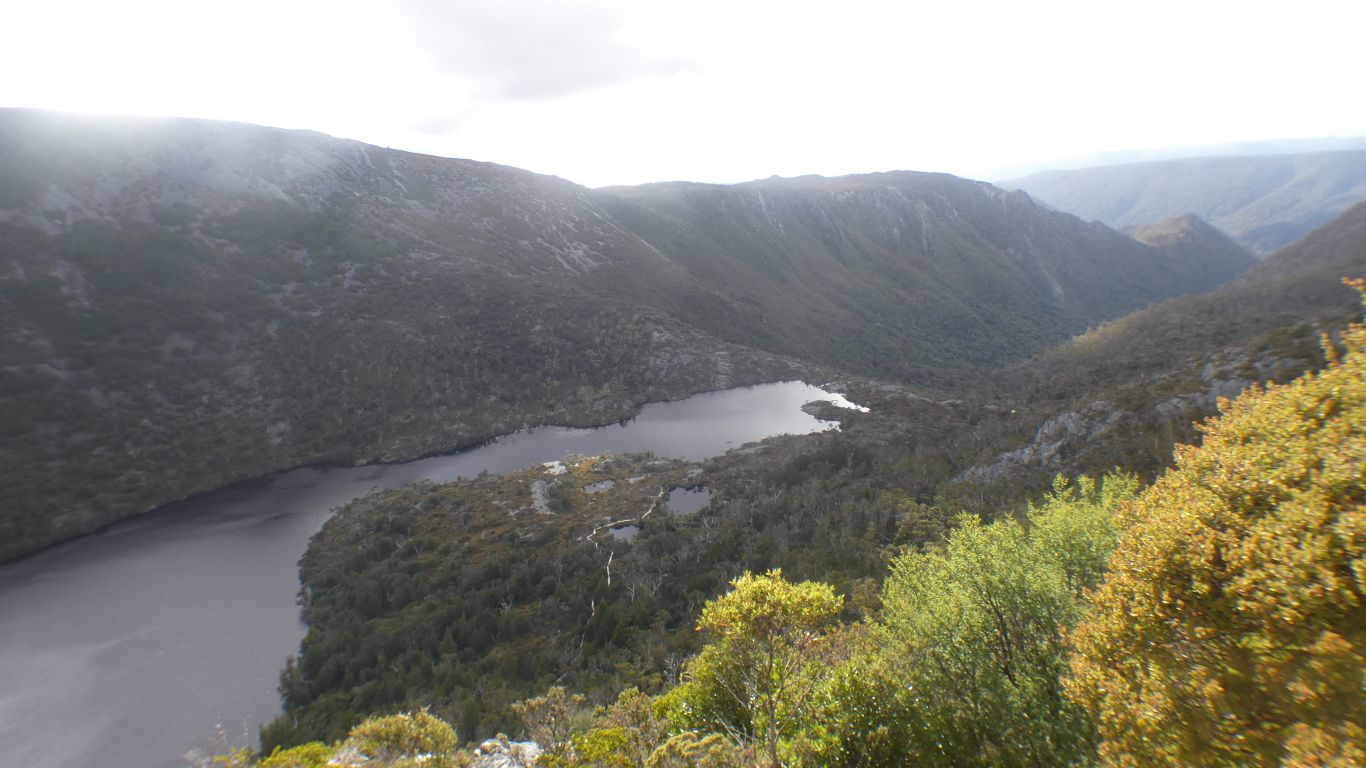
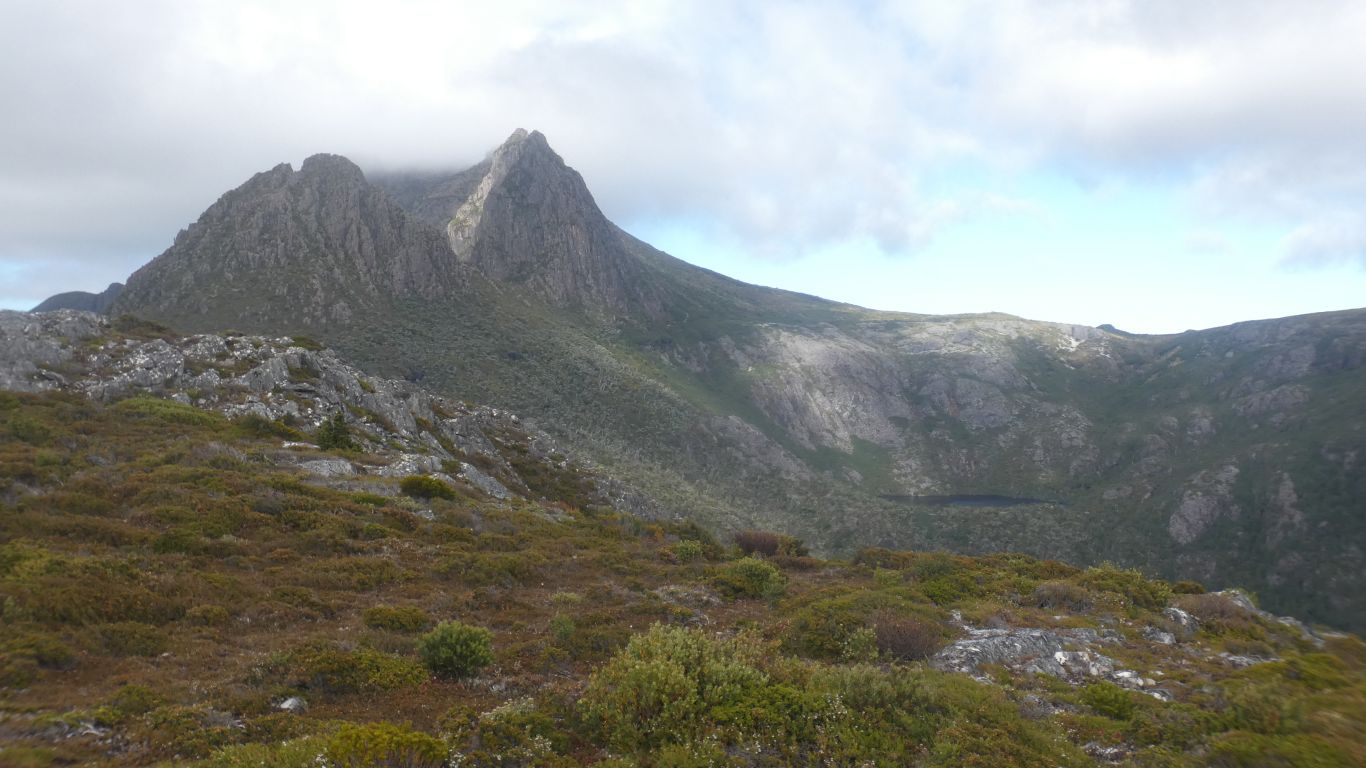
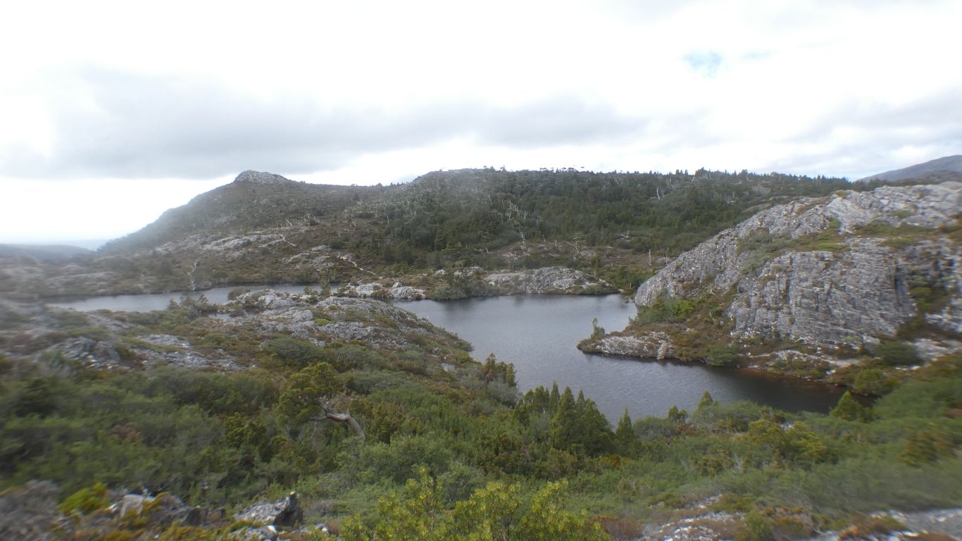
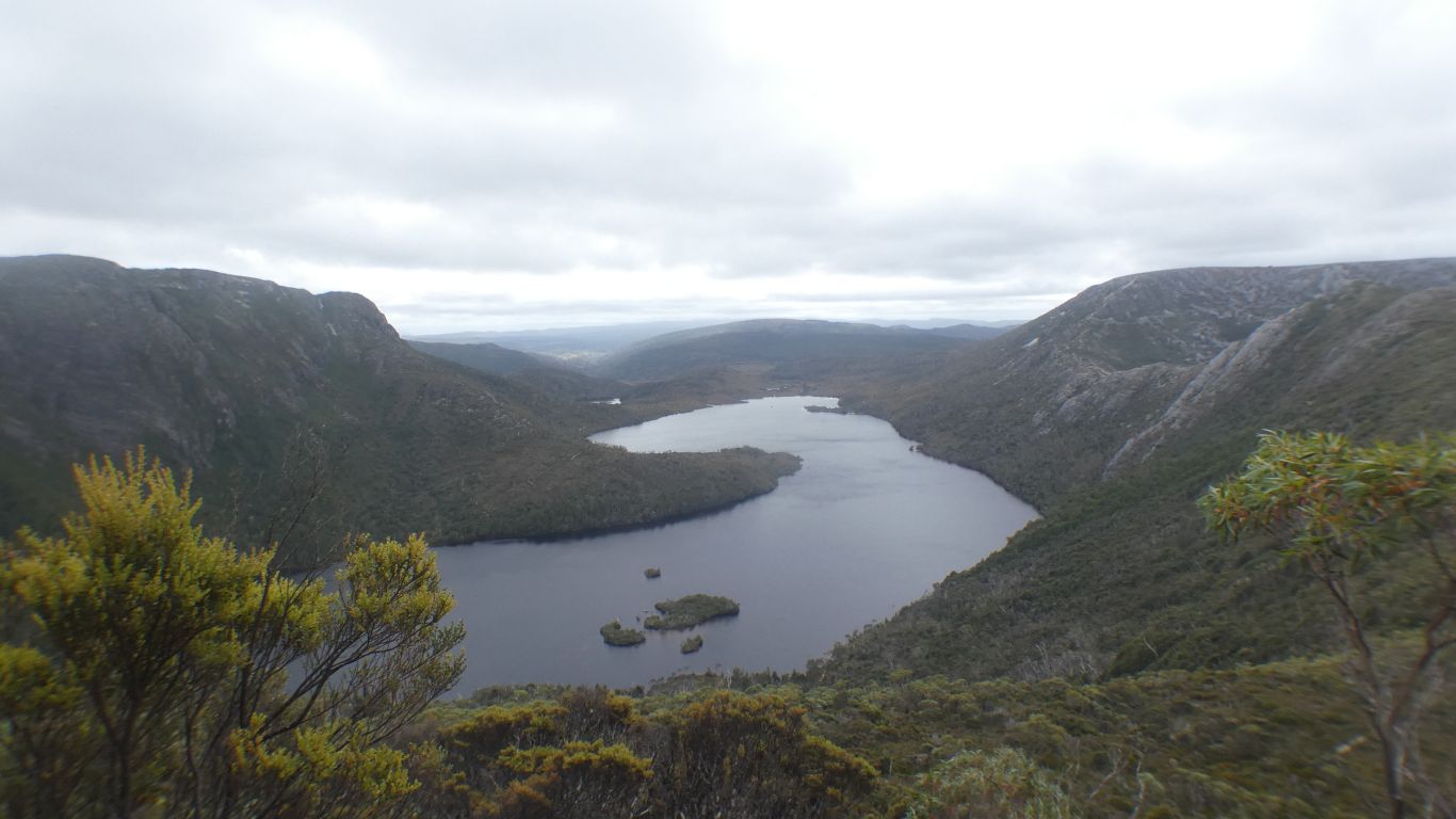
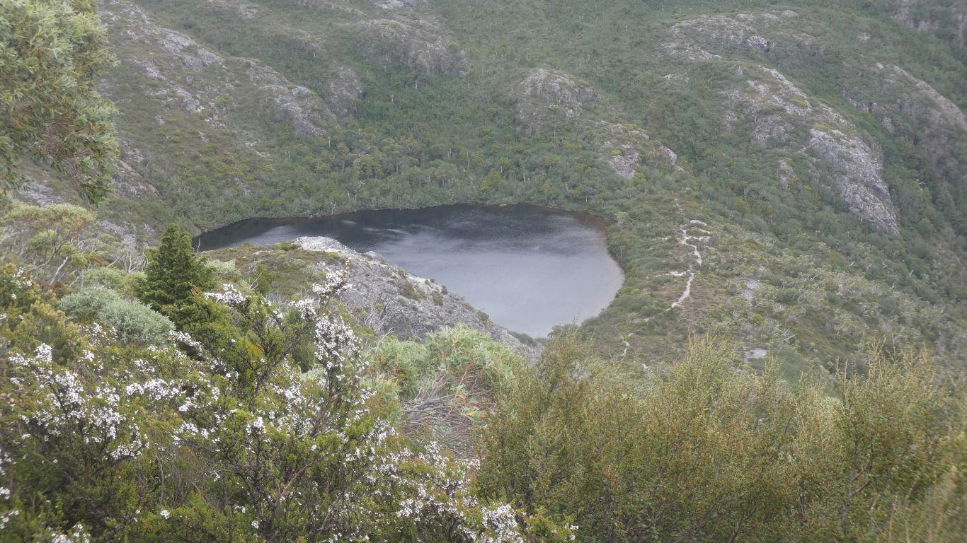
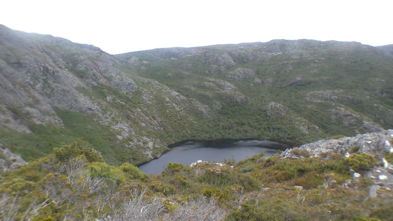
Lake Wilks is in the dip to the right of centre.

     
  Ever higher. The walking fairly easy.

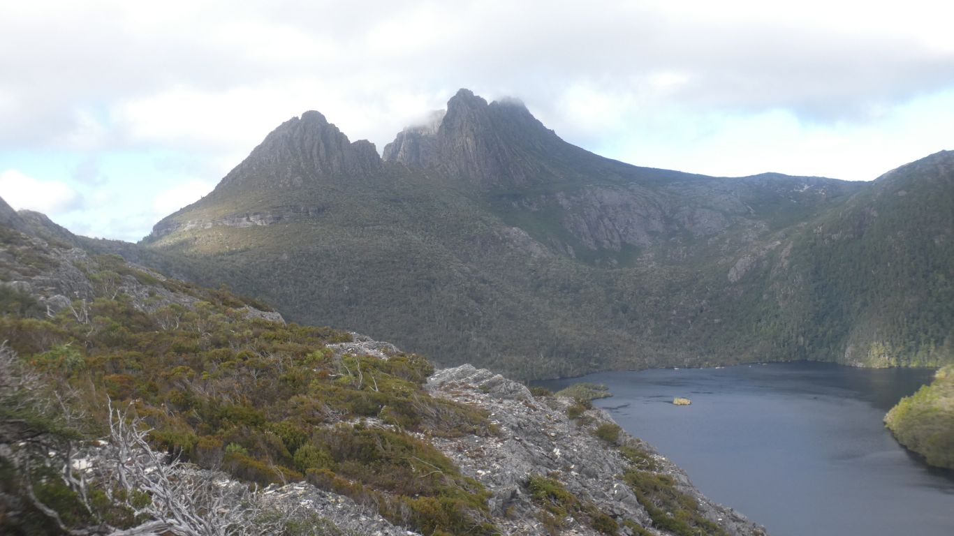
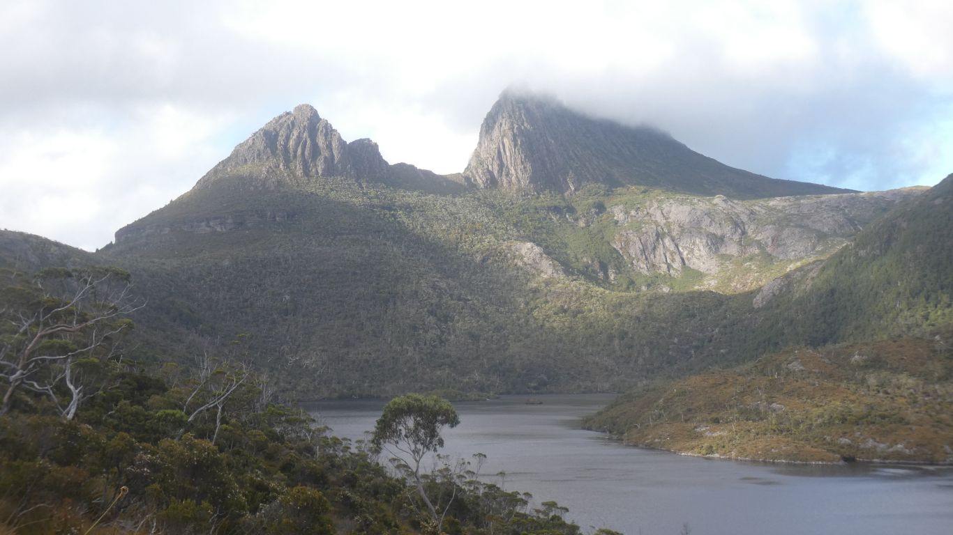
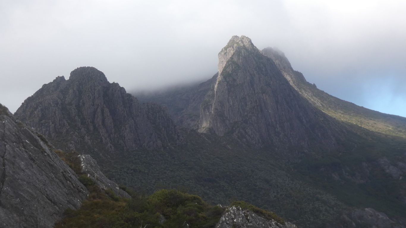
There is Cradle Mountain (1545m), furthest away, Smithies Peak (1527m), a bit closer, Weindorfers Tower (1459m), and closest, separate, is Little Horn (1355m).

     
  Lake Hanson. Looking east.
     
  We are on a saddle between Mt Campbell and Hansons Peak.

Hanson was prospecting and caught in bad weather in 1905. His companion survived, but not Hanson.

     
  Marions Lookout on the far side of Dove Lake. On the accepted route to the top of Cradle Mountain.
     
  A steep bit to Hansons Peak. A chain is provided.
     
  A quick look back.
     
  Beautiful.
     
  We've come a long way.

At least 2km!

     
  Beginning of the steep bit and chain.

Estimate of 100m a bit high. I reckon about 30m, if that.

     
  Definitely steep.
     
  Our perspective on the mountain changes.


  Lake Hanson, looking east.
     
  We are now high enough to look down on Lake Wilks.
     
  The walking easier.
     
  There's a loop around the east side Hansons Peak which passes Twisted Lakes.
     
  The pied currawong entertains. Obviously enjoying itself as much as us.
     
  Another look back.

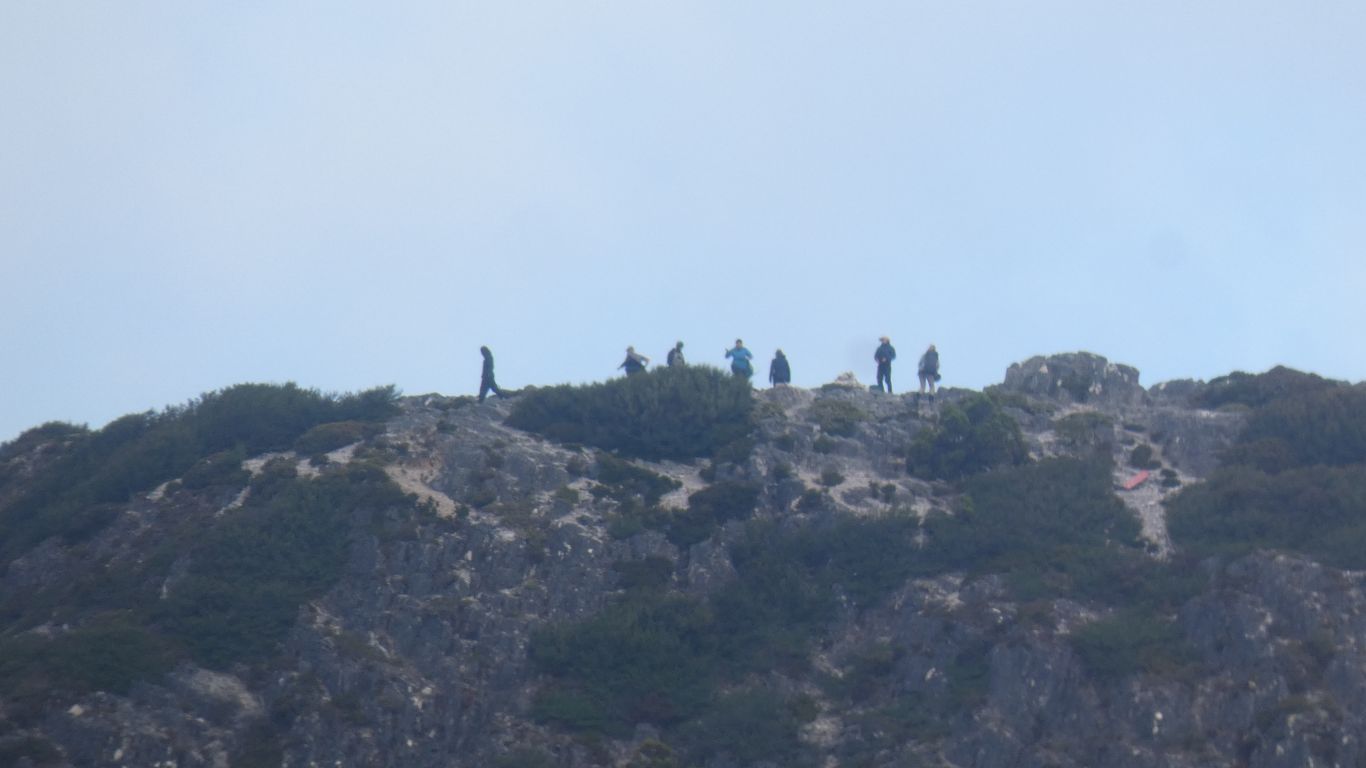
"Haven't we done well!".

     
  More twisted lakes.
     
  There's a junction in front of the mountain, a track that heads round the back, to the left, to Lake Rodway, that joins the Overland Track that led over Marion Lookout.

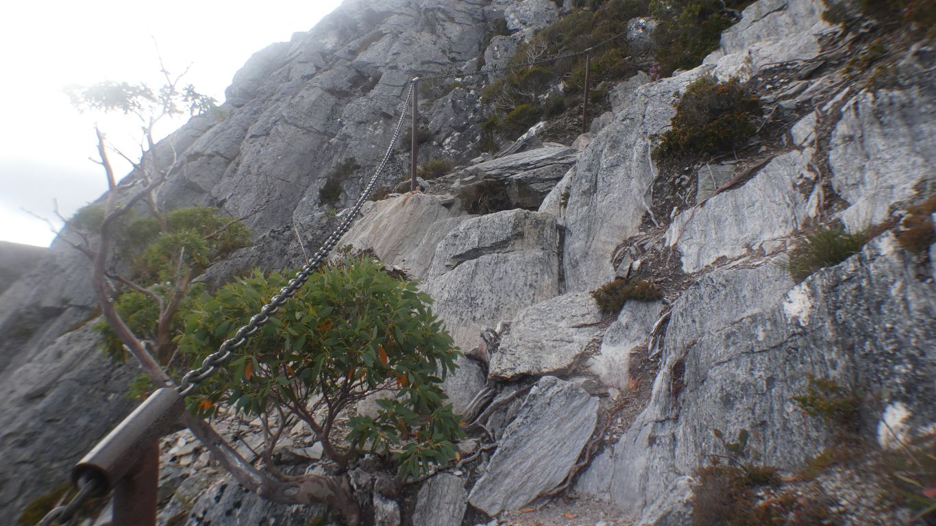
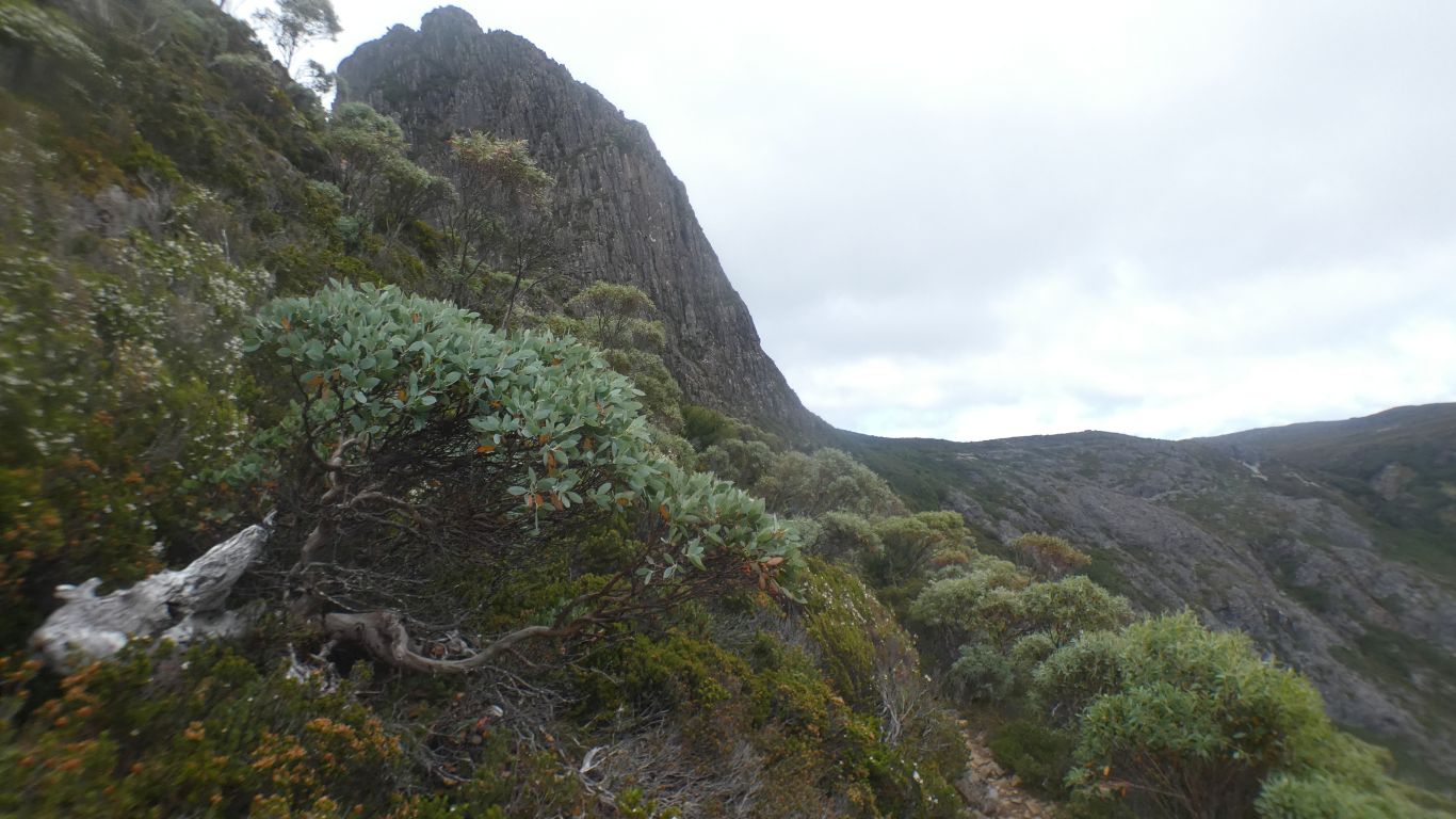
The right hand track leads up to above the bluff then more or less level, the Face Track, which also joins the Marion Lookout Track.

We will follow that, but about one third of the way along descend via the Lake Wilks Track to Lake Wilks and Dove Lake.

     
  Taking time out to admire the flowers.
     
  Despite the dryness we have experienced so far in Tassie we expected wetter weather in the mountains.

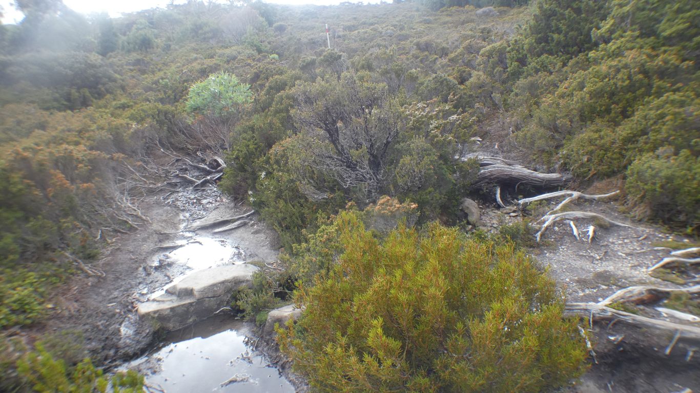
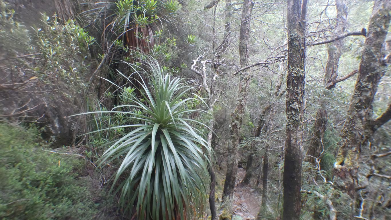
Remarkably this is the only small patch of mud we encountered.

We walked around it.

     
  Dove Lake.

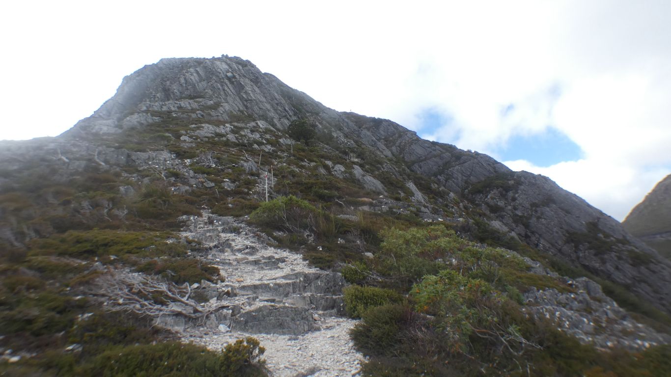
Our track rose from the lake to the saddle between Mt Campbell and Hansons Peak, then the steep bit onto the peak.

     
  We are climbing quite rapidly above the track junction, Lake Rodway track to the right. We've arrived from top left, and followed bottom left, up to here.

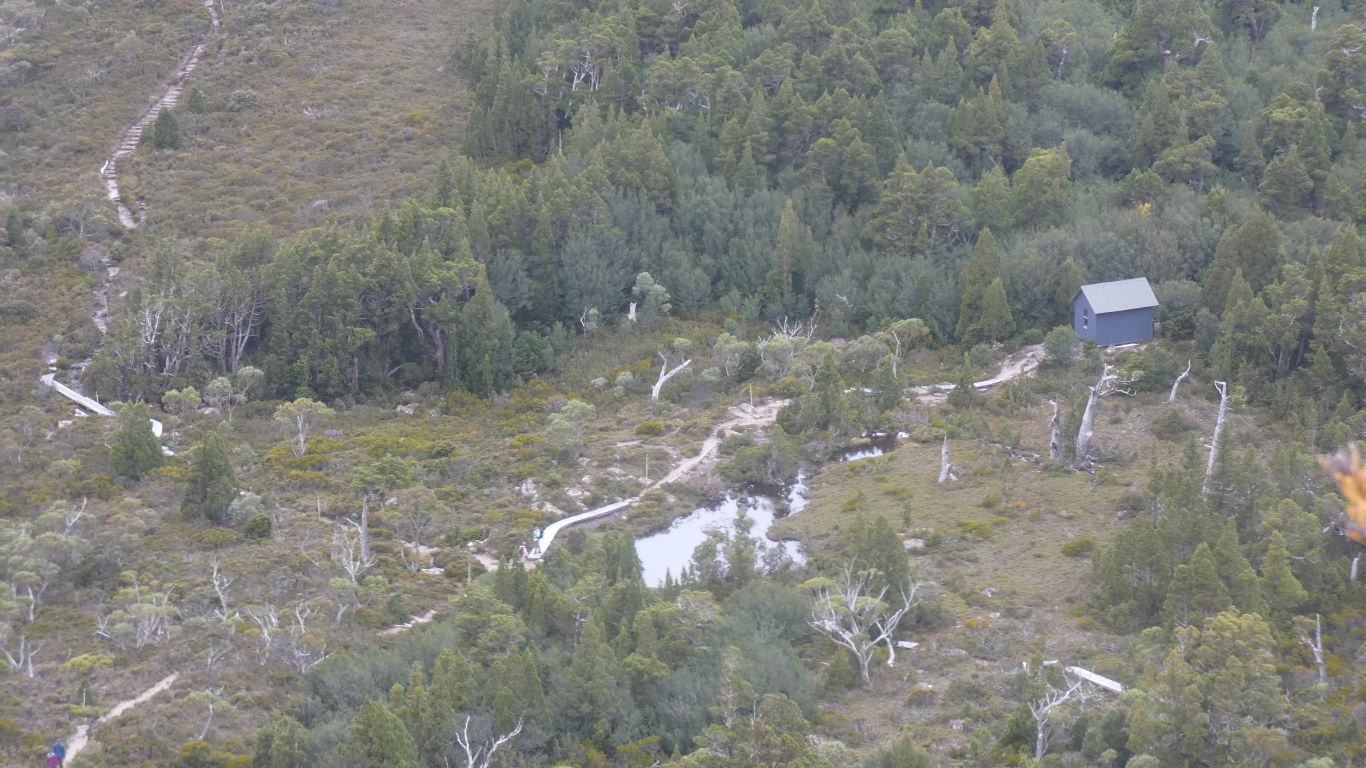
We were unaware of the emergency shelter, invisible to us from the junction.

     
  Ever higher, nearly above the bluff we saw earlier. And above Hansons Peak.
     
  Having traversed a bit of the face, on the Face Track, we are at the Lake Wilks Track junction. We will descend. Steep.

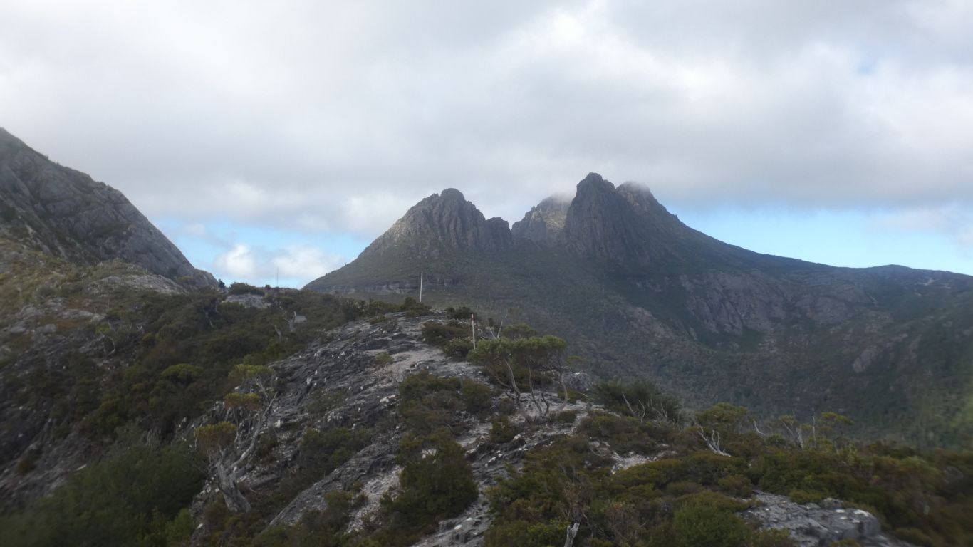
The Face Track is as high as we climb. About 1220m. Hansons Peak about 1180m.

We are about 300m below the high point of Cradle Mountain.

Dove Lake about 950m. We are about 270m above it.

     
  The Face Track carries on to meet the Marion Lookout track.

We decide a bridge too far.

     
  Dove Lake.

Hansons Peak hasn't moved.

     
  The beginning of the chain down a steep bit.
     
  I put the camera in the pack so I had two hands to steady myself.

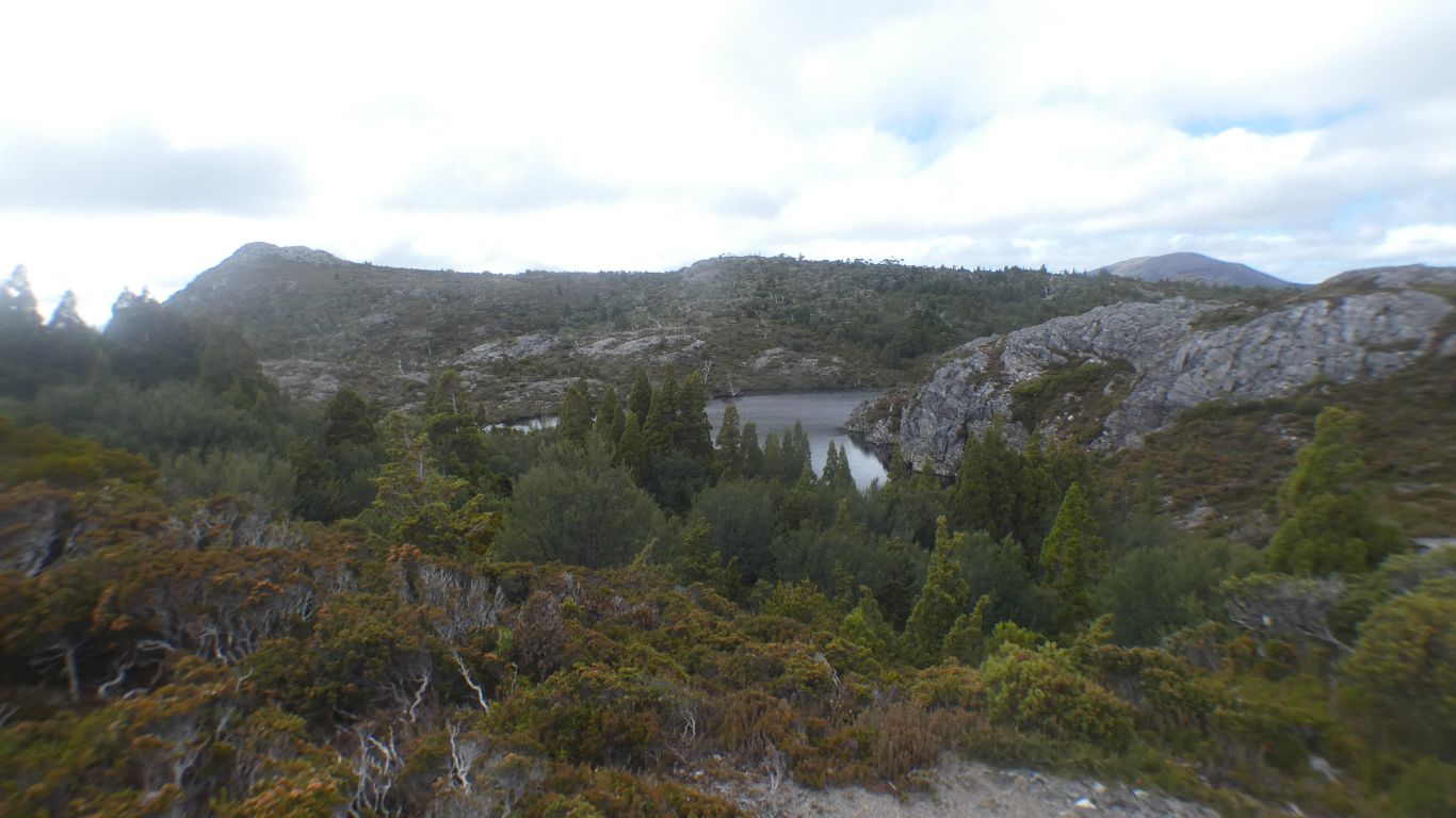
Last pic of Lake Wilks before we were beside it.

     
  We think the Face Track follows the top green line of bush.

The couple who showed us their 1:100,000 map and encouraged us later reported that track as "rough".

     
  At Lake Wilks.

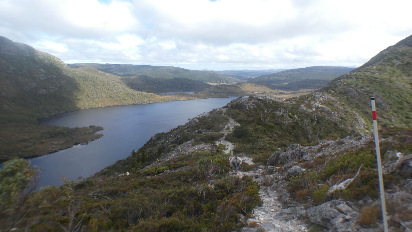
Altitude about 1050m. Less than 100m down to Dove Lake. We are beginning to feel tired.

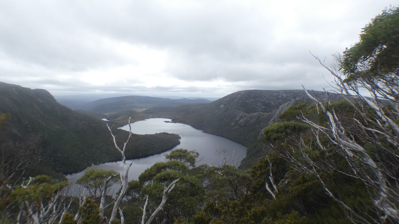
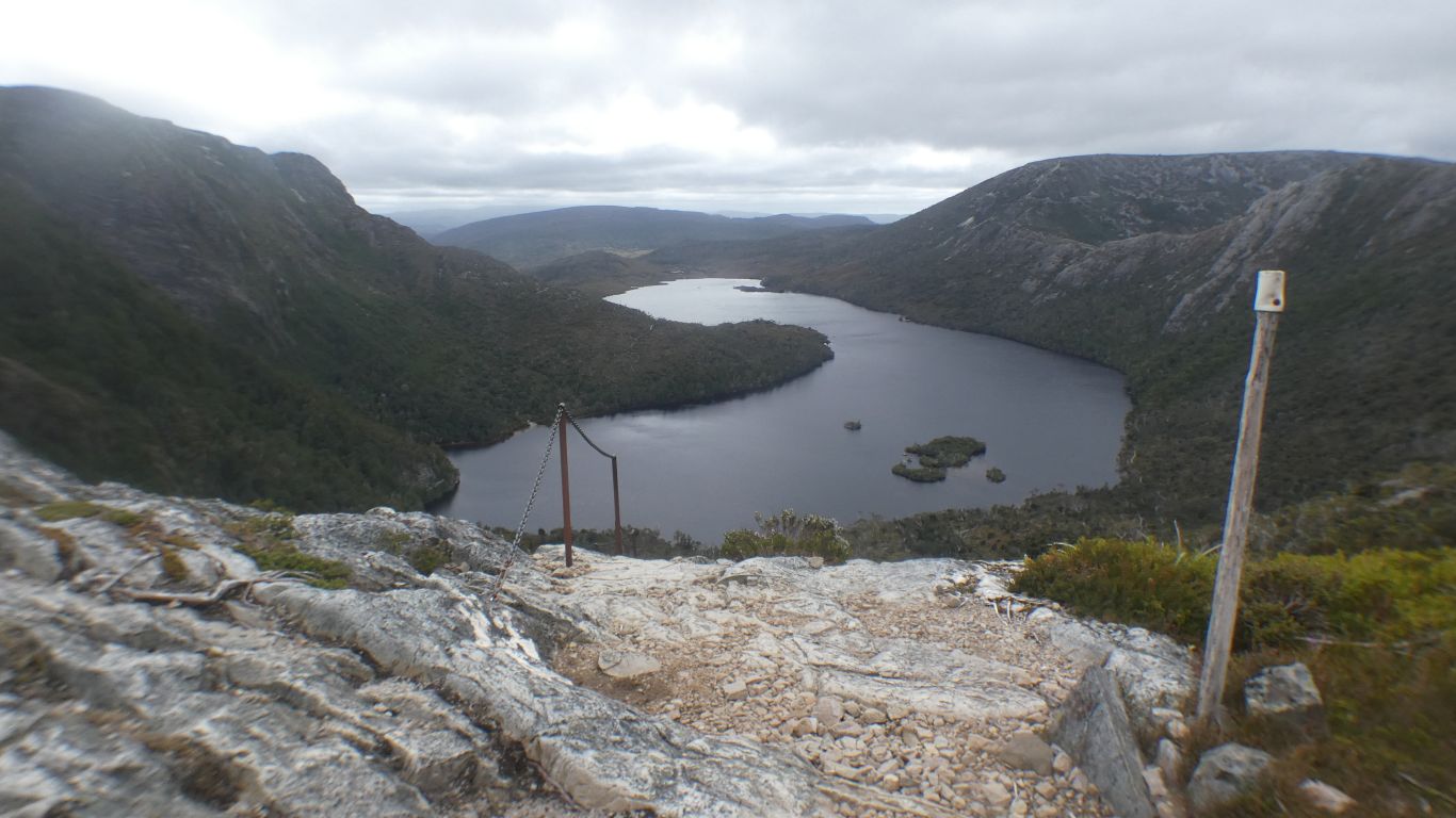
Easy to see how a glacier carved out the lake, and the mountain.

We decide the advice offered at the Visitor Centre about which direction and track to take was good.

     
  The exit creek, a convenient bridge to cross it.
     
  From the edge of Lake Wilks.

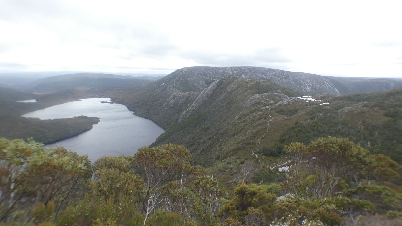
Our route over Hansons Peak easy to see. For us.

     
  Into the trees. And pandanus.
     
  Down at Dove Lake level. Not sure why this is called "ballroom forest".
     
  Nearly home.

The steep ridge, with the chain, we followed down to Lake Wilks visible.

     
  A last view of the mountain, and the ever changing light.
     
  Then back to Vale of Belvoir to lick our wounds.

Not quite as tired as after previous walks, the training working, slowly becoming stronger, but still aware of being near our limit.

We camp in the first spot next to the road. We learn the next morning there were only two campers in the nominated camp site. Such is life!

Only walked 8km. But mountainous.

What a wonderful day.


Gateway
CommentsHome


Feel free to make a (useful!) comment.
Please enter this number so we know you are a real person   

and your name      and email address     
your email address will not be displayed. Nor will your ip address which is 216.73.216.11  
and enter your comment .....